Arizona is the 48th state of the USA which is admitted to the union on 14 February 1912. Arizona is located in the southwestern region of the United States. Arizona has three nicknames which are The Grand Canyon State, The Cooper State, and The Valentine State.
You may get more information about this state with the help of an Arizona map. So, scroll down the page and check our collection of printable maps related to Arizona (AZ), county maps, blank maps, google maps, outline maps, regional maps, physical maps, and some other maps.
Collections of Arizona State Maps:
1. Map of Arizona:

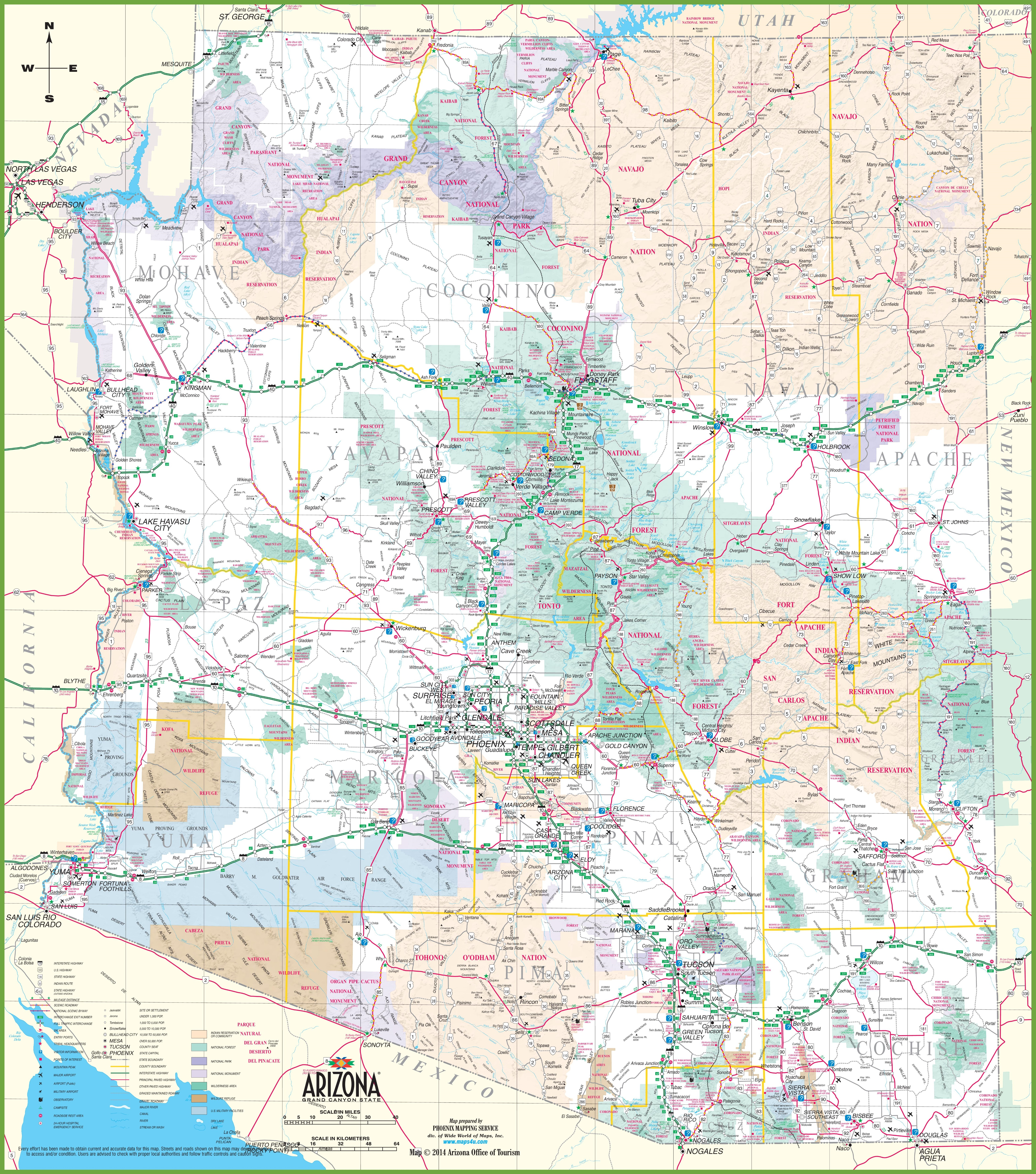
2. Detailed Map of Arizona with Towns & Cities:
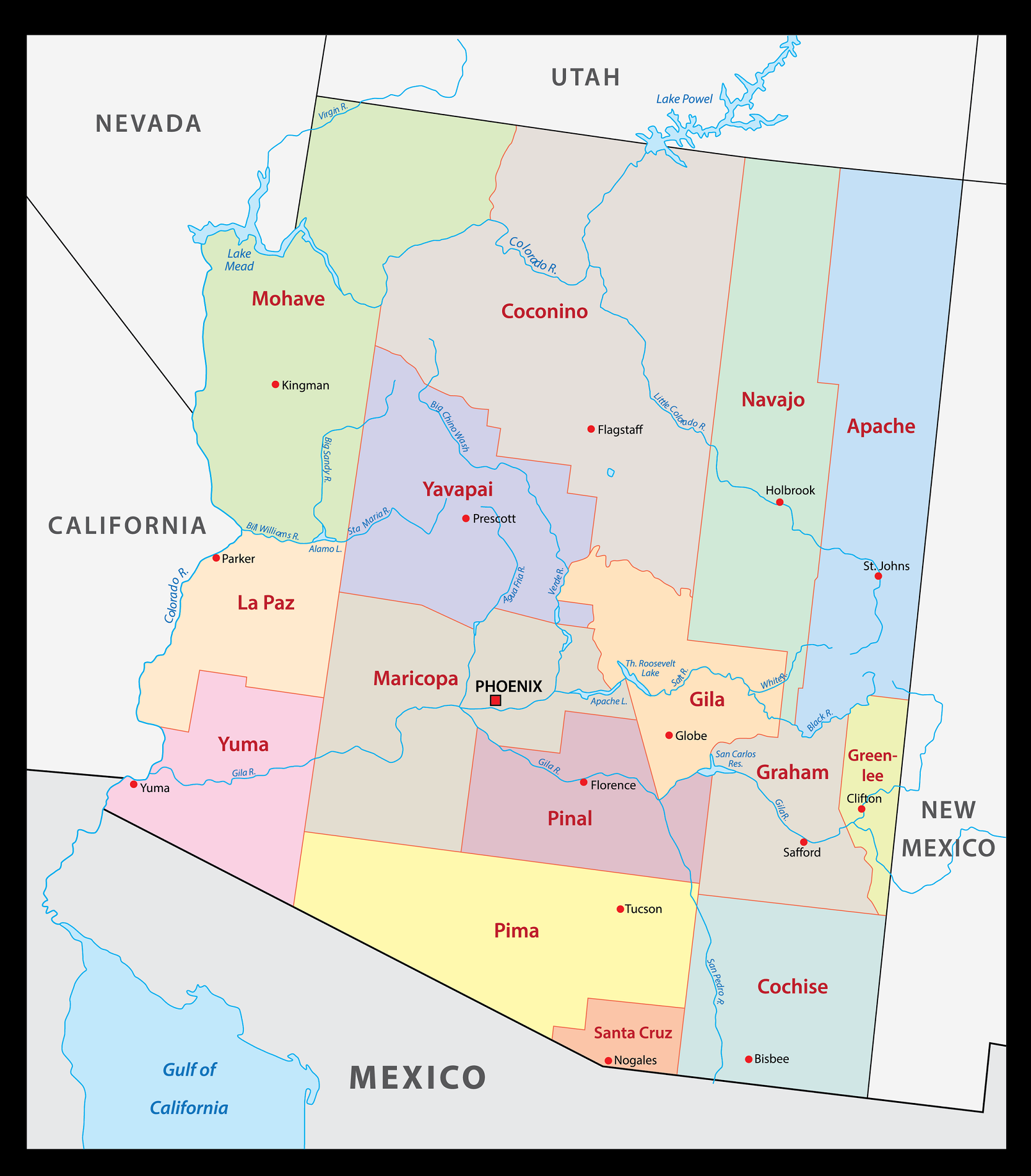
3. County Map of Arizona:
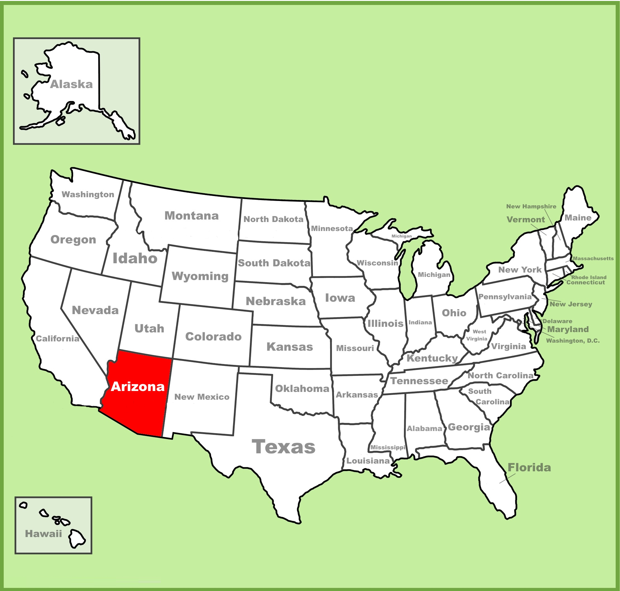
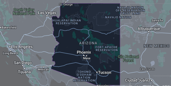
4. Arizona on USA Map:
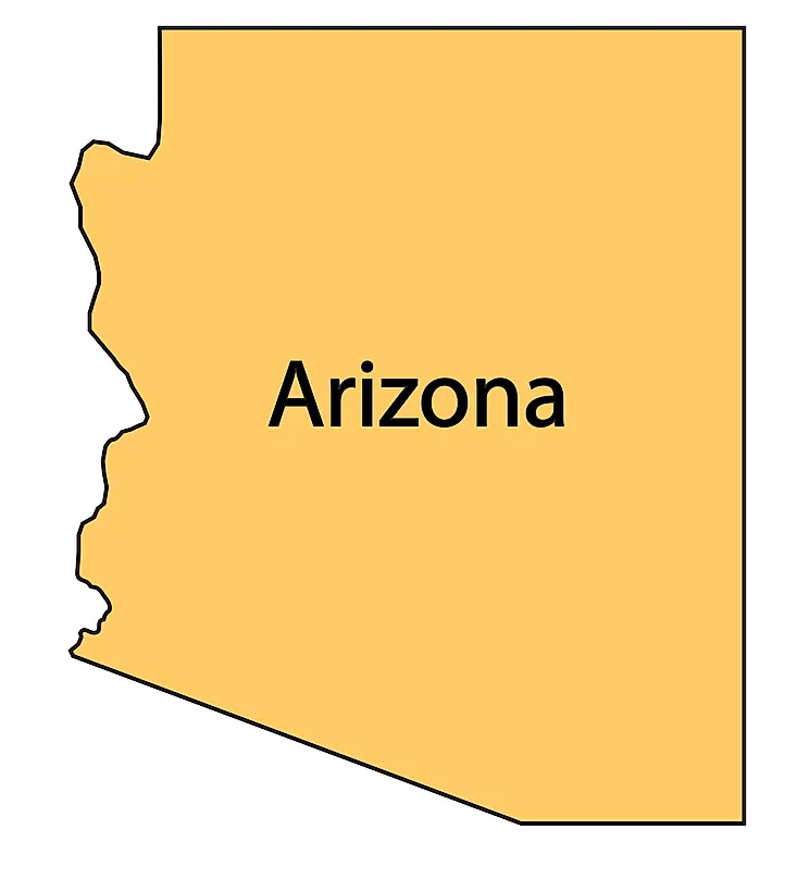
5. Blank Map of Arizona:
6. Google Map of Arizona:
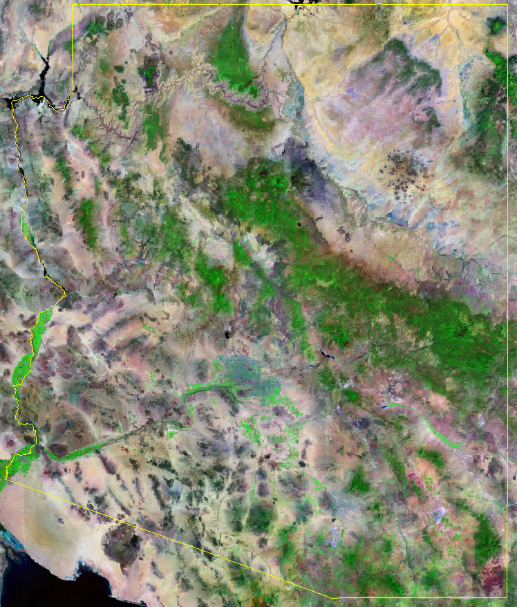
7. Satellite Map of Arizona:
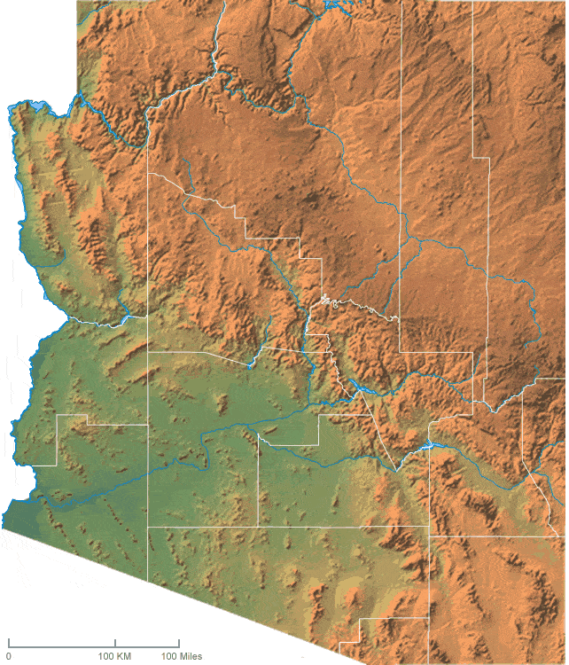
8. Topographic Map of Arizona:
This is the collection of Arizona State Map that we have added above. We have added a total of eight different maps that contain some helpful information about Arizona and its cities. Below, we are also adding some brief information about each map. So, please read the full description before viewing or downloading any map from the above.
The first map is related to the main state map of this state, which shows all counties and major cities on the map. The second map shows all the cities, towns, counties, and other significant places. It is a complete and detailed map of Arizona with cities and towns. And on this map, you can also know about all parks, malls, beaches, airports, railroads, street roads, city roads, and interstate highways. Now, the third map is related to the County map of Arizona which shows all counties along with the major cities of Arizona.
If you are looking for some other maps related to Arizona (AZ), USA then you should check our other articles.
- Arizona County Map | County maps with Cities
- Free Arizona Zip Code Maps
- Free Arizona Time Zone Maps
- Free Arizona Mountain Ranges Maps
- Free Arizona Road Maps
- Free Arizona Highway Maps
- Free Arizona River Maps
- Free Arizona Lake Maps
- Map of Arizona Cities and Towns | Printable City Maps
And the fourth map shows the location of Arizona on the US map. As you can see, an area filled with red indicates this state’s location on its country map. The fifth map is a blank outline map of this state, which shows the outer boundary of this state. The sixth map is a type of google map which shows some cities and counties of this state. Now, the seventh map is a type of satellite image or map of Arizona (AZ), USA that shows the structure of this state. As you can see on the map, a thin yellow line marks the outer boundary. Now, the last map is a Topographic map of Arizona. These types of images or maps are used for geographic purposes.
These were some most useful and printable AZ state maps that we have added above. These high-quality maps are available in PDF format and JPG (Image) format. You can easily download any map by clicking on the buttons under the preview image. All these HD large maps are free to download.