India is situated in the south of the Asian continent. India is also known as Bharat or the Republic of India. India is the seventh largest country and the second most populous country in the world. Its capital city is New Delhi.
Here on this page, we are providing some information about India and adding some printable maps of India that you can download for free. So, scroll down the page and check our collection of printable maps.
Collection of maps of India:
1. India Map:
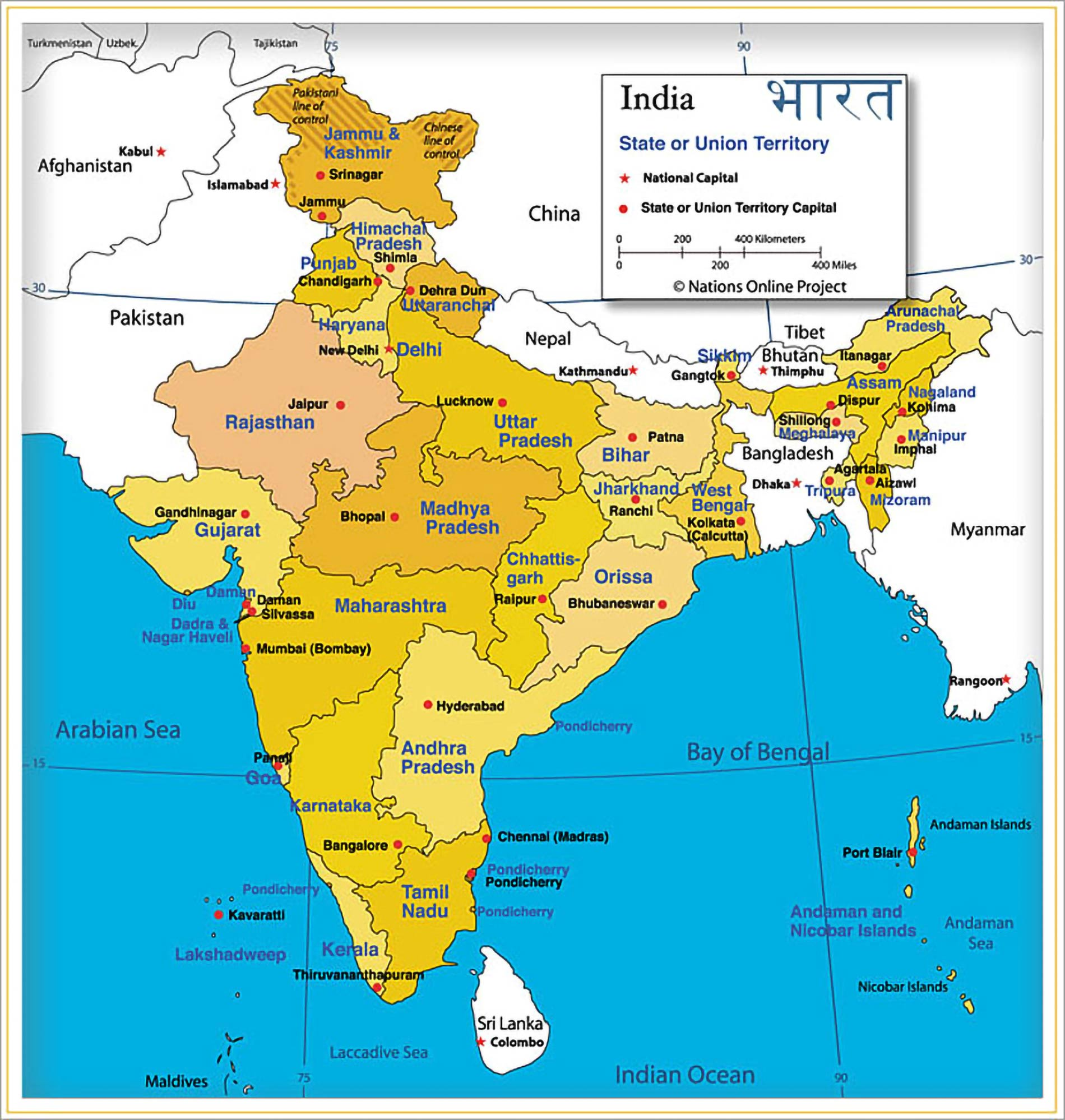
2.Political Map of India:
3. Physical Map of India:
4. Outline Map of India:
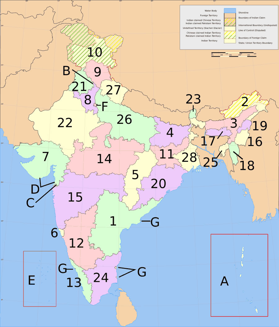
5. Numbered Map of India with State:
6. India State Map with Capital:
7. India’s State & Union Territories Map:
8. Location of India on world map:
9. Google Map of India:
10. Blank Map of India:
This is the collection of the India map that we have added above. We have added a total of ten different maps that contain some helpful information. Below, we are also adding some brief details on each map. So, please read the full description before viewing or downloading any India ka map from the above.
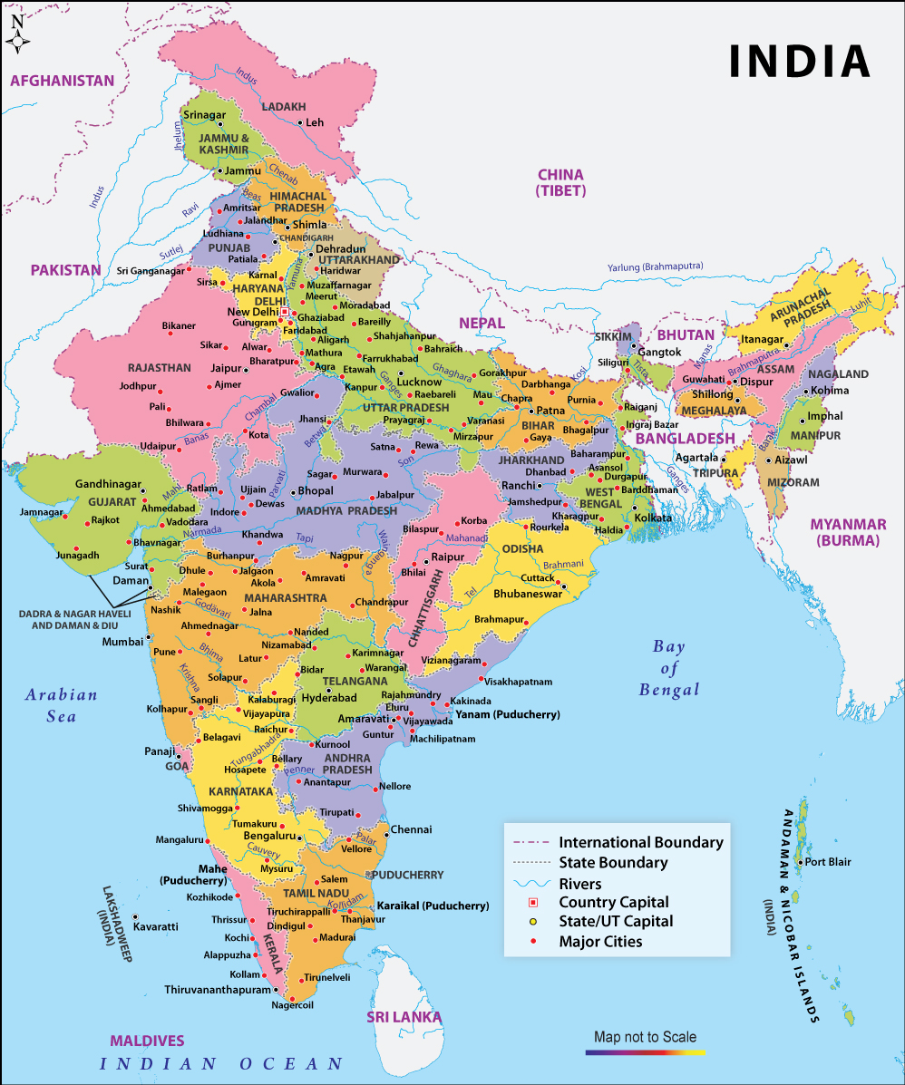
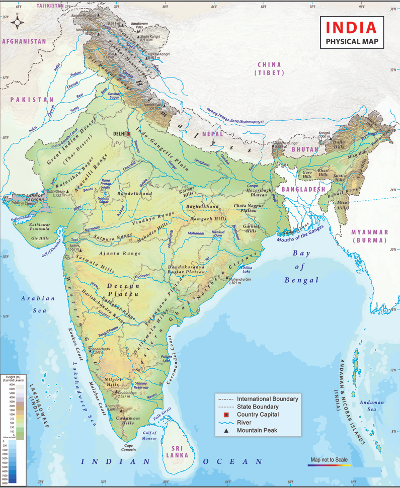
The first map is the main map of India (IN)which shows all 28 states and some major cities of these states. If you are looking for a particular state map then you should check our other article which is “State Maps of India, IN”. The second map is related to the political map of India which indicates the government body of each state. Different colour means different political parties. The next map is a type of physical map of India which shows all water bodies (rivers and lakes), mountain ranges, the terrain of different areas, and national and international boundaries.
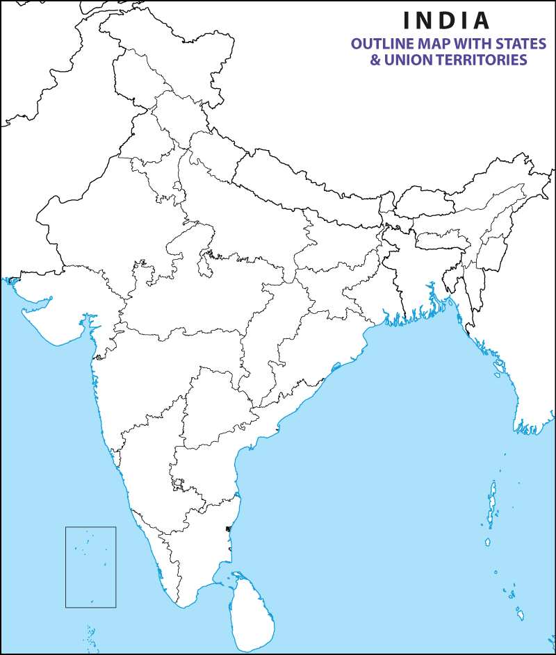
The fourth map is an outline map of India which shows the outer boundaries of each state. The fifth map shows all the states with a different number and this number means when which state was formed, that is, as you see in the map, Maharashtra is written as fifteen, so it means that it was the fifteenth state. So in this way, you can also find out about other states with the help of this map.
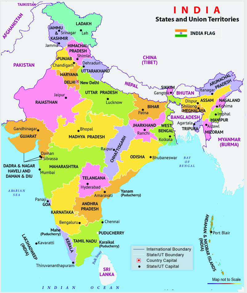
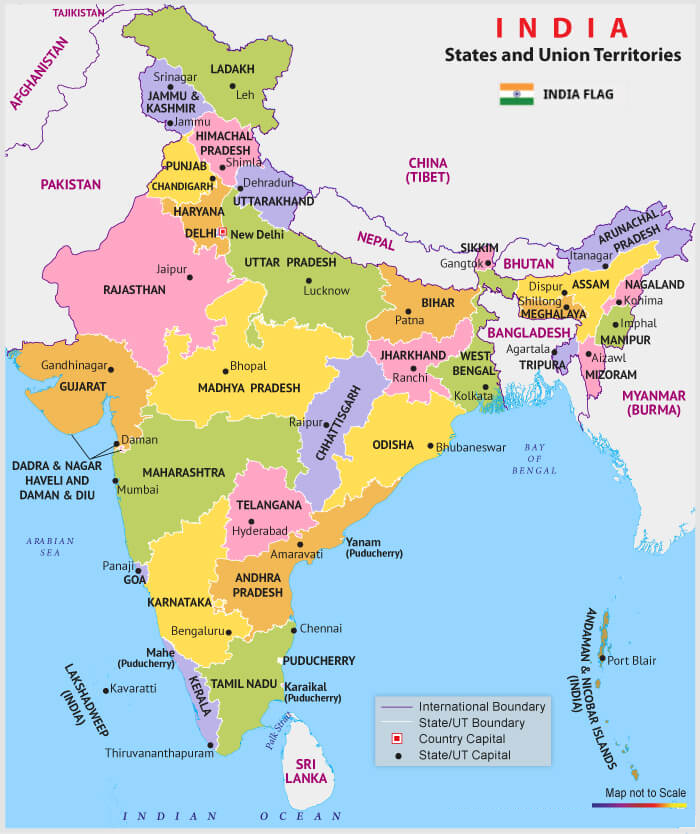
The sixth map shows all states with their capital city. The next map is related to the India map with state name and shows all 8 Union Territories and 28 states. Below we are also adding a table in which you can see all States and Union Territories of India.
List of all States in India:
| State | ISO | Zone | Capital |
| Andhra Pradesh | IN-AP | Southern | Amaravati |
| Arunachal Pradesh | IN-AR | North-Eastern | Itanagar |
| Assam | IN-AS | North-Eastern | Dispur |
| Bihar | IN-BR | Eastern | Patna |
| Chhattisgarh | IN-CT | Central | Raipur |
| Goa | IN-GA | Western | Panaji |
| Gujarat | IN-GJ | Western | Gandhinagar |
| Haryana | IN-HR | Northern | Chandigarh |
| Himachal Pradesh | IN-HP | Northern | Shimla (Summer) |
| Dharamshala (Winter) | |||
| Jharkhand | IN-JH | Eastern | Ranchi |
| Karnataka | IN-KA | Southern | Bangalore |
| Kerala | IN-KL | Southern | Thiruvananthapuram |
| Madhya Pradesh | IN-MP | Central | Bhopal |
| Maharashtra | IN-MH | Western | Mumbai (Summer) |
| Nagpur (Winter) | |||
| Manipur | IN-MN | North-Eastern | Imphal |
| Meghalaya | IN-ML | North-Eastern | Shillong |
| Mizoram | IN-MZ | North-Eastern | Aizawl |
| Nagaland | IN-NL | North-Eastern | Kohima |
| Odisha | IN-OR | Eastern | Bhubaneswar |
| Punjab | IN-PB | Northern | Chandigarh |
| Rajasthan | IN-RJ | Northern | Jaipur |
| Sikkim | IN-SK | North-Eastern | Gangtok |
| Tamil Nadu | IN-TN | Southern | Chennai |
| Telangana | IN-TG | Southern | Hyderabad |
| Tripura | IN-TR | North-Eastern | Agartala |
| Uttar Pradesh | IN-UP | Central | Lucknow |
| Uttarakhand | IN-UT | Central | Bhararisain (Summer) |
| Dehradun (Winter) | |||
| West Bengal | IN-WB | Eastern | Kolkata |
List of all Union Territories in India:
| Union Territory | ISO | Zone | Capital |
| Andaman and Nicobar Islands | IN-AN | Southern | Port Blair |
| Chandigarh | IN-CH | Northern | Chandigarh |
| Dadra and Nagar Haveli and Daman and Diu | IN-DH | Western | Daman |
| Delhi | IN-DL | Northern | New Delhi |
| Jammu and Kashmir | IN-JK | Northern | Srinagar (Summer) |
| Jammu (Winter) | |||
| Ladakh | IN-LA | Northern | Leh (Summer) |
| Kargil (Winter) | |||
| Lakshadweep | IN-LD | Southern | Kavaratti |
| Puducherry | IN-PY | Southern | Puducherry |
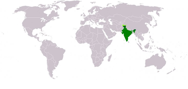
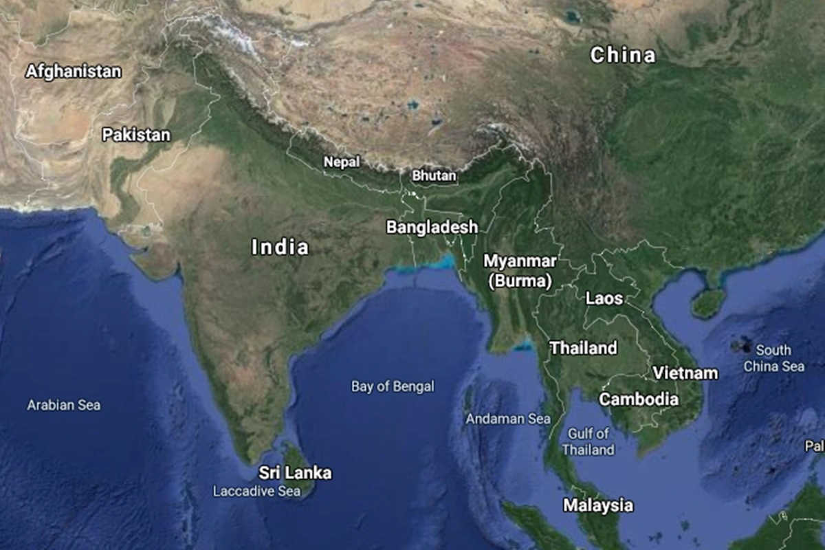
The eighth map shows the location of India on the world map, as you can see that the area filled with green colour indicates India on a global map. The next map is a type of google map of India, these types of the map actually shows the satellite view of a particular location.
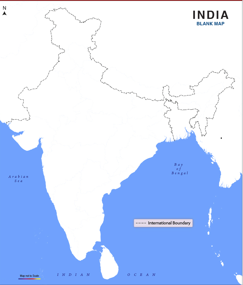
Now, the last map is a blank map of India, which shows only the outer boundary of India. If you are looking for a new map of India or a detailed map of India then you can check the first three maps. So, these were some best maps in high resolution that we have added above. All the maps are available in PDF format and JPG format. You can easily download any map by clicking on the buttons under the preview image. All these maps are free to download.