Alaska is the 1st largest state by area in the United States of America. Alaska covers an area of 663,268 sq. miles which includes 91,316 sq. miles of water and 571,951 sq. miles of land. And, based on area, Alaska ranked 1st in the country.
So, if you are an explorer or traveler then you should explore more about this state with the help of an Alaska map with cities and towns. Below, we are adding some printable maps related to the towns in Alaska. Please scroll down the page and check our collections.
Printable maps of Alaska with Cities and Towns:
1. Map of Alaska with Cities:
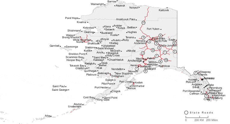
2. Map of Alaska with Towns:
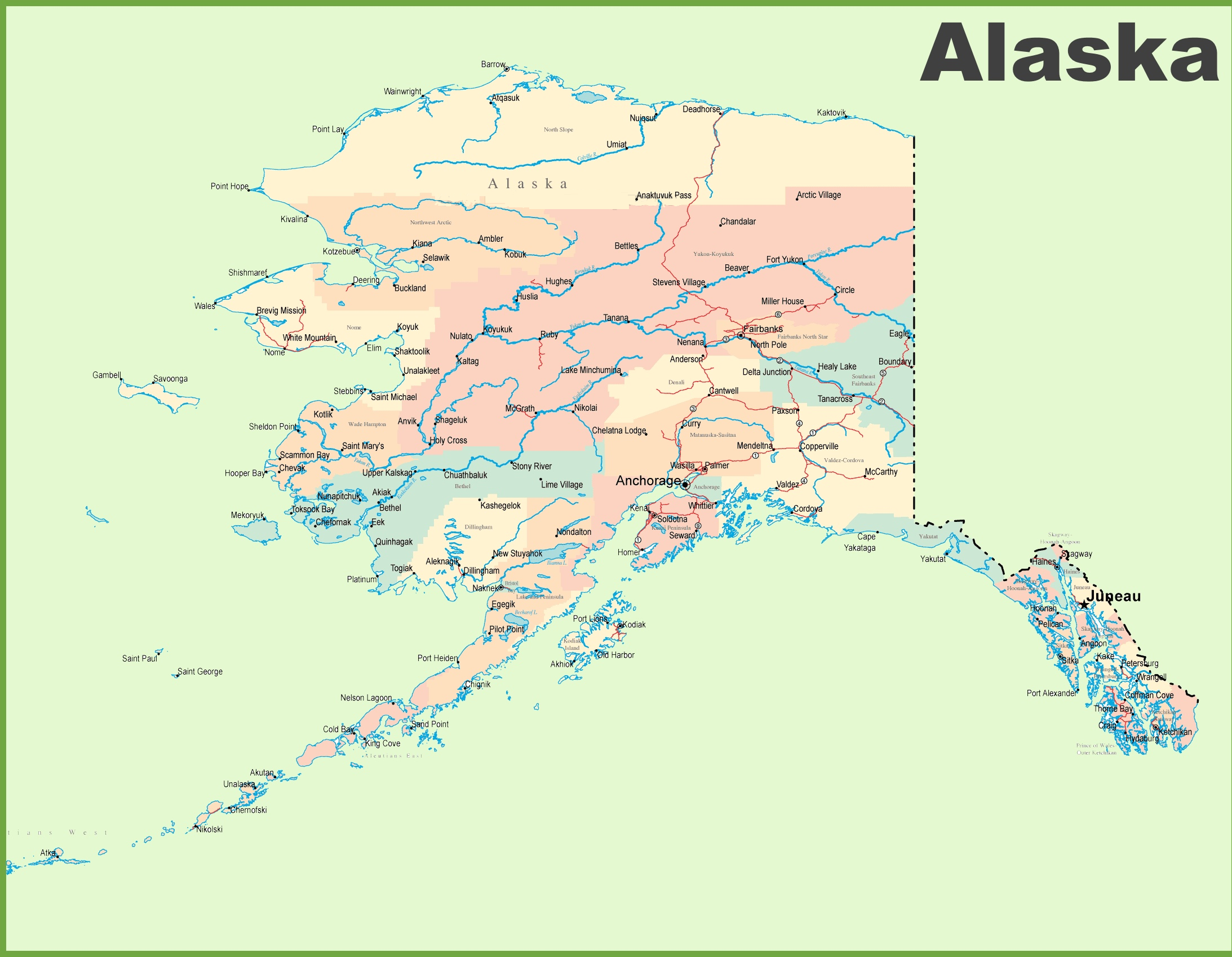
3. Large Map of Alaska with Towns & Cities:
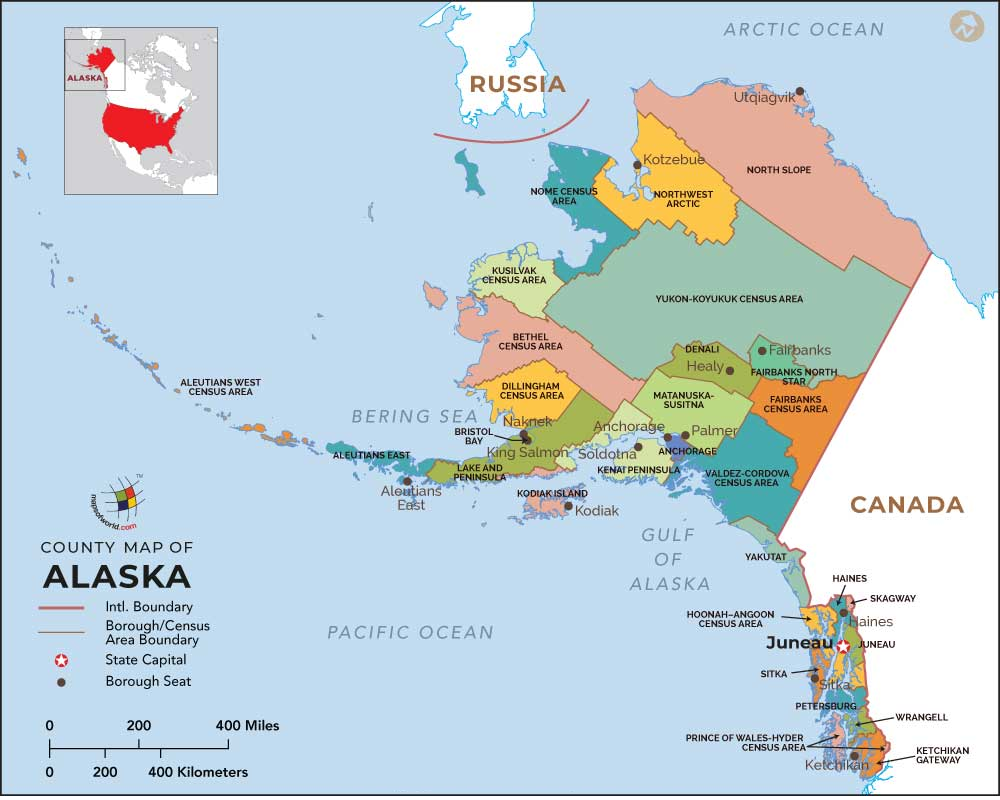
4. Borough Map of Alaska:
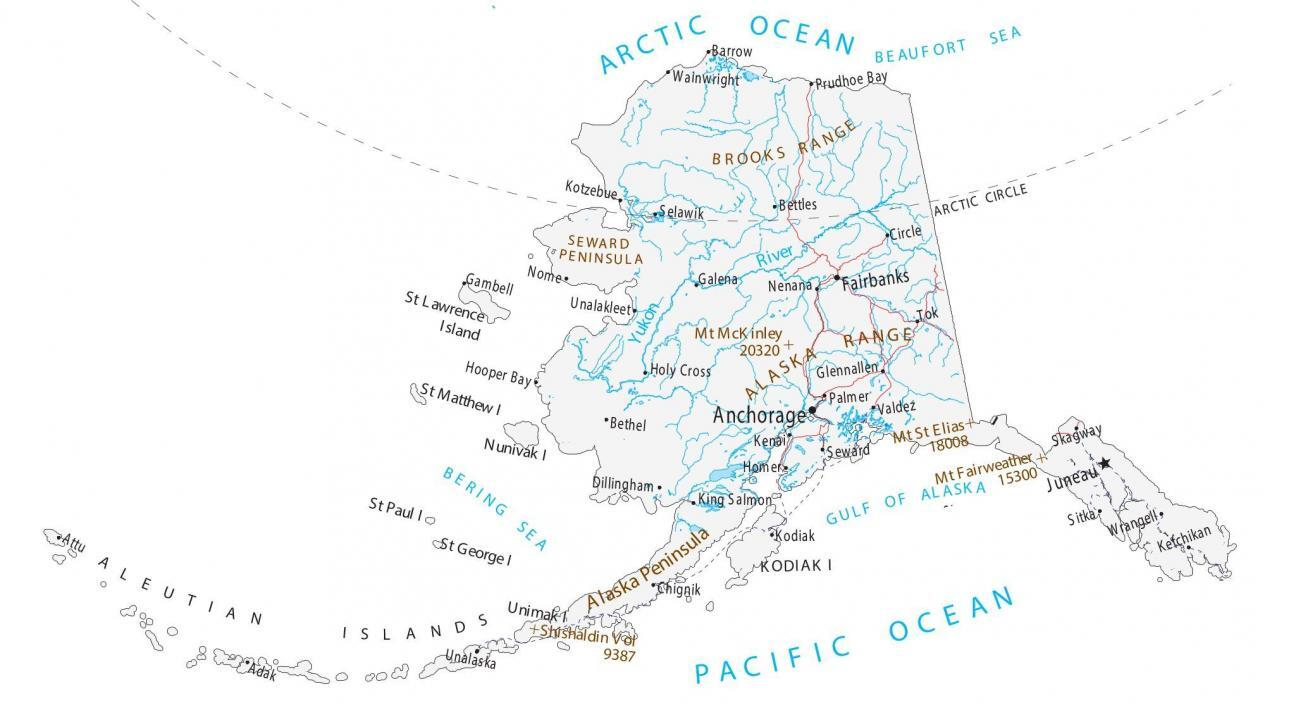
5. Map of Alaska:
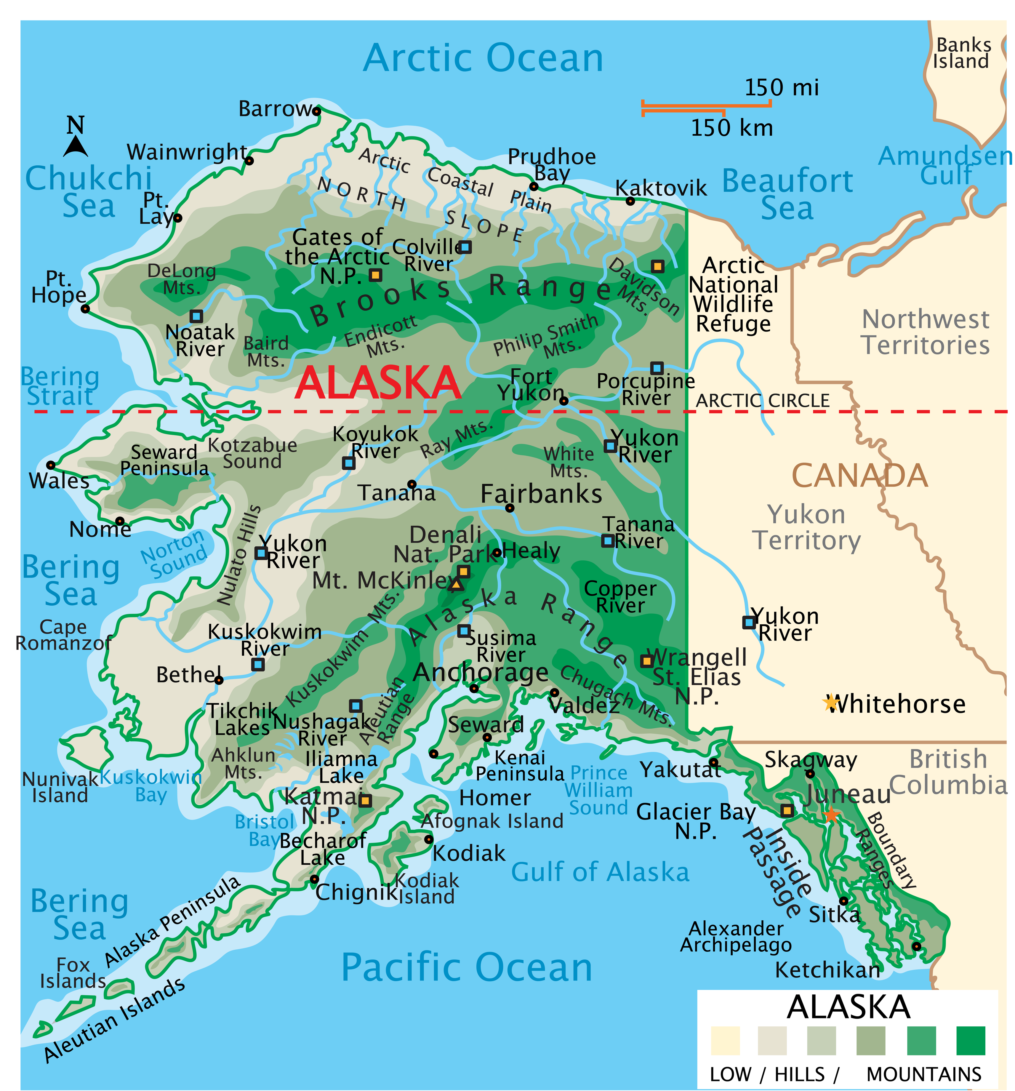
Above, we have added five types of different maps related to the cities and towns of Alaska state. Here, we are also giving some information about each map, so read the information and get any map on your device these maps are available for free.
The first map is related to the Cities of Alaska. So, you can easily locate any city in this state with the help of this map. Now, on the second map, you will get to know about the towns of AK, USA on this map, you will also find the roads and highways of these towns. The third map is the complete map of Alaska towns, villages, and cities with roads and highways. With the help of this map, you can easily navigate from one city to another city in this state. It is also a detailed map of Alaska with all major cities and towns that will also help you during travel and while traveling or roaming in this state all cities, towns, roads, street roads, highways, rivers, lakes, railroads, stations, beaches, parks, national museums, hotels, malls, fuel stations, airports and etc are visible on this map.
The fourth map is related to the main Borough map of Alaska. On this map, you can easily locate any borough. The borough seat is also visible on this map. The fifth map is related to the main state map of Alaska. This map shows all counties, major cities, towns, and some water bodies also. So, get this map for free if you need a complete state map. So, these were some best printable Alaska town and city maps. You can easily print any map because all maps are of HD quality and available in both PDF and JPG format. And you can download any map for free by clicking on the buttons under the preview image.