The State of Alaska is situated in the western region of the United States of America. Alaska ranked 1st in the USA and was divided into 19 boroughs. Bristol Bay becomes the first borough in 1962. Based on the area, Aleutians East is the largest borough and Skagway is the smallest borough in Alaska, USA.
If you want to explore more about the boroughs of Alaska state, then you should scroll down the page because we have added an Alaska borough map and some other printable maps along with some detailed information about each borough. So, let’s start with these high-quality & interactive maps.
Free & Printable Alaska (AK) Borough Maps Collection:
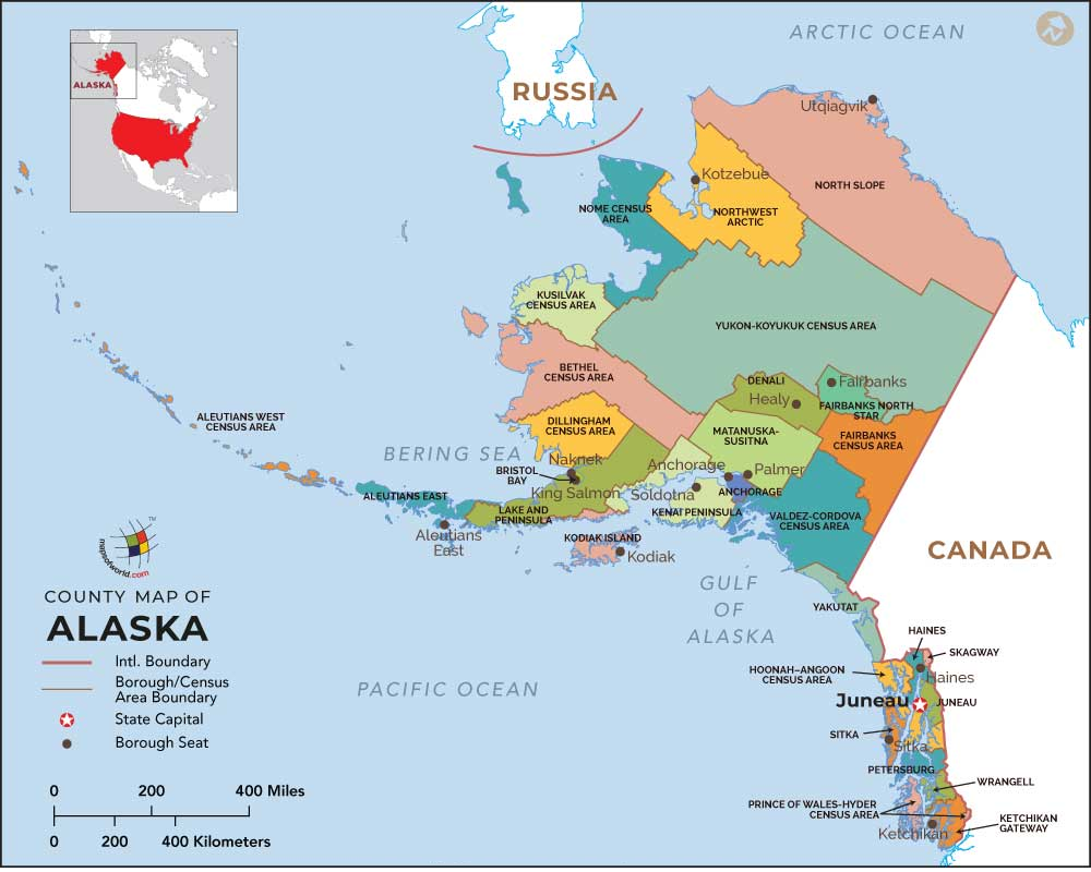
1. Map of Alaska with Borough:
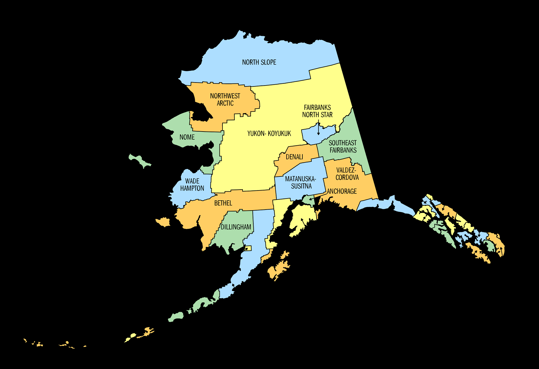
2. Alaska Borough Map:
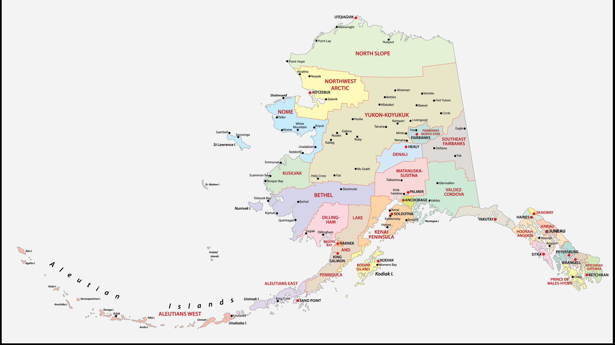
3. AK Borough Map:
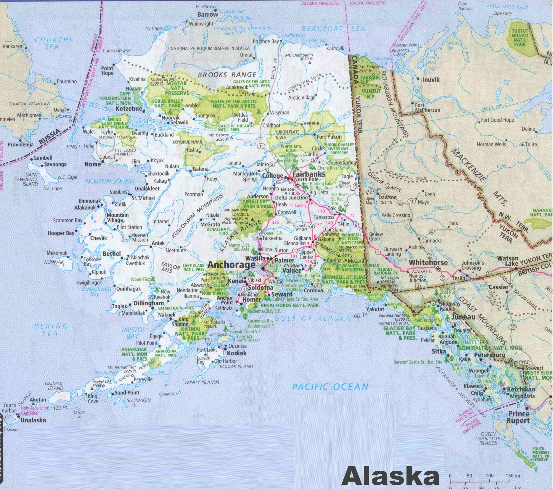
4. Cities & Towns Map of Alaska:
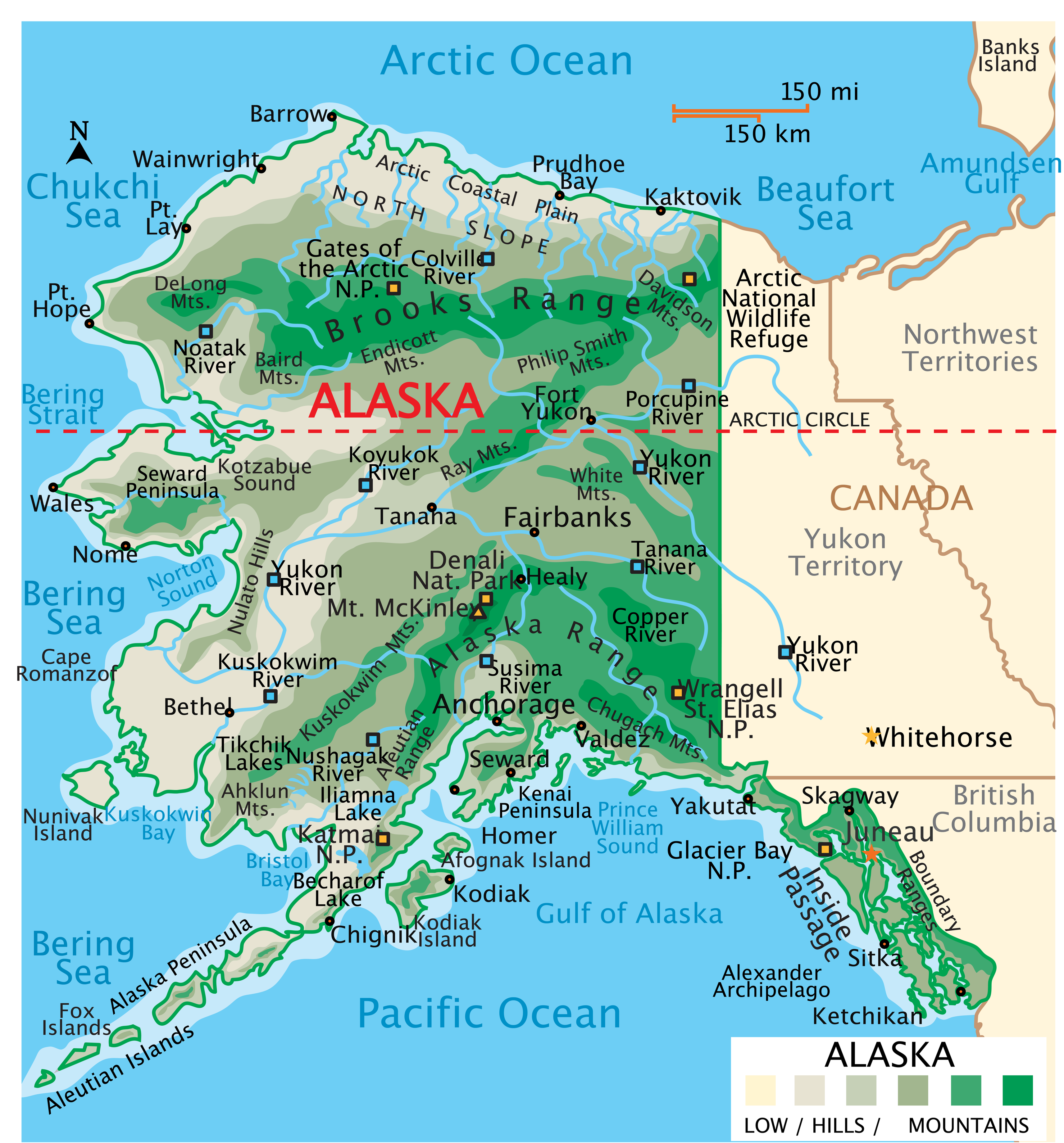
5. Map of Alaska:
Above we have added a total of five maps of Boroughs in Alaska. So, check all these maps and get the correct map you are looking for. And for more detailed information about the Boroughs, you check the table we are providing below.
List of all Boroughs that are in Alaska:
In this table, you will get useful information such as the Name of the Borough, Year of Establishment, approx. population, average area, and the Borough seat of all Boroughs. And, if you are looking for the maps of any Borough, please check the first three maps.
| Borough | Borough Seat | Established | Population | Area |
| Anchorage | (Consolidated | 1964/1975 | 288121 | 1,707 sq mi |
| Bristol Bay Borough | Naknek | 1962 | 838 | 482 sq mi |
| Denali Borough | Healy | 1990 | 1593 | 12,641 sq mi |
| Fairbanks North Star Borough | Fairbanks | 1964 | 95593 | 7,335 sq mi |
| Haines Borough | (Consolidated | 1968 | 2071 | 2,343 sq mi |
| Juneau | (Consolidated | 1970 | 31973 | 2,704 sq mi |
| Kenai Peninsula Borough | Soldotna | 1964 | 59767 | 16,017 sq mi |
| Ketchikan Gateway Borough | Ketchikan | 1963 | 13754 | 4,857 sq mi |
| Kodiak Island Borough | Kodiak | 1963 | 12787 | 6,689 sq mi |
| Lake and Peninsula Borough | King Salmon | 1989 | 1416 | 23,832 sq mi |
| Matanuska-Susitna Borough | Palmer | 1964 | 110686 | 24,707 sq mi |
| North Slope Borough | Utqiaġvik | 1972 | 10972 | 88,824 sq mi |
| Northwest Arctic Borough | Kotzebue | 1986 | 7560 | 35,663 sq mi |
| Petersburg Borough | Petersburg | 2013 | 3356 | 2,901 sq mi |
| Sitka | (Consolidated | 1971 | 8407 | 2,870 sq mi |
| Skagway | (Consolidated | 2007 | 1132 | 434 sq mi |
| Unorganized Borough | – | 1961 | 76490 | 319,852 sq mi |
| Wrangell | (Consolidated | 2008 | 2055 | 2,556 sq mi |
| Yakutat | (Consolidated | 1992 | 704 | 7,623 sq mi |
In the first map, you will see the name of all Boroughs and their location on the Alaska Map. The second map is a simple Borough map that shows the outline of all Boroughs. This type of map is also known as a blank map or outline map. Now, the third map is a detailed Borough map of Alaska. This map shows Boroughs along with all major cities, Borough seats, and towns. So, you can get this map if you have any work related to the Boroughs of this state.
The fourth map is a detailed and large map of Alaska’s Cities and Towns. This is a complete and printable map showing all cities, roads, state highways, and their routes. With the help of this map, you can easily move anywhere in any city in this state. The last map is a simple state map of Alaska. This map only shows all Boroughs, cities, mountains, hills, rivers, and lakes.
So, these were some printable maps related to Alaska (AK) Boroughs and towns that we have added above. These high-quality maps are available in PDF and JPG formats. You can easily download any map by clicking on the buttons under the preview image. All these maps are free to download.