Delaware (DE) is a state located in the United States of America. Delaware is divided into 57 towns and cities. This state covers an area of 6450 km2., based on area, Delaware ranked 49th in the country. Delaware has approx. the population of 1003,384 inhabitants and ranked 45th in the country.
So, if you are an explorer or traveler then you should explore more about this state with the help of a Delaware map with cities and towns. Below, we are adding some printable maps related to the towns of Delaware. Please scroll down the page and check our collections.
Printable maps of Delaware with Cities and Towns:
1. Map of Delaware with Towns:
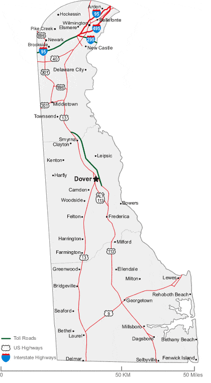
2. Map of Delaware with Cities:
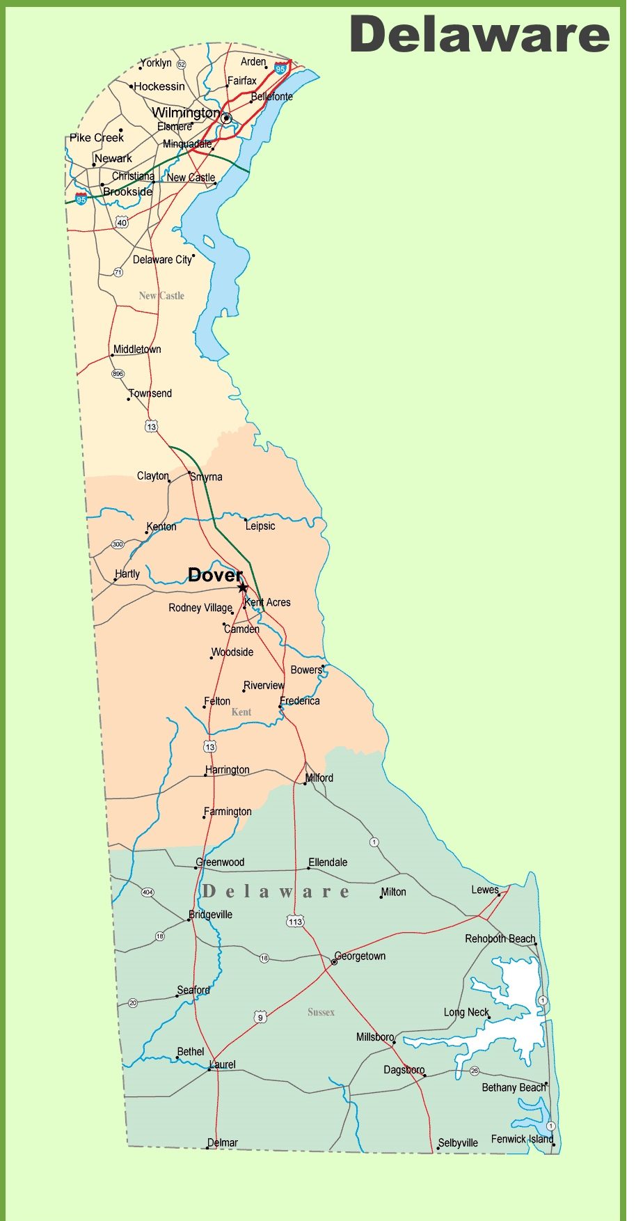
3. Detailed Map of Delaware with Cities & Towns:
4. County Map of Delaware:
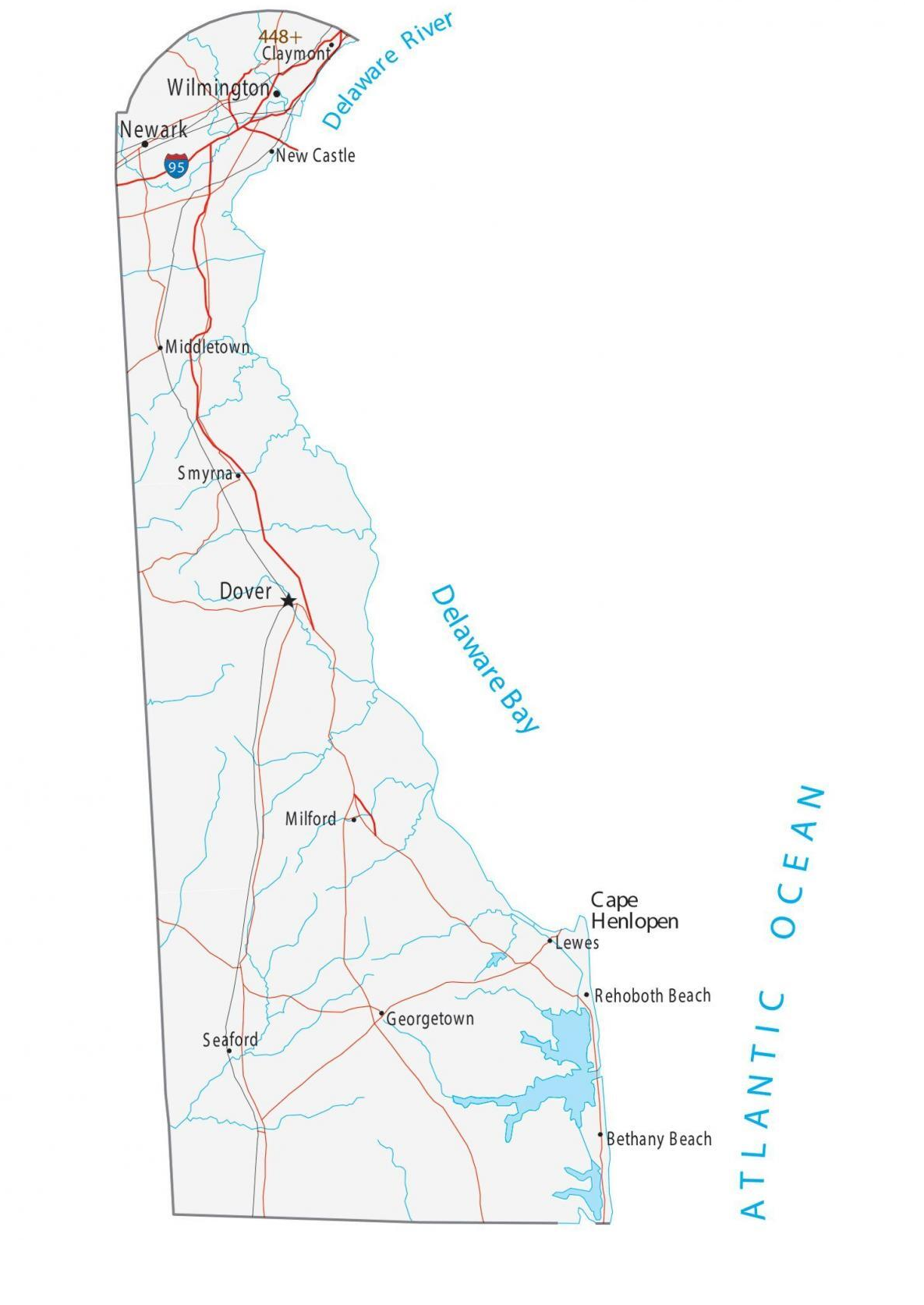
5. Delaware Map:
Above we have added some high-quality maps of Delaware with cities and towns, a county map of Delaware, and a map of Delaware state. These maps are high in resolution so you can easily save or print any map on your device for free. Below, we are also describing each map so read the description before viewing and downloading any map.
The first map is related to the main DE, USA map with towns. This map shows all towns of this state, so you can easily locate any city and navigate anywhere. Now, the second map is about the Delaware map with cities. On this map, you will see all cities of this state. In both maps, roads are also visible to find any route with the help of these maps. When you check the third map is a detailed map of Delaware Cities and Towns. This map shows all counties, cities, towns, and all city roads, street roads, national highways, interstate highways, and other major roads, this map also shows all lakes, rivers, and other major water bodies.
The fourth map is a printable County map of Delaware. This is a full version of Delaware Counties. All major cities, towns, and other important places are visible on this map. Now, the last map is the main state map of Delaware. All these maps are free to download. All the maps are available in PDF and JPG (Image) formats. You can easily download any map by clicking on the buttons under the preview image.