Florida (FL) is a state located in the United States of America. Florida is divided into 411 municipalities which include 267 cities, 123 towns, and 21 villages. This state covers an area of 170,312 km2 (including 31,424 km2 of water and 138,887 km2 of land)., based on area, Florida ranked 22nd in the country. Florida becomes 3rd most populous state with an approx. the population of 21,538,187.
So, if you are an explorer or traveler then you should explore more about this state with the help of a Florida map with cities and towns. Below, we are adding some printable maps related to the towns of Florida. Please scroll down the page and check our collections.
Printable maps of Florida with Cities and Towns:
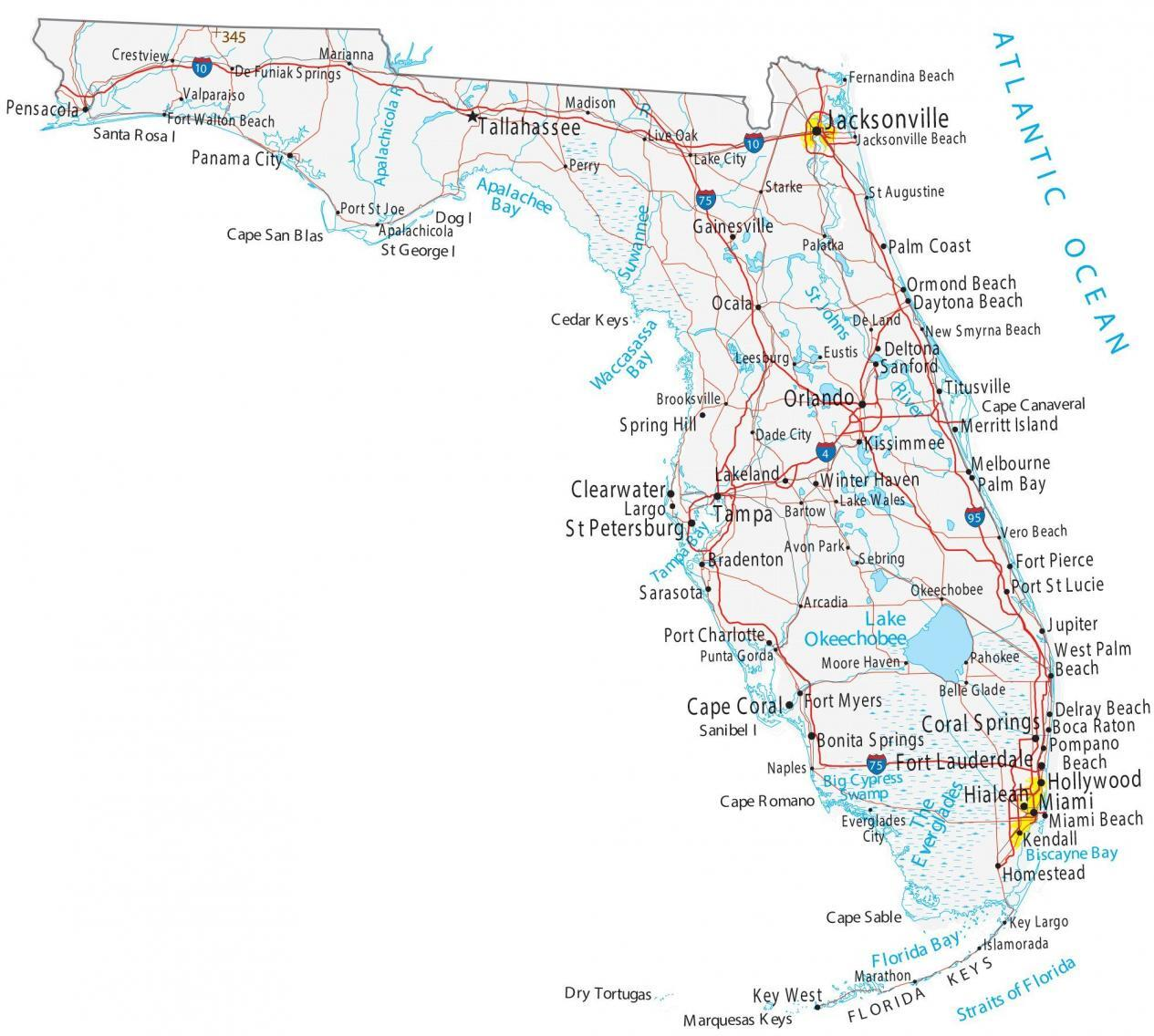
1. Map of Florida with Towns:
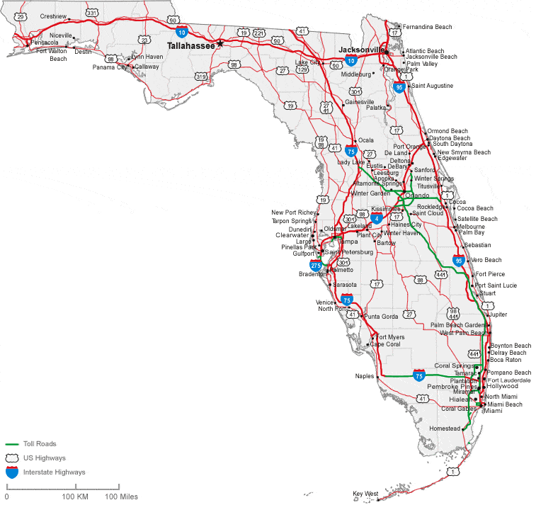
2. Map of Florida with Cities:
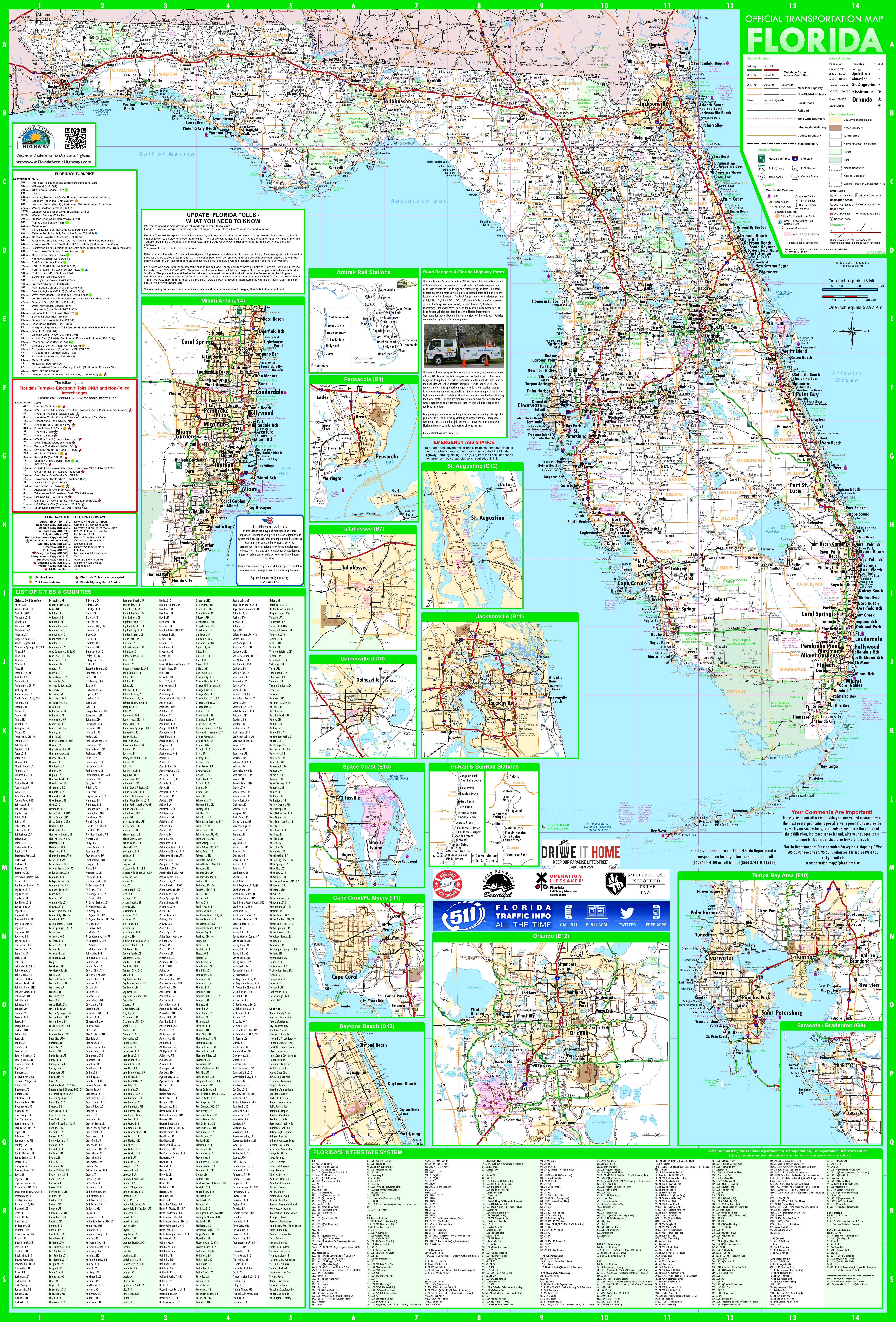
3. Detailed Map of Florida with Towns & Cities:
4. Florida (FL), USA Map:

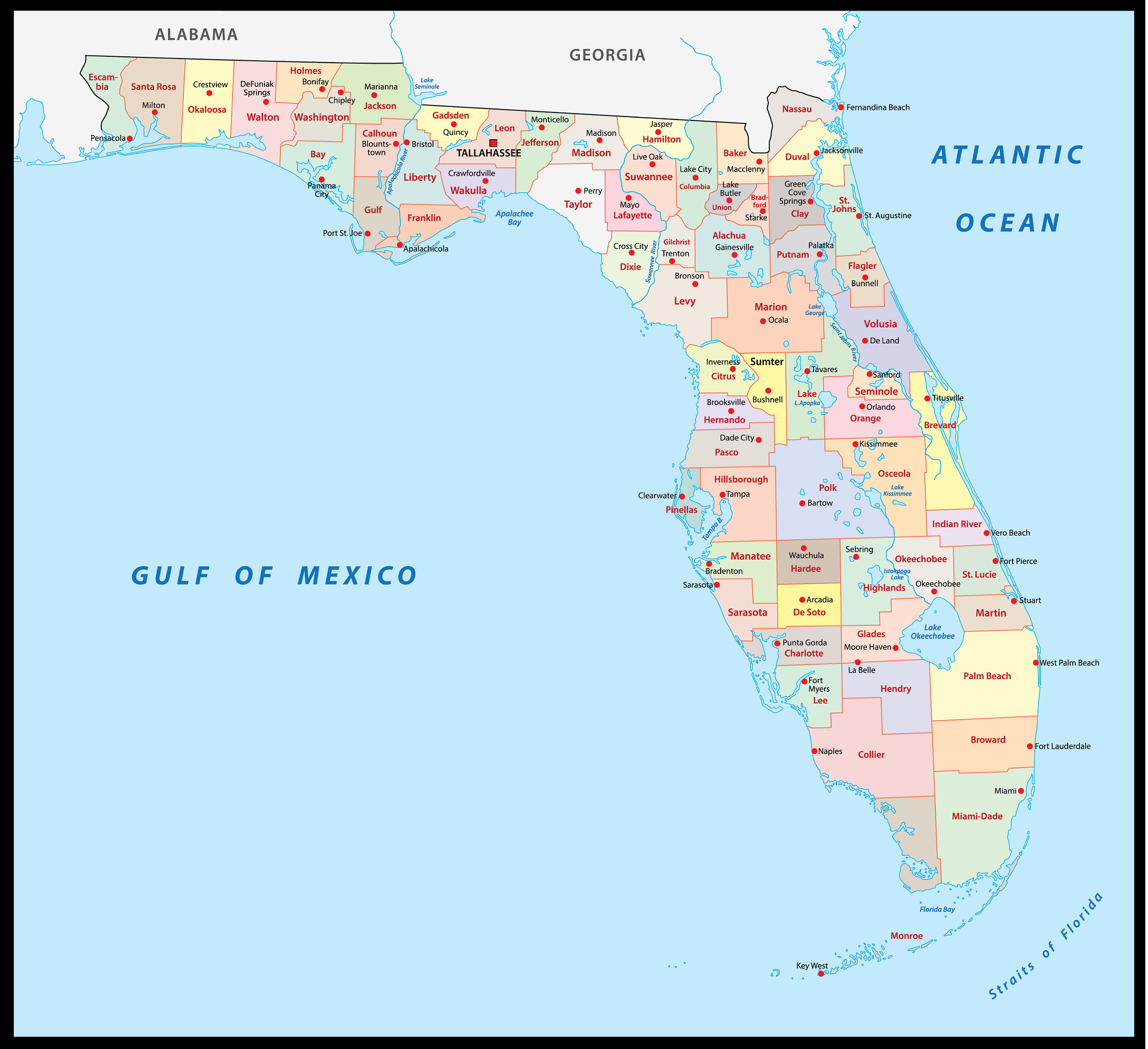
5. County Map of Florida:
This is the collection of maps of Florida Cities and Towns that we have added above. We have added five different maps that contain some helpful information. Below, we are also adding some brief information about each map. So, please read the full description before viewing or downloading any map from the above.
The first map is about the city map of Florida state, and this map shows all cities. You can locate any city on this map. This map also shows all counties. The second is related to the Town map of this state. As you can see on the map, all major towns are visible, along with some interstate highways. A thick red line indicates all interstate highways of this state.
The third map is a large and detailed Map of Florida Cities and Towns, showing all the cities, towns, counties, other significant places, and tourist places. And on this map, you can also know about all parks, malls, beaches, airports, railroads, street roads, city roads, interstate highways, and other states’ highways. The fourth map is related to the main state map of this state, which shows all counties and major cities on the map. This map also shows national highways, major roads, railway lines, the state capital, and major towns.
The last map is related to the Florida County map. You can easily identify any county with the help of this map. So, these were some large and printable FL State maps that we have added above. All these high-quality maps are available in PDF format and JPG (Image) format. You can easily download any map by clicking on the buttons under the preview image. All these high-quality maps are free to download.