Colorado becomes the 38th state of the USA which is admitted to the union on 1 August 1876. Colorado is situated in the mountain west subregion of the Western USA. The State of Colorado is also known as The Centennial State.
You may explore more about this state with the help of a Colorado map. So, scroll down the page and check our collection of printable maps related to CO USA, county maps, blank maps, google maps, physical maps, and some other maps.
Collections of Colorado State Maps:
1. Map of Colorado, USA:
2. County Map of Colorado:

3. Large Map of Colorado with Cities & Towns:

4. Colorado location on USA Map:

5. Google Map of Colorado:

6. Blank or Outline Map of Colorado:

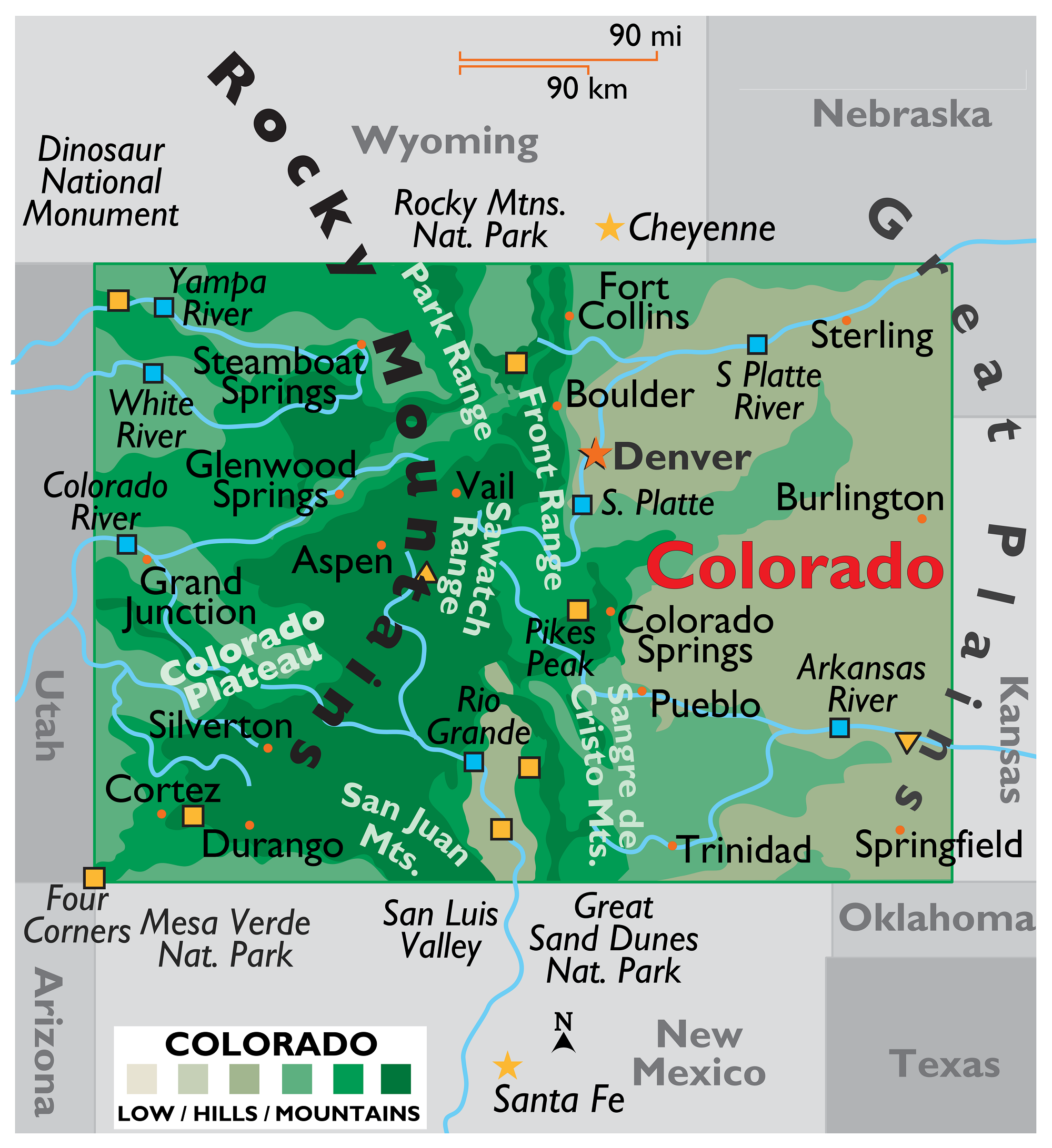
7. Physical Map of Colorado:

8. Satellite Map of Colorado:

This is the collection of the CO USA map that we have added above. We have added a total of eight different maps that contain some helpful information. Below, we are also adding some brief information about each map. So, please read the full description before viewing or downloading any map from the above.
The first map is related to the state map of Colorado, which shows all counties, towns and cities on the map. The second map is related to the County map of Colorado, which shows all counties and some major cities. The third map shows all the cities, towns, counties, and other tourist places. It is a complete and detailed cities and towns map of Colorado state. You can use this map if you are an explorer, traveller or tourist because, on this map, you can also know about all parks, malls, beaches, airports, railroads, street roads, city roads, interstate highways, U.S. routes, and other states’ highways.
Now, the fourth map shows the location of this state on the U.S.A map. As you can see, an area filled with red colour indicates its location. The fifth map is a google map that shows some cities, capital city and counties of this state. The sixth map is a blank outline map of this state, which shows the boundary of Colorado. And, the seventh map is a physical map of Colorado, this type of map shows the height, depth, shape, mountains, desert, or water bodies of any state. Now, the eighth map is a satellite image of Colorado that shows the structure of this state. As you can see on the map, a thin yellow line marks the outer boundary.
So, if you are looking for such types of information then you must check this map. These were some most useful and printable Colorado State Map that we have added above. These high-quality maps are available in PDF format and JPG (Image) format. You can easily download any map by clicking on the buttons under the preview image.