Arizona is the 6th largest state by area in the United States of America. Arizona covers an area of 113,990 sq. miles. Arizona has a population of 7,151,502 and is ranked 14th in the country.
So, if you are an explorer or traveler then you should explore more about this state with the help of an Arizona map with cities and towns. Below, we are adding some printable maps related to the towns in Arizona. Please scroll down the page and check our collections.
Printable maps of Arizona with Cities and Towns:
1. Map of Arizona with Cities:

2. Map of Arizona with Towns:
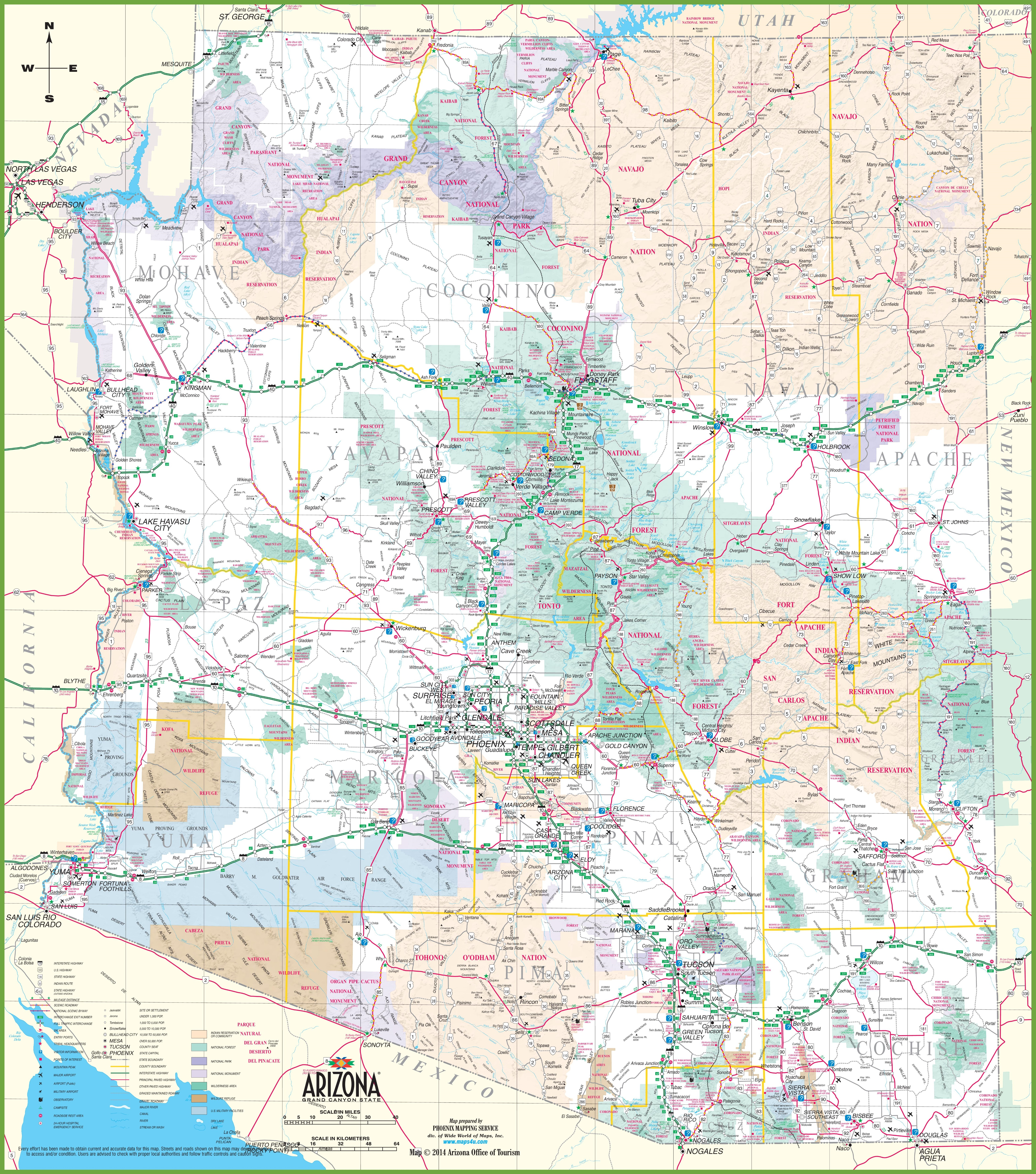
3. Detailed Map of Arizona with Towns & Cities:
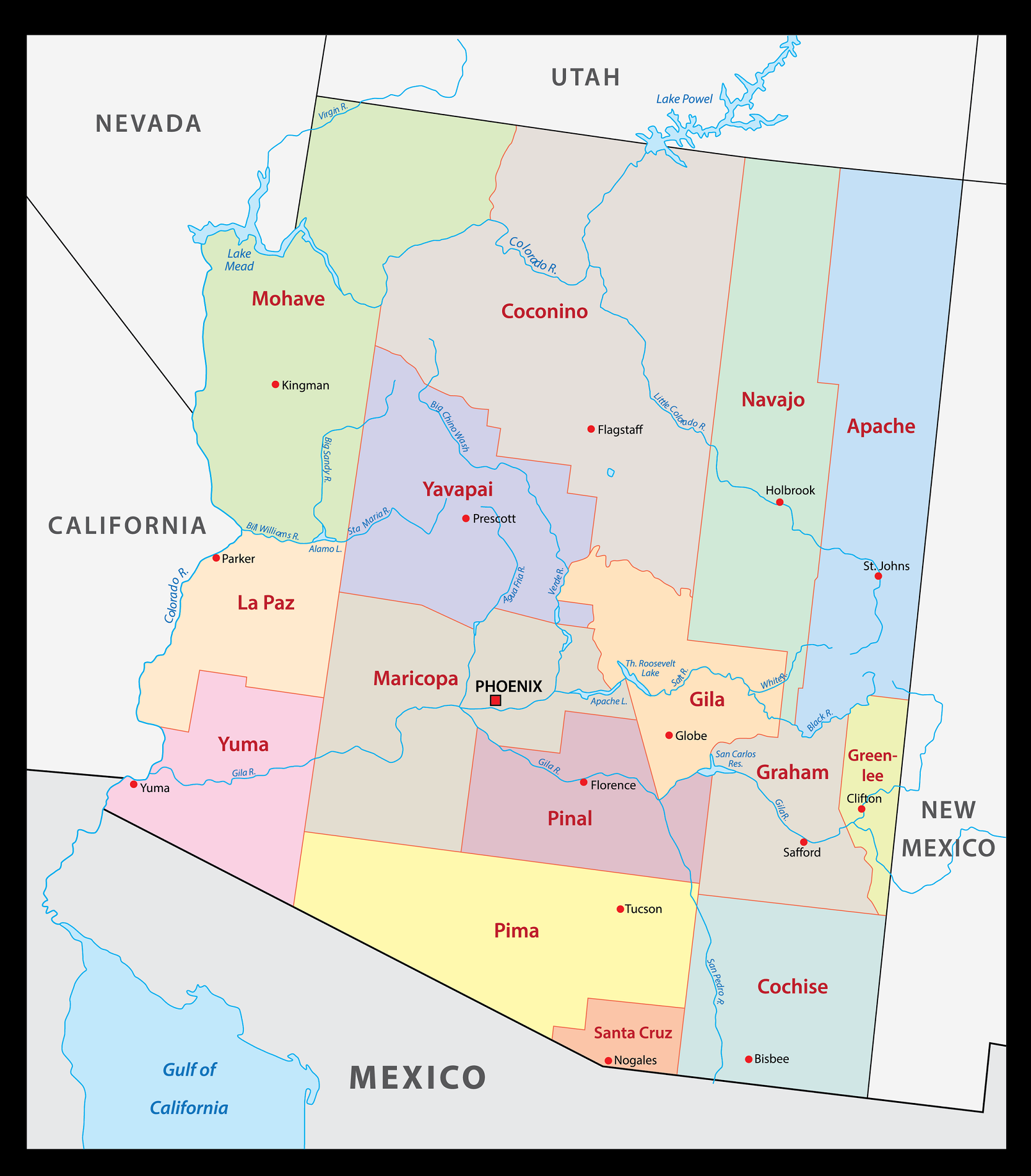
4. County Map of Arizona:
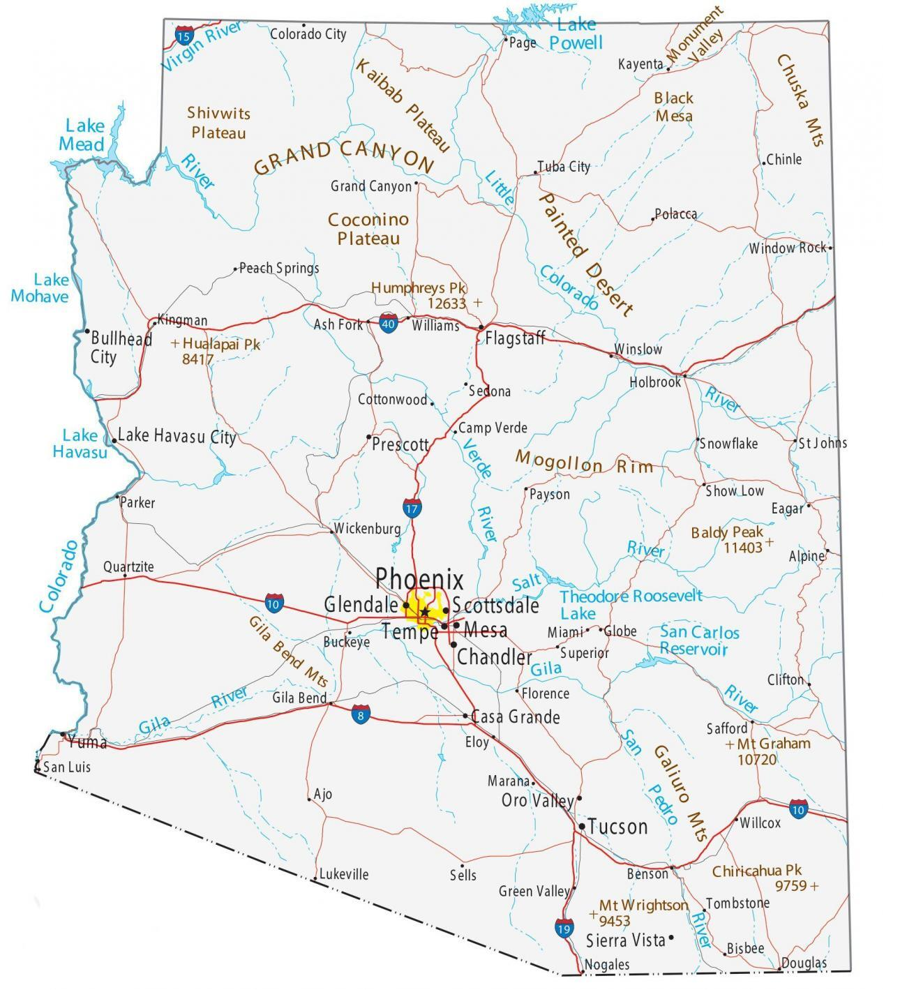
5. Arizona State Map:

Here, we have added five different types of maps. All maps belong to Arizona cities and towns. We have also added some other Arizona State and County Map of Arizona. Each map contains some helpful information. For you, we are adding some more useful information about each map.
The first map is related to the main City map of Arizona. This map shows all cities of this state, so you can easily locate any city. Now, the second map is about the Town maps of Arizona. On this map, you will see the towns of this state. In both maps, roads are also visible to find any route with the help of these maps.
If you are looking for some other maps related to Arizona (AZ), USA then you should check our other articles.
- Arizona County Map | County maps with Cities
- Free Arizona Zip Code Maps
- Free Arizona Time Zone Maps
- Free Arizona Mountain Ranges Maps
- Free Arizona Road Maps
- Free Arizona Highway Maps
- Free Arizona River Maps
- Free Arizona Lake Maps
- Map of Arizona | State, Outline, County, Cities, Towns
The third map is a large and printable map of Arizona. This is a detailed and large version of Arizona Cities and Towns. All cities, towns, and other important places are visible on this map. The fourth map is a county map of Arizona. This map shows all counties, major cities, and their county seats.
Now, the last map is also about the state map of Arizona, and this map is a detailed map of this state. Because this map shows all counties, cities, towns, and all city roads, street roads, national highways, interstate highways, and other major roads, this map also shows all lakes, rivers, and other major water bodies. So, these were some practical and printable maps of AZ state Cities and Towns. All these maps are free to download. All the maps are available in PDF and JPG (Image) formats. You can easily download any map by clicking on the buttons under the preview image.