Georgia often called the State of Georgia is located in the southeastern region of the country. This state is admitted to the union on 2nd January 1788 and becomes the 4th state of the United States of America. Atlanta is the capital city as well as the largest city of Georgia, USA. This state has two nicknames also which are – “Peach State” and “Empire State of South”.
If you want to know more about this state then you should stay on this page, because here we are adding a map of Georgia state. So, scroll down the page and check our collection of maps related to Georgia (GA).
Collections of Georgia State Maps:
1. Georgia Map:
2. Georgia on USA Map:

3. Georgia on World Map:

4. Google Maps Georgia:

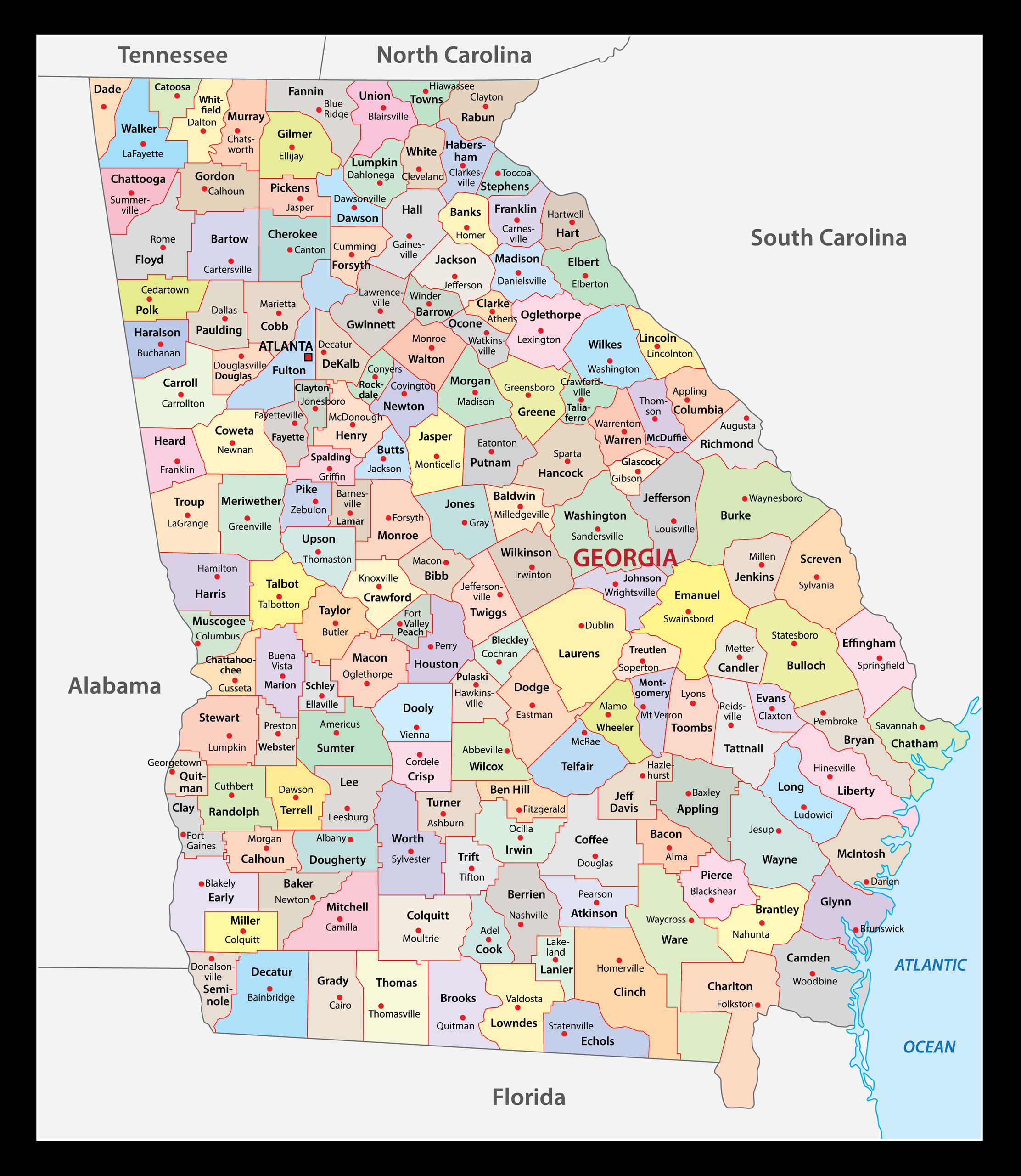
5. Georgia County Map:
6. Map of Southern Georgia:

7. Map of Northern Georgia:

8. Georgia Map with Cities & Towns:
9. Georgia Map Outline:

10. Topographic Map of Georgia:

Here, we have added different types of GA map. Each map contains some useful information. For you, we are adding some more useful information about each map here.
If you are looking for some other maps related to the State of Georgia then you should check our other articles.
- Free Printable Georgia (GA) Lakes Map
- Free Printable Highway Maps of Georgia (GA)
- Free Road Maps of Georgia
- Free Georgia River Maps
- Free Georgia Mountain Maps
- Map of Georgia | State, Outline, County, Cities, Towns
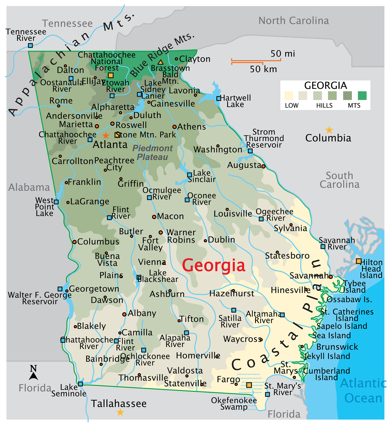
The first map is related to the detailed state map of Georgia, and this map shows some counties, lakes, rivers, cities, towns, and mountains. You can easily locate major places with the help of this map. The second map shows the location of Georgia on the USA Map. As you can see on the map, the area filled with red color indicates its location on the country map. The third map is also related to the location of this state – this map shows the location on the world map, as you can see that an arrow of red color points to the location of Georgia, USA.
The fourth map is titled “Google Map of Georgia.” This map is a Google map version of this state which shows some cities, towns, and the capital city of Georgia. The fifth map is related to the map of Georgia county. It is a full-detailed IL county map with cities. County seats are also shown on this map. The next two maps are the specific area maps of Georgia, USA. On the sixth map, you will see all cities, towns, and roads of Southern Georgia, and on the seventh map, you will get to know all cities, towns, and roads of Northern Georgia. Both maps are the regional maps of Georgia state.
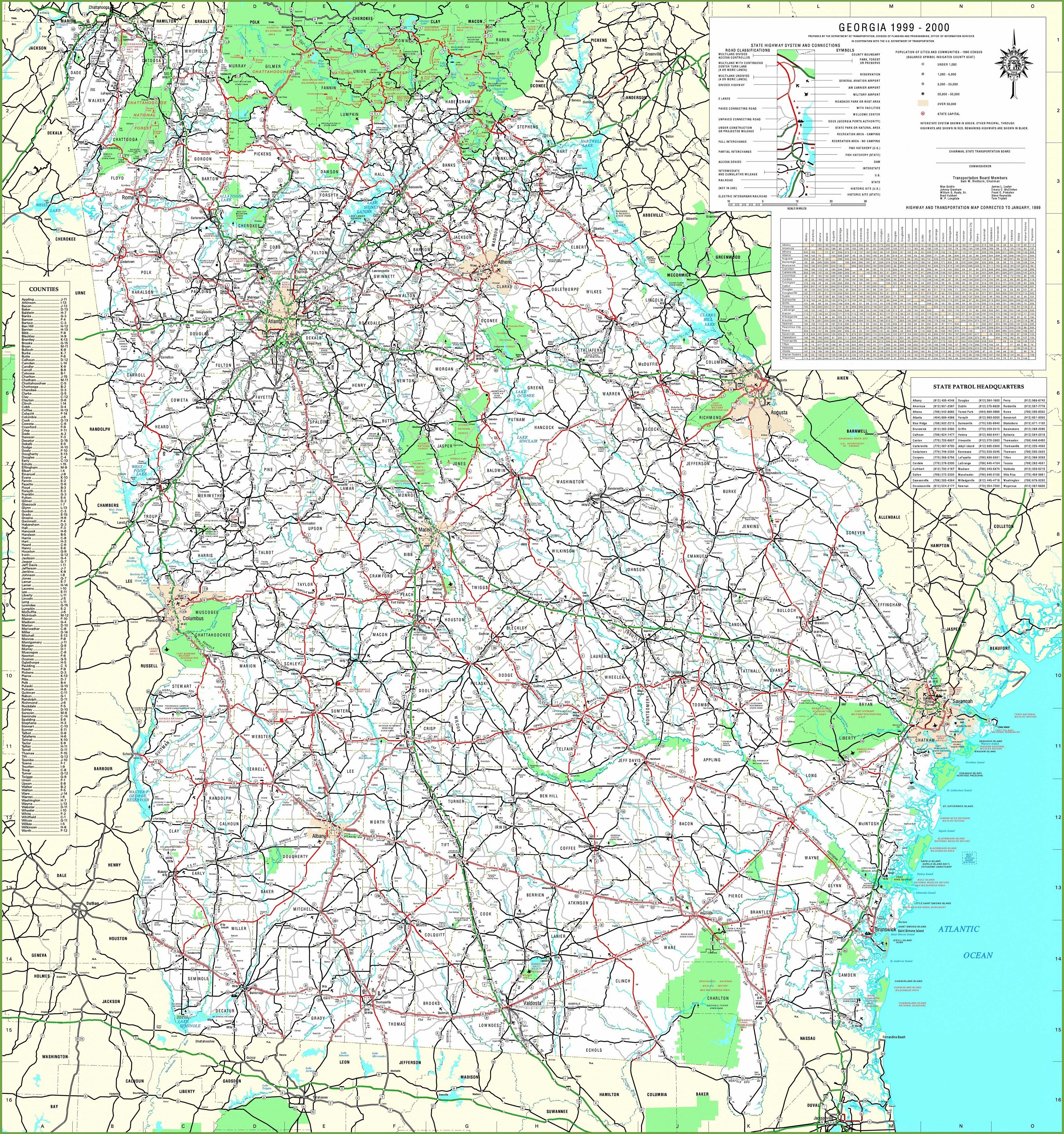
The eighth map is a large and detailed map of Georgia with cities and towns. This map shows all cities, towns, roads, highways, railroads, airports, rivers, lakes, mountains, etc. The ninth map is a simple outline or blank map of Georgia, which shows the outer boundary. Now, the last map is the topographic map of Georgia state this map shows all geographic features of this state like mountains, water bodies, terrain, elevation, depth, etc.
So, these were some best and most useful Georgia maps that we have added above. All the maps are available in PDF format and JPG format. You can easily download any map by clicking on the buttons under the preview image. All these maps are free to download.