Georgia mountains starts in the northeast corner of the Georgia in the United States. It has spread in the western direction. The mountains of Georgia covers 3000 km2 area of land. This geological information regarding the Georgia mountain maps are very helpful. If you want to know more about the Georgia mountain, then you should check the best collection of Georgia mountains maps.
Collection of Georgia Mountain Maps:
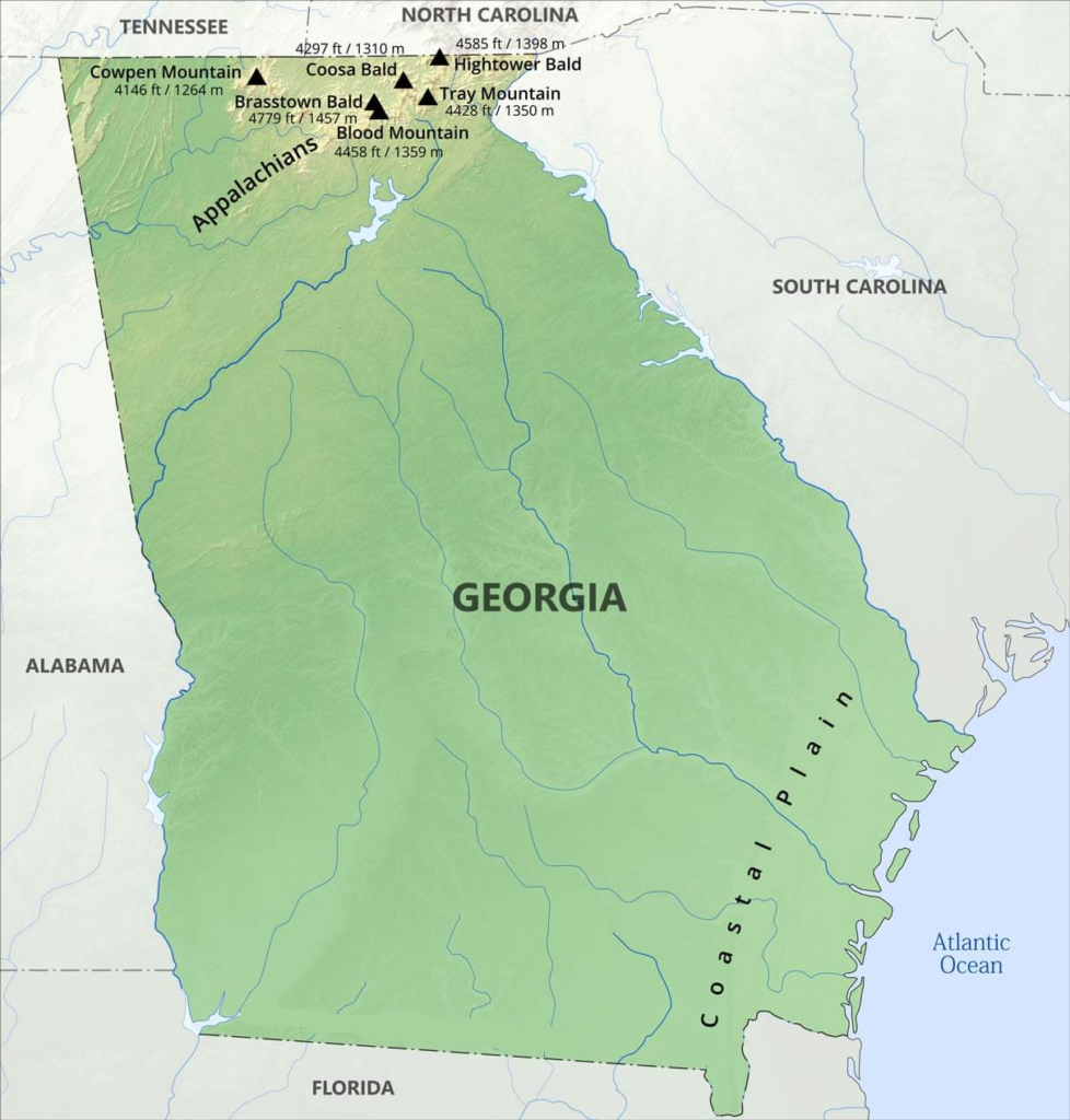
1. Georgia Mountain Map:
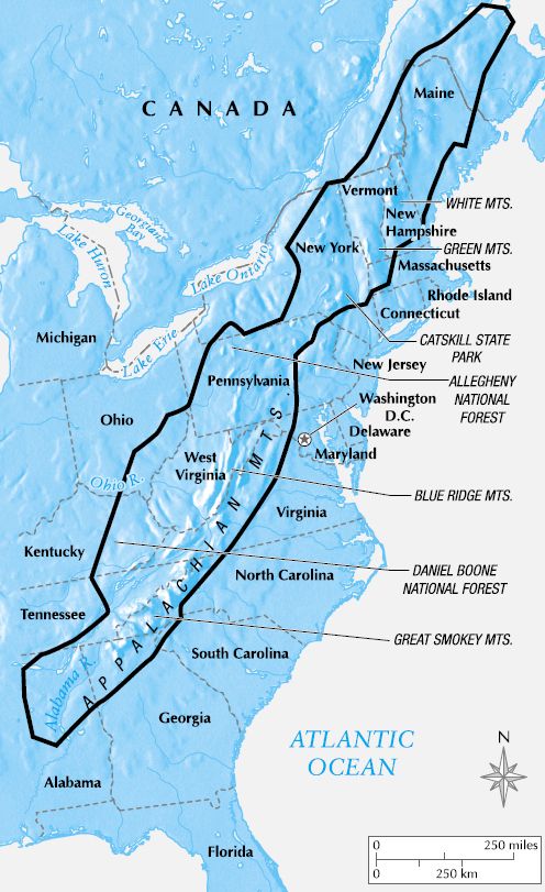
2. Appalachian Mountains Georgia Map:
3. Stone Mountain Park Map:

4. Pine Mountain GA Map:

Here, we have added 4 types of Georgia mountain maps. The first image shows all the Georgia mountains on a map. All these mountains are located in the North direction of Georgia. This is the reason that all these mountains are known as the north Georgia mountains.
The second image shows the map of the Appalachian mountains. If was formed approx 480 million years ago. The highest peak of this mountain is known as Mount Mitchell. It has an elevation of 6,684 ft (2,037 m). This mountain covers 1,500 mi (2,400 km) of land area.
The third image shows the map of the stone mountain park. It has an elevation of 1,686 feet (514 m) above the sea and 825 feet (251 m) above the surrounding area. The last one shows the map of the Pine mountains. It is located in the north direction of Georgia. The highest peak of the Pine mountain is known as Dowdell’s K.nob. It has an elevation of 1,395 ft (425 m).
All these mountain maps are included. These maps are not for sale but for the help for mankind. If you want to get these maps, then you can easily get these maps by clicking on the PDF button as shown in the particular category of map.