Virginia is a state of the USA that is located in the mid-Atlantic and southeastern region of the country. Virginia is the 12th most populous state in the country with an approx. population of 8,654,542. This state covers an area of 110,785.67 km2 and is ranked 35th by area in the USA. Below, we are adding a map of Virginia with cities and towns along with useful information. So, scroll down the page and check our collection of maps related to the town of Virginia. You may also check some other maps related to Roads and Highways of Virginia, USA by clicking on this link.
Maps Collection of Virginia Cities and Towns:
1. Map of Virginia with Cities:

2. Map of Virginia with Towns:

3. Cities & Towns Maps of Virginia:
4. County Map of Virginia:

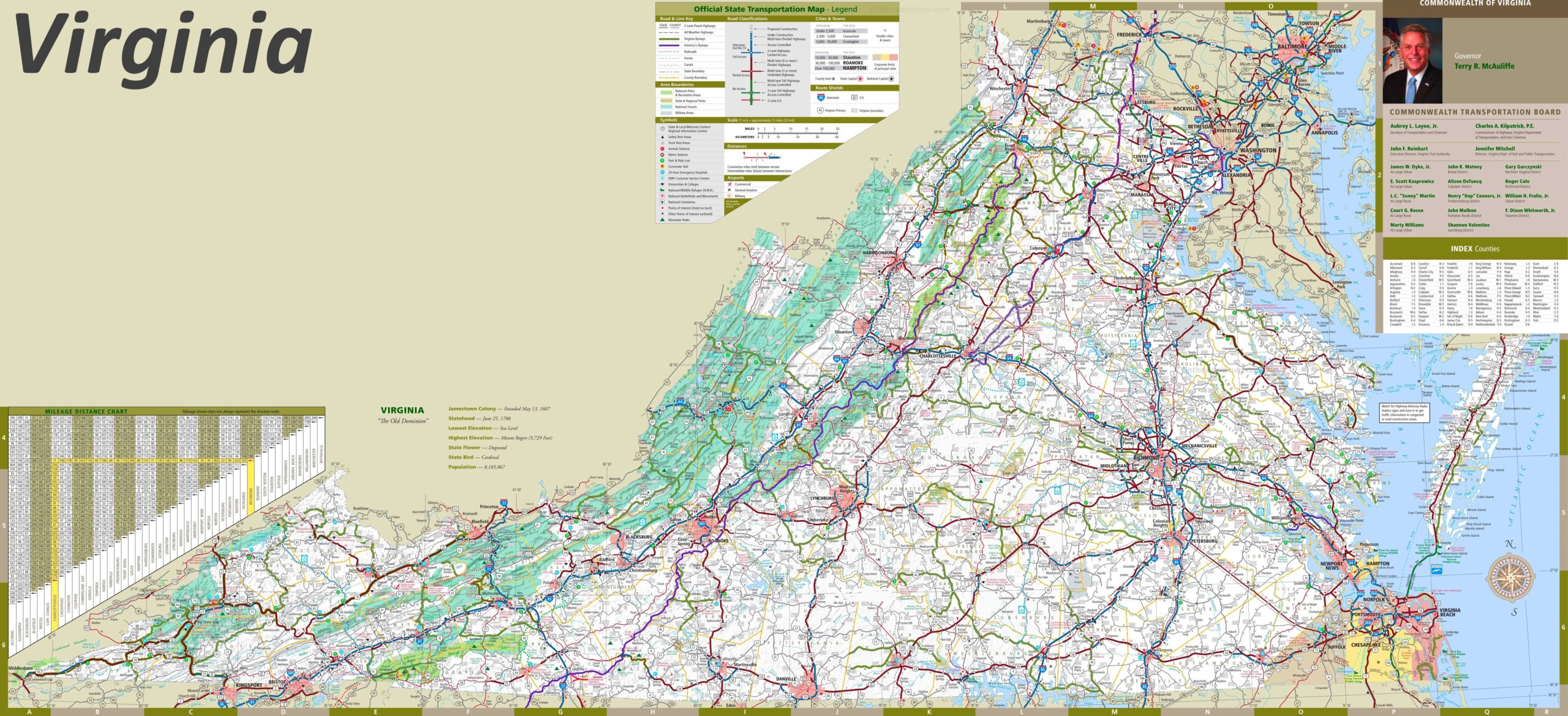
5. Map of Virginia:

Here, we have added five different types of maps. All maps belong to Virginia cities and towns. We have also added some other Virginia State and County Map of Virginia maps. Each map contains some helpful information. For you, we are adding some more useful information about each map.
The first map is related to the main City map of Virginia. This map shows all cities of this state, so you can easily locate any city. Now, the second map is about the Town maps of Virginia. On this map, you will see the towns of this state. In both maps, roads are also visible to find any route with the help of these maps.
The third map is a large and printable map of Virginia. This is a detailed and large version of Virginia Cities and Towns. All cities, towns, and other important places are visible on this map. The fourth map is a county map of Virginia. This map shows all counties, major cities, and their county seats.
Now, the last map is also about the state map of Virginia, and this map is a detailed map of this state. Because this map shows all counties, cities, towns, and all city roads, street roads, national highways, interstate highways, and other major roads, this map also shows all lakes, rivers, and other major water bodies. So, these were some practical and printable maps of VA state Cities and Towns. All these maps are free to download. All the maps are available in PDF and JPG (Image) formats. You can easily download any map by clicking on the buttons under the preview image.