South Dakota is a state in the United States of America that is located in the north-central region of the USA. SD (South Dakota) is the seventeenth-largest state by area in the country. If you want to know more about this state through maps, you must check the collection of South Dakota maps that we have added below. Here on this page, we have added all kinds of maps such as SD state maps, South Dakota map with cities and towns, county map of South Dakota, and South Dakota google map. So, please scroll down the page and have a look at these amazing and printable maps. And, if you’re also planning to travel in this state, then you must have a Road and Highway Map of South Dakota. For this, please visit this link and get all Road and Highway maps.
Collection of South Dakota (SD) Maps:
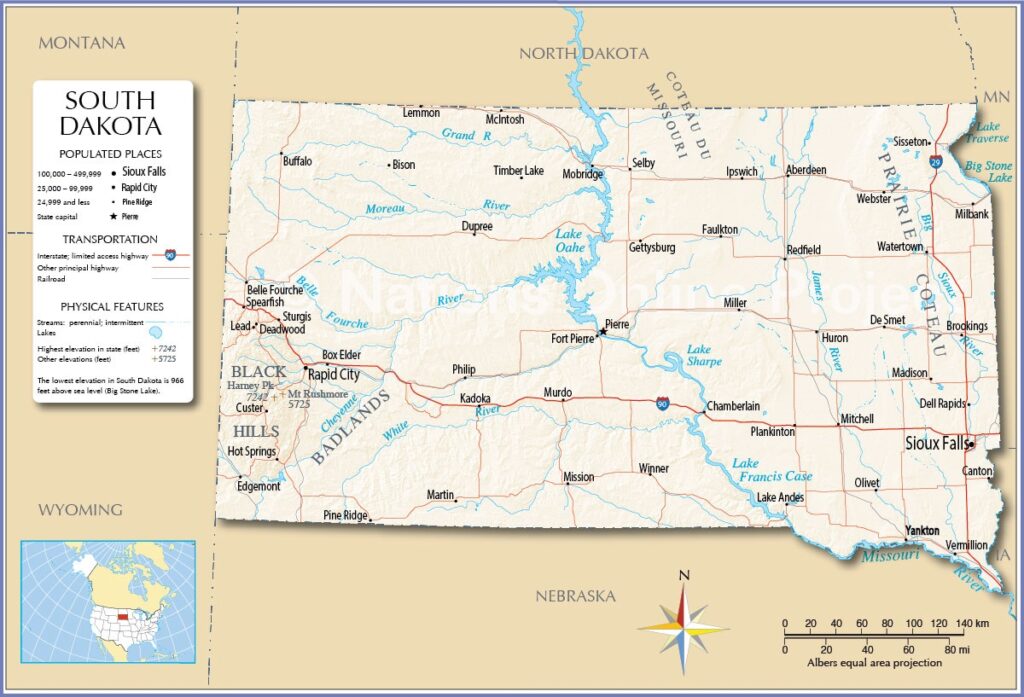
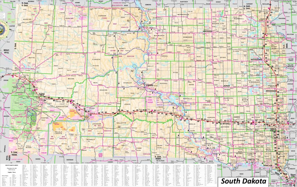
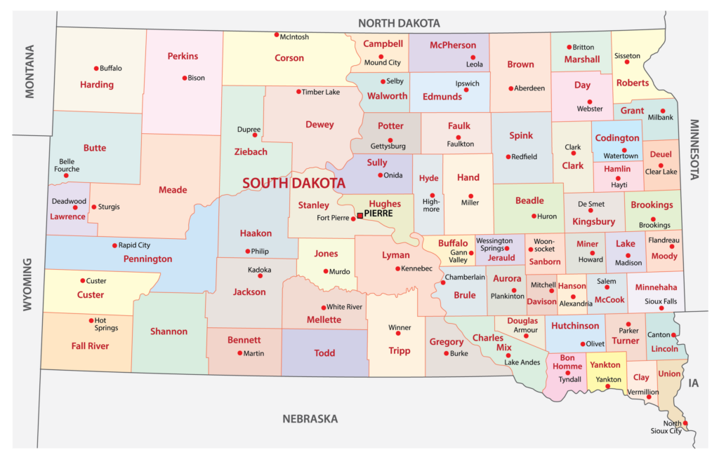
1. South Dakota Map:
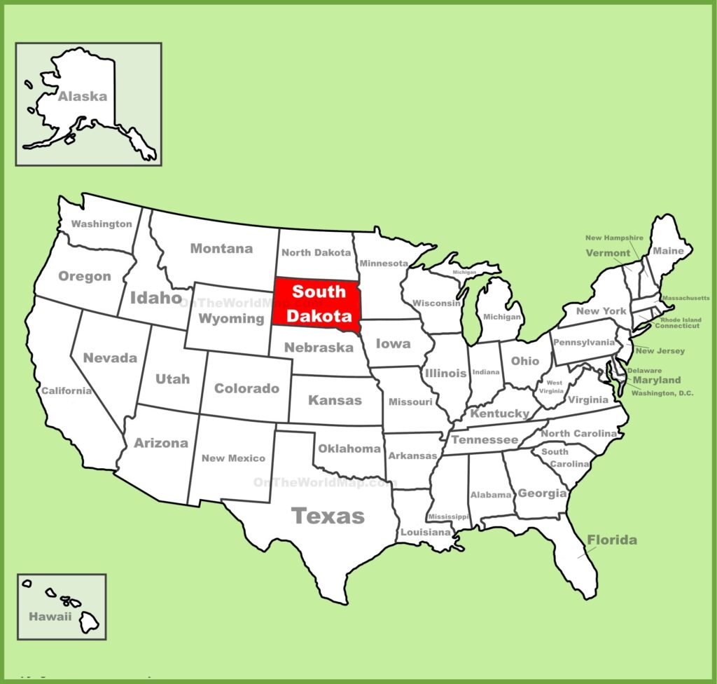
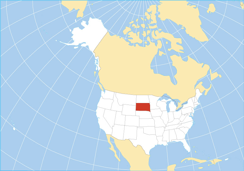
2. South Dakota on US Map:
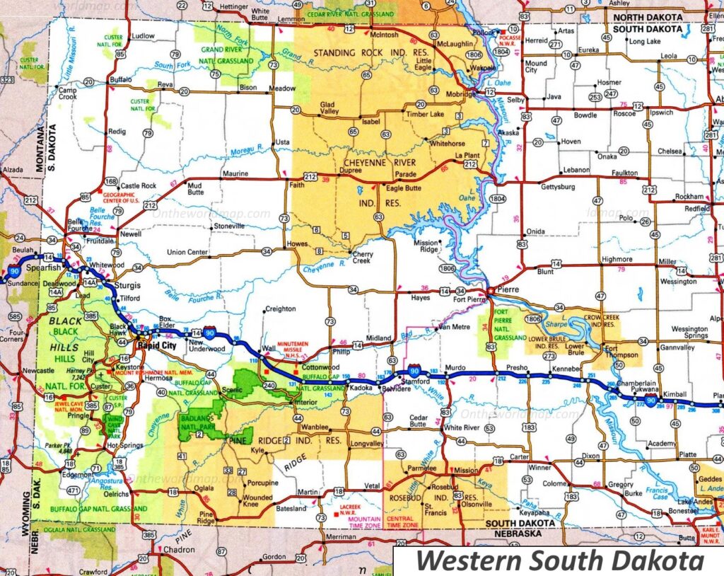
3. Map of Western South Dakota:
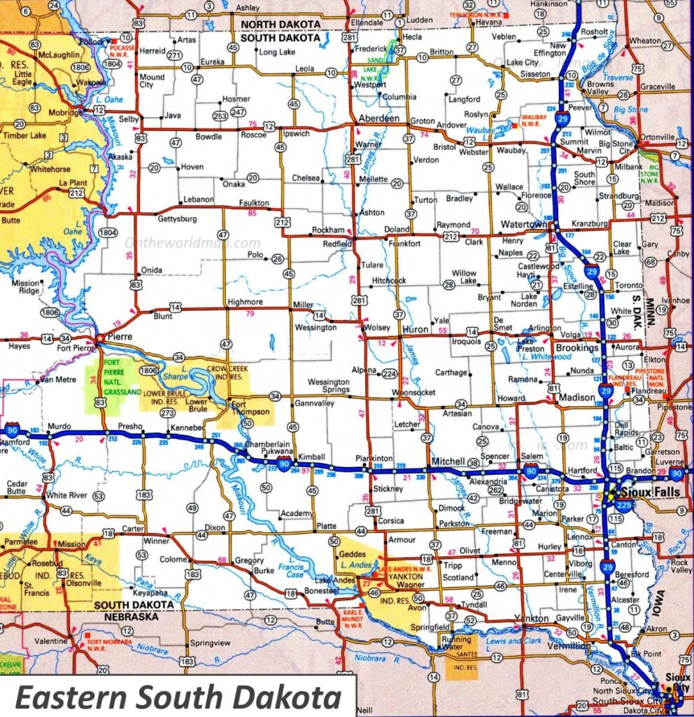
4. Map of Eastern South Dakota:
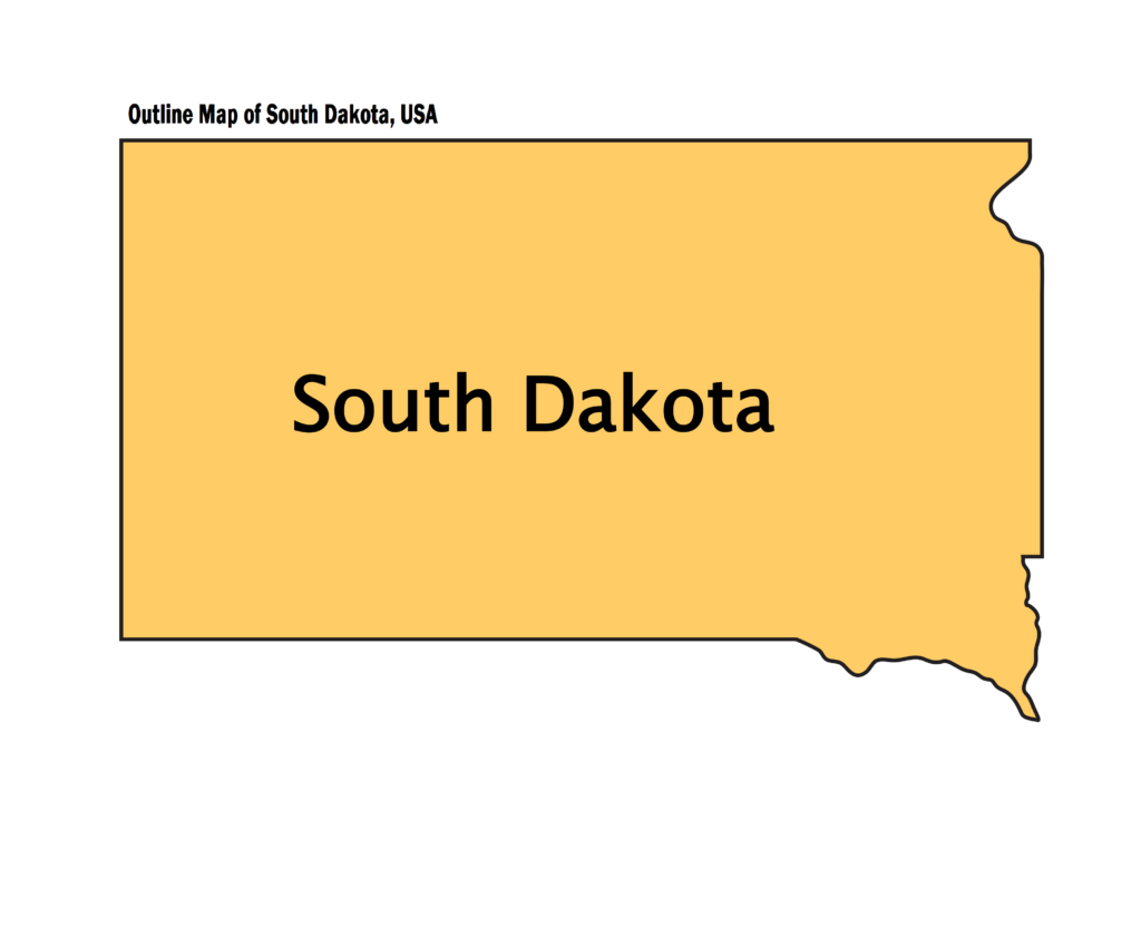
5. South Dakota Outline Map:
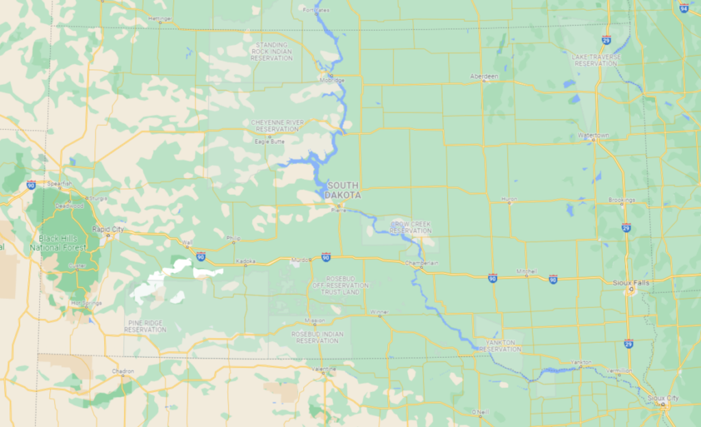
6. South Dakota Google Map:
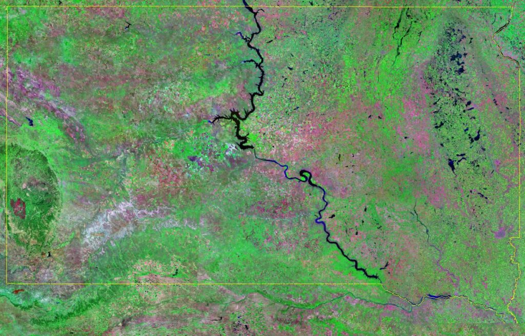
7. South Dakota Satellite Map:
8. South Dakota Map with Cities:
9. County Map of South Dakota:
10. South Dakota Location on World Map:
Here, we have added ten different types of maps. All maps belong to South Dakota State and cities of this state. Each map contains some useful information. For you, we are adding some more useful information about each map.
The first map is related to the main state map of South Dakota, and this map shows all major cities and counties. You can quickly identify any city or town with the help of this map. The next map shows the location of South Dakota state on the USA Map. As you can see in the map, the area filled with red colour indicates the South Dakota state.
The third map is related to Western South Dakota, and the fourth map is related to Eastern South Dakota. Both maps are the specific region map of this state. So, if you are looking for a specific area map, then these maps will help you.
Now, the fifth map is a simple outline and blank map of the South Dakota State, which shows only the outer boundary of this state. The sixth map is titled “South Dakota Google Map.” This map is a type of google map of this state which shows some major cities, towns, and the capital city. The following map is a Satellite map of this state which shows the Satellite image and the outer boundary of this state. A thin yellow line is indicated its boundary and location. So, if you want a detailed map of this state, please check the first map.
The eighth map shows the Cities and Towns of SD state. In this map, you can see all major cities, towns, and county names. This is a full and detailed map of this state. And the ninth map is related to the county map of South Dakota. It is a full-detailed SD county map with cities.
The last map is also a state’s location map, which shows South Dakota’s location on the world map. These were some best and most helpful SD (South Dakota) State Maps that we have added above. All these maps are free to download. All the maps are available in PDF and JPG (Image) formats. You can easily download any map by clicking on the buttons under the preview image.