West Virginia, also known as the Mountain State, is a state of the USA located in Appalachian, Mid-Atlantic, and South-eastern regions of the United States of America. West Virginia is the 41st-largest state by area. It is a very beautiful state to travel and explore, so if you plan to visit this state, you should have some knowledge about this state and its cities. So, for this, you must have a printable map of West Virginia State.
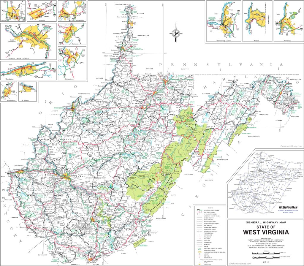
Here, on this page, we are adding some useful state maps of West Virginia with some WV City maps and County maps of West Virginia. And you should also check some other maps of the Roads and Highways Maps of West Virginia.
Maps Collection of West Virginia (WV) State:
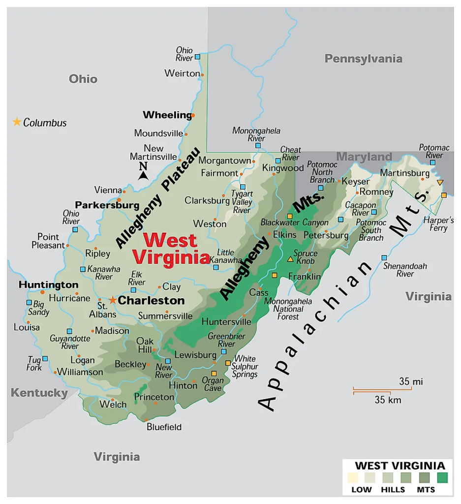
1. West Virginia Map:
2. Map of West Virginia Cities and Towns:
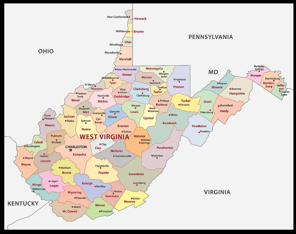
3. West Virginia County Map:
4. West Virginia on US Map:

5. West Virginia on World Map:

6. West Virginia Outline Map:

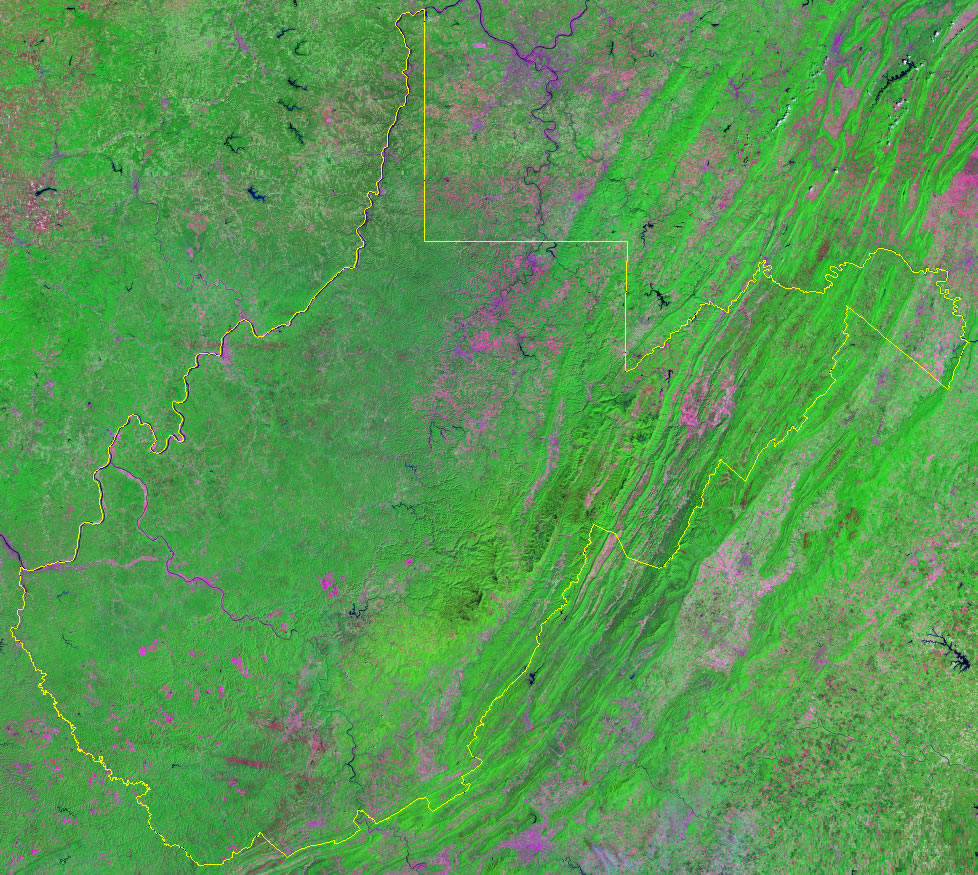
7. West Virginia Satellite Map:
8. Google Map of West Virginia:

9. Map of Southern West Virginia:

Here, we have added nine different types of maps. All maps belong to West Virginia State. Each map contains some useful information. For you, we are adding some more useful information about each map here.
The first map is related to the main state map of West Virginia, and this map shows all major cities and all forty-six counties. You can easily identify any city with the help of this map. The second map is related to the county map of West Virginia. It is a printable and large WV county map. This County map also shows all county seats.
The third map shows the Cities and Towns of WV state. In this map, you can see all major cities and towns and county names. The next map shows the location of West Virginia state on the USA Map. As you can see in the map, the area filled with red color indicates the West Virginia state. The next map is also a location map that shows West Virginia’s location on a global or world map.
The sixth map is a simple outline map of the West Virginia state which shows the outer boundary of this state. The seventh map is a Satellite map of this state which shows the Satellite image and structure of this state. You will only see the boundaries on this map. So, if you want a detailed map of this state, please check the first map. A thin yellow line indicated its boundary.
The eighth map is titled “Google Map of West Virginia.” This map is a type of Google map or Google Earth Map of this state that shows some major cities, towns, and capital cities. The last map is a specific region map of this state, which is the Southern West Virginia Map. In this map, you will get to know all Southern area cities, towns, and roads.
These were some best and most useful West Virginia Map that we have added above. All the maps are available in PDF and JPG (Image) formats. You can easily download any map by clicking on the buttons under the preview image. All these maps are free to download.