Maps are very useful. During travel, study, or work, maps help us to complete our purpose. So, if you are an explorer, traveler, or student and looking for some printable New Mexico map, you are on the right page. Because here, we are adding some best and most useful state maps, county maps, and city maps of New Mexico State. Please scroll down the page and look at these high-quality maps of N.M. State. You should also check our other collection of Roads and Highways Maps of New Mexico. These maps will help you during your travel.
New Mexico (NM) State Maps Collection:
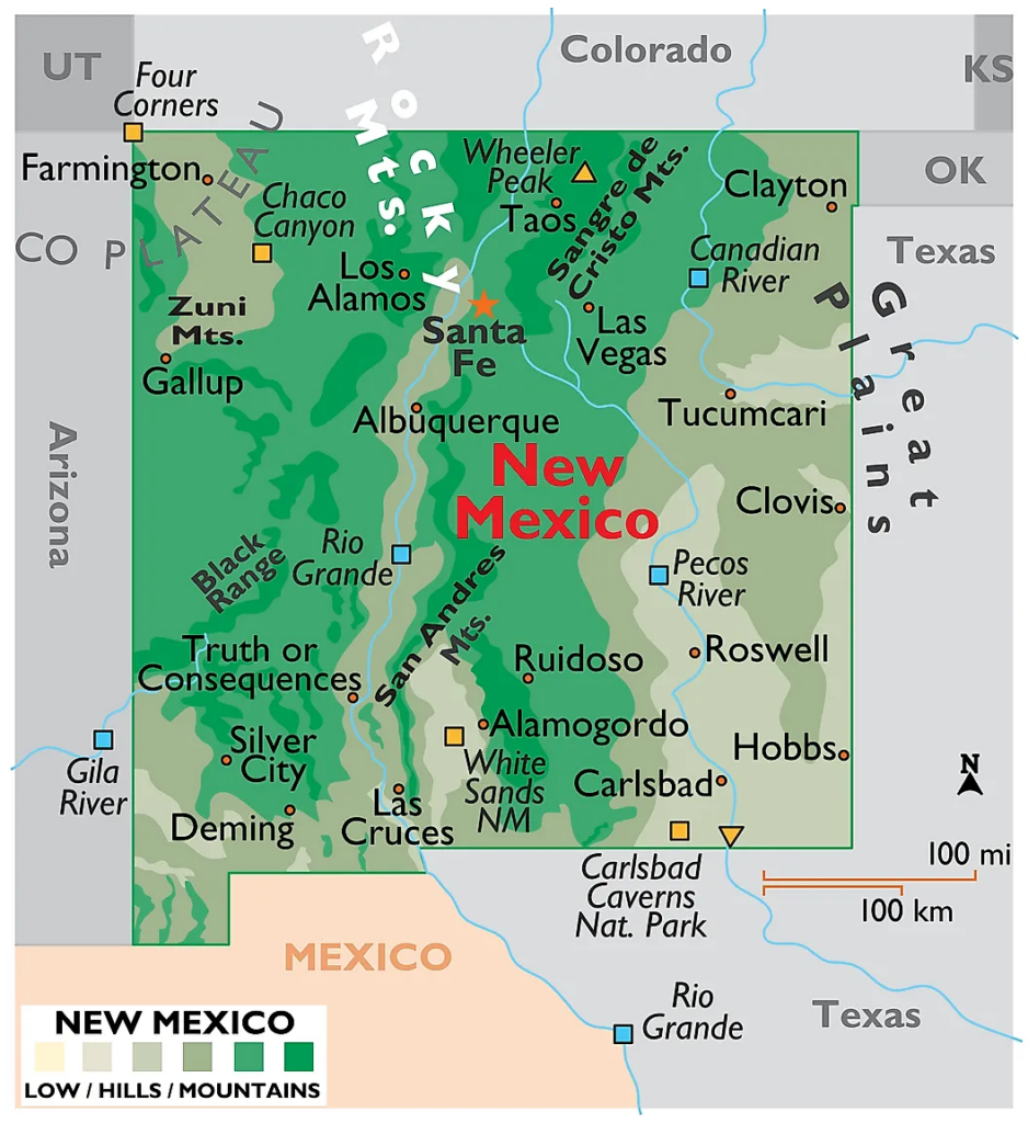
1. New Mexico Map:
2. New Mexico on US Map:

3. New Mexico on World Map:

4. Outline of New Mexico:

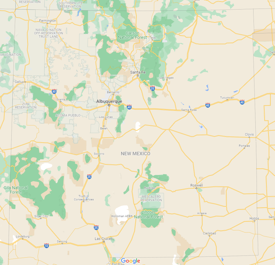
5. New Mexico Google Map:
6. Satellite Map of New Mexico:

7. New Mexico Map with Cities & Towns:

8. New Mexico County Map:

9. Map of Northern New Mexico:

10. Map of Southern New Mexico:

This is the New Mexico State Maps collection that we have added above. We have added a total of eight different maps that contain some helpful information about the state and its cities, county, and towns. Below, we are also adding some brief information about each map. So, please read the full description before viewing or downloading any map from the above.
The first map is related to the main state map of this State, which shows all counties, major cities, and major roads of this State. And the second map shows the location of New Mexico state on the USA map. As you can see, an area filled with red indicates this State located on the U.S. map. In the third map, you can see the location of New Mexico on the world map. A red color box indicates the location of this State on the global map. You can check the preview image of this map for a quick view.
The fourth map is a blank outline map of this State, which shows the outer boundary of New Mexico. The fifth map is a google map which shows some major cities and all counties of this State. Now, the sixth map is related to a satellite image of New Mexico that shows the structure of this State. As you can see on the map, a thin yellow line marks the outer boundary. These types of satellite images or maps are used for geographic studies and work. For its complete and actual map, please check the first maps.
The seventh map shows all the cities, towns, counties, other places. It is a complete and detailed map of New Mexico state with cities and towns. And on this map, some other places are also visible, like airports, railroads, street roads, city roads, interstate highways, U.S. routes, and other states’ highways. Finally, the eighth map is related to the County map of New Mexico that shows all counties and the major cities of these counties.
The last two maps are the specific region maps in this collection of maps. The ninth map shows the Northern region of New Mexico, and the last map shows Southern New Mexico. You can quickly identify all counties, cities, and towns of New Mexico. So, these were some printable maps of New Mexico (N.H.) that we have added above. These high-quality maps are available in PDF format and JPG (Image) format. You can easily download any map by clicking on the buttons under the preview image. All these H.D. maps are free to download.