Roads and highways connect major cities and provides travel facilities. West Virginia’s roads and highways connect major cities with its neighbouring state or cities. If you want to know more about the West Virginia state roads and highways, then you should check the West Virginia road map that we have added below. Please scroll down the page and have a look at these roads and highways maps.
West Virginia Road and Highway Map Collection:
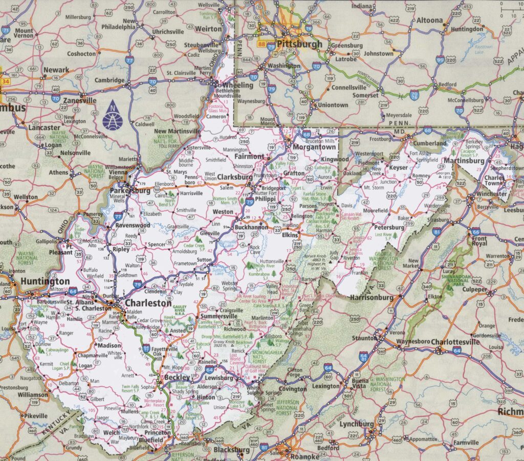
1. West Virginia Road Map:
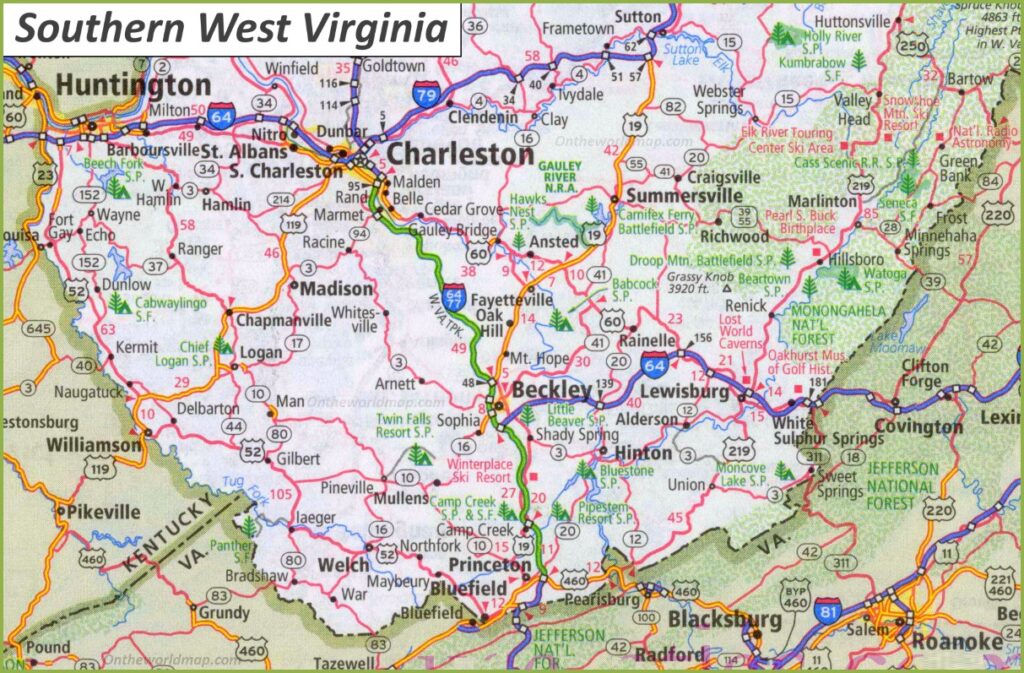
2. Road Map of Southern West Virginia:
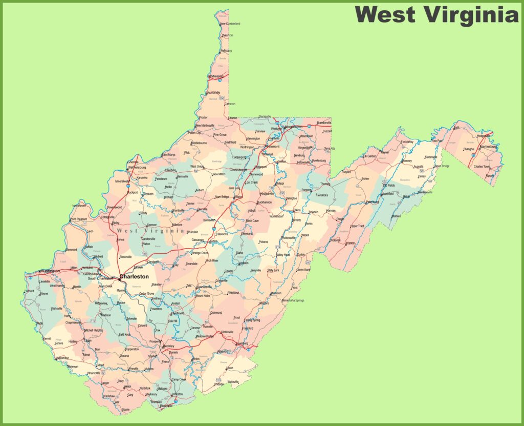
3. West Virginia’s Road Map with Cities:
4. Large Detailed map of West Virginia with Cities and Towns:
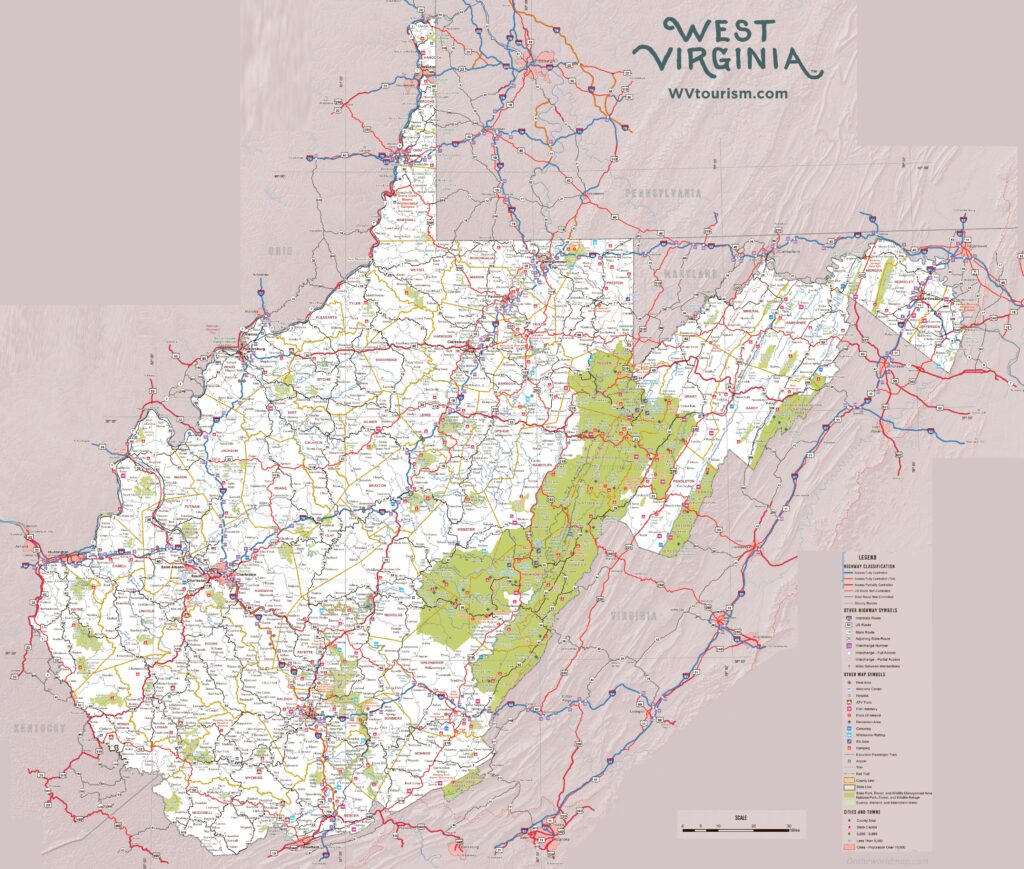
5. Large Detailed Tourist map of West Virginia:
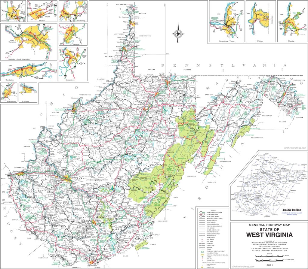
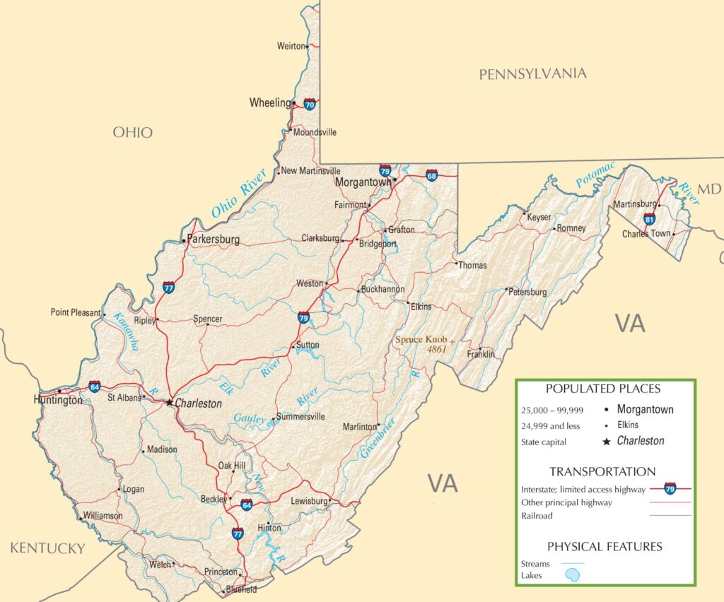
6. West Virginia Highway Map:
As you saw that this was the collection of all the road and highway maps of West Virginia State. There are six types of different maps that we have added in the above section of the page. These maps are very interactive and contain every single piece of information that you need.
Although the West Virginia Department of Transportation manages roads and Highways of this state, the West Virginia Division of Highways (DOH) is responsible for managing all public roads. Therefore, the DOH works under the West Virginia Department of Transportation. Below, there is a list of all Interstate highways, please check the table for more information.
List of all Interstate Highways in this state.
| Number | Length (mi) | Length (km) | Formed |
| I-64 | 188.75 | 303.76 | 1956 |
| I-68 | 31.5 | 50.7 | 1991 |
| I-70 | 14.45 | 23.26 | 1963 |
| I-77 | 187.21 | 301.29 | 1956 |
| I-79 | 160.52 | 258.33 | 1967 |
| I-81 | 26 | 42 | 1963 |
In the first section of “Road Maps”, there are a total of five maps, and all maps belong to roads of all cities in West Virginia (WV). There we have also added some specific region maps. So, you can easily navigate in all directions of this state.
When you look at the first map, which is the “West Virginia Road Map “, you will see all the roads and their routes. Therefore, you can easily navigate in any city of this state. Now, in this second map, the “Southern West Virginia road map”, you will get to know all the information about roads and their routes that connect all the cities in the south region of this state.
The next map is a large and detailed road and highway map of this state. This map shows all the city’s roads, interstate highways, or major highways of all cities and towns. The third and fourth maps are the complete and detailed maps of West Virginia State. You can also print these interactive maps for various purposes.
List of all US Highways in this state.
| Number | Length (mi) | Length (km) |
| US 11 | 26.2 | 42.2 |
| US 19 | 249 | 400.7 |
| US 22 | 5.97 | 9.61 |
| US 30 | 4 | 6.4 |
| US 33 | 248 | 399 |
| US 35 | 22.6 | 36.4 |
| US 40 | 16 | 25.7 |
| US 50 | 196.2 | 315.75 |
| US 60 | 177.8 | 286.1 |
| US 219 | 196 | 315 |
| US 220 | 93 | 150 |
| US 522 | 19 | 31 |
The fifth map, titled “Large Detailed Tourist Map of West Virginia”, will provide you with information about tourist places and their location as well as their routes. You can easily navigate to anywhere in the city with the help of this map. Important contact numbers of places are also listed on the map. This map contains all important places like Historic Places, Ancient Buildings, Malls, Shopping Complexes, Schools, Colleges, Hospitals, Parks, Zoos, Police Stations, Gas Stations, Restaurants, all roads, lakes, rivers, and streets roads.
When you check the last map, “West Virginia Highway Map,” which shows all information about the interstate highways, state routes and U.S. highways, as you know, highways are the major and important roads of any city or state. So, you must have proper knowledge about their routes to navigate these highways easily. All the highway numbers are mentioned on this map, so you can easily identify and navigate anywhere. Above we have also added two tables that show details of all Interstate highways and U.S. routes of W.V. state.
So, these were some roads, highways and important maps that we have provided above. All the maps are available in PDF format as well as in Image format. You can easily download any map by clicking on the buttons that are under the preview image of a particular map. And, you don’t need to pay while downloading these maps. You can also print these high-quality maps for any document work.