West Virginia is located in the Southeastern and Appalachian, Mid-Atlantic regions of the United States. Maryland borders WV State to the east, northeast, and southeast, Pennsylvania to the northeast and east, Virginia to the southeast, Kentucky to the southwest, and Ohio to the northwest. It is the 41st-largest state by area and ranks 40th based on its population in the country. The capital and largest city of West Virginia is Charleston. If you want to learn more about this state with the help of maps, please stay on this page and look at the collections of maps that we have added below. So, please scroll down the page and let’s start with the county map of West Virginia. You can also check some Roads and Highways maps of West Virginia.
West Virginia (WV) County Maps Collection:
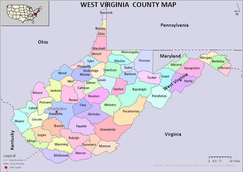
1. West Virginia County Map:
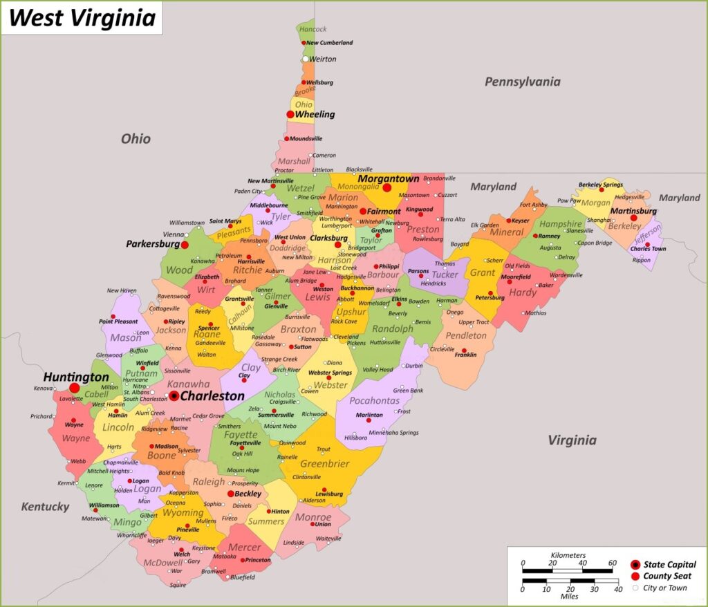
2. West Virginia County Map with Cities:
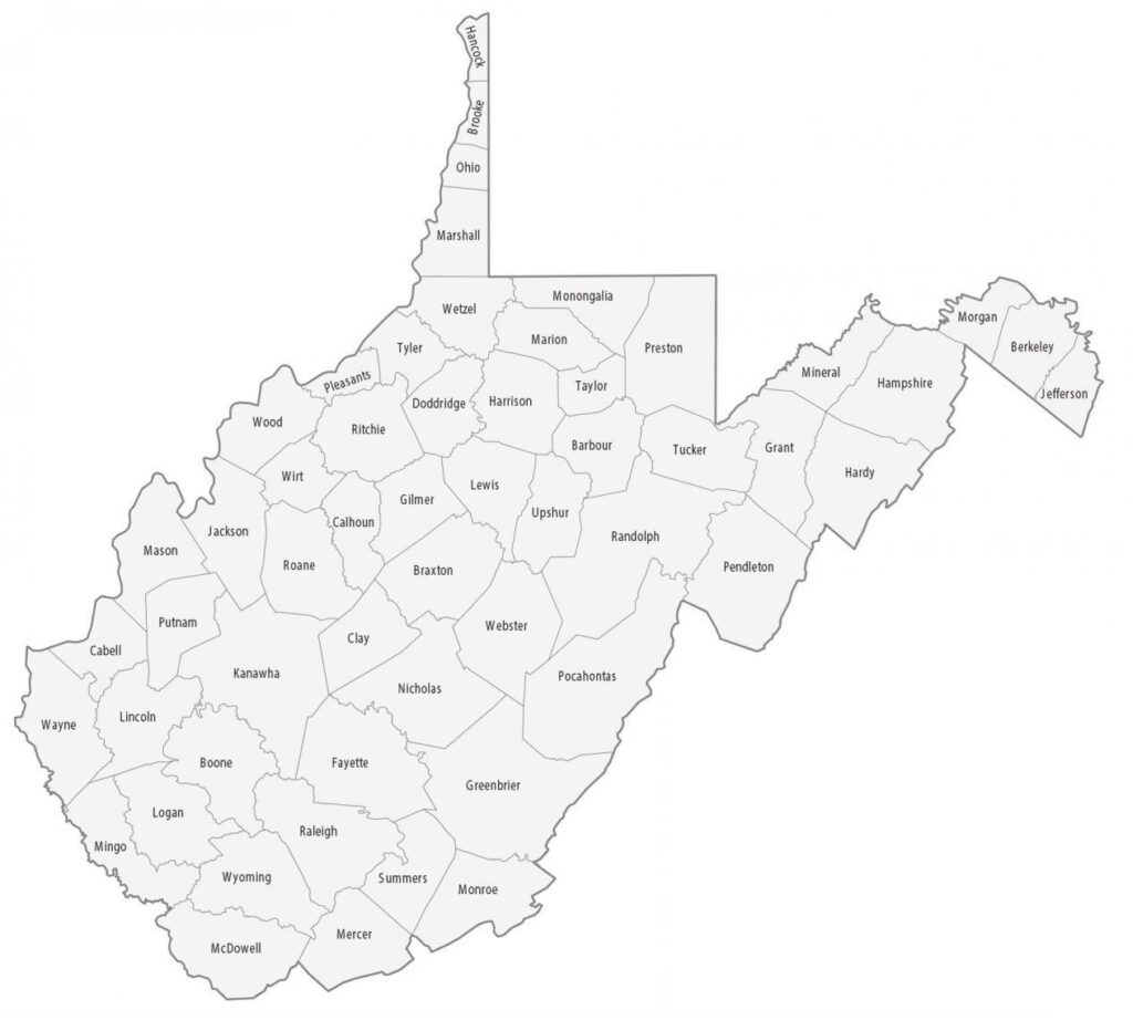
3. County Map of West Virginia:
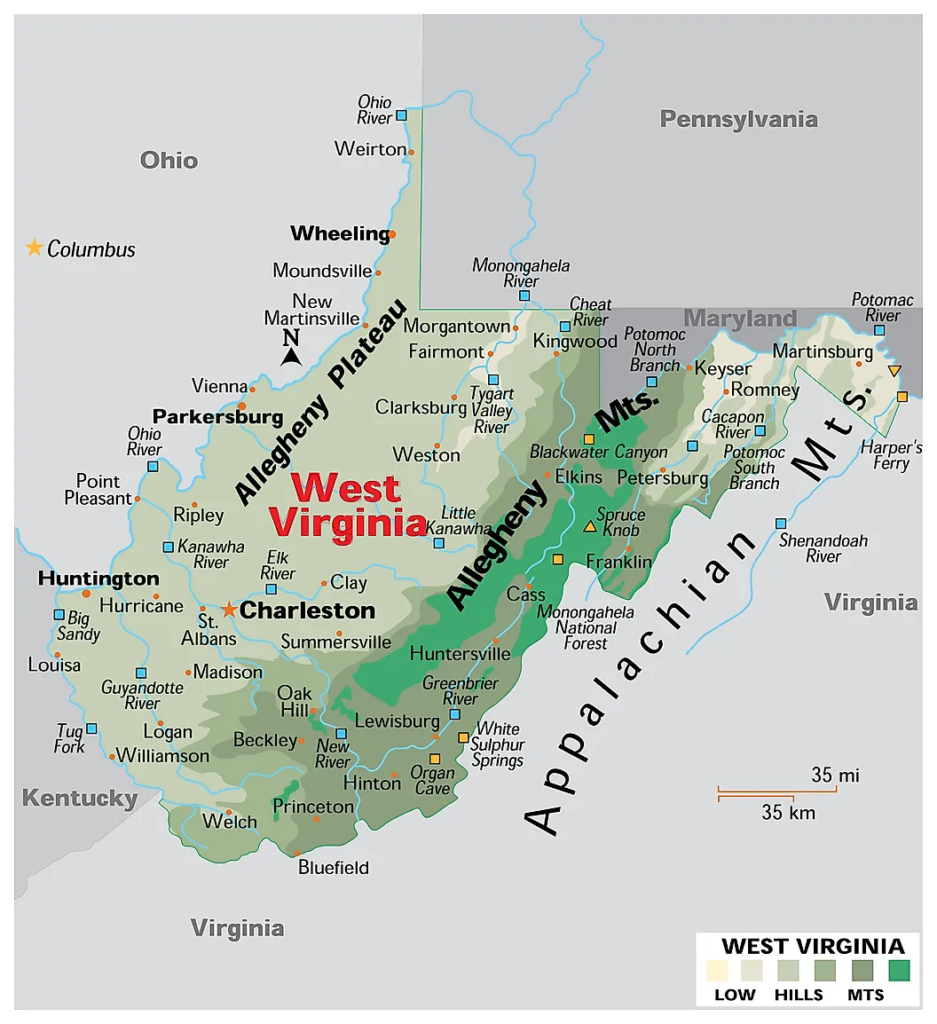
4. West Virginia State Map:
5. West Virginia State Map with Cities and Towns
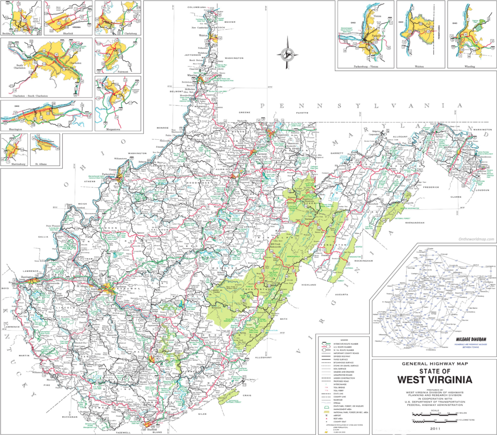
We have added above this collection of printable and high-quality maps of West Virginia County. We have added a total of five different maps that contain helpful information about the counties and cities of West Virginia. Below, we are also adding some brief information about each map. So, please read the full description before viewing or saving any map in your device. Below we are also adding a list that shows some useful information about the counties of this state. Please read the entire table.
List of all Counties in West Virgnia
This is a list of all counties of West Virginia with some helpful and additional information like name of county name, year of established in, populations, the county seat, and total area.
| County | Est. | County Seat | Area | Population |
| Barbour County | 1843 | Philippi | 341 sq mi | 15465 |
| Berkeley County | 1772 | Martinsburg | 321 sq mi | 122076 |
| Boone County | 1847 | Madison | 503 sq mi | 21809 |
| Braxton County | 1836 | Sutton | 514 sq mi | 12447 |
| Brooke County | 1796 | Wellsburg | 89 sq mi | 22559 |
| Cabell County | 1809 | Huntington | 282 sq mi | 94350 |
| Calhoun County | 1856 | Grantsville | 281 sq mi | 6229 |
| Clay County | 1858 | Clay | 342 sq mi | 8051 |
| Doddridge County | 1845 | West Union | 320 sq mi | 7808 |
| Fayette County | 1831 | Fayetteville | 664 sq mi | 40488 |
| Gilmer County | 1845 | Glenville | 340 sq mi | 7408 |
| Grant County | 1866 | Petersburg | 477 sq mi | 10976 |
| Greenbrier County | 1778 | Lewisburg | 1,021 sq mi | 32977 |
| Hampshire County | 1754 | Romney | 642 sq mi | 23093 |
| Hancock County | 1848 | New Cumberland | 83 sq mi | 29095 |
| Hardy County | 1786 | Moorefield | 583 sq mi | 14299 |
| Harrison County | 1784 | Clarksburg | 416 sq mi | 65921 |
| Jackson County | 1831 | Ripley | 466 sq mi | 27791 |
| Jefferson County | 1801 | Charles Town | 210 sq mi | 57701 |
| Kanawha County | 1789 | Charleston | 903 sq mi | 180745 |
| Lewis County | 1816 | Weston | 389 sq mi | 17033 |
| Lincoln County | 1867 | Hamlin | 438 sq mi | 20463 |
| Logan County | 1824 | Logan | 454 sq mi | 32567 |
| Marion County | 1842 | Fairmont | 310 sq mi | 56205 |
| Marshall County | 1835 | Moundsville | 307 sq mi | 30591 |
| Mason County | 1804 | Point Pleasant | 432 sq mi | 25453 |
| McDowell County | 1858 | Welch | 535 sq mi | 19111 |
| Mercer County | 1837 | Princeton | 420 sq mi | 59664 |
| Mineral County | 1866 | Keyser | 328 sq mi | 26938 |
| Mingo County | 1895 | Williamson | 423 sq mi | 23568 |
| Monongalia County | 1776 | Morgantown | 361 sq mi | 105822 |
| Monroe County | 1799 | Union | 473 sq mi | 12376 |
| Morgan County | 1820 | Berkeley Springs | 229 sq mi | 17063 |
| Nicholas County | 1818 | Summersville | 649 sq mi | 24604 |
| Ohio County | 1776 | Wheeling | 106 sq mi | 42425 |
| Pendleton County | 1788 | Franklin | 698 sq mi | 6143 |
| Pleasants County | 1851 | Saint Marys | 131 sq mi | 7653 |
| Pocahontas County | 1821 | Marlinton | 940 sq mi | 7869 |
| Preston County | 1818 | Kingwood | 648 sq mi | 34216 |
| Putnam County | 1848 | Winfield | 346 sq mi | 57440 |
| Raleigh County | 1850 | Beckley | 607 sq mi | 74591 |
| Randolph County | 1787 | Elkins | 1,040 sq mi | 27932 |
| Ritchie County | 1843 | Harrisville | 454 sq mi | 8444 |
| Roane County | 1856 | Spencer | 484 sq mi | 14028 |
| Summers County | 1871 | Hinton | 361 sq mi | 11959 |
| Taylor County | 1844 | Grafton | 173 sq mi | 16705 |
| Tucker County | 1856 | Parsons | 419 sq mi | 6762 |
| Tyler County | 1814 | Middlebourne | 258 sq mi | 8313 |
| Upshur County | 1851 | Buckhannon | 355 sq mi | 23816 |
| Wayne County | 1842 | Wayne | 506 sq mi | 38982 |
| Webster County | 1860 | Webster Springs | 556 sq mi | 8378 |
| Wetzel County | 1846 | New Martinsville | 359 sq mi | 14442 |
| Wirt County | 1848 | Elizabeth | 233 sq mi | 5194 |
| Wood County | 1798 | Parkersburg | 367 sq mi | 84296 |
| Wyoming County | 1850 | Pineville | 501 sq mi | 21382 |
The first map is a simple coloured county map of West Virginia, which shows only county names. And the next map is a detailed WV county map with cities. So, check this map if you are looking for a full detailed county map of this state. The third map is also a WV county map (West Virginia), but it differs from the above two maps. It is a simple black and white outline map.
The fourth map is a complete state map of West Virginia that shows all counties, major cities, and major rivers and lakes. And the last map is a detailed city map of West Virginia state. All major cities and towns are visible on this map, with all street roads, national highways, all lakes, rivers are also shown on this map.
So, these were some high-quality and printable maps that we have added above. These large HD maps are available in PDF and JPG (Image) formats. You can easily download any map by clicking on the buttons under the preview image. All these maps are free to download.