Connecticut is divided into 21 cities and 144 towns that cover a total area of 5,567 square miles (including 698 sq. miles of water and 4,849 sq. mi of land). This state scores 48th rank in the USA based on area. In Connecticut, the largest city is Bridgeport. The total population of Connecticut is 3,605,944 and obtains 29th rank in the county. If you want to learn more about the cities and towns of this state, then you can start with a map of CT towns because below, we are adding some useful and printable maps related to all cities and towns of this state.
So, have a look at our collection of maps. And if you are also looking for all Connecticut state maps, please click this link.
Collection of Cities and Towns Maps of Connecticut:
1. Map of Connecticut with Cities:

2. Map of Connecticut with Towns:

3. Map of Connecticut Cities and Towns:
4. Connecticut Map:
5. County Map of Connecticut:
This is the collection of maps of Connecticut Cities and Towns that we have added above. We have added five different maps that contain some helpful information. Below, we are also adding some brief details on each map. So, please read the full description before viewing or downloading any map from the above.
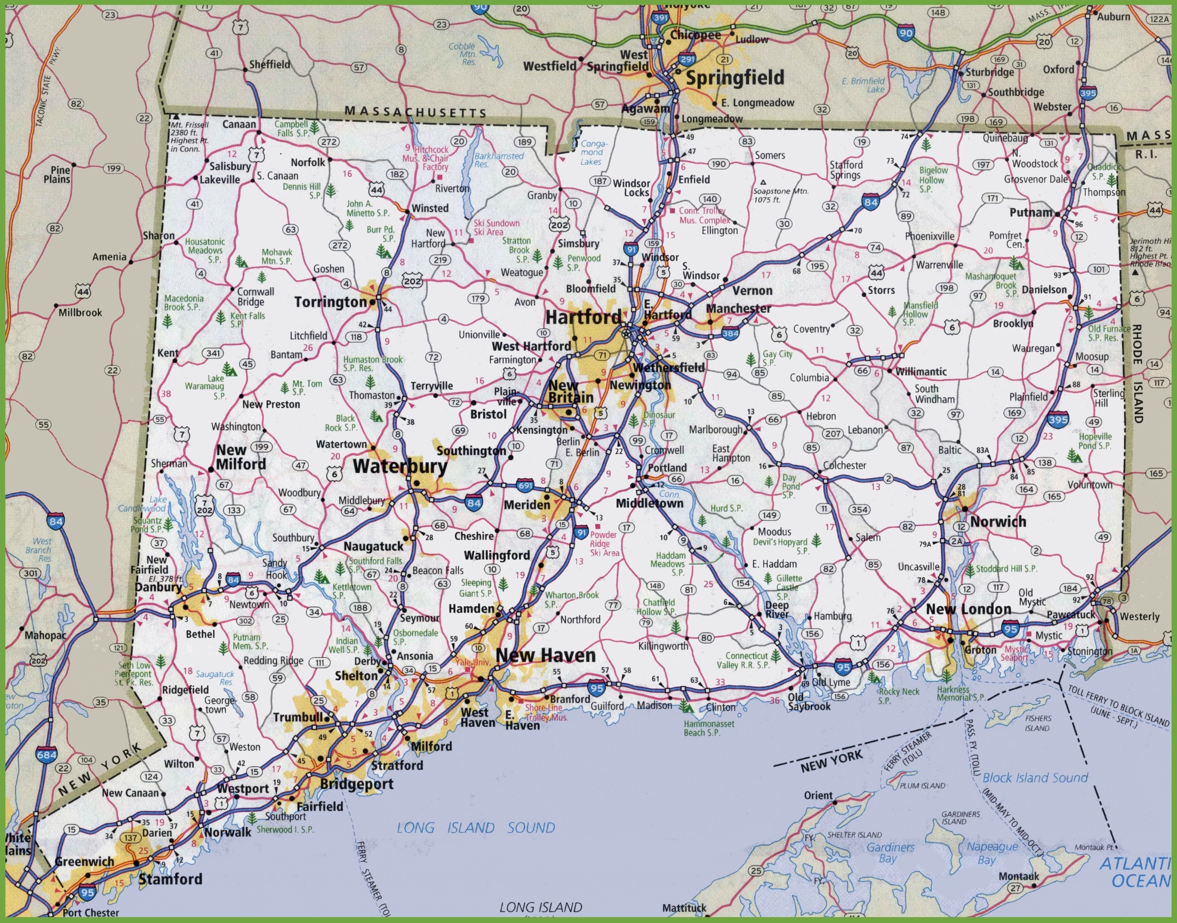
The first map is about the city map of Connecticut state, and this map shows all cities of CT, USA. You can locate any city on this map. This map also shows all counties. The second is related to the Town map of this state. As you can see on the map, all major towns are visible, along with some interstate highways. A thick red line indicates all interstate highways of this state.
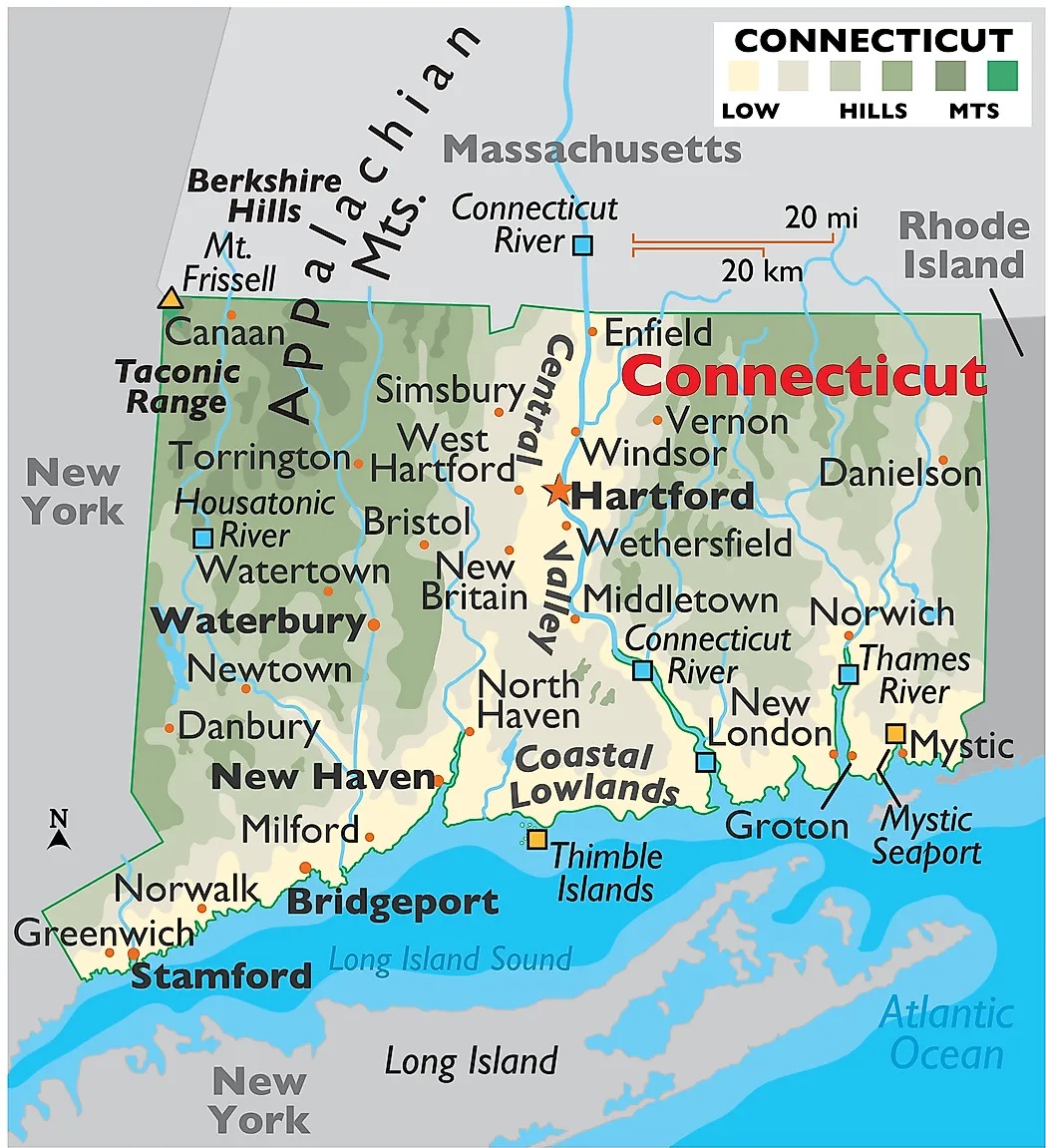
The third map is a large and detailed Map of Connecticut Cities and Towns, showing all the cities, towns, counties, other significant places, and tourist places. And on this map, you can also learn about all parks, malls, beaches, airports, railroads, street roads, city roads, interstate highways, and other states’ highways. The fourth map is related to the main state map of this state, which shows all counties and major cities on the map. This map also indicates national highways, major roads, railway lines, the state capital, and towns.
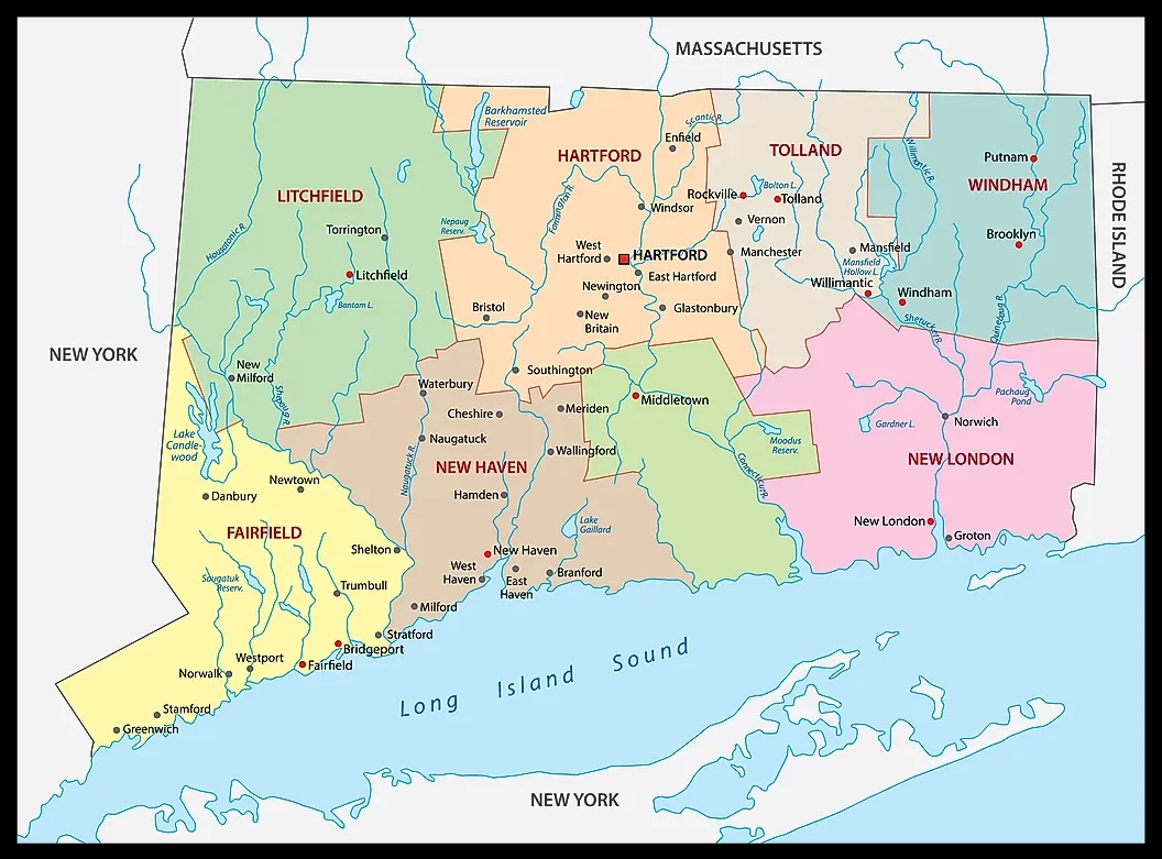
The last map is related to the Connecticut County map. You can easily identify any county with the help of this map. So, these were some large and printable CT State map that we have added above. All these high-quality maps are available in PDF format and JPG (Image) format. You can easily download any map by clicking on the buttons under the preview image. All these high-quality maps are free to download.