Tennessee is the 16th most populous state in the country that have 548 municipalities that include all cities and towns. All cities and towns cover an area of 42,143 sq. mi. On this page, we are providing some brief information about cities and towns of this state with some printable cities and towns maps of Tennessee. So, please scroll down the page and let’s start with a Tennessee map with cities. And you can also check our collection of state maps of Tennessee, and for this please click this link.
Maps Collection of Tennessee (TN) Cities and Towns:
1. Map of Tennessee with Cities:

2. Map of Tennessee Towns:

3. Tennessee Map with Cities and Towns:
4. County Map of Tennessee:
5. Tennessee Map:
Above, we have added different maps related to the cities and towns of Tennessee state. Here, we are also giving some information about each map, so read the information and get any map on your device and these maps are available for free.
The first map is related to the Cities of Tennessee state. So, you can easily locate any city in this state with the help of this map. Now, on the second map, you will get to know about the towns of this state, on this map, you will also find the roads and highways of these towns. So, the second map is a detailed map of Tennessee towns with highways that will also help you during travel.
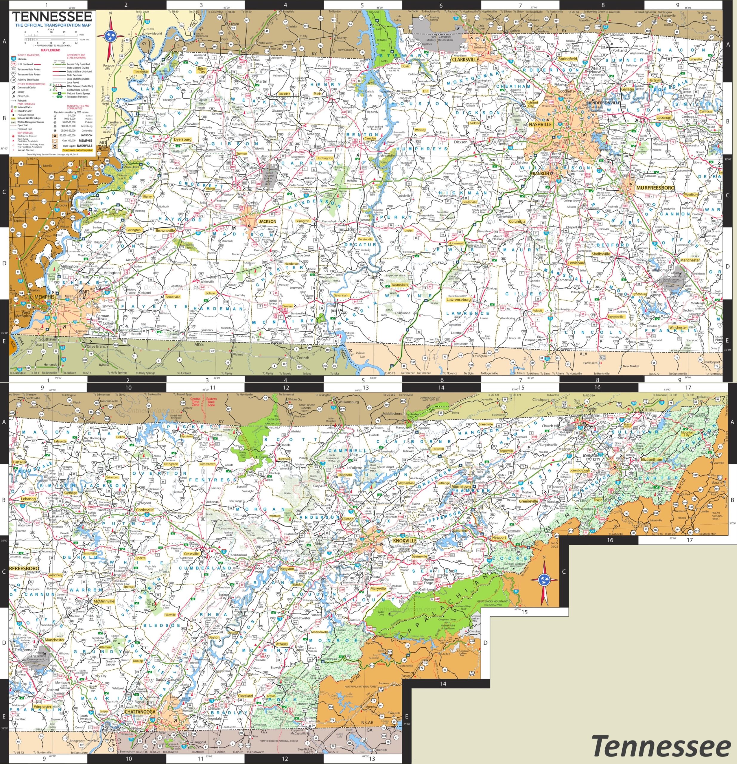
The third map is also a map of Tennessee towns and cities, although it’s a detailed high-quality map of Tennessee with all cities and towns. This map will help you a lot while travelling or roaming in this state. Because all cities, towns, roads, street roads, highways, rivers, lakes, railroads, stations, beaches, parks, national museums, hotels, malls, fuel stations, airports and etc are visible on this map.
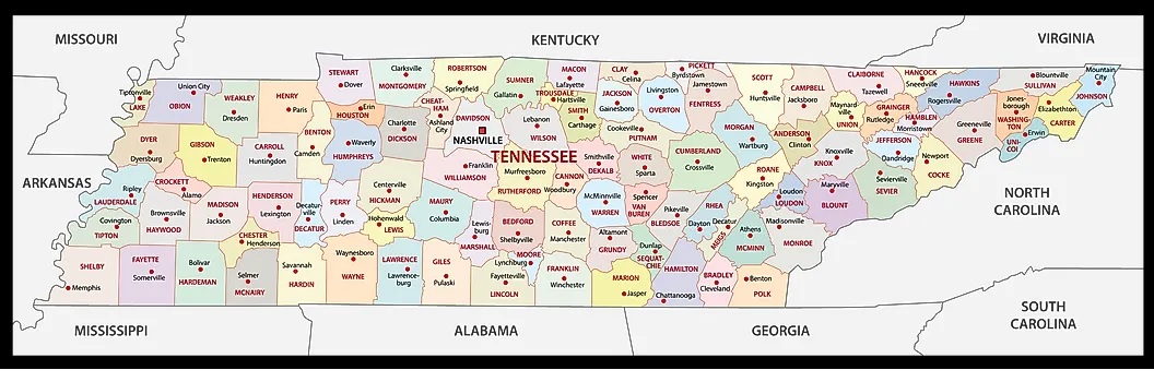
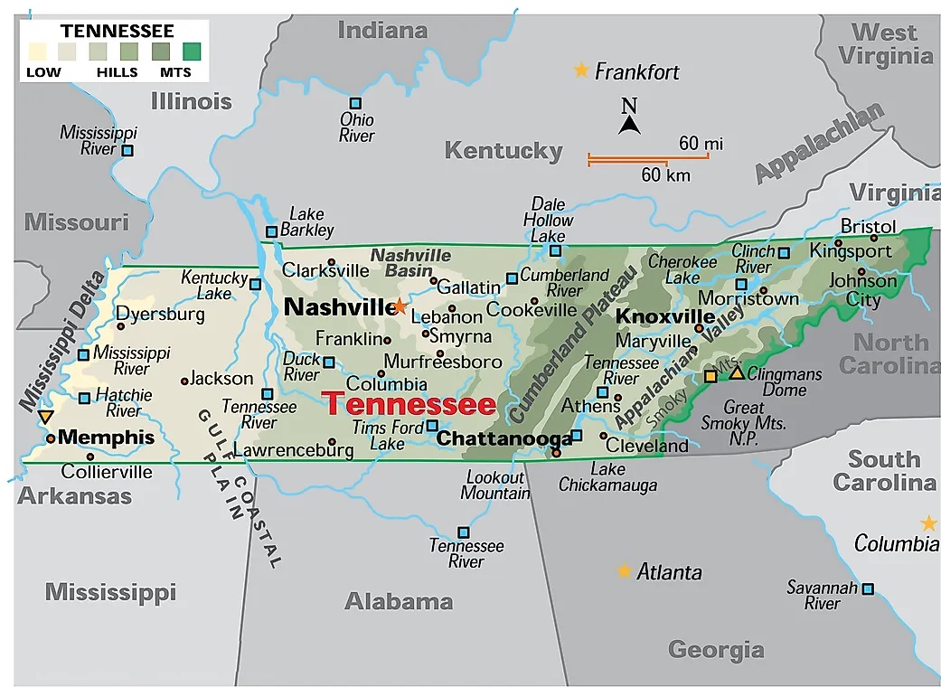
The fourth map is related to the main County map of Tennessee. On this map, you can easily locate any county. The county seat is also visible on this map. The fifth map is related to the main state map of Tennessee. This map shows all counties, major cities, towns, and some water bodies also. So, get this map for free if you need a complete state map. So, these were some best printable TN cities and township maps. You can easily print any map because all maps are of HD quality and available in both PDF and JPG format. And you can download any map for free by clicking on the buttons under the preview image.