Connecticut is the southernmost state of the USA, located in the New England region of the northeastern region. This state has four nicknames, but the official nickname is The Constitution State, and the other names are The Nutmeg State, The Provisions State, and the Land of Steady Habits. Connecticut is the third smallest state by area.
Massachusetts borders Connecticut to the north, Long Island Sound to the south, Hartford to the north-central, Rhode Island to the east, and New York to the west. This is a wonderful state to explore and travel to. So, if you want to visit this state, you must have a map of Connecticut. Below we are adding some printable maps related to Connecticut State, county, and cities. So, have a look at our collection of Connecticut map.
Maps Collection of Connecticut (CT) State:
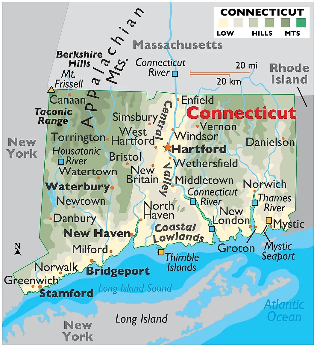
1. Connecticut Map:
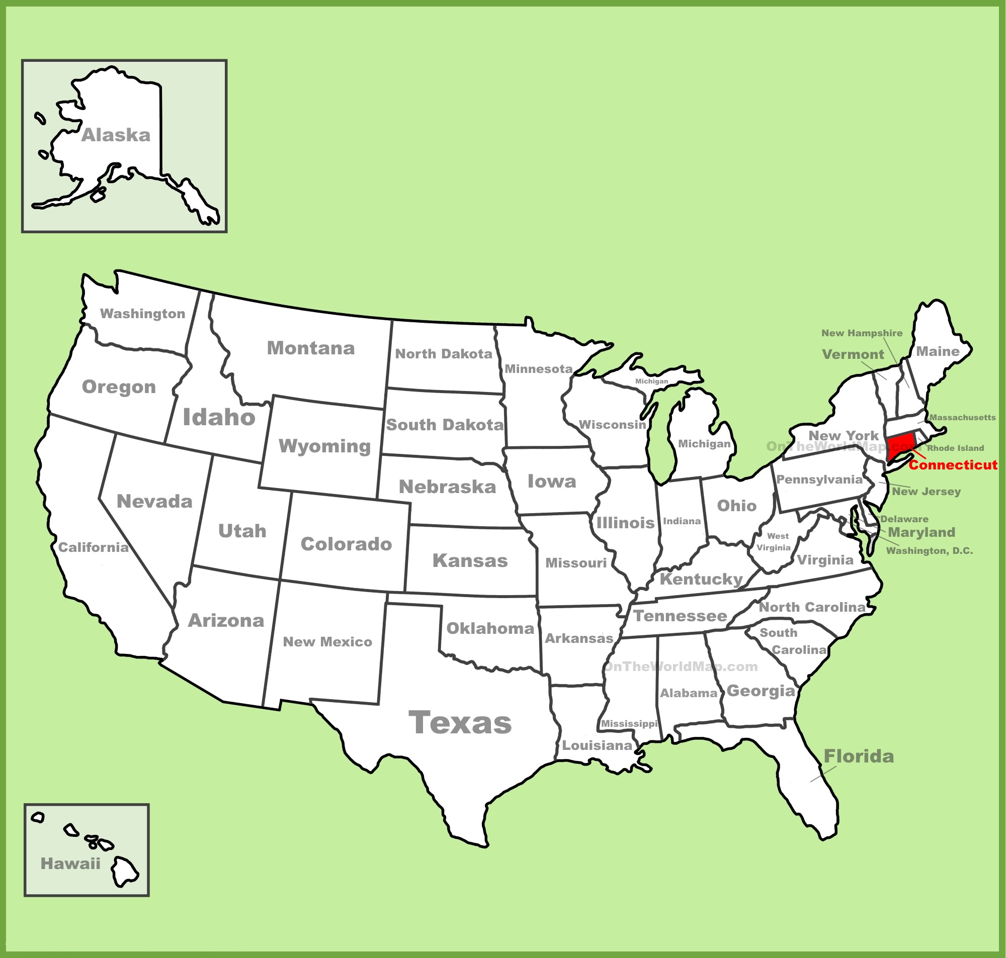
2. Connecticut on US Map:
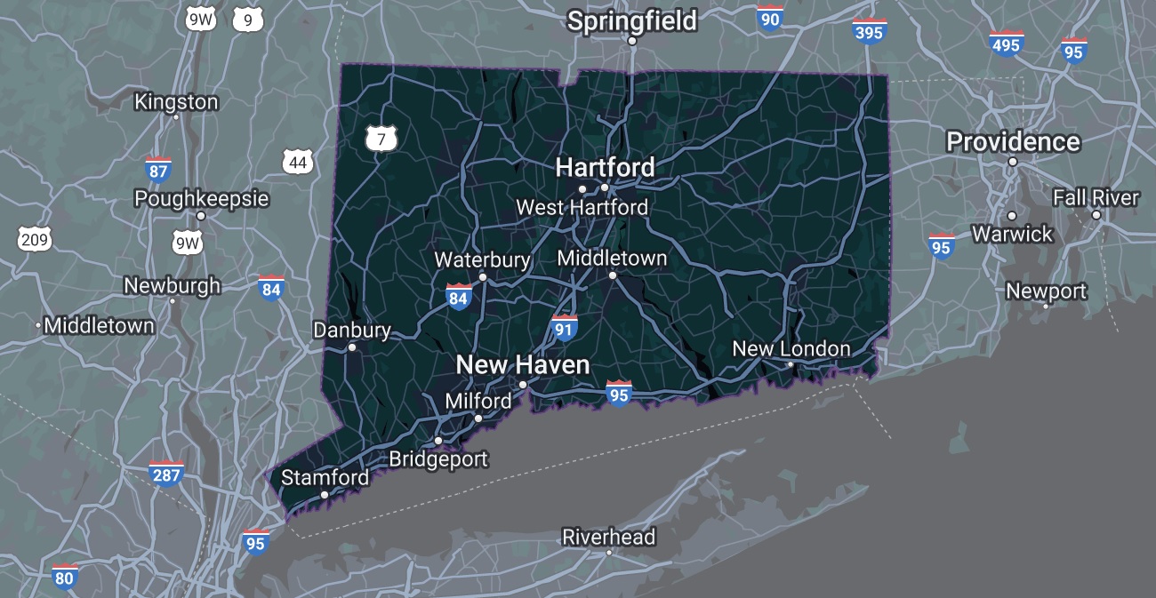
3. Google Map of Connecticut:
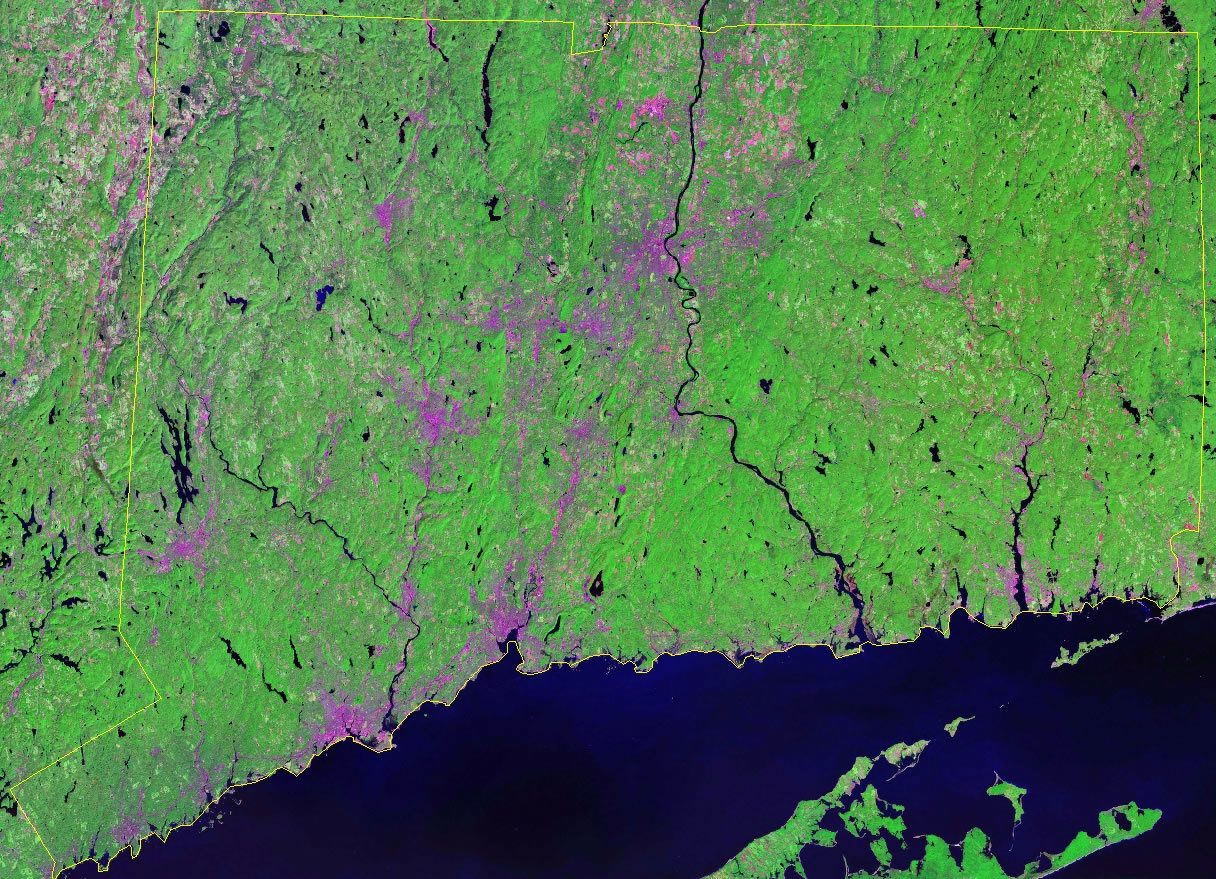
4. Satellite Image of Connecticut:
5. Blank Map of Connecticut:
6. County Map of Connecticut:
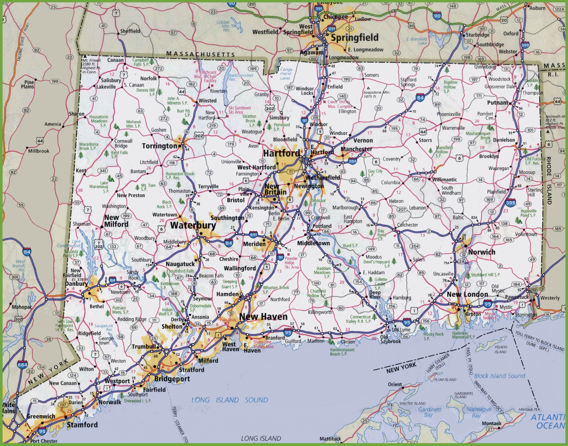
7. Connecticut Map with Cities and Towns:
Here, we have added eight different types of maps. All maps belong to Connecticut State. Each map contains some helpful information. We are adding some more useful information about each map here.
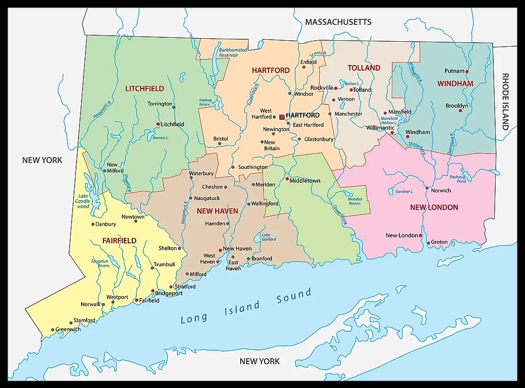
The first map is related to the main state map of Connecticut, and this map shows all major cities and all counties. You can quickly identify any city with the help of this map. The following map shows the location of Connecticut state on the USA Map. As you can see on the map, the area filled with red color indicates this state. The next map is also a location map that shows Connecticut’s location on a global or world map. The third map is titled “Google Map of Connecticut.” This map is a type of Google map or Google Earth Map of this state that shows some major cities, towns, and capital city.
The fourth map is a Satellite map of this state, showing the Satellite image and structure. You will only see the boundaries on this map. So, if you want a detailed map of this state, please check the first map. A thin yellow line indicated its boundary. The fifth map is a simple outline or blank map of Connecticut, which shows the outer boundary of this state.
The sixth map is related to the county map of CT state. It is a printable and large Connecticut county map. This County map also shows all county seats of this state. The seventh map shows the Cities and Towns of CT state. You can see all major cities, towns, and county names on this map. These were some of the best and most useful Connecticut maps we have added above. All the maps are available in PDF and JPG (Image) formats. You can easily download any map by clicking on the buttons under the preview image. All these maps are free to download