Connecticut is a state in the USA divided into 08 counties. Among them, Fairfield County is the oldest, established in 1666, and Windham County is the newest one (established in 1726). Litchfield County is the largest county based on area, and Middlesex County is the smallest county by area. So, if you want to know more about every county in Connecticut, in that case, you must read the entire page because, along with useful information, we are also adding some maps related to Connecticut’s counties.
Please scroll down the page and start with a Connecticut county map. And, if you are also looking for some road and highway maps of Connecticut then please visit this link.
Connecticut (CT) County Maps Collection:
1. County Map of Connecticut:
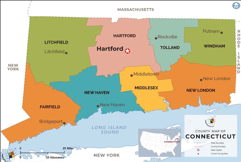
2. CT County Map:
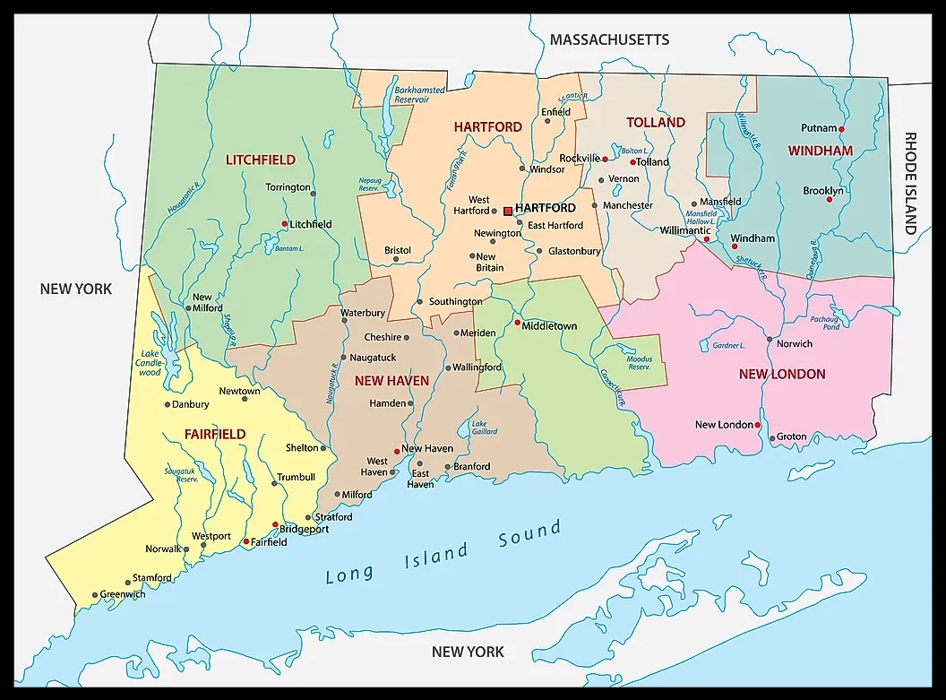
3. Connecticut County Map:
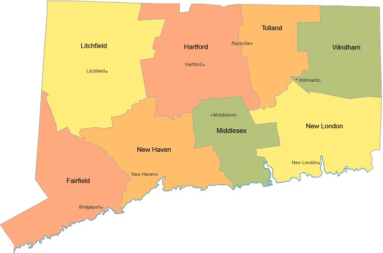
4. Connecticut Map:
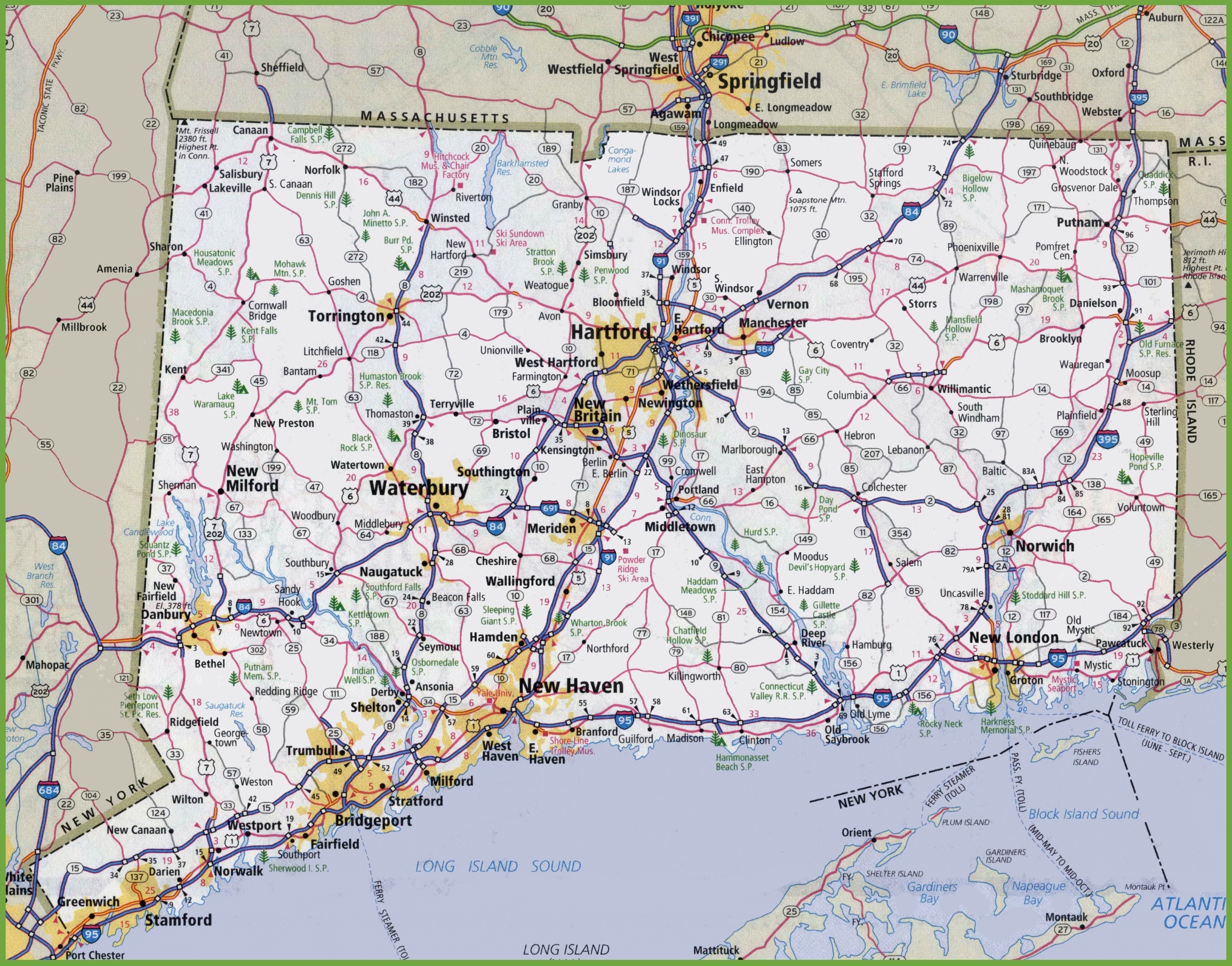
5. Connecticut Map with Cities and Towns:
This is the collection of some CT county map that we have added above. We have added a total of five different maps that contain some helpful information about the counties and cities of this state . Here, we are adding some brief information about each map. So, please read the full description before downloading any map from the above collection. And, you can also check some printable River maps of Connecticut. Please click this link for river maps.
The first map is the main county map of Connecticut, which shows only county names. And the next map is also a map of CT counties but it is visually different. This is a blank and outlined county map of Connecticut state. Below we are also adding a table that shows some useful information about the counties of this state. Please check the table for useful and additional information.
Counties in Connecticut, USA:
This is a list of all counties of Connecticut with some useful information like the name of the county, the county seat, the year in which a county was formed, and the total area covered by these counties.
| County | Seat | Established | Population | Area |
| Litchfield County | N/A | 1751 | 185000 | 920 sq mi |
| Middlesex County | Middletown | 1785 | 164759 | 369 sq mi |
| New Haven County | New Haven | 1666 | 863700 | 606 sq mi |
| New London County | New London | 1666 | 268805 | 666 sq mi |
| Tolland County | Rockville | 1785 | 150293 | 410 sq mi |
| Windham County | Willimantic | 1726 | 116418 | 513 sq mi |
As we have briefly discussed about some counties in the introduction. Now, with the help of about mentioned table you can get more information about the population, county seats and area of counties. And, for more additional information you can check the maps that we have pinned in the upper section.
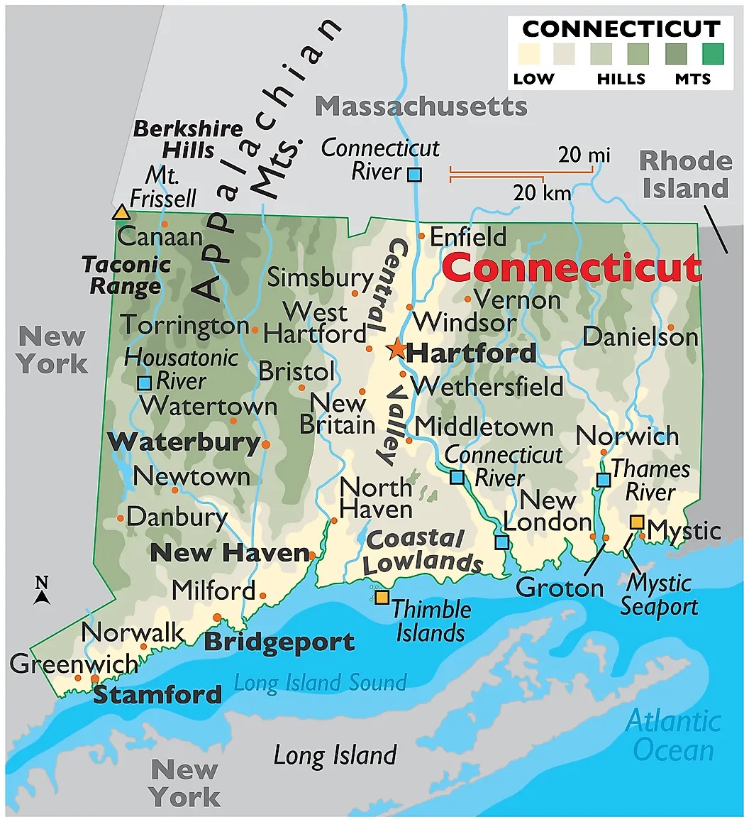
And the fourth map is a detailed map of Connecticut. All major cities and towns are visible on this map with all major roads. And major lakes and rivers are also shown on this map. The fifth map is a cities and towns map of this state that shows all counties, major cities, city roads, and interstate highways. So, these were some printable maps that we have added above. These large maps are available in PDF and JPG (Image) formats. You can easily download any map by clicking on the buttons under the preview image. All these maps are free to download.