Kentucky officially known as the Commonwealth of Kentucky is a state in the USA that is located in the Southeast region of the country. Its capital is Frankfort. Kentucky is also known as the Horse Capital of the world. There are lots of beautiful places in this state that you can explore or visit. But before exploring you must have knowledge about the locations and areas of Kentucky. You can learn more about this state through its maps. And, here on this page, we are adding some printable maps related to Kentucky state. So, please scroll down the page, and let’s start with Kentucky Map. You may also check some other maps related to Roads and Highways maps of Kentucky (KY), USA.
Kentucky (KY) State Maps Collection:
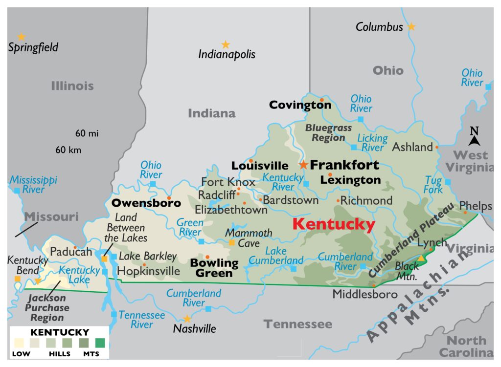
1. Map of Kentucky:
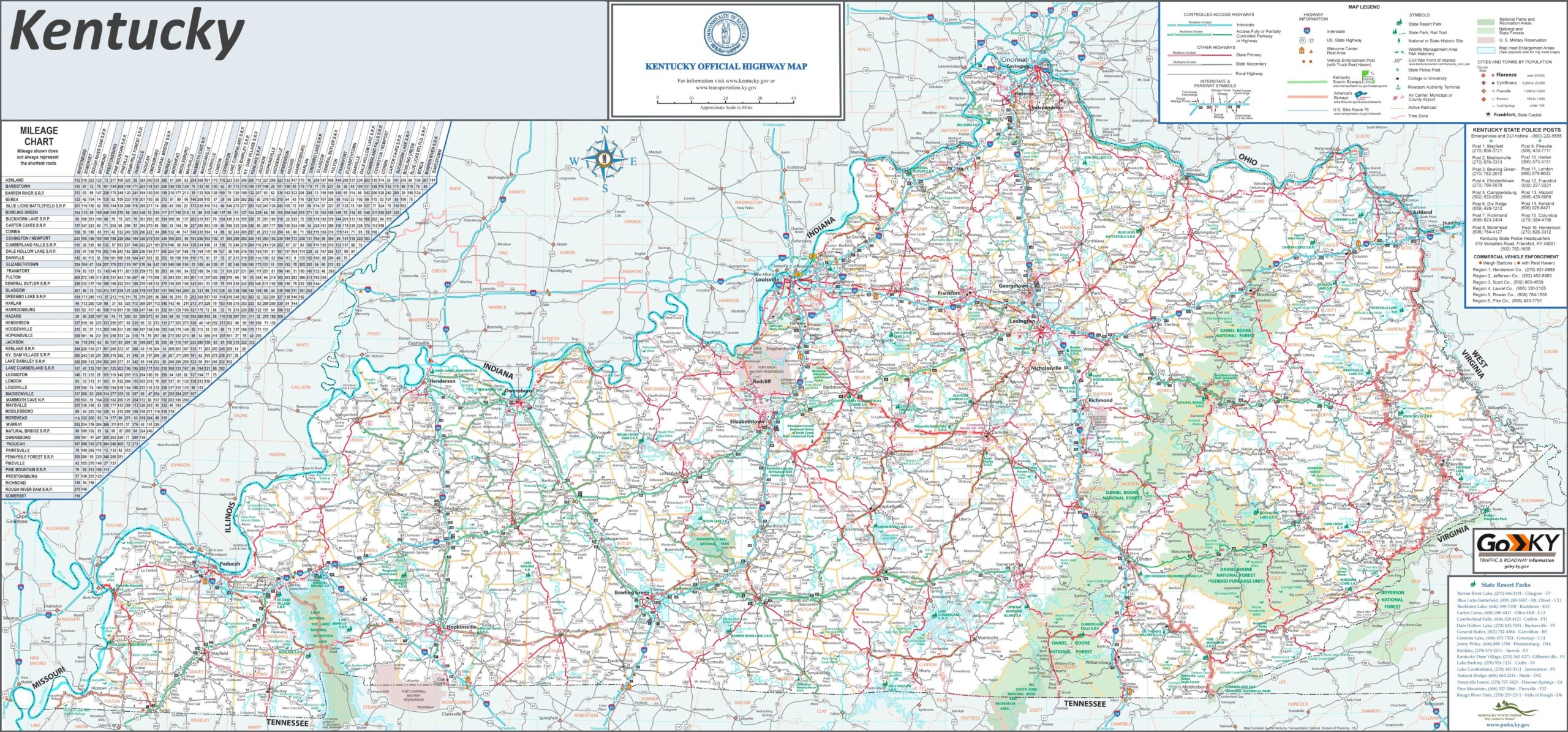
2. Map of Kentucky with Cities:
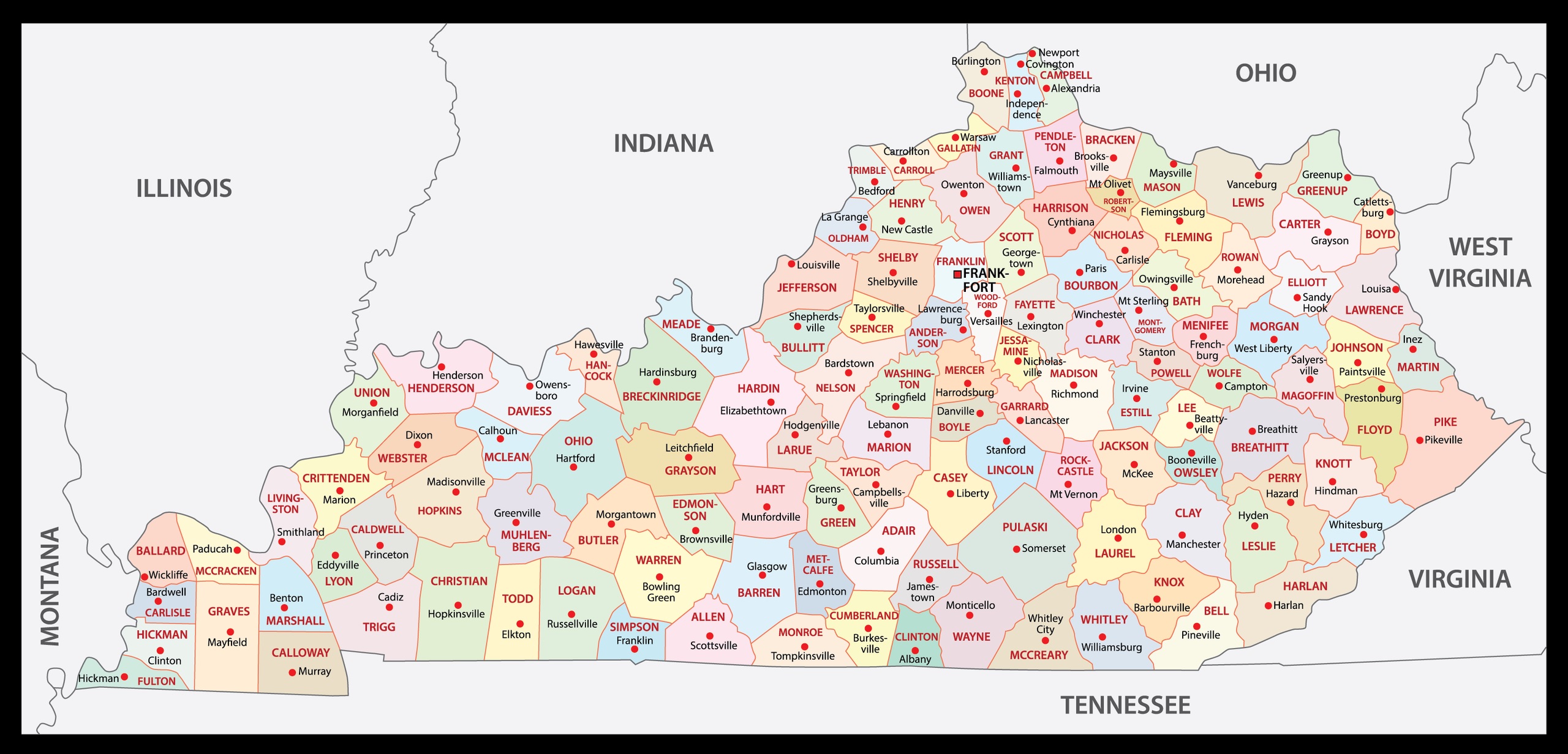
3. County Map of Kentucky:
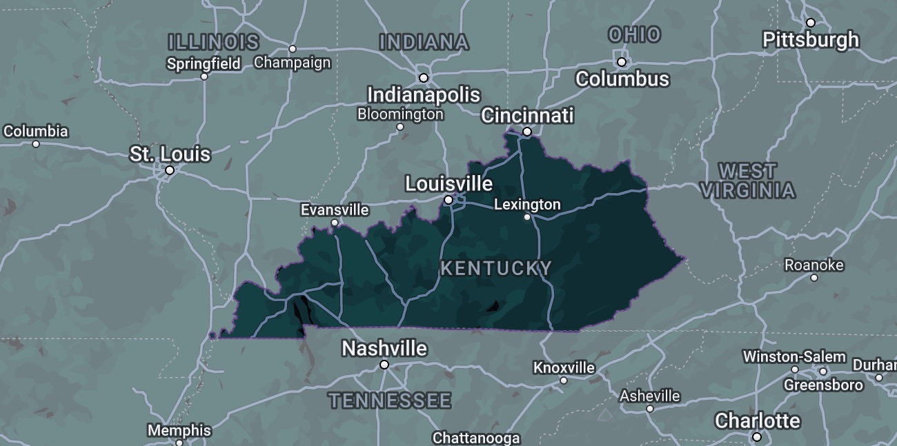
4. Google Map of Kentucky:
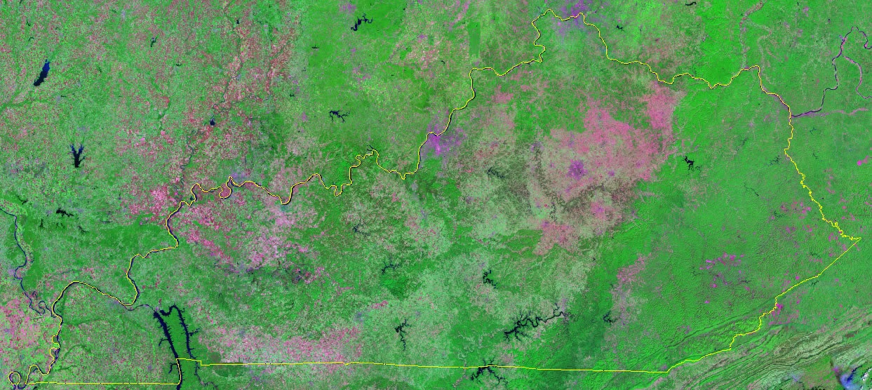
5. Satellite Map of Kentucky:
6. Blank/Outline Map of Kentucky:
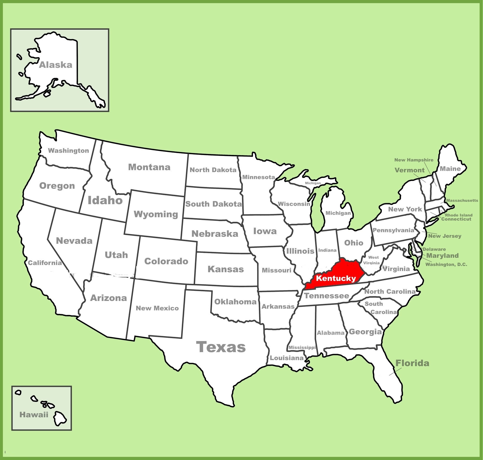
7. Kentucky on US Map:
8. Map of Eastern Kentucky:

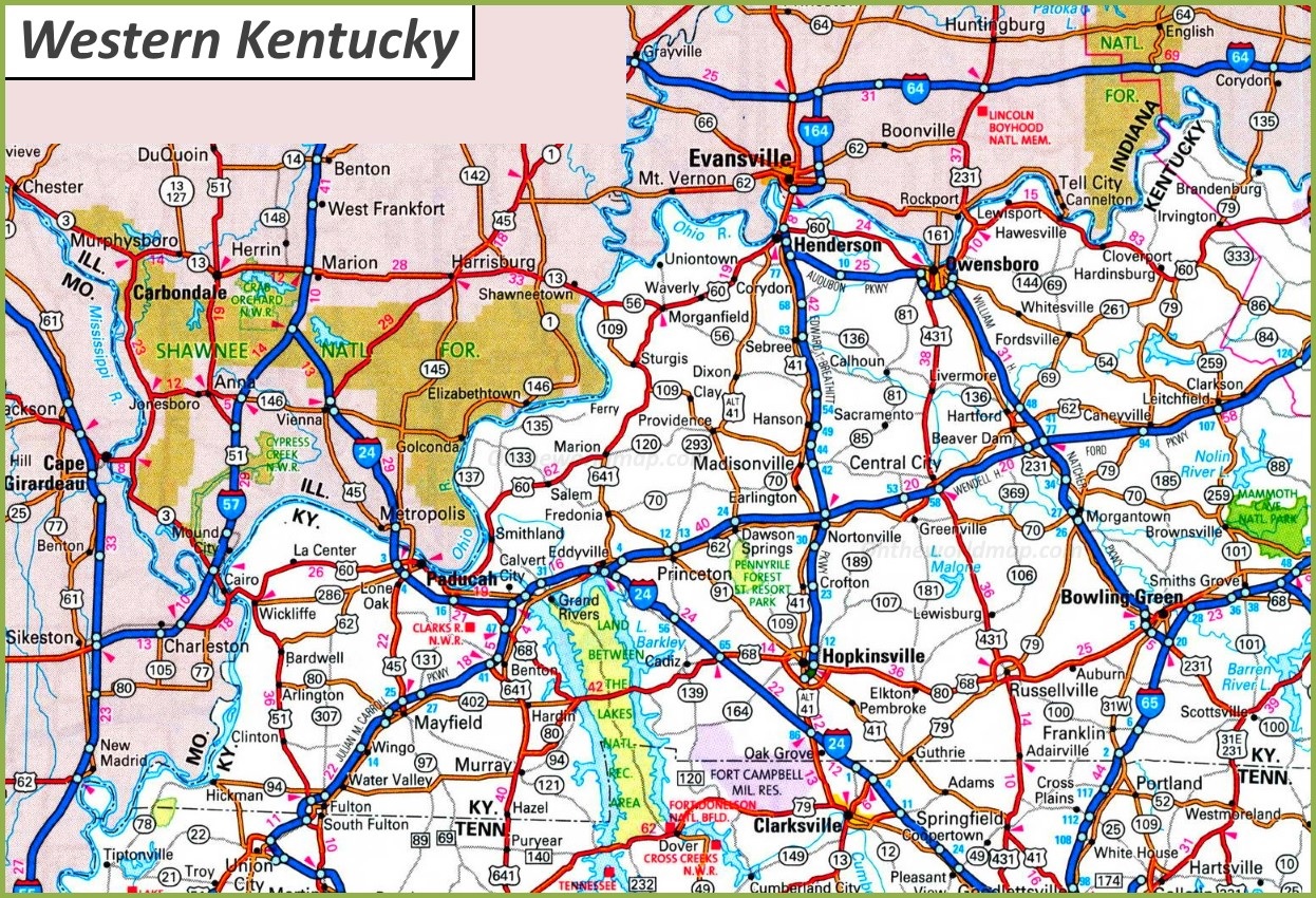
9. Map of Western Kentucky:
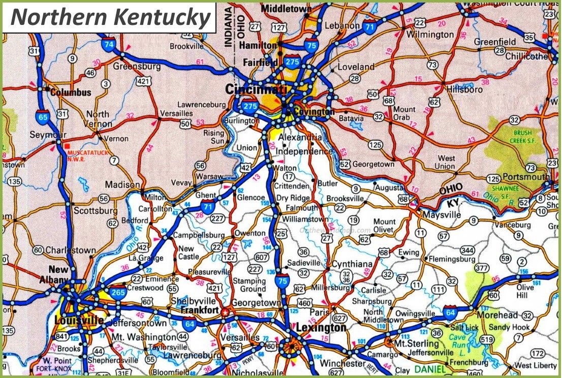
10. Map of Northern Kentucky:
Here, we have added different types of KY map. Each map contains some useful information. For you, we are adding some more useful information about each map here. The first map is related to the detailed state map of Kentucky, and this map shows some cities, counties, lakes, rivers, and mountains. You can easily locate a major place with the help of this map. The second map is a large and detailed map of Kentucky with cities and towns. This map shows all cities, towns, roads, highways, railroads, airports, rivers, lakes, mountains, etc. The third map is related to the map of Kentucky county. It is a full-detailed IL county map with cities. County seats are also shown on this map.
The fourth map is titled “Google Map of Kentucky.” This map is a Google map version of this state which shows some cities, towns, and the capital city of Kentucky. The fifth map is a Satellite image of this state. You will only see the outer boundary on this map. So, if you want a detailed map of this state, please check the first map. Now, the sixth map is a simple outline or blank map of Kentucky, which shows the outer boundary. The seventh map shows the location of Kentucky on the USA Map. As you can see on the map, the area filled with red color indicates its location on the country map.
The next three maps are the specific area maps of Kentucky, USA. On the eighth map, you will see all cities, towns, and roads of Eastern Kentucky, and on the ninth map, you will get to know all cities, towns, and roads of Western Kentucky. Now, the last map is related to Northern Kentucky. All three maps are the regional maps of Kentucky state.
So, these were some best and most useful Kentucky maps that we have added above. All the maps are available in PDF format and JPG format. You can easily download any map by clicking on the buttons under the preview image. All these maps are free to download.