Illinois is a state of the USA located in the Midwest region of America. The roads and highways of this state are managed and controlled by the Illinois Department of Transportation (IDOT). This government agency is responsible for all activities of roads and highways. If you want to get more knowledge about the roads and highways of this state, then you should check some maps related to Illinois. So, let’s start with the Illinois Road Map. Please scroll down the page and check all the maps.
Illinois Road and Highway Maps Collection:
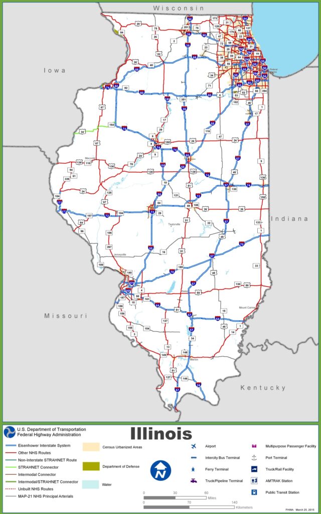
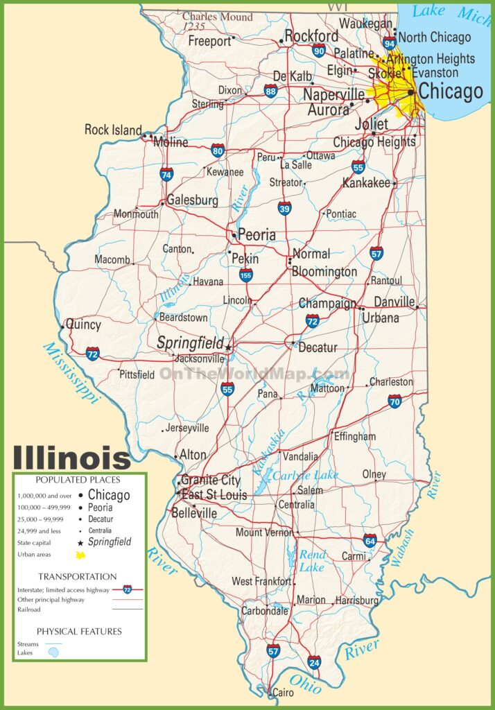
1. Illinois Road Map:
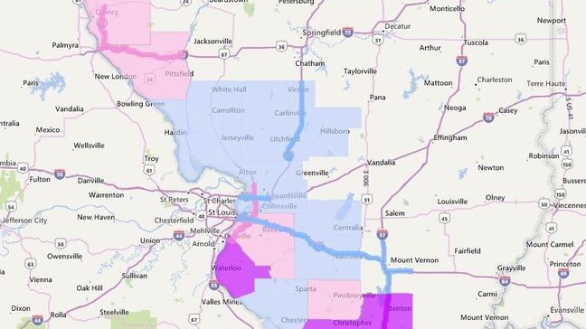
2. Illinois Road Conditions Map:
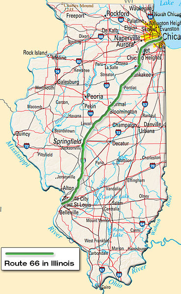
3. Route 66 Illinois Map:
4. Great River Road Illinois Map:

5. Road Map of Southern Illinois:
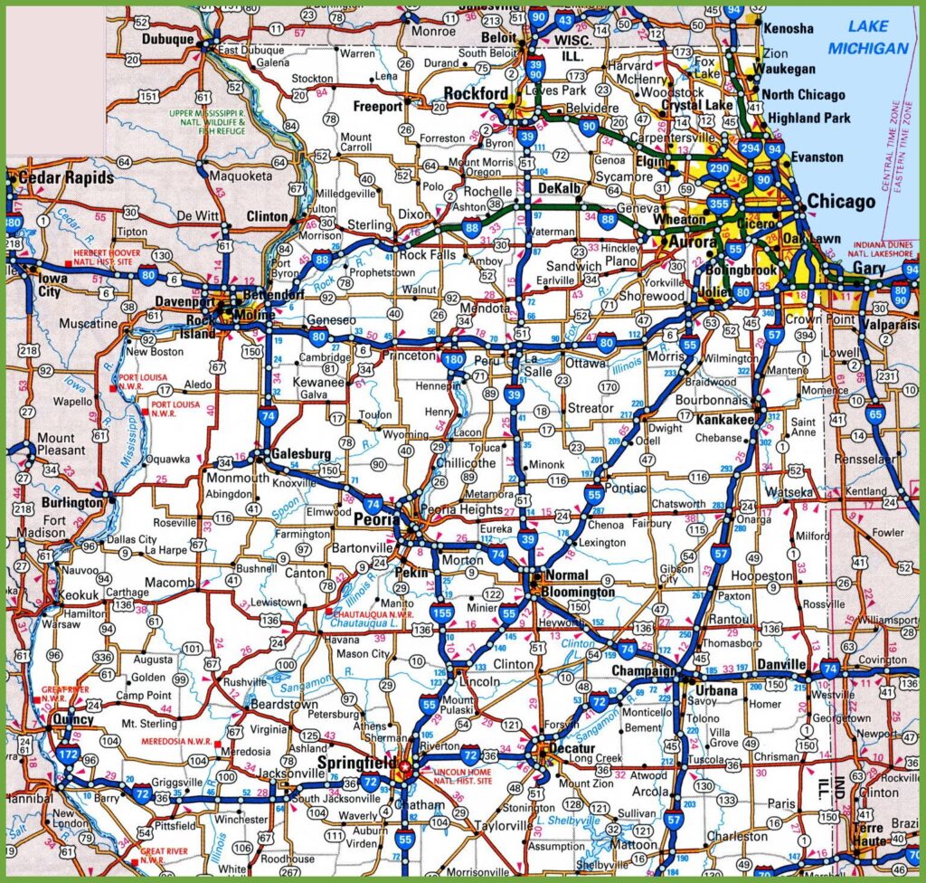
6. Road Map of Northern Illinois:
7. Detailed Tourist Road Map of Illinois:
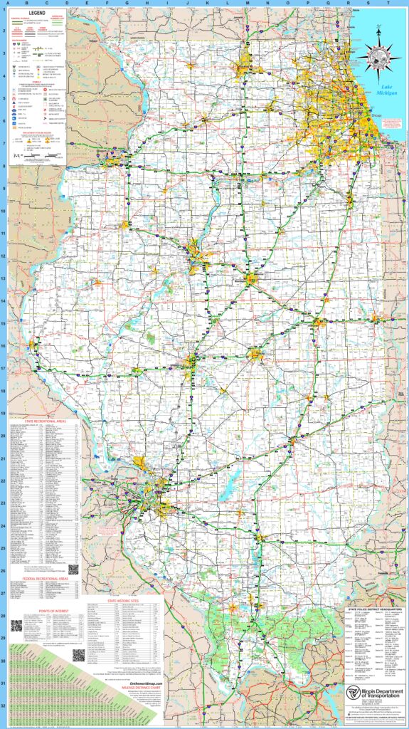
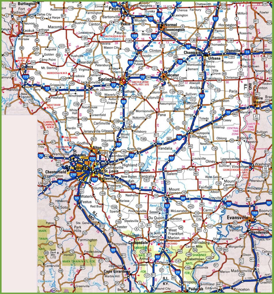
8. Illinois Highway Map:
Above we have added eight types of different maps of Illinois (IL) Road and Highway. Each map shows useful information about roads and their routes. With the help of these maps, you can easily identify any location and navigate anywhere in the cities of Illinois state. Below, we are describing each map. Please read the description of each map before viewing or downloading any map from the above section.
List of Interstate Highways in Illinois State:
| Number | Length (mi) | Length (km) |
| I-24 | 38.73 | 62.33 |
| I-39 | 123.42 | 198.63 |
| I-41 | 0.9 | 1.45 |
| I-55 | 294.38 | 473.76 |
| I-57 | 364.16 | 586.06 |
| I-64 | 128.12 | 206.19 |
| I-72 | 177.35 | 285.42 |
| I-80 | 163.52 | 263.16 |
| I-88 | 140.6 | 226.27 |
List of US Highways in Illinois:
| Number | Length (mi) | Length (km) |
| US 6 | 179.88 | 289.49 |
| US 12 | 85.14 | 137.02 |
| US 14 | 69.55 | 111.93 |
| US 20 | 233.93 | 376.47 |
| US 24 | 255.13 | 410.59 |
| US 30 | 153.79 | 247.5 |
| US 34 | 211.37 | 340.17 |
| US 40 | 159.99 | 257.48 |
| US 41 | 64.81 | 104.3 |
| US 45 | 428.99 | 690.39 |
| US 50 | 165.79 | 266.81 |
| US 51 | 415.95 | 669.41 |
| US 67 | 213.99 | 344.38 |
Let’s start with the first map, which is Illinois Road Maps. In this map, you will get to know the details of city roads, street roads and state routes of all major cities of this state. The next map shows the conditions of the cities road. On this map, you can see the roads that have high traffic and low traffic, roads that are under maintenance and the routes that are diverted.
The third map is related to Route 66 Map. This route is also known as the U.S. Numbered highway or U.S. route 66. The total length of this highway is 301 mi (484 km). The fourth map is about Great River Road Map. The Great River Road is a collection of local and states roads. This road follows the Mississippi River through the ten states of the USA. This road covers a length of 2,069.0 mi (3,329.7 km).
The fifth and sixth map is the specific region map that shows the local roads, state roads and U.S. Highways of North and South Illinois. The next map is a detailed tourist map of the whole state. In this map, all famous destinations, historical places, zoos, Malls, Heritage Buildings, Ancient places, beaches, and other tourist places are visible. With the help of this map, you can easily navigate any famous place.
The last map is titled “Illinois Highway Map,” which is a detailed map that shows the Interstate Highways and State Highway along with the Rivers of Illinois. The thick red lines indicate the Interstate (I) highways of this state. Please check this H.D. map for more information.
These were some best road and highways maps of Illinois State that we have added above. All maps are available in PDF format as well as in JPG (Image) format. You can easily download any map by clicking on the buttons. And, these maps are available free for you.