Houston is the fourth-largest city in the United States with a population of approximately 2 million people. This city is incorporated in 1837. So, if you want to visit some famous places in Houston and also want to explore this city then you need Houston road maps and highway maps to navigate in this city. For you, we are adding some best and detailed Houston texas road maps. So, check each map and download any map according to your need.
Houston Road & Highway Maps Collection:
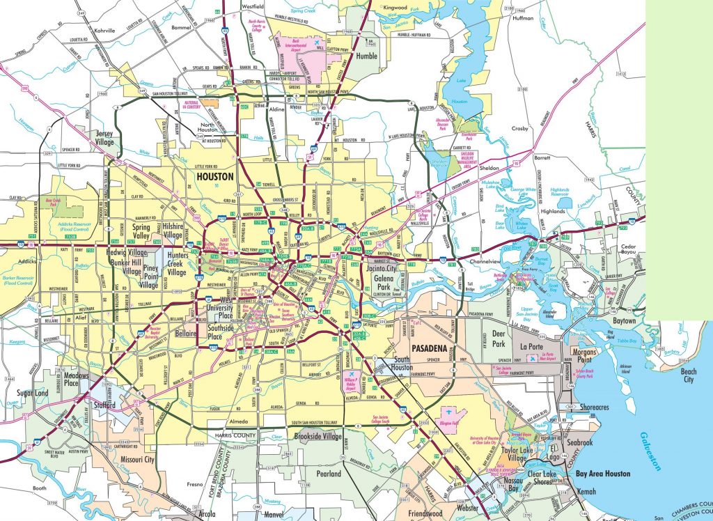
1. Houston Road Closures Map:
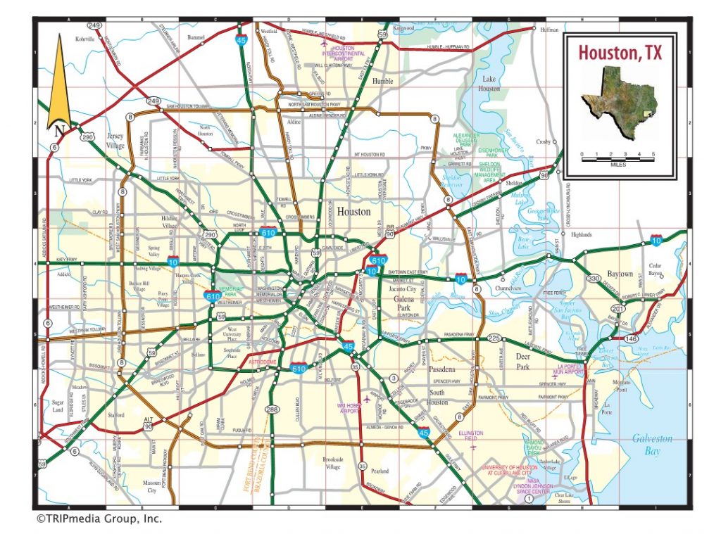
2. Houston Highway Map:
Above were some best and useful free Houston City road maps and highway maps in high quality that we have added above. These maps have shown the useful information that you need. Below we are describing some brief descriptions of each map that we have added above.
The first map is the “Houston Road Map” which contains all the information about all the main roads, major roads, and street roads of this city. In this map, you will get to know all the routes that will help you in navigation while driving or walking. This map will also show you all the roads that are connecting different cities of Texas State.
When you will check the second map which is “Houston Highway Map” shows all information about the highways, interstate highways, and the roads that connect Houston city with other major cities or other states. All the highway numbers are mentioned on this map so you will easily identify and navigate to anywhere.
Road and Highway of Houston City are controlled by a USA government agency which is the Texas Department of Transportation (TxDOT). This city contains over 40000 km area of the roadway. The major highway of Houston city is I-10, I-45, and I-69(this highway is also known as US Route – 59). Interstate-10 is the longest highway which is 1413 km long.
This beautiful city is located in eastern Texas. Houston has two nicknames. Houston’s official nickname is “Space City” and Its unofficial nickname is “Bayou City”. Houston is well known for its energy (oil) and aeronautics industries and Houston is also famous for Johnson Space Center which is located in this city.
These were some best road and highways maps that we have provided above. All the maps are available in PDF format as well as in JPG (Image) format. You can easily download any map by clicking on the buttons that are under the preview image. And, these maps are available free for you.