Zip Code is a five-digit unique number that is used by the United States Postal Service. Zipcodes helps us to route mails, couriers and parcels to anywhere in the country. If you want to send a mail or a courier to anyone then you need a Zip Code of the particular destination, because without a zip code you can’t send your courier.
That’s why you must have knowledge about the Zip Codes. Here, on this page, we have some Indiana zip code maps. With the help of these maps, you will get to know the zip codes of all the cities and counties of Indiana. Please scroll down the page and check all the maps.
Collection of Indiana Zip Code Maps:
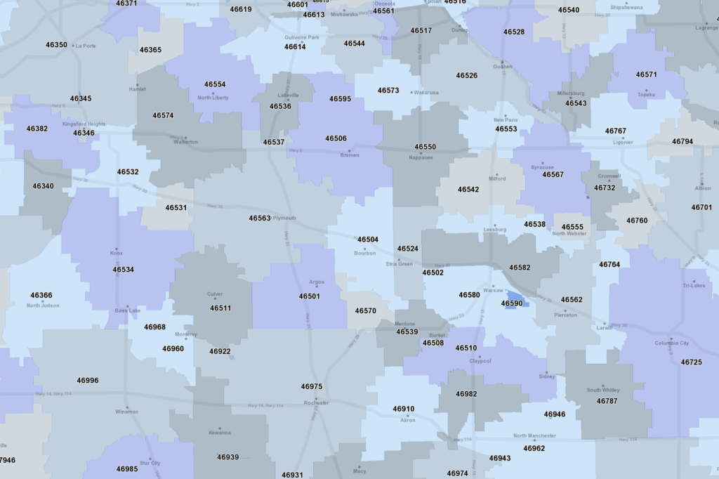
1. Indiana Zip code Map:
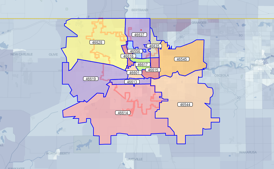
2. South Bend Zip Code Map:
3. East Central Indiana Zip Codes Map:
4. North East Indiana Zip Codes Map:
5. North West Indiana Zip Codes Map:
6. South East Indiana Zip Codes Map:
7. South West Indiana Zip Codes Map:
8. West Central Indiana Zip Codes Map:
Above we have added a total of 08 different Zip Codes maps of the Indiana State. In Indiana, there is a total of 991 cities. You can check all maps and can find any zip code of any county and city. We have also included a region-wise zip codes map. Below we are describing each map, so you can easily understand all the maps.
The first map is a full and detailed zip codes map of Indiana state. You can easily find the zip code of any city easily with the help of this map. The second map is a particular zip code map of South Bend City. This city is located in the St. Joseph County of Indiana. In this map, you can find all 13 Zip Codes of different locations.
Now, the third map is a specific region map which is East Central Indiana. In this map, you will get to know all the zip codes of the east-central area of Indiana. The fourth map is a specific region map of North East Indiana. In this map, you will get to know all the zip codes of any city that are in the northeast area of Indiana.
If you are looking for some North West Indiana’s Zip Code Maps then you should check the fifth map. In this map, you will get to know the details of the zip codes of the northwest area of Indiana. The sixth map is also a specific region map which is South East. You will get to know all the zip codes of the southeast area of this state.
Now, the seventh map is a specific region map which is South West, Indiana. In this map, you will get to know all the zip codes of the southwest area of Indiana. The last map is related to a particular region map which is West Central Indiana. This map is showing all the zip codes of the west-central region of Indiana State.
These were some useful and informative Zip Codes Maps of Indiana State. You can easily download any map by clicking on the PDF / JPG buttons that are under the preview image of each map. We have added two kinds of maps here the first one is in PDF format and the second one is of Image type. So, download or save any map according to your requirement.