Montana is a state in the USA, situated in the Western region of the country. This state has 56 counties, which covers a total area of 380,800 kilometres square. Beaverhead is the largest county-based in the area and Yellowstone is the most populous county of this state. And, if you want to know more about the counties of this state and also looking for some interactive county maps of Montana then you are on the right page. Because, here on this page, we are adding some detailed information of all counties of MT, USA along with some printable maps. So, please scroll down the page and check our collections of the maps. Now, let’s start with a county map of Montana.
Montana (MT) County Maps Collection:
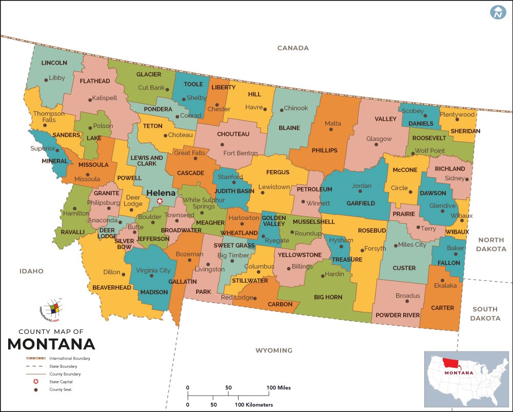
1. County Map of Montana:

2. Map of Montana with Counties:
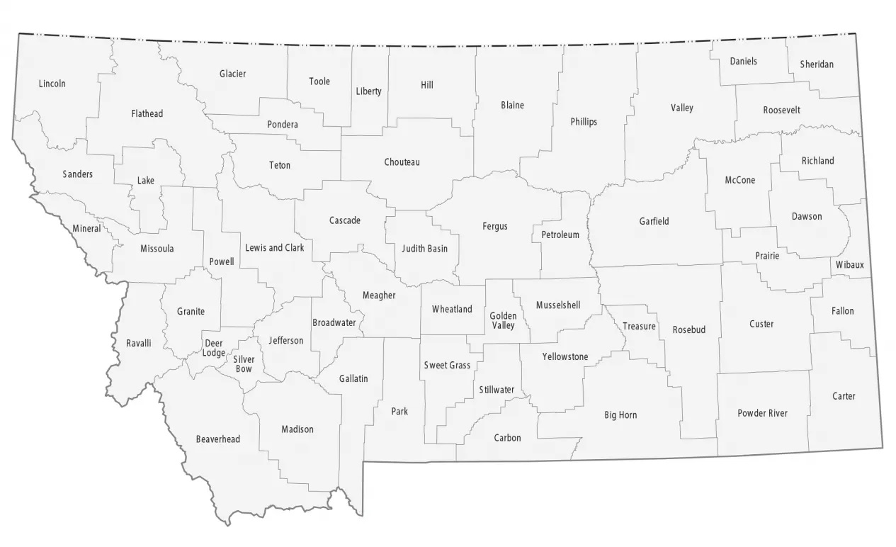
3.Blank County Map of Montana:
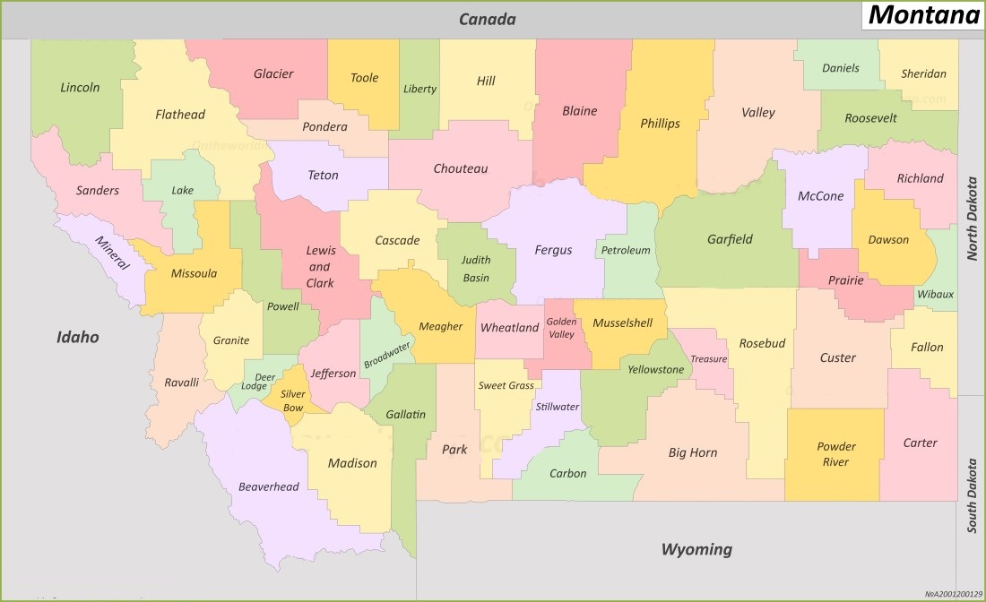
4. MT County Map:
5. Montana County Map with Cities:
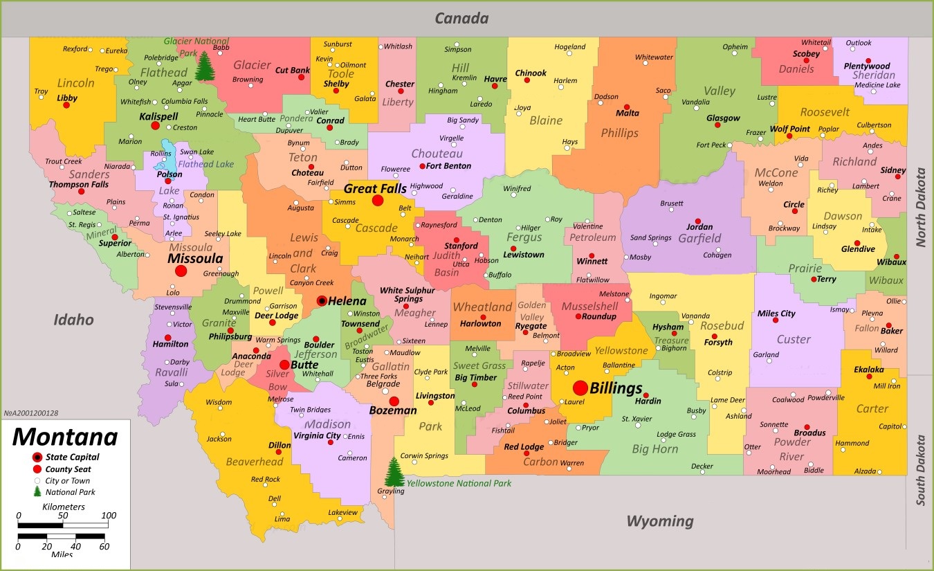
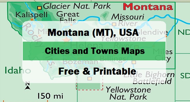
6. Montana Map with Cities and Towns:

7. Map of Montana:
This is the collection of some high-quality MT county map that we have added above. We have added a total of seven different maps that contain some helpful information about the counties and cities of Montana state. Here, we are adding some brief information about each map. So, please read the full description before downloading any map from the above collection.
The first map is a simple county map of Montana, which shows only county names. And the next map is a detailed county map with cities. So, you can check the second map if you need a detailed county map of this state. The third map is also a blank or outline county map of Montana, the fourth and fifth maps are also related to counties of Montana, but these maps are visually different. Below we are also adding a table that shows some useful information about the counties of Montana. Please read the entire table for additional information.
Counties in Montana, USA:
This is a list of all counties of this state with some useful information like name of county, the county seat, year of established in and total area.
| County | County Seat | Est. | Population | Area |
| Big Horn County | Hardin | January 13, 1913 | 13124 | 4,995 sq mi |
| Blaine County | Chinook | February 29, 1912 | 7044 | 4,226 sq mi |
| Broadwater County | Townsend | February 9, 1897 | 6774 | 1,192 sq mi |
| Carbon County | Red Lodge | March 4, 1895 | 10473 | 2,048 sq mi |
| Carter County | Ekalaka | February 22, 1917 | 1415 | 3,340 sq mi |
| Cascade County | Great Falls | September 12, 1887 | 84414 | 2,698 sq mi |
| Chouteau County | Fort Benton | February 2, 1865 | 5895 | 3,973 sq mi |
| Custer County | Miles City | February 2, 1865 | 11867 | 3,783 sq mi |
| Daniels County | Scobey | August 30, 1920 | 1661 | 1,426 sq mi |
| Dawson County | Glendive | January 15, 1869 | 8940 | 2,373 sq mi |
| Deer Lodge County | Anaconda | February 2, 1865 | 9421 | 737 sq mi |
| Fallon County | Baker | December 9, 1913 | 3049 | 1,620 sq mi |
| Fergus County | Lewistown | March 12, 1885 | 11446 | 4,339 sq mi |
| Flathead County | Kalispell | February 6, 1893 | 104357 | 5,099 sq mi |
| Gallatin County | Bozeman | February 2, 1865 | 118960 | 2,507 sq mi |
| Garfield County | Jordan | February 7, 1919 | 1173 | 4,668 sq mi |
| Glacier County | Cut Bank | February 17, 1919 | 13778 | 2,995 sq mi |
| Golden Valley County | Ryegate | October 4, 1920 | 823 | 1,175 sq mi |
| Granite County | Philipsburg | March 2, 1893 | 3309 | 1,728 sq mi |
| Hill County | Havre | February 22, 1912 | 16309 | 2,896 sq mi |
| Jefferson County | Boulder | February 2, 1865 | 12085 | 1,657 sq mi |
| Judith Basin County | Stanford | December 10, 1920 | 2023 | 1,870 sq mi |
| Lake County | Polson | May 11, 1923 | 31134 | 1,494 sq mi |
| Lewis and Clark County | Helena | February 2, 1865 | 70973 | 3,461 sq mi |
| Liberty County | Chester | February 11, 1920 | 1959 | 1,430 sq mi |
| Lincoln County | Libby | March 9, 1909 | 19677 | 3,613 sq mi |
| Madison County | Virginia City | February 2, 1865 | 8623 | 3,587 sq mi |
| McCone County | Circle | February 20, 1919 | 1729 | 2,643 sq mi |
| Meagher County | White Sulphur Springs | November 16, 1867 | 1927 | 2,392 sq mi |
| Mineral County | Superior | August 7, 1914 | 4535 | 1,220 sq mi |
| Missoula County | Missoula | February 2, 1865 | 117922 | 2,598 sq mi |
| Musselshell County | Roundup | February 11, 1911 | 4730 | 1,867 sq mi |
| Park County | Livingston | February 23, 1887 | 17191 | 2,656 sq mi |
| Petroleum County | Winnett | November 24, 1924 | 496 | 1,654 sq mi |
| Phillips County | Malta | February 5, 1915 | 4217 | 5,140 sq mi |
| Pondera County | Conrad | February 17, 1919 | 5898 | 1,625 sq mi |
| Powder River County | Broadus | March 7, 1919 | 1694 | 3,297 sq mi |
| Powell County | Deer Lodge | January 31, 1901 | 6946 | 2,326 sq mi |
| Prairie County | Terry | February 5, 1915 | 1088 | 1,737 sq mi |
| Ravalli County | Hamilton | February 16, 1893 | 44174 | 2,394 sq mi |
| Richland County | Sidney | May 27, 1914 | 11491 | 2,084 sq mi |
| Roosevelt County | Wolf Point | February 18, 1919 | 10794 | 2,356 sq mi |
| Rosebud County | Forsyth | February 11, 1901 | 8329 | 5,012 sq mi |
| Sanders County | Thompson Falls | February 7, 1905 | 12400 | 2,762 sq mi |
| Sheridan County | Plentywood | March 24, 1913 | 3539 | 1,677 sq mi |
| Silver Bow County | Butte | February 16, 1881 | 35133 | 718 sq mi |
| Stillwater County | Columbus | March 24, 1913 | 8963 | 1,795 sq mi |
| Sweet Grass County | Big Timber | March 5, 1895 | 3678 | 1,855 sq mi |
| Teton County | Choteau | February 7, 1893 | 6226 | 2,273 sq mi |
| Toole County | Shelby | May 7, 1914 | 4971 | 1,911 sq mi |
| Treasure County | Hysham | February 7, 1919 | 762 | 979 sq mi |
| Valley County | Glasgow | February 6, 1893 | 7578 | 4,921 sq mi |
| Wheatland County | Harlowton | February 22, 1917 | 2069 | 1,423 sq mi |
| Wibaux County | Wibaux | August 17, 1914 | 937 | 889 sq mi |
| Yellowstone County | Billings | February 26, 1883 | 164731 | 2,635 sq mi |
The sixth map is a main map of Montana with cities that shows all counties, major cities, city roads and interstate highways. And the last map is a detailed map of this state. All major cities and towns are visible on this map with all major roads. And some water bodies like Lakes and Rivers are also shown on this map. So, these were some printable maps that we have added above. These large maps are available in PDF format and JPG (Image) format. You can easily download any map by clicking on the buttons under the preview image. All these H.D. maps are free to download.