Louisiana is the 25th most populous state in the country and the 20th smallest state in the area in the USA. This state is located in the Southern United States of America. Louisiana was divided into 488 cities and towns (including Parishes). Louisiana covers approx. an area of 135,382 km2 (including 21,455 km2 of water and 112,927 km2 of land). And the approx. the population of Louisiana is 4,657,757.
If you want to learn more about this state then you must stay on this page because here, we are adding some useful maps related to the cities and towns of Louisiana. So, please scroll down the page and start with a map of Louisiana with cities. You may also check some other maps related to Roads and Highways maps of Louisiana (LA), USA if you are wondering to travel in this state or any city of LA.
Maps of Louisiana with Cities and Towns:
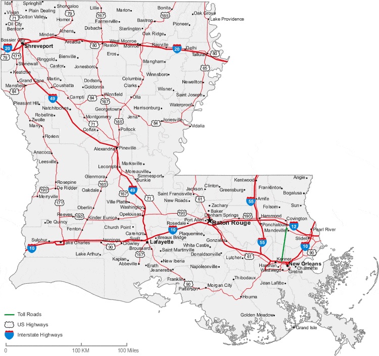
1. Map of Louisiana with Cities:
2. Map of Louisiana with Towns:
3. Map of Louisiana Cities & Towns:

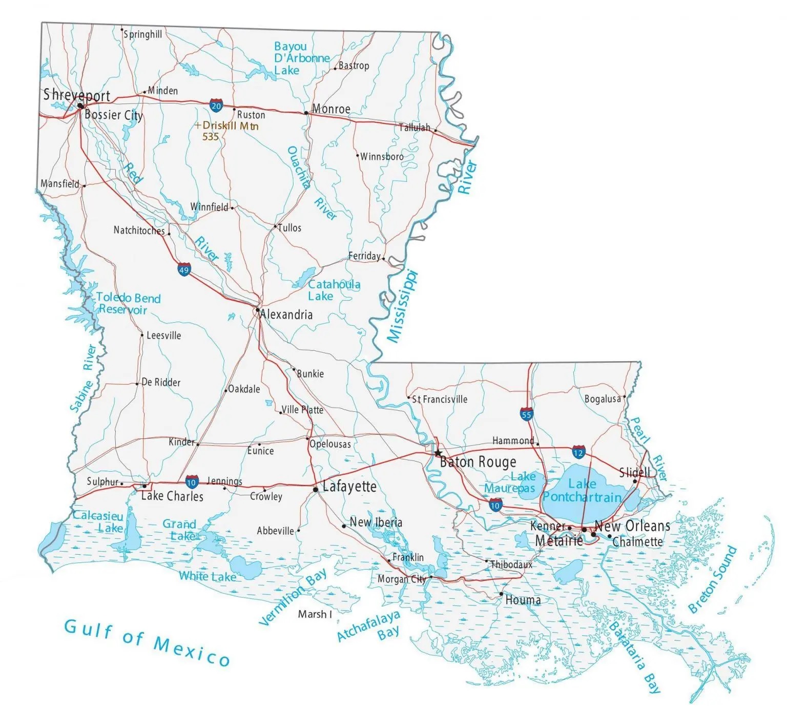
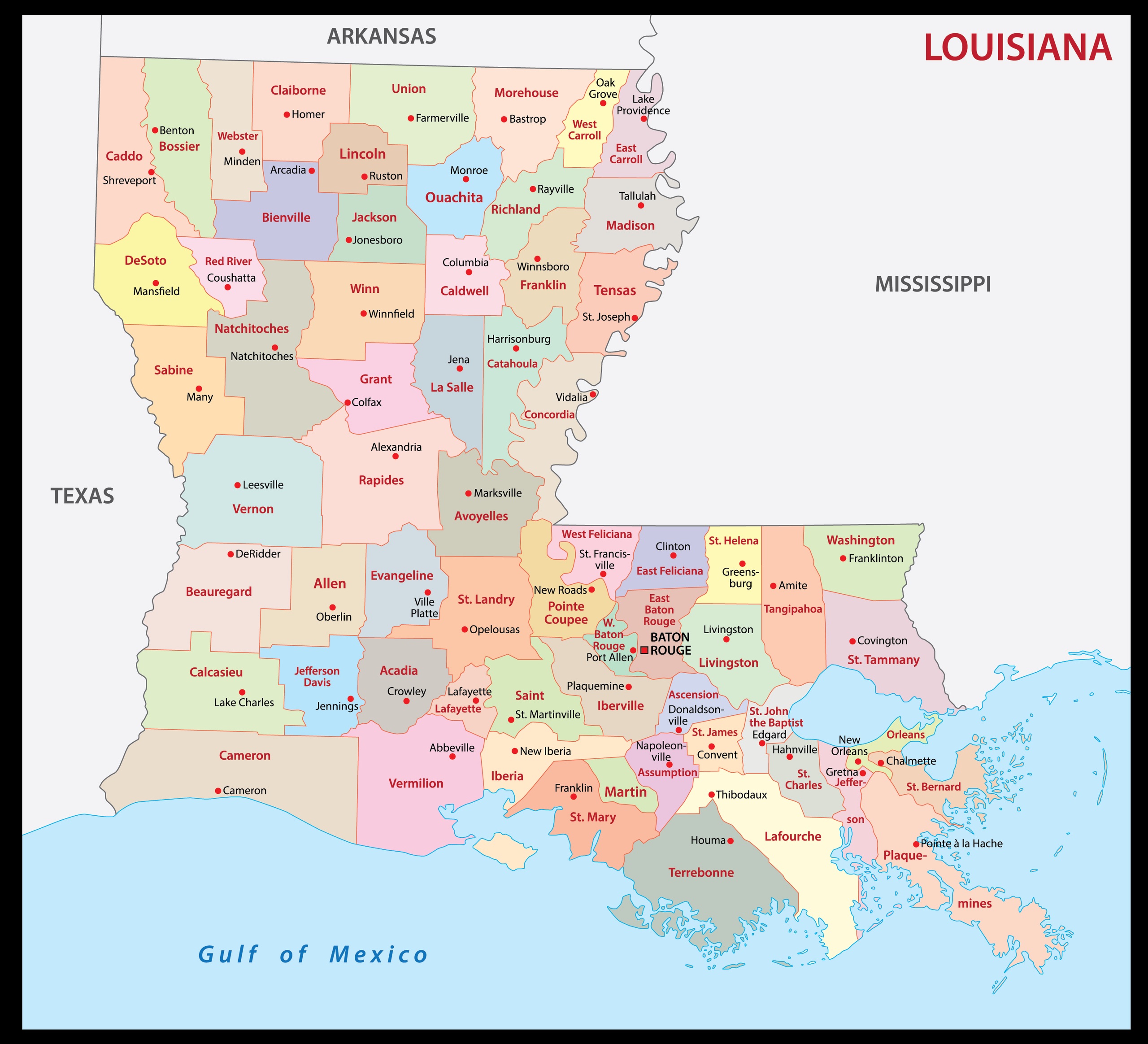
4. Parish Map of Louisiana:
5. Map of Louisiana:

Above, we have added five types of different maps related to the cities and towns of Louisiana. Below, we’re also giving some information about each map, so read the information and get any map on your device for free.
The first map is related to the cities of Louisiana state. So, you can easily locate any city in Louisiana with the help of this map. Now, on the next map, you will get to know about the city of Louisiana. And the third map is the main and detailed map of Louisiana with Cities and Towns. You will easily navigate anywhere inside any city of LA, USA on this map because roads and highways are also visible. You can also check some other Roads and Highway Maps of Louisiana State if you are looking for a detailed city road and highway network map.
The fourth map is related to the complete state map of Louisiana with towns, cities, roads, and highways. This map is similar to the previous map, but this map shows some other places and landmarks. For example, you will see rail networks, airports, beaches, malls, rivers, lakes, etc. The fifth map is related to the main Parish map of Louisiana. In this map, you can easily locate any county in this state. The county seat major cities are also mentioned on this map.
So, these were some best printable Town and City maps of Louisiana. You can easily print any map because all maps are HD quality and available in PDF and JPG format. And you can download any map for free by clicking on the buttons under the preview image.