Arkansas is a state in the United State of America that is positioned in the South-Central region of the country. There are 25 stars printed on the flag of Arkansas because Arkansas was made the 25th state of the USA. If you want to learn more about the Arkansas state then you must scroll down the page because below, we are adding some useful information about Arkansas along with high-quality maps. A map of Arkansas helps you a lot. So, check our collection of maps.
Arkansas (AR) State Maps Collection:
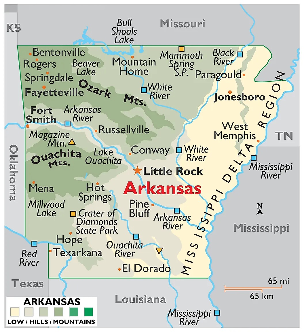
1. Map of Arkansas:
2. Arkansas on US Map:

3. Google Map of Arkansas:

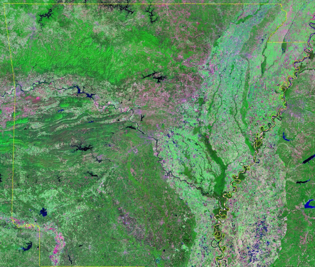
4. Satellite Image of Arkansas:
5. Blank Map of Arkansas:
6. County Map of Arkansas:

7. Arkansas Map with Cities and Towns:

Here, we have added seven different types of AR map. Each map contains some useful information. For you, we are adding some more useful information about each map here.
The first map is related to the detailed state map of Arkansas state, and this map shows some cities, counties, lakes, rivers, hills, and mountains. You can easily identify any major location with the help of this map. The second map shows the location of Arkansas on the US Map. As you can see on the map, the area filled with red color indicates its location on the country map.
The third map is titled “Google Map of Arkansas.” This map is a Google map version of this state which shows some cities, towns, and the capital city. The fourth map is a Satellite image that shows the structure. You will only see the outer boundary on this map. So, if you want a detailed map of this state, please check the first map. Now, the fifth map is a simple outline or blank map of Arkansas, which shows the outer boundary.
The sixth map is related to the map of Arkansas county. It is a full-detailed AR county map with cities. County seats are also shown on this map. The seventh map is a large and detailed map of Arkansas with cities and towns. This map shows all cities, towns, roads, highways, railroads, airports, beaches, rivers, lakes, mountains, etc. So, these were some best and most useful Arkansas maps that we have added above. All the maps are available in PDF format and JPG format. You can easily download any map by clicking on the buttons under the preview image. All these maps are free to download.