Minnesota is a state of the USA that is located in the upper Midwestern region of the country. Its capital city is Saint Paul and the official nickname of MN, USA is North Star State. The name Minnesota comes from the Dakota tribe’s Minnesota river which means cloudy or sky-tinted water. Minnesota is also bordered by Canada in the North. Minnesota is famous for natural resource mining which is “manganese”. You can learn more about Minnesota state with the help of our page because below we are adding useful information with some printable map of Minnesota. So, please scroll down the page and check our collections of maps related to Minnesota state, cities, counties, and towns.
Minnesota (MN) State Maps Collection:
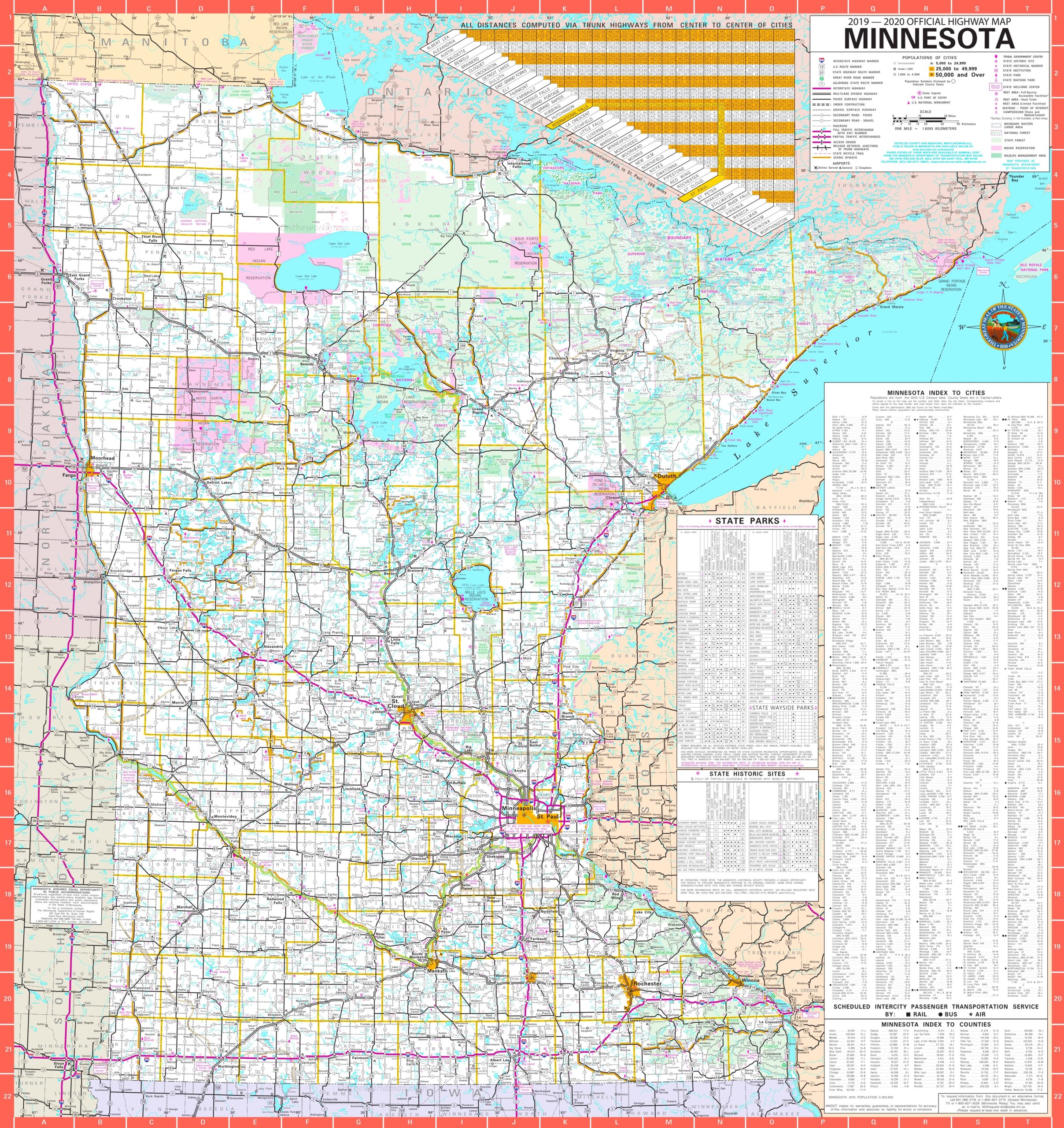
1. Map of Minnesota:

2. Minnesota on US Map:

3. Google Map of Minnesota:

4. Satellite Image of Minnesota:

5. Blank Map of Minnesota:
6. County Map of Minnesota:

7. Minnesota Map with Cities and Towns:
8. Northern Minnesota Map

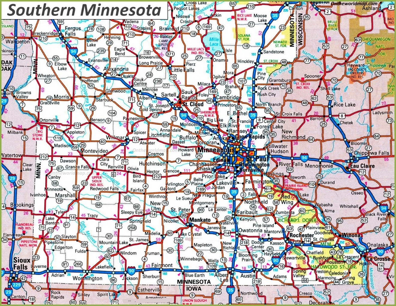
9. Southern Minnesota Map
This is the collection of Minnesota State Map that we have added above. We have added a total of eight different maps that contain some helpful information about Minnesota and its cities. Below, we are also adding some brief information about each map. So, please read the full description before viewing or downloading any map from the above.
The first map is related to the main state map of this state, which shows all counties and major cities on the map. The second map shows all the cities, towns, counties, and other significant places. It is a complete and detailed map of Minnesota with cities and towns. And on this map, you can also know about all parks, malls, beaches, airports, railroads, street roads, city roads, and interstate highways. Now, the third map is related to the County map of Minnesota which shows all counties along with the major cities of Minnesota.
And the fourth map shows the location of Minnesota on the US map. As you can see, an area filled with red indicates this state’s location on its country map. The fifth map is a blank outline map of this state, which shows the outer boundary of this state. The sixth map is a type of google map which shows some cities counties of this state. Now, the seventh map is a type of satellite image or map of Minnesota (MN) that shows the structure of this state. As you can see on the map, a thin yellow line marks the outer boundary. Now, the last map is a Topographic map of Minnesota. These types of images or maps are used for geographic purposes.
These were some most useful and printable MN state map that we have added above. These high-quality maps are available in PDF format and JPG (Image) format. You can easily download any map by clicking on the buttons under the preview image. All these HD large maps are free to download.