Connecticut (CT) is a beautiful state that is located in the northeastern corner of the country. Roads of this state are controlled by the Connecticut Department of Transportation (CTDOT and occasionally ConnDOT, or CDOT). So, if you are planning to travel across Connecticut state and want to explore its beauty, you must have Connecticut’s Highways Maps and CT road map.
These maps will help you in travel. So, have a look at these amazing maps that we have below.
Connecticut Road & Highway Map Collection:
1. Connecticut Highway Map:
2. Connecticut Road Map:

So, these were some best and useful free Connecticut road maps and CT highway map in high quality that we have provided above. These maps have shown the useful information that you need.
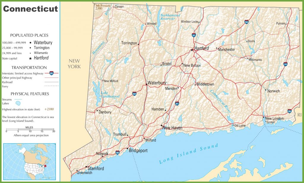
The first map, named “Connecticut Highway Map”, shows all information about the highways, interstate highways, and roads connecting Connecticut city with other major cities or other states. All the highway numbers are mentioned on this map, so you can easily identify and navigate anywhere.
The second map, titled “Connecticut Road Map”, contains all the information about all the state’s roads. In this map, you will see all the U.S highways, interstate highways, and roads and their routes. This map will show you all the roads that lead to different cities of CT state.
In this state, the total area of the road and highways is about 7586 kms which includes 3,719 mi (5,985 km) of state routes, 547.75 mi (881.52 km) of U.S. Highways and 446.33 mi (718.30 km) of Interstate highways. The longest routes in Connecticut are Route-15, US-1 and I-95.
Connecticut’s official nickname is the “Constitution State.” But it has some other nicknames also like “The Nutmeg State”, “The Provisions State”, and “The Land of Steady Habits”. It is the smallest state that is rectangular. Connecticut is a natural wonderland packed with some of the country’s most beautiful waterfalls, lakes, forests, beaches, and towns. This ct state is also famous for its Yale University.
So, these were some best road and highways maps that we have provided above. All the maps are available in PDF format as well as in JPG (Image) format. You can easily download any map by clicking on the buttons that are under the preview image. And, these maps are available free for you.