Wisconsin is a state situated in the upper Midwestern part of the United States of America and is divided into 743 towns and cities. Wisconsin is the 25th largest state in the USA based on total area. It is spread over 65,498.37 sq miles of area that include only land area. The largest city in Wisconsin is Milwaukee, with a population of 586,503 (approx.) If you are looking for some useful information about the cities of Wisconsin and a map of Wisconsin with cities and towns then you are on the right page.
Please scroll down the page to check our collections of maps related to all cities, villages, and towns of Wisconsin. You may also check some other collections of Roads and Highways Maps of Wisconsin, USA.
Maps of Wisconsin with Cities and Towns:
1. Map of Wisconsin with Cities:

2. Map of Wisconsin with Towns:

3. Wisconsin Map with Cities and Towns:

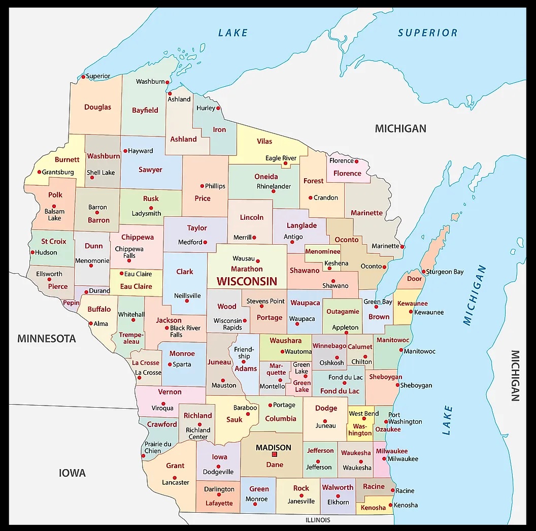
4. County Map of Wisconsin:
5. Wisconsin Map:

Here, we have added five different types of maps. All maps belong to Wisconsin cities and towns. We have also added some other Wisconsin State and County Map of Wisconsin maps. Each map contains some helpful information. For you, we are adding some more useful information about each map.
The first map is related to the main City map of Wisconsin. This map shows all cities of this state, so you can easily locate any city. Now, the second map is about the Town maps of Wisconsin. On this map, you will see the towns of this state. In both maps, roads are also visible to find any route with the help of these maps.
The third map is a large and printable map of Wisconsin. This is a full version of Wisconsin Cities and Towns. All cities, towns, and other important places are visible on this map. The fourth map is a county map of Wisconsin. This map shows all counties, major cities, and their county seats.
Now, the last map is also about the state map of Wisconsin, and this map is a detailed map of this state. Because this map shows all counties, cities, towns, and all city roads, street roads, national highways, interstate highways, and other major roads, this map also shows all lakes, rivers, and other major water bodies. So, these were some practical and printable maps of WI state Cities and Towns. All these maps are free to download. All the maps are available in PDF and JPG (Image) formats. You can easily download any map by clicking on the buttons under the preview image.