South Caroline is a state of the USA which is located in the southeastern region of the United States of America. The capital of this state is Columbia. This state has 46 counties. It is also the 23rd most populous state in America. So, if you want to know more about this state and want to explore it and its cities, you must have a South Carolina Map, which will help you a lot. Here on this page, we are adding some best SC USA maps, South Carolina County map, South Carolina City’s Map, and county map with cities. Please scroll down the page and have a look at these maps. You can also check some Road and Highway maps of South Carolina (SC) by clicking this link.
South Carolina State Map Collection:
1. South Carolina State Map:

2. South Carolina County Map:

3. South Carolina Map with Cities:

4. South Carolina State on USA Map:

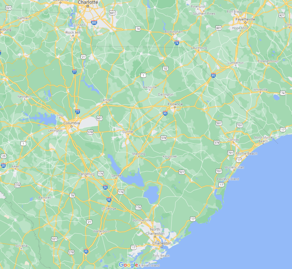
5. South Carolina Google Map:
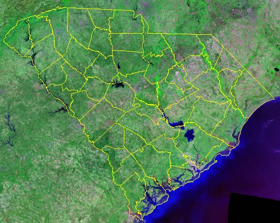
6. South Carolina Satellite Map:
7. SC District Map:

8. South Carolina Outline Map:

Here, we have added eight different types of maps. All maps belong to South Carolina State. Each map contains some useful information. For you, we are adding some more useful information about each map here.
The first map is related to the main state map of South Carolina, and this map shows all major cities and all forty-six counties. You can easily identify any city with the help of this map. The second map is related to the county map of South Carolina. It is a full-detailed SC county map with cities.
The third map shows the Cities and Towns of SC state. In this map, you can see all major cities and towns along with County names. The next map shows the location of South Carolina state on the USA Map. As you can see in the map, the area filled with red color indicates the South Carolina state.
The fifth map is titled “South Carolina Google Map.” This map is a Google map version of this state which shows some major cities, towns, and the capital city. The following map is a Satellite map of this state which shows the Satellite image and structure of this state. You will only see the boundaries on this map. So, if you want a detailed map of this state, please check the first map. Now, the last map is a simple outline map of the South Carolina state which shows the outer boundary of this state.
These were some best and most useful SC (South Carolina) State Maps that we have added above. All the maps are available in PDF format and JPG (Image) format. You can easily download any map by clicking on the buttons under the preview image. All these maps are free to download.