Road maps play an essential role in our daily lives. Road Maps are used mainly by travelers, explorers, researchers, and universities to know about roads. A traveler must have a road map during their journey. This will help them explore their surroundings without getting lost. That’s why we’ve added some Chicago highway maps and Chicago road and street maps here. Please scroll down the page and have a look at these maps.
Chicago Road & Highway Map Collection:
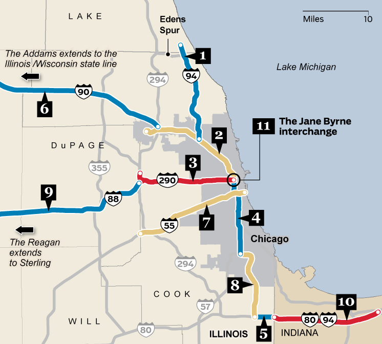
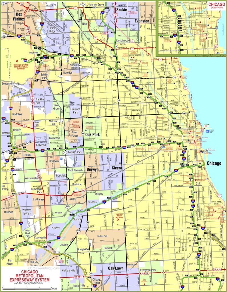
1. Chicago Highway Map:
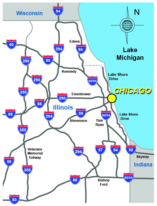
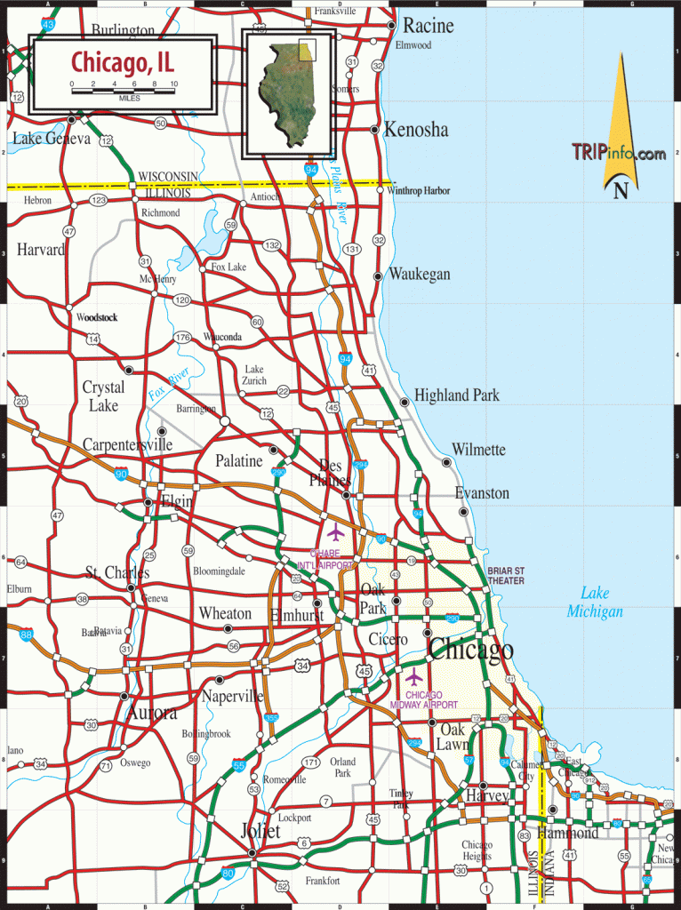
2. Highways Map of Chicago:
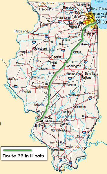
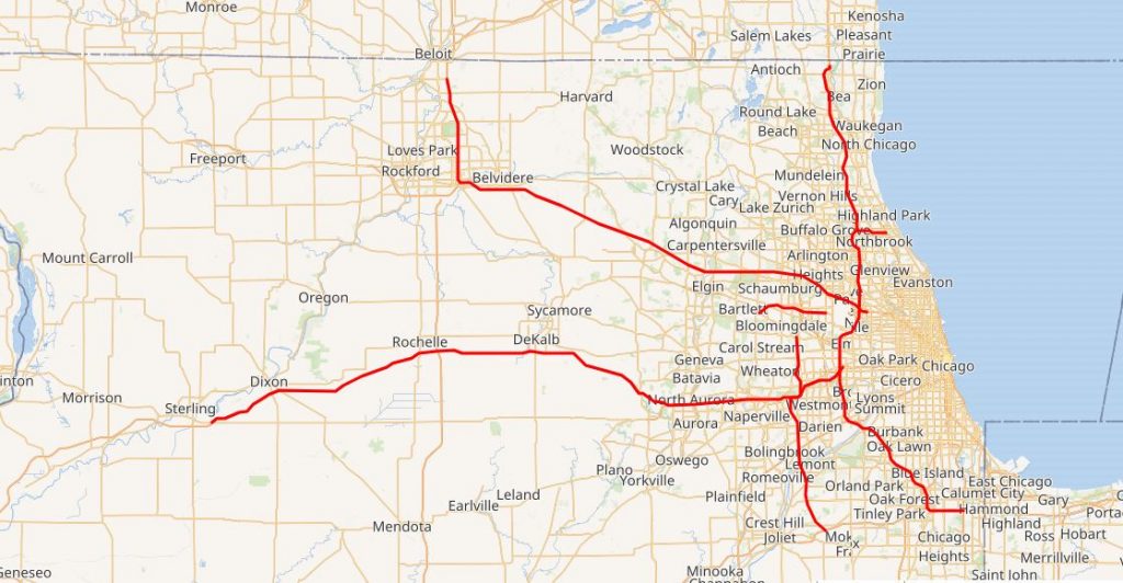
3. Route 66 Map, Chicago:
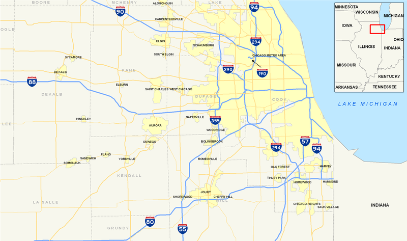
4. Chicago Interstate Map:
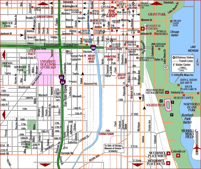
5. Chicago Road Map:
6. Road Map of Chicago:
7. Map of Chicago Streets:
8. Chicago Toll Roads Map:
Above we have added four types of Chicago Highway and Interstate Highway maps. Below we describe each map, so before downloading any map, read the description for more information.
Some popular Interstate Highways in Chicago
| I-190: Kennedy Expressway |
| I-290: Eisenhower Expressway |
| I-294: Tri-State Tollway |
| I-355: Veterans Memorial Tollway |
| I-55: Stevenson Expressway |
| I-57: (unnamed) |
| I-80: Kingery Expressway, Tri-State Tollway, (unnamed) |
| I-88: Ronald Reagan Memorial Tollway |
| I-90: Chicago Skyway, Dan Ryan Expressway, Kennedy Expressway, Jane Addams Memorial Tollway |
| I-94: Kingery Expressway, Bishop Ford Memorial Freeway, Dan Ryan Expressway, Kennedy Expressway, Edens Expressway, Edens Expressway Spur, Tri-State Tollway |
Some Important Expressway in Chigao
| Kingery Expressway: I-80, I-94 |
| Bishop Ford Memorial Freeway: I-94 |
| Chicago Skyway: I-90 |
| Dan Ryan Expressway: I-90, I-94 |
| Ronald Reagan Memorial Tollway: I-88 |
| Edens Expressway: I-94 |
| Edens Expressway Spur: I-94 |
| Eisenhower Expressway: I-290 |
| Elgin O’Hare Expressway: I-390 |
| Kennedy Expressway: I-190, I-90, I-94 |
| Veterans Memorial Tollway: I-355 |
| Jane Addams Memorial Tollway: I-90 |
| Stevenson Expressway: I-55 |
| Tri-State Tollway: I-294, I-94 |
The first map is related to the main Chicago Highway maps. In this map, you can see all highways, major interstate highways and other U.S. route highways. The second map is showing only Chicago’s all Interstate Highways. Check the entire map and you will find any route of these highways. The third map is about the Historic U.S. Route 66. This is famous U.S. highway which starts from Chicago and ends in the Los Angles. The total length of this highway is 301 miles (484 kms).
Roads and Highways of the Chicago city is maintained by the Chicago Department of Transportation (CDOT). It is an executive government department who is responsible for all the road’s activity in this city. Above some useful and interactive Chigao Highway Maps. These maps are available in both PDF or JPG format. Download or save any map as per your requirement.