North Dakota is a state in the United States of America that is located in the upper Midwestern region of the country. This state has 53 counties, which the county government or local government manages. If you want to get more information about its counties and cities, then you must stay on this page. Because here we are adding some best ND County maps. So, scroll down the page and have a look at these amazing collections of maps. You can also check some other maps related to North Dakota. We also have Roads and Highways Maps and main North Dakota State Maps. Now let’s start with County maps of North Dakota.
North Dakota County Map:
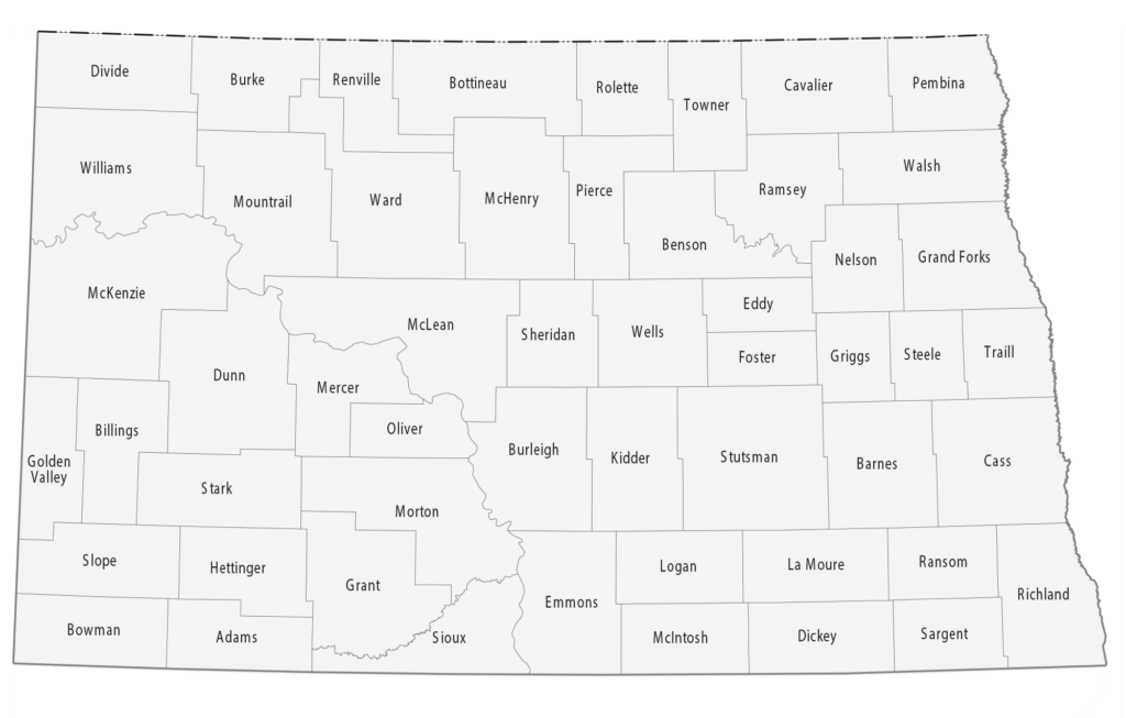
1. County Map of North Dakota:
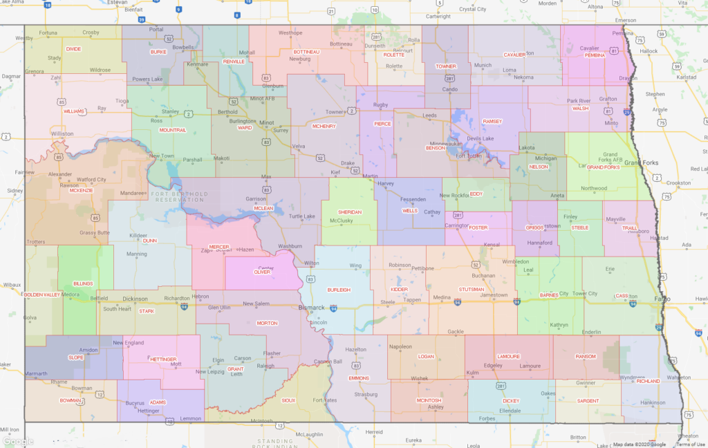
2. North Dakota County Map with Cities:
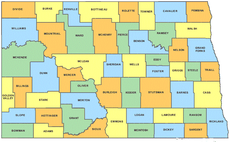
3.Printable North Dakota County Map:
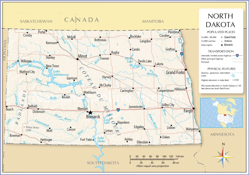
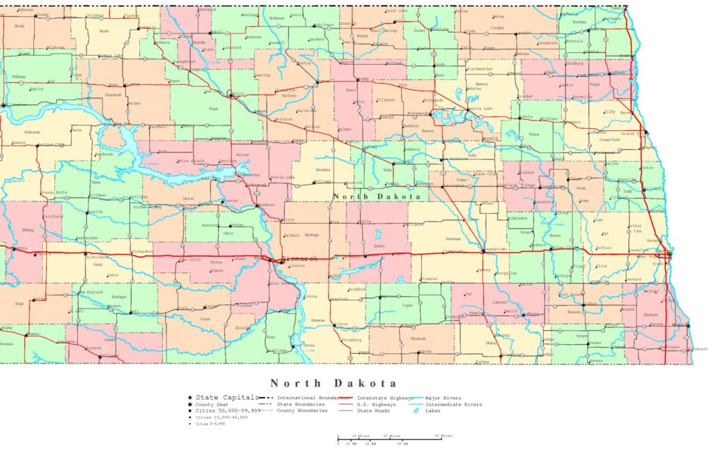
4. North Dakota Map:
5. North Dakota Map with Cities:
This is the collection of some high-quality map of ND counties that we have added above. We have added a total of five different maps that contain some helpful information about the counties and cities of North Dakota. Below, we are also adding some brief information about each map. So, please read the full description before viewing or downloading any map from the above.
The first map is a simple outline county map of North Dakota, which shows only county names. And the next map is a detailed county map with cities. So, you can check the second map if you need a full detailed county map of this state. The third map is also a county map of ND state, but it is visually different. It is an HD and large map, and you can print this map for any purpose. Below we are also adding a table that shows some useful information about the counties of North Dakota. Please have a look at the table.
Counties in North Dakota:
| County | County Seat | Eastablished in | Area (sq mi) | Area (km2) |
| Adams County | Hettinger | 1885 | 988 | 2559 |
| Barnes County | Valley City | 1875 | 1492 | 3864 |
| Benson County | Minnewaukan | 1883 | 1389 | 3597 |
| Billings County | Medora | 1879 | 1152 | 2984 |
| Bottineau County | Bottineau | 1873 | 1669 | 4323 |
| Bowman County | Bowman | 1883 | 1162 | 3010 |
| Burke County | Bowbells | 1910 | 1104 | 2859 |
| Burleigh County | Bismarck | 1873 | 1633 | 4229 |
| Cass County | Fargo | 1873 | 1766 | 4574 |
| Cavalier County | Langdon | 1873 | 1489 | 3856 |
| Dickey County | Ellendale | 1881 | 1131 | 2929 |
| Divide County | Crosby | 1910 | 1259 | 3261 |
| Dunn County | Manning | 1883 | 2010 | 5206 |
| Eddy County | New Rockford | 1885 | 632 | 1637 |
| Emmons County | Linton | 1879 | 1510 | 3911 |
| Foster County | Carrington | 1873 | 635 | 1645 |
| Golden Valley County | Beach | 1912 | 1002 | 2595 |
| Grand Forks County | Grand Forks | 1873 | 1438 | 3724 |
| Grant County | Carson | 1916 | 1660 | 4299 |
| Griggs County | Cooperstown | 1881 | 708 | 1834 |
| Hettinger County | Mott | 1883 | 1132 | 2932 |
| Kidder County | Steele | 1873 | 1352 | 3502 |
| LaMoure County | LaMoure | 1873 | 1147 | 2971 |
| Logan County | Napoleon | 1873 | 993 | 2572 |
| McHenry County | Towner | 1873 | 1874 | 4854 |
| McIntosh County | Ashley | 1883 | 975 | 2525 |
| McKenzie County | Watford City | 1905 | 2742 | 7102 |
| McLean County | Washburn | 1883 | 2110 | 5465 |
| Mercer County | Stanton | 1875 | 1045 | 2707 |
| Morton County | Mandan | 1873 | 1926 | 4988 |
| Mountrail County | Stanley | 1873 | 1824 | 4724 |
| Nelson County | Lakota | 1883 | 982 | 2543 |
| Oliver County | Center | 1885 | 724 | 1875 |
| Pembina County | Cavalier | 1867 | 1119 | 2898 |
| Pierce County | Rugby | 1887 | 1018 | 2637 |
| Ramsey County | Devils Lake | 1873 | 1186 | 3072 |
| Ransom County | Lisbon | 1873 | 863 | 2235 |
| Renville County | Mohall | 1873 | 875 | 2266 |
| Richland County | Wahpeton | 1873 | 1437 | 3722 |
| Rolette County | Rolla | 1873 | 902 | 2336 |
| Sargent County | Forman | 1883 | 859 | 2225 |
| Sheridan County | McClusky | 1873 | 972 | 2517 |
| Sioux County | Fort Yates | 1915 | 1094 | 2833 |
| Slope County | Amidon | 1915 | 1218 | 3155 |
| Stark County | Dickinson | 1879 | 1338 | 3465 |
| Steele County | Finley | 1883 | 712 | 1844 |
| Stutsman County | Jamestown | 1873 | 2222 | 5755 |
| Towner County | Cando | 1883 | 1025 | 2655 |
| Traill County | Hillsboro | 1875 | 862 | 2233 |
| Walsh County | Grafton | 1881 | 1282 | 3320 |
| Ward County | Minot | 1888 | 2013 | 5214 |
| Wells County | Fessenden | 1873 | 1271 | 3292 |
| Williams County | Williston | 1890 | 2071 | 5364 |
This is a list of all counties of North Dakota with some helpful and additional information like name of county, the county seat, year of established in and total area.
The fourth map is a complete and main state map of North Dakota that shows all counties, major cities and some major city roads and interstate highways. And the last map is a detailed city map of North Dakota state. All major cities and towns are visible on this map with all major roads. And some water bodies (Major Lakes and Rivers) are also shown on this map.
So, these were some printable maps that we have added above. These high-quality maps are available in PDF format and JPG (Image) format. You can easily download any map by clicking on the buttons under the preview image. All these H.D. maps are free to download.