New Hampshire is a state of the USA, located in the New England region of the United States. This state is also known as “The Granite State” and”The White Mountain State”. It is a very beautiful state to explore, so if you are an explorer or a traveller and want to get more information about this state and cities, you should check our collection of the map of New Hampshire. You should also check some Roads and Highways Maps of New Hampshire. Please scroll down the page and have a look at the NH usa map
New Hampshire (NH) State Maps Collection:
1. New Hampshire Map:

2. Map of Southern NH:

3. Map of Northern NH:
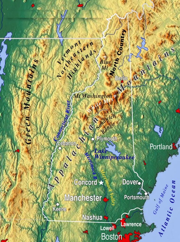
4. NH Topographic Map:
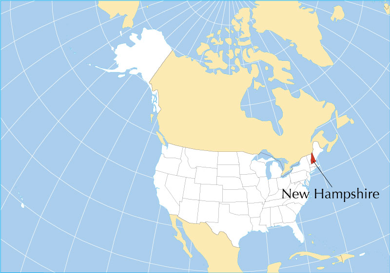
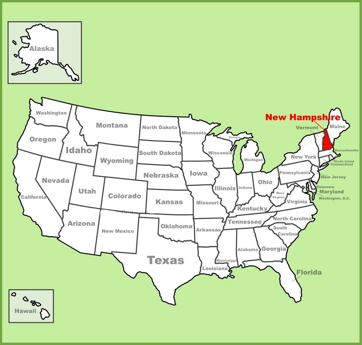
5. New Hampshire on US Map:
6. New Hampshire on World Map:
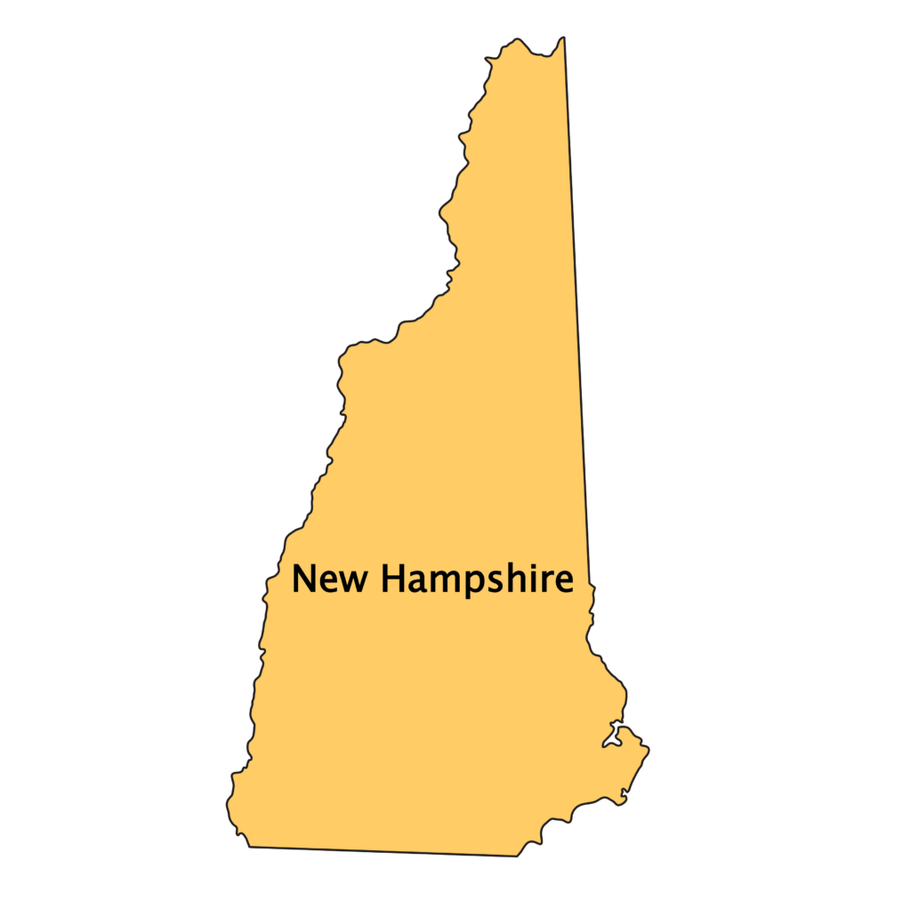
7. New Hampshire State Outline:
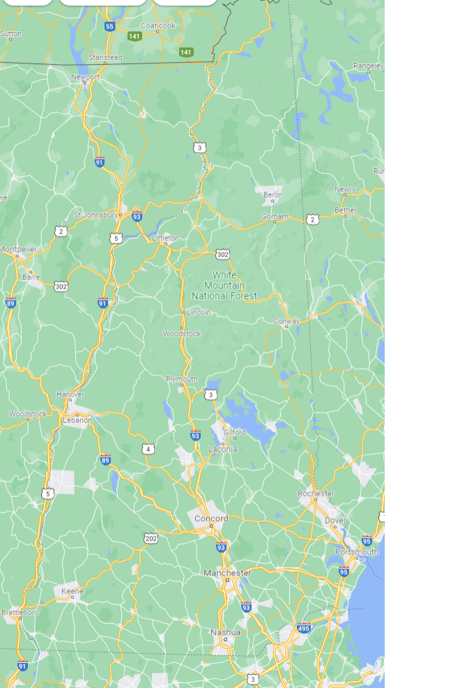
8. Google Map of New Hampshire:
9. New Hampshire Map with Cities and Towns:

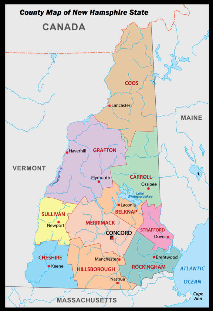
10. New Hampshire County Map:
Here, we have added ten different types of maps. All maps belong to NH, USA State, and cities of this state. Each map contains some useful information. For you, we are also adding some more useful information of each map. So, read the description and save or view any map on your device for free.
The first map is related to the main state map of New Hampshire, and this map shows all major cities and counties. So, you can locate any city or place with the help of this map. The next map is related to Southern New Hampshire, and the third map is related to Northern New Hampshire. Both maps are the specific region or area map of this state. So, if you are looking for a specific area map, then these maps will help you.
The fourth map is a New Hampshire Topographic or Satellite map of this state, which shows the Satellite image and the area covered by this state. A white line is indicated its boundary and location. And, if you want a detailed map of New Hampshire, please check the first map. The next map shows the location of New Hampshire state on the USA Map. As you can see in the map, the area filled with red color indicates the state’s locations. The sixth map is also a state’s location map, which shows New Hampshire’s location on the world map. Both maps are just blank and boundary maps. So, if you are looking for complete maps, you should check other maps.
Now, the seventh map is a simple outline and blank map of the New Hampshire State, which shows only the outer boundary of this state. The eighth map is titled “Google Map of New Hampshire.” This map is a google map version of this state which shows some major cities, towns, and their roads and highways. The ninth map is related to the NH state map with cities, and this map shows all Cities and Towns of New Hampshire. On this map, you can see all major cities, towns, the county with all major roads. And the last map is related to the county map of New Hampshire. It is a full-detailed NH county map with towns and cities.
So, these were some printable and helpful New Hampshire Maps of State, Cities, County, etc., that we added above. All these maps are free to download. All the maps are available in PDF and JPG (Image) formats. You can easily download any map by clicking on the buttons under the preview image.