South Dakota (SD) is also known as Mount Rushmore State. This state is located in the Northcentral region of the United States of America. This state is the seventeenth largest by area, which covers approx 77,116 sq mi (199,729 km2) includes 75,811 sq mi (196,350 km2) of land and 1,305 sq mi (3,379 km2) 1.7% of water. If you want to know more about this state through maps, then you should check our collection of the maps of South Dakota Cities and Towns.
So, please scroll down the page and have a look at these amazing maps. And, you should also check some Road and Highways Maps of South Dakota State, if you are travelling to this state. Because these maps will help you a lot during your journey.
Maps of South Dakota with Cities and Towns:
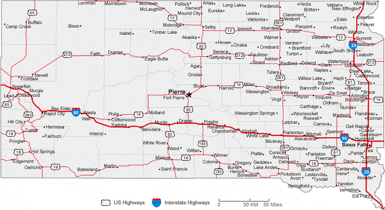
1. South Dakota Map with Cities:
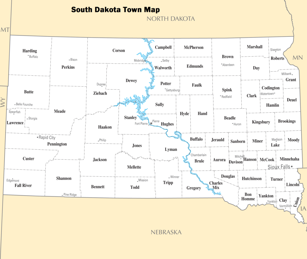
2. South Dakota Map with Towns:
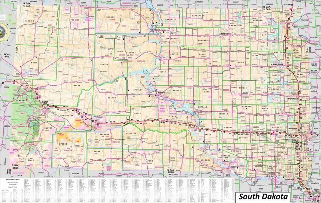
3. Large and Detailed South Dakota Map with Cities and Towns:
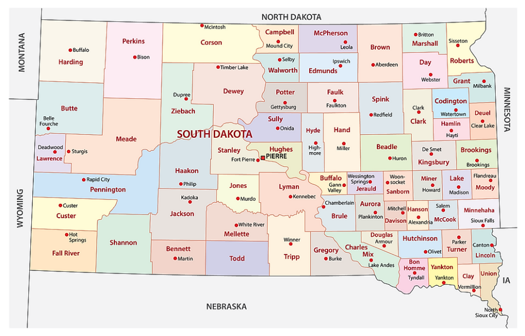
4. County Map of South Dakota:
5. Printable Map of South Dakota (SD):
6. Detailed Map of South Dakota State :
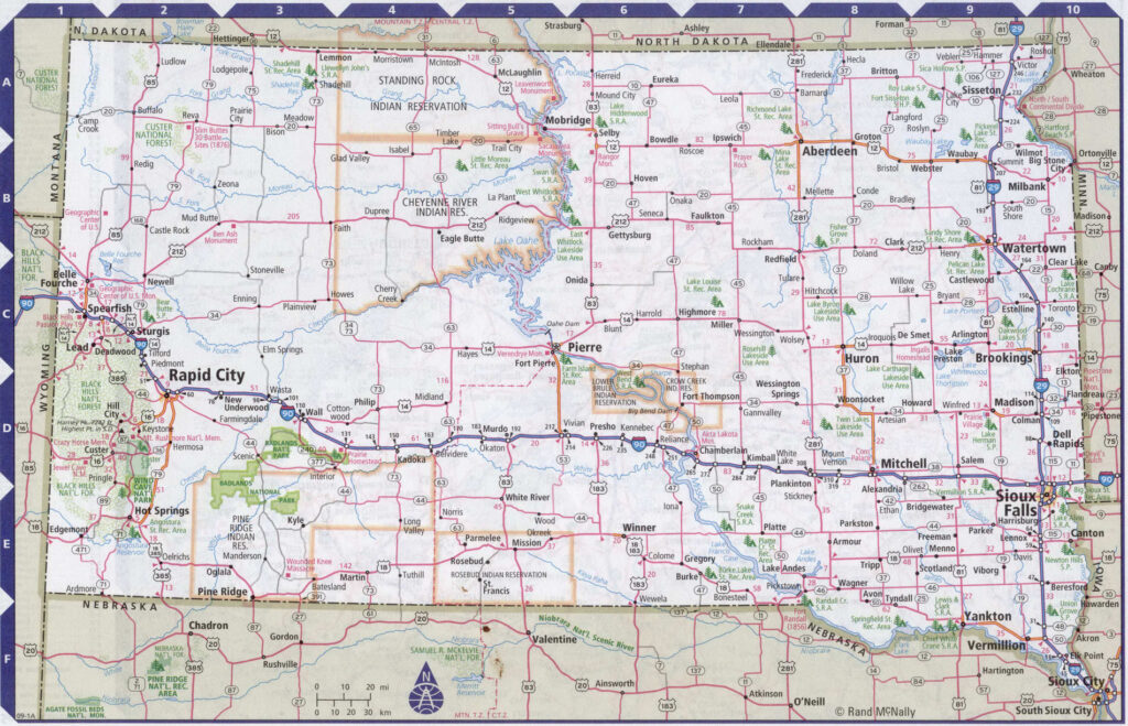
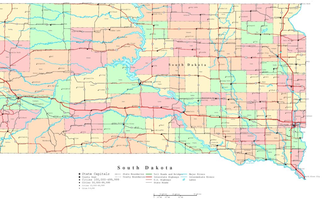
Here, we have added six different types of maps. All maps belong to South Dakota’s cities and towns. We have also added some other South Dakota State Map and County Map maps. Each map contains some useful information. For you, we are adding some more useful information about each map.
The first map is related to the main City map of South Dakota. This map shows all cities of this state, so you can easily locate any city. Now, the second map is about the Town maps of South Dakota. On this map, you will see the towns of this state. In both maps, roads are also visible so that you can find any route with the help of these maps. When you check the third map, this is a large and detailed map of S.D. cities and towns. This map shows all counties, all cities and towns. This map also contains all city roads, major street roads, all interstate highways, U.S. routes. So, you can easily navigate anywhere with the help of this map.
The fourth map is a large county map of South Dakota. Check this map if you are looking for a county map. This map shows all counties and their county seats. The next map is a high-quality printable map of South Dakota State, which shows all major cities, towns and counties. This map also contains a list of all towns and cities. Now, the last map is also about the state map of South Dakota, but this map is a detailed map of this state. Because this map shows all counties, cities, towns, and all city roads, street roads, national highways, all interstate highways, and other major roads, this map also shows all lakes, rivers, and other major water bodies.
So, these were some useful and printable maps of South Dakota Cities and Towns. All these maps are free to download. All the maps are available in PDF and JPG (Image) formats. You can easily download any map by clicking on the buttons under the preview image.