Michigan is the 26h state of the USA, located in the upper region of the Midwest United States. Michigan is also a part of the Great Lakes region. This state was admitted to the union on 26 January 1837. Its capital city is Lansing and the largest city is Detroit. You can get more information about Michigan state with the help of our page. Because here we are adding some useful information about Michigan State and in addition, we are also adding printable maps. So, scroll down the page and start with a map of Michigan state.
Michigan (MI) State Maps Collection:
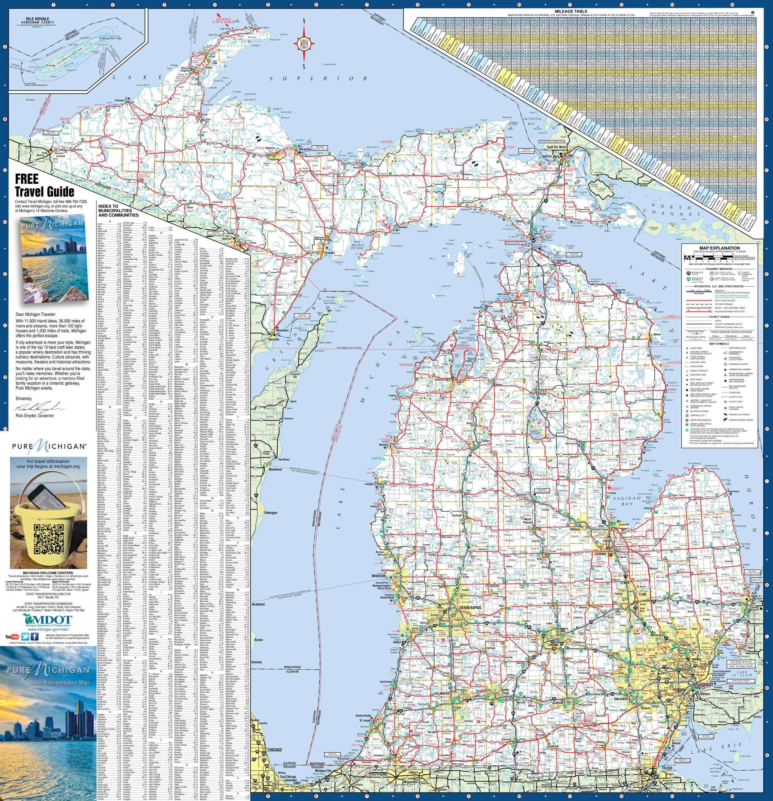
1. Michigan State Map:

2. Cities & Towns map of Michigan:
3.County Map of Michigan:

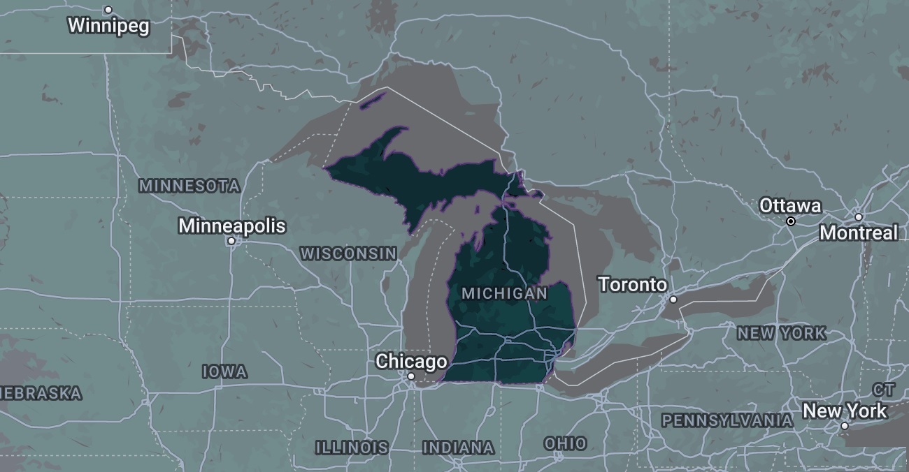
4. Google Map of Michigan:
5. Satellite Image of Michigan:

6. Blank Map of Michigan:
7. Michigan on US Map:

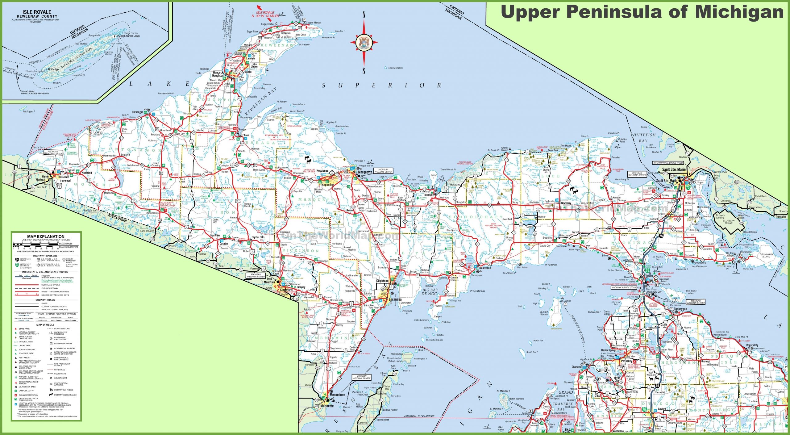
8. Map of Michigan Upper Peninsula
9. Map of Michigan Lower Peninsula

Here, we have added different types of MI map. Each map contains some useful information. For you, we are adding some more useful information about each map here. The first map is related to the detailed state map of Michigan, and this map shows some cities, counties, lakes, rivers, and mountains. You can easily locate a major place with the help of this map. The second map is a detailed map of Michigan with cities and towns. This map shows all cities, towns, roads, highways, railroads, airports, rivers, lakes, mountains, etc. The third map is related to the map of Michigan state county. It is a full-detailed county map with cities. County seats are also shown on this map.
The fourth map is titled “Google Map of Michigan.” This map is a Google map version of this state which shows some cities, towns, and the capital city of Michigan. The fifth map is a Satellite image of this state. You will only see the outer boundary on this map. So, if you want a detailed map of this state, please check the first map. Now, the sixth map is a simple outline or blank map of Michigan, which shows the outer boundary. The seventh map shows the location of Michigan on the USA Map. As you can see on the map, the area filled with red color indicates its location on the country map.
The next three maps are the specific area maps of Michigan, USA. On the eighth map, you will see all cities, towns, and roads of Eastern Michigan, and on the ninth map, you will get to know all cities, towns, and roads of Western Michigan. Now, the last map is related to Northern Michigan. All three maps are the regional maps of Michigan state. So, these were some best and most useful Michigan maps that we have added above. All the maps are available in PDF format and JPG format. You can easily download any map by clicking on the buttons under the preview image. All these maps are free to download.