Arkansas is situated in the south-central part of the country with an area of 137,732 km2 (including both water and land). Arkansas is the 34th most populous state in the USA with an average population of more than 03 million. There are some beautiful places to explore and visit in AR, USA. So, if you are a globetrotter then you should visit those places. But before starting your journey you must have a map of Arkansas with Cities. That’s why below we are adding some printable maps related to the cities and towns of Arkansas. So, scroll down the page and check our collections of maps.
Arkansas (AR) Cities & Towns Maps Collection:
1. Map of Arkansas with Cities:

2. Map of Arkansas with Towns:

3. Arkansas Map with Cities and Towns:

4. County Map of Arkansas:

5. Map of Arkansas:
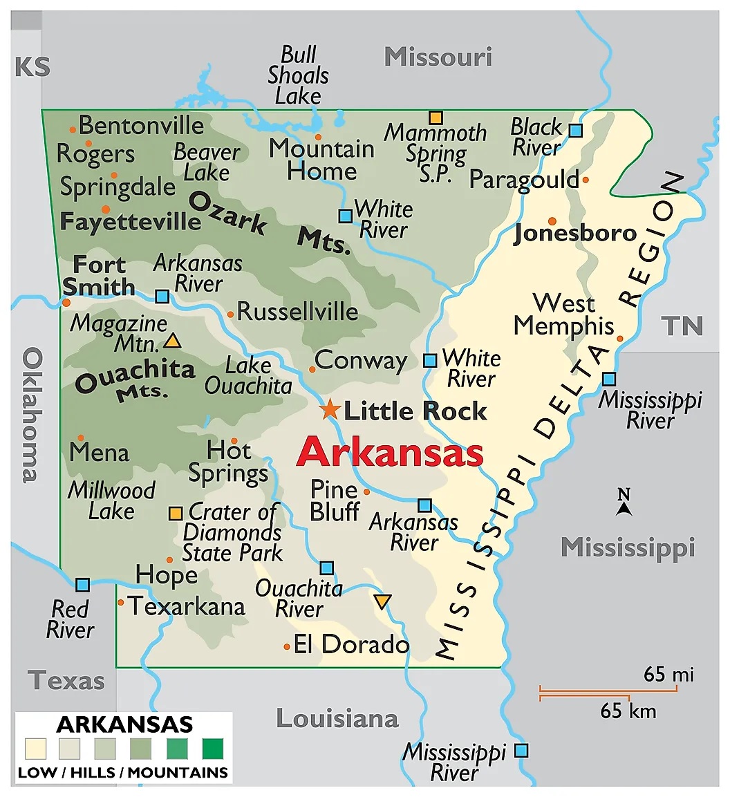
Above we have added some high-quality maps of Arkansas with cities and towns, a county map of Arkansas, and a map of Arkansas state. These maps are high in resolution so you can easily save or print any map on your device for free. Below, we are also describing each map so read the description before viewing and downloading any map.
The first map is related to the main AR state map with cities. This map shows all cities of this state, so you can easily locate any city and navigate anywhere. Now, the second map is about the Arkansas map with towns. On this map, you will see all towns of this state. In both maps, roads are also visible to find any route with the help of these maps. When you check the third map is a detailed map of Arkansas Cities and Towns. This map shows all counties, cities, towns, and all city roads, street roads, national highways, interstate highways, and other major roads, this map also shows all lakes, rivers, and other major water bodies.
The fourth map is a printable County map of Arkansas. This is a full version of Arkansas Counties. All major cities, towns, and other important places are visible on this map. Now, the last map is the main state map of Arkansas. All these maps are free to download. All the maps are available in PDF and JPG (Image) formats. You can easily download any map by clicking on the buttons under the preview image.