Wyoming is located in the west mountain subregion of Western USA. Wyoming is the tenth largest state by area in the country, and according to a survey of 2020, this state is the least populous with 576,851 citizens. Wyoming has 99 Cities and towns; the total area of Wyoming is approx. 97,914 square miles (253,600 km2). You can also get more additional information through a map of the state of Wyoming. So, please scroll down the page and look at the collection of Wyoming map with cities. These printable maps will surely help you with work, study, and traveling. You may also check some other maps of the Roads and Highways of Wyoming (WY). With the help of these road maps, you can easily navigate anywhere in this state.
Maps of Wyoming with Cities and Towns:
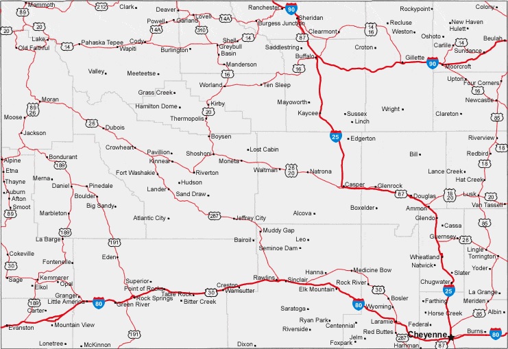
1. Map of Wyoming with Cities:
2. Map of Wyoming with Towns:
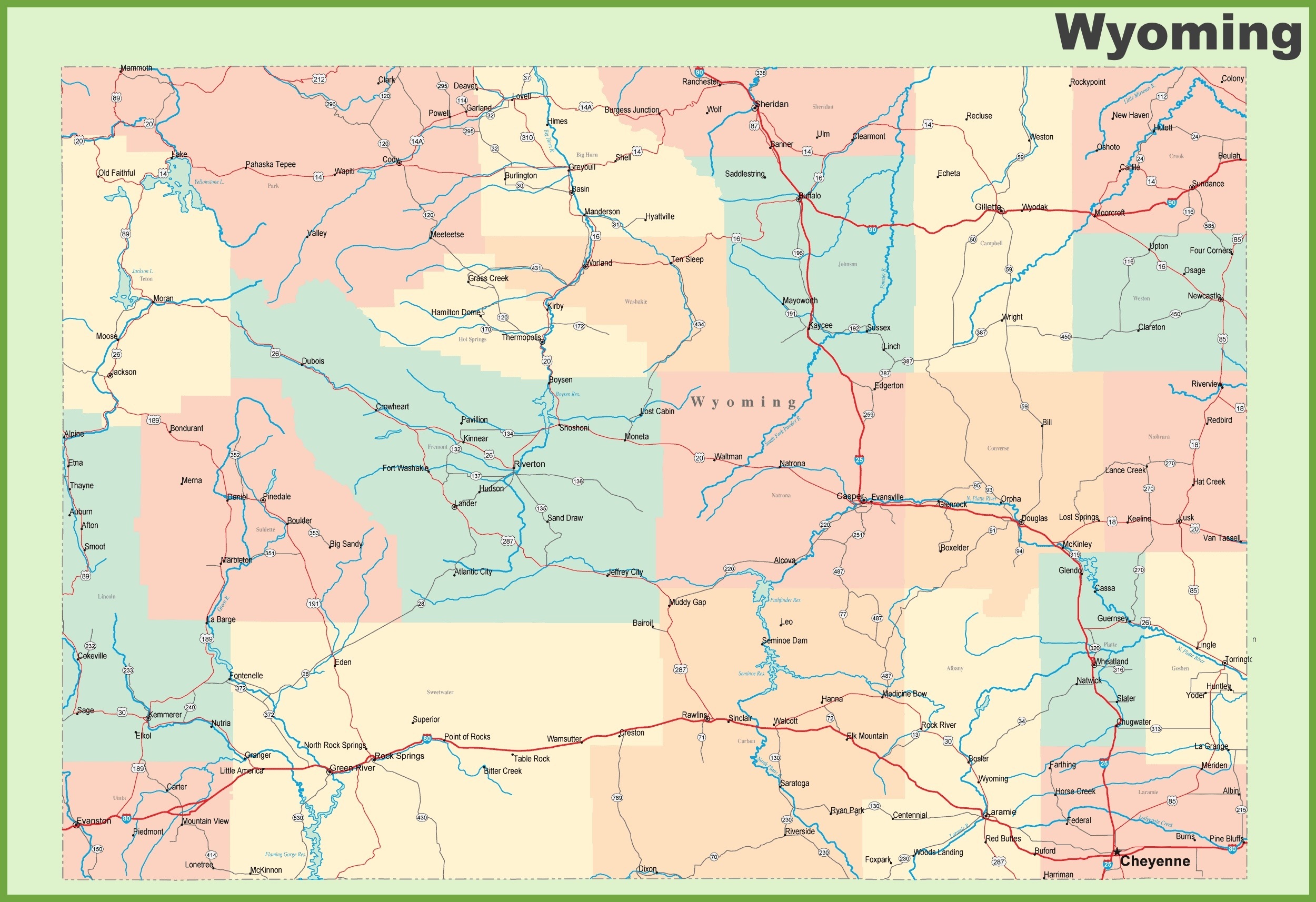
3. Wyoming Map with Cities & Towns:
4. Map of Wyoming with Cities and Towns:
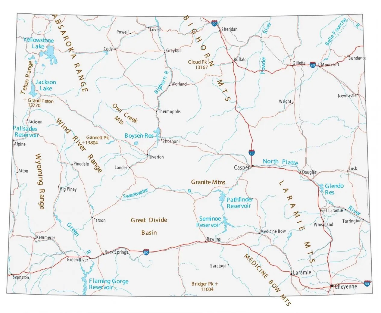
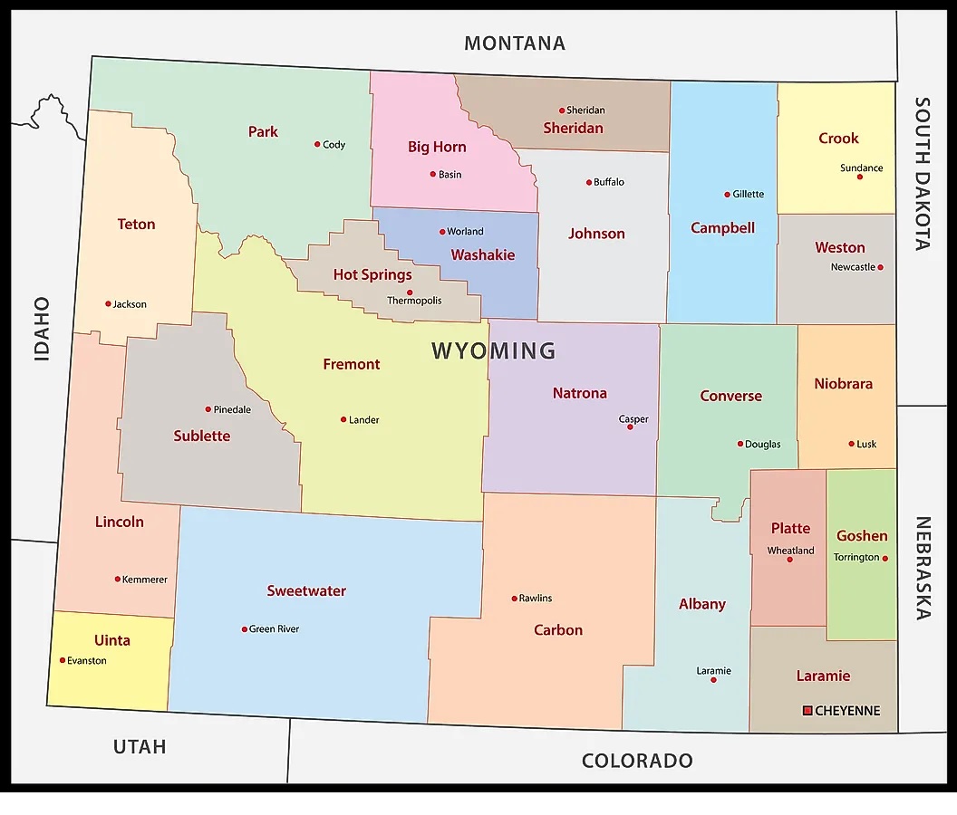
5. County Map of Wyoming:
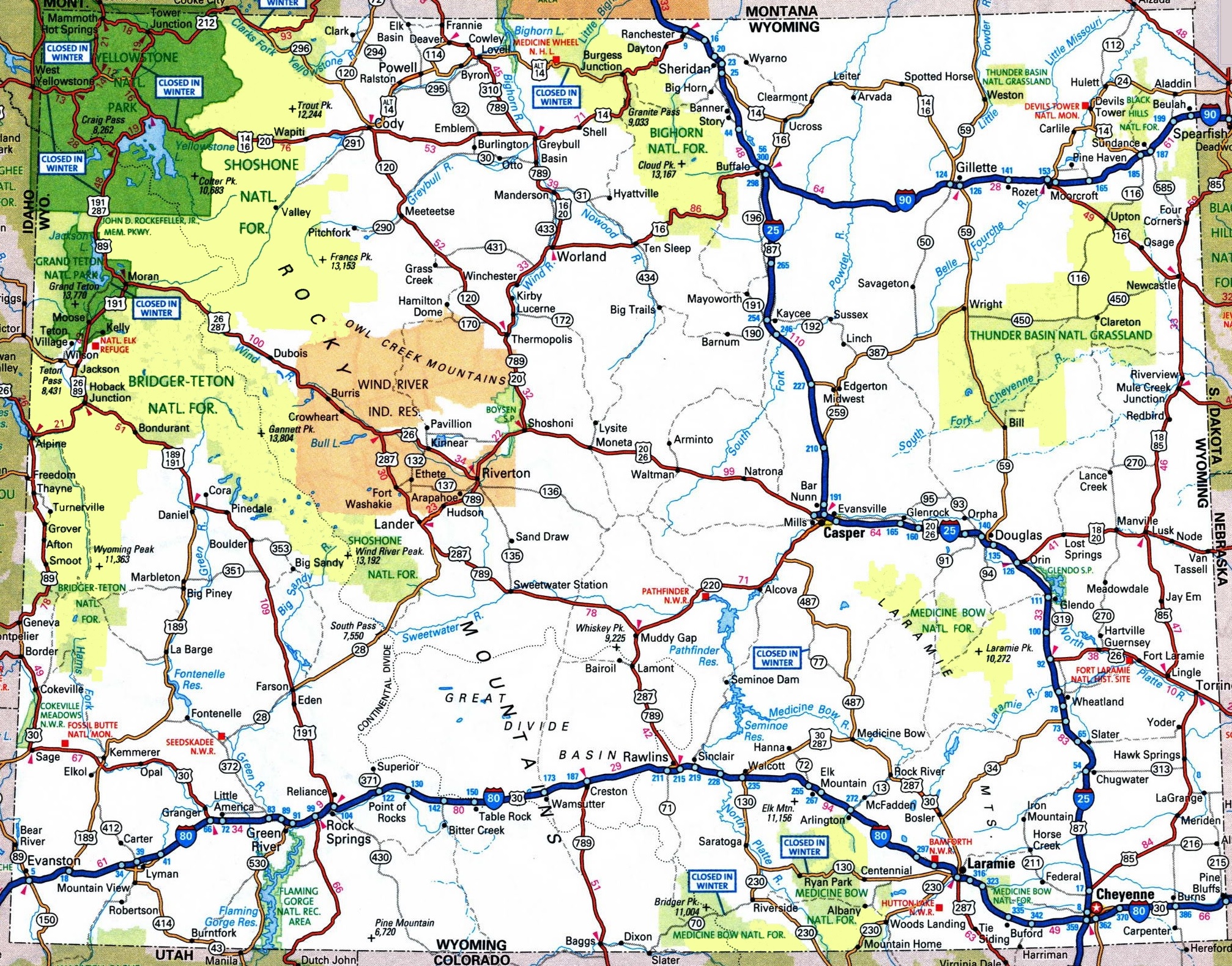
6. Wyoming Map:
Here, we have added six different types of maps. All maps belong to Wyoming cities and towns. We have also added some other Wyoming State Map and County Map maps. Each map contains some helpful information. For you, we are adding some more useful information about each map.
The first map is related to the main City map of Wyoming. This map shows all cities of this state, so you can easily locate any city. Now, the second map is about the Town maps of Wyoming. On this map, you will see the towns of this state. In both maps, roads are also visible to find any route with the help of these maps. When you check the third map, this is also of detailed cities and towns map. This map shows all counties, all cities and towns. This map also contains all city roads, major street roads, interstate highways, U.S. routes. So, you can easily navigate anywhere with the help of this map.
The fourth map is a large and printable map of Wyoming. This is a full version of Wyoming Cities and Towns. All cities, towns, and other important places are visible on this map. The fifth map is a county map of Wyoming. This map shows all counties, major cities and their county seats.
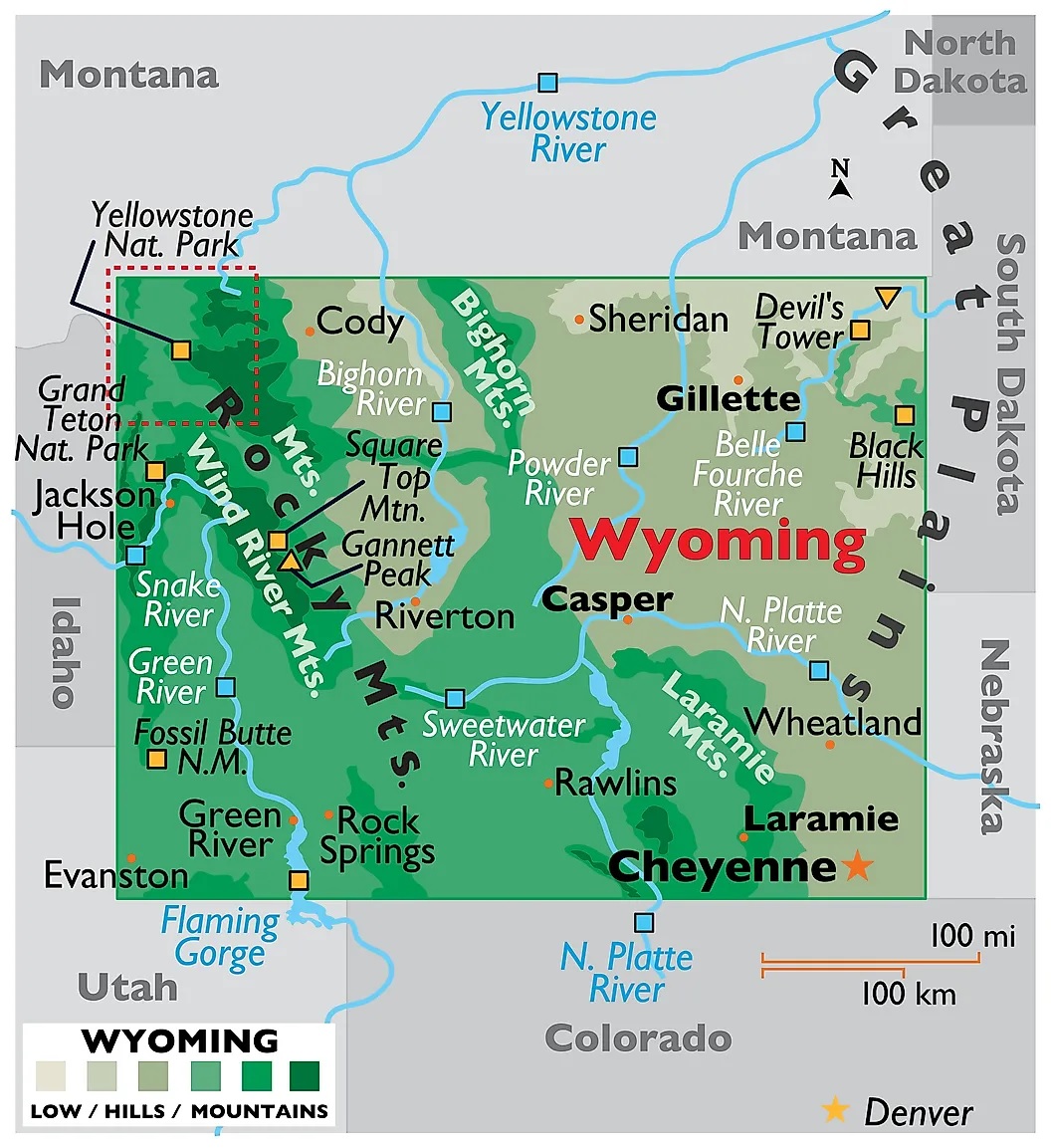
Now, the last map is also about the state map of Wyoming, but this map is a detailed map of this state. Because this map shows all counties, cities, towns, and all city roads, street roads, national highways, interstate highways, and other major roads, this map also shows all lakes, rivers, and other major water bodies. So, these were some practical and printable maps of Wyoming Cities and Towns. All these maps are free to download. All the maps are available in PDF and JPG (Image) formats. You can easily download any map by clicking on the buttons under the preview image.