County maps are very helpful if someone is gathering information about the counties and cities of any state. With the help of these maps, you can easily locate any county. So, if you are looking for a map of Wyoming with counties, then you are on the right page. Here on this page, we are adding some Wyoming County maps and state map. Please scroll down the page and have a look at these best printable maps.
Wyoming (WY) County Maps Collection:
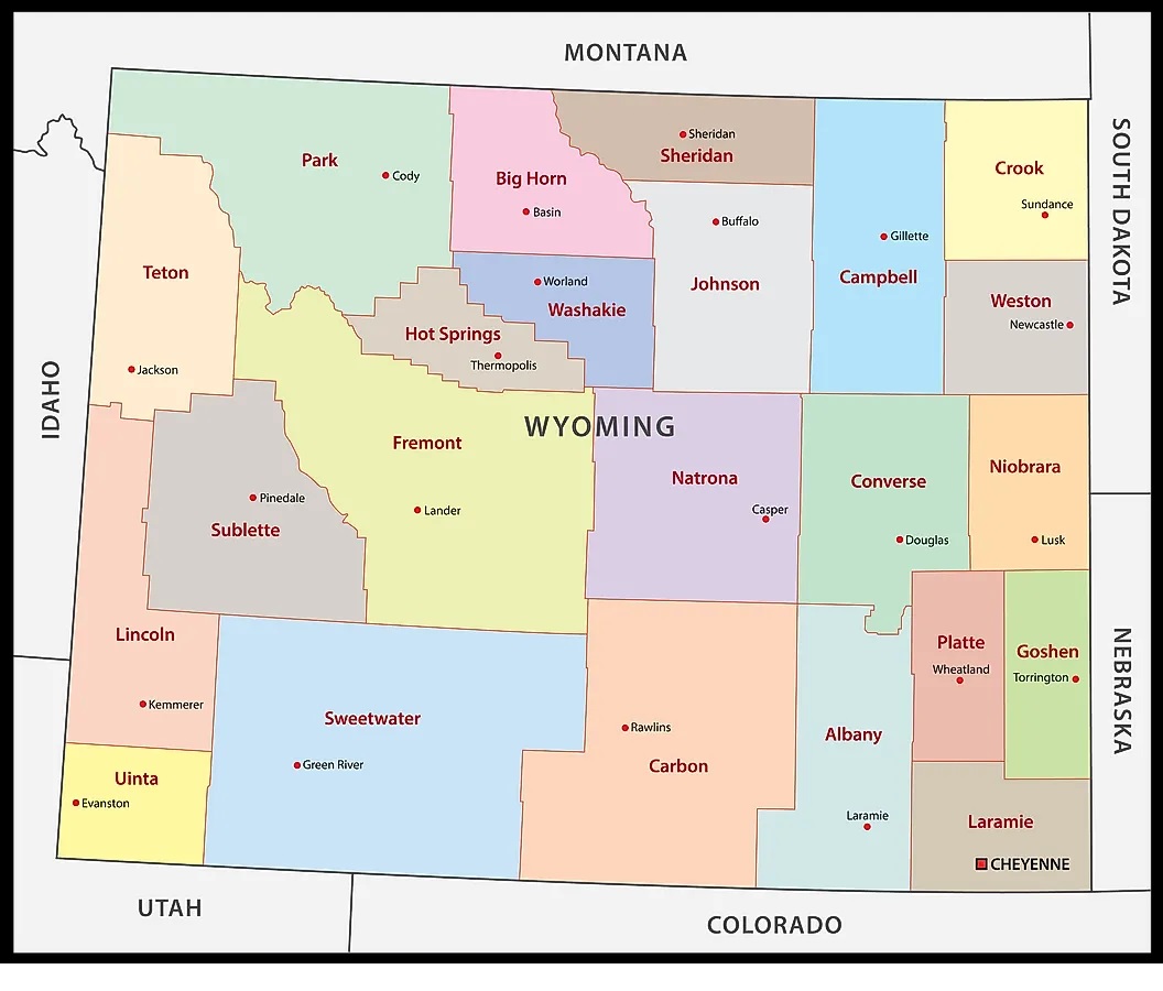
1. County Map of Wyoming:
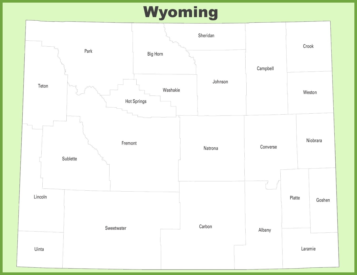
2. Wyoming County (Outline):
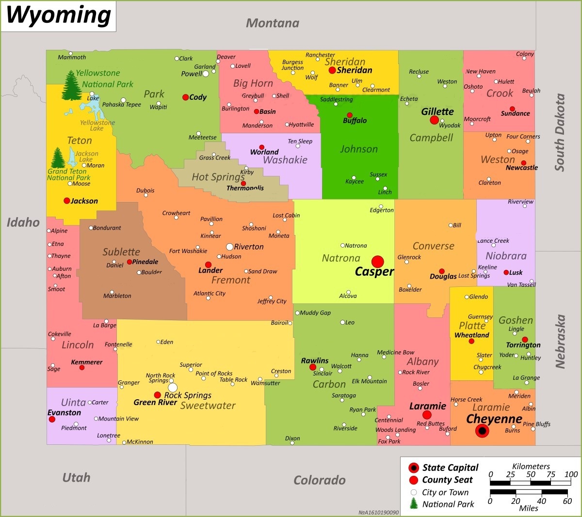
3. Map of Wyoming with Counties:
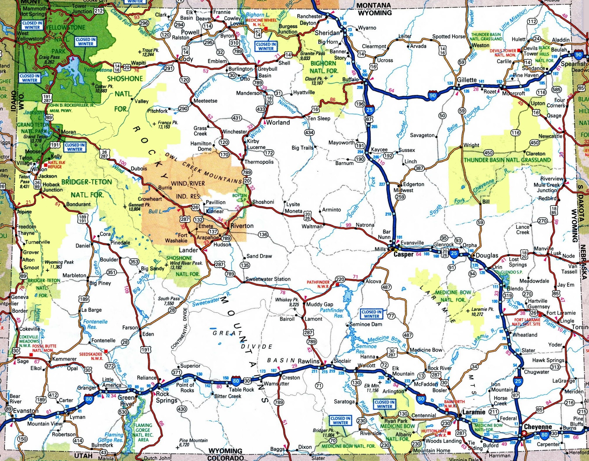
4. Map of Wyoming with Cities and Towns:
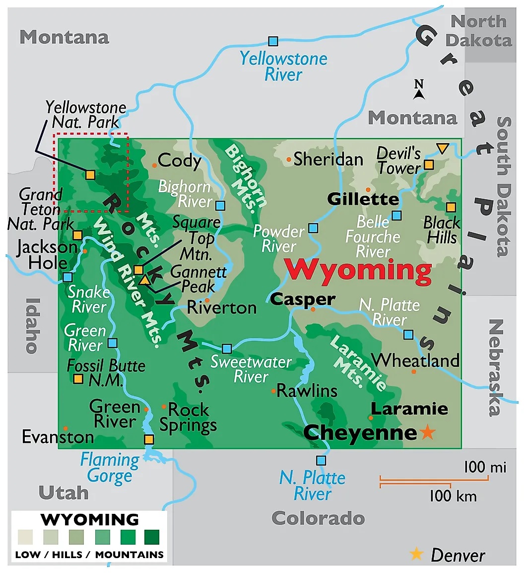
5. Wyoming Map:
Above we have added total five maps of Counties of Wyoming. So, check all these maps and get the correct map you are looking for. And for more detailed information about the Counties, you check the table we are providing below.
List of all Counties that are in the Wyoming:
In this table, you will get useful information such as Name of County, Year of Establishment, approx. population, average area, and their county seat of all counties. And, if you are looking for the maps of any county, please check the first three maps.
| County | County Seat | Population | Area | Est. |
| Albany County | Laramie | 38950 | 4,274 sq mi | 1868 |
| Big Horn County | Basin | 11575 | 3,137 sq mi | 1896 |
| Campbell County | Gillette | 46676 | 4,797 sq mi | 1911 |
| Carbon County | Rawlins | 14711 | 7,897 sq mi | 1868 |
| Converse County | Douglas | 13804 | 4,255 sq mi | 1888 |
| Crook County | Sundance | 7593 | 2,859 sq mi | 1875 |
| Fremont County | Lander | 39317 | 9,183 sq mi | 1884 |
| Goshen County | Torrington | 13235 | 2,225 sq mi | 1911 |
| Hot Springs County | Thermopolis | 4621 | 2,004 sq mi | 1911 |
| Johnson County | Buffalo | 8588 | 4,166 sq mi | 1875 |
| Laramie County | Cheyenne | 100512 | 2,686 sq mi | 1867 |
| Lincoln County | Kemmerer | 19581 | 4,069 sq mi | 1911 |
| Natrona County | Casper | 80815 | 5,340 sq mi | 1888 |
| Niobrara County | Lusk | 2467 | 2,626 sq mi | 1911 |
| Park County | Cody | 29331 | 6,943 sq mi | 1909 |
| Platte County | Wheatland | 8578 | 2,085 sq mi | 1911 |
| Sheridan County | Sheridan | 30863 | 2,523 sq mi | 1888 |
| Sublette County | Pinedale | 9856 | 4,882 sq mi | 1921 |
| Sweetwater County | Green River | 42673 | 10,426 sq mi | 1867 |
| Teton County | Jackson | 23497 | 4,008 sq mi | 1921 |
| Uinta County | Evanston | 20450 | 2,082 sq mi | 1869 |
| Washakie County | Worland | 7760 | 2,240 sq mi | 1911 |
| Weston County | Newcastle | 6838 | 2,398 sq mi | 1890 |
In the first map, you will see the name of all counties and their location on the Wyoming Map. The second map is a simple county map that shows the outline of all county. This type of map is also known as blank map or outline map. Now, the third map is a detailed County map of Wyoming. This map shows counties along with all major cities, county seat and towns. So, you can get this map if you have any work related to the Counties of this state.
The fourth map is a detailed and large map of Wyoming’s Cities and Towns. This is a complete and printable map showing all cities, roads, state highways, and their routes. With the help of this map, you can easily move anywhere in any city of this state. The last map is a simple state map of Wyoming. This map only shows all counties, cities, mountains, hills, rivers and lakes. So, these were some printable maps related to Wyoming (WY) county and towns that we have added above. These high-quality maps are available in PDF and JPG formats. You can easily download any map by clicking on the buttons under the preview image. All these maps are free to download.