Wyoming, also known as Cowboy State, is a U.S. state located in the Mountain West subregion of the Western United States. Wyoming is a very beautiful state to travel to. And, if you are thinking of travelling in this state, you must have a map of Wyoming state because maps are helpful materials for our journey or any other work purposes. So, please scroll down the page and check our collection of Wyoming state map, City and Town map and county map of Wyoming. These maps are of high quality. And you may also check our other collection of Roads and Highways Map of Wyoming State.
Wyoming (WY) State Maps Collection:
1. Wyoming Map:
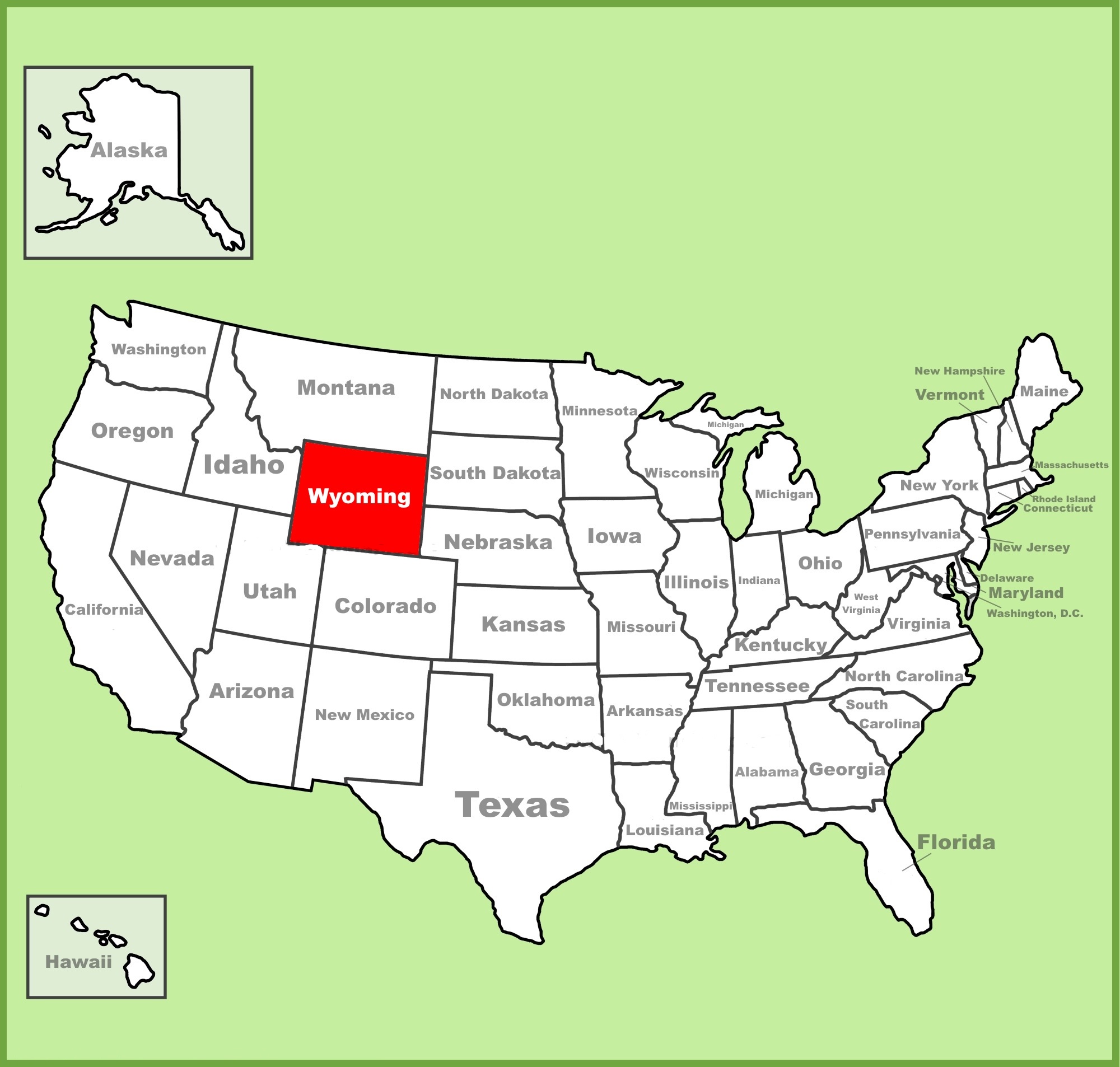
2. Wyoming on US Map:
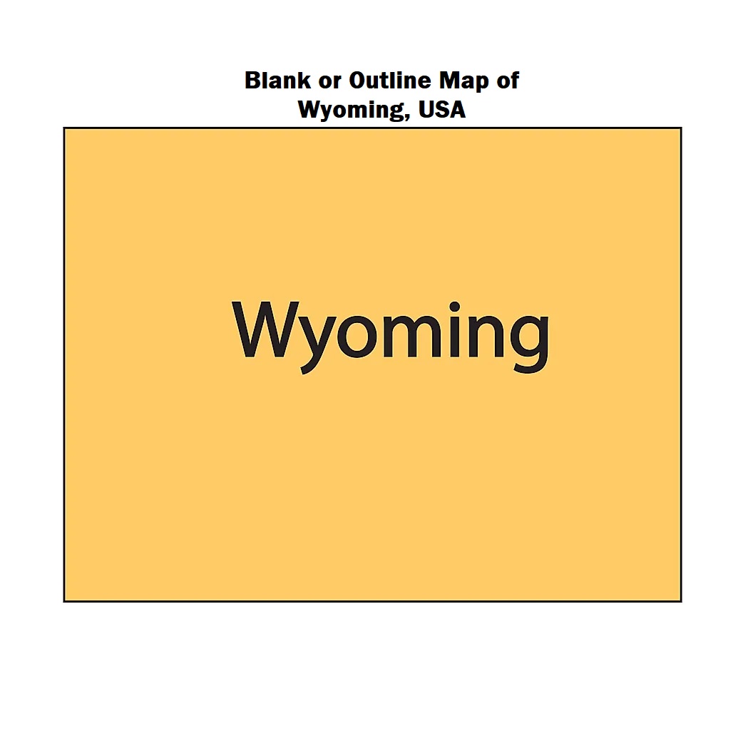
3. Wyoming State Outline
4. Google Map of Wyoming
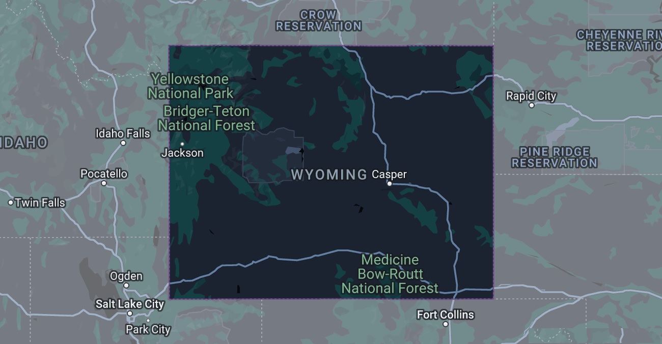
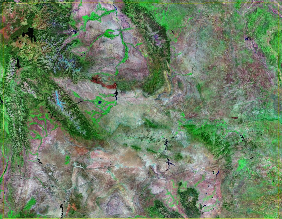
5. Satellite Image of Wyoming
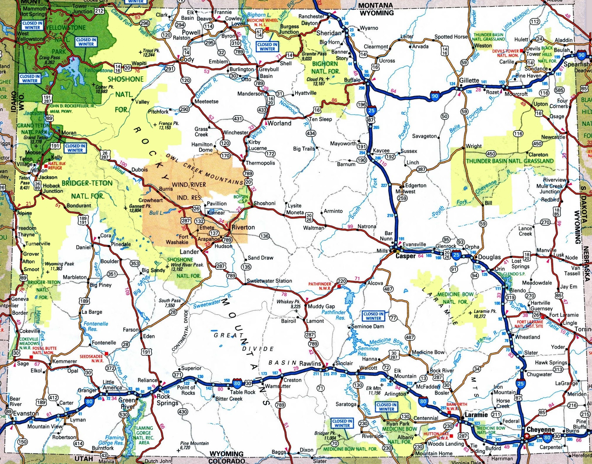
6. Map of Wyoming with Cities and Towns:
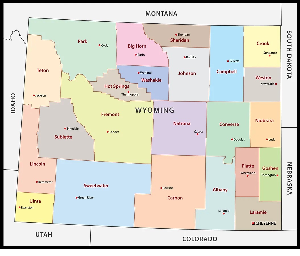
7. County Map of Wyoming:
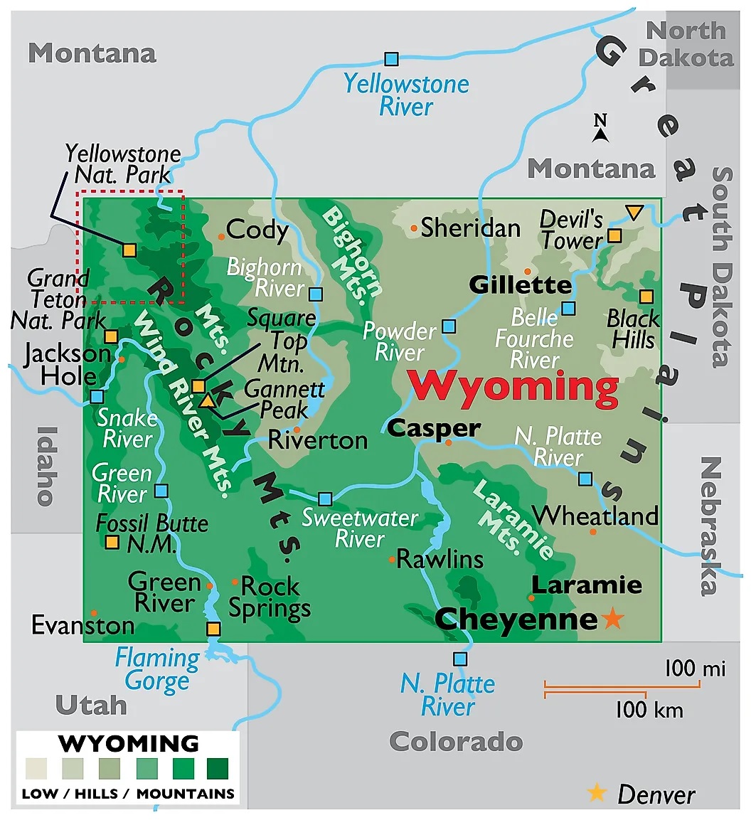
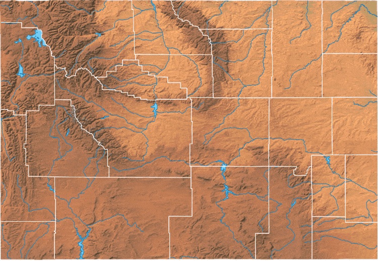
8. Physical Map of Wyoming:
This is the collection of the Wyoming U.S. map that we have added above. We have added a total of eighth different maps that contain some helpful information. Below, we are also adding some brief information about each map. So, please read the full description before viewing or downloading any map from the above.
The first map is related to the state map of this state, which shows all counties, towns and cities on the map. And the second map shows the location of Wyoming on the U.S. map. As you can see, an area filled with red indicates this state location.
The third map is a blank outline map of this state, which shows the outer boundary. The fourth map is a type of google map which shows some cities, capital city and counties of this state. Now, the fifth map is a satellite image of Wyoming that shows the structure of this state. As you can see on the map, a thin yellow line marks the outer boundary. These types of satellite images or maps are used for geographic purposes.
The sixth map shows all the cities, towns, counties, other significant places and tourist places. It is a complete and detailed map of Wyoming state. And on this map, you can also know about all parks, malls, beaches, airports, railroads, street roads, city roads, interstate highways, U.S. routes, and other states’ highways. The seventh map is related to the County map of Wyoming, which shows all counties and the major cities. Now, the eighth map is the Topographic map of Wyoming. You can check the preview image of this map for a quick view. This map shows only some cities and the capital of Wyoming.
These were some most useful and printable Wyoming Map (W.Y.) that we have added above. These high-quality maps are available in PDF and JPG (Image) formats. You can easily download any map by clicking on the buttons under the preview image. All these H.D. large maps are free to download.