Illinois is a beautiful state in the USA and is located in the Midwest region of the country. Its capital city is Springfield and the largest city is Chicago. This state also has three nicknames which are as follows: “Land of Lincoln”, “Prairie State”, and “The Inland Empire State”. And, if you want to gather more information about this state, then you should start with a map of Illinois. Here on this page, we are adding some printable maps related to Illinois, USA. These maps are very interactive and useful and help you to explore this state. You may also check our other collection of Roads and Highway Maps of Illinois (IL) if you are wondering to travel in this state.
Illinois State Maps Collection:
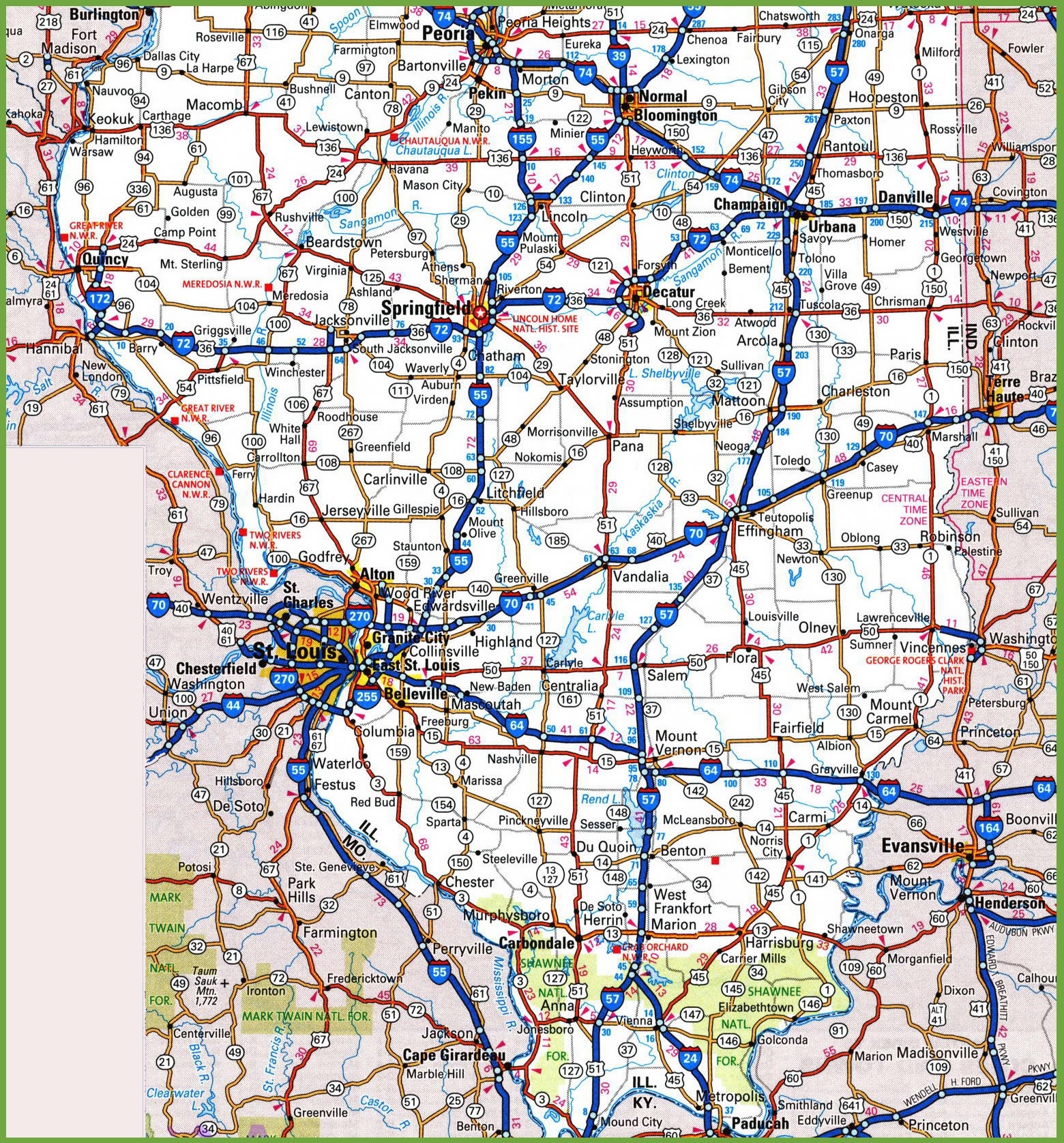
1. Illinois Map:

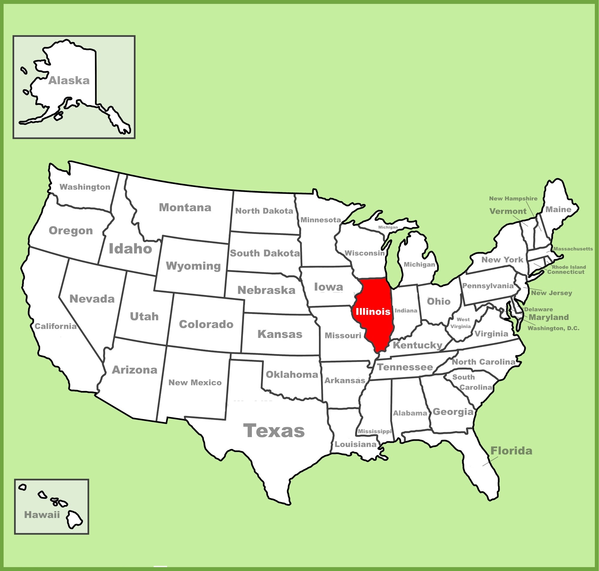
2. IL on US Map:
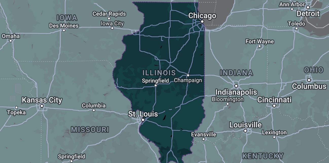
3. Google Map of Illinois:
4. Illinois Satellite Map:

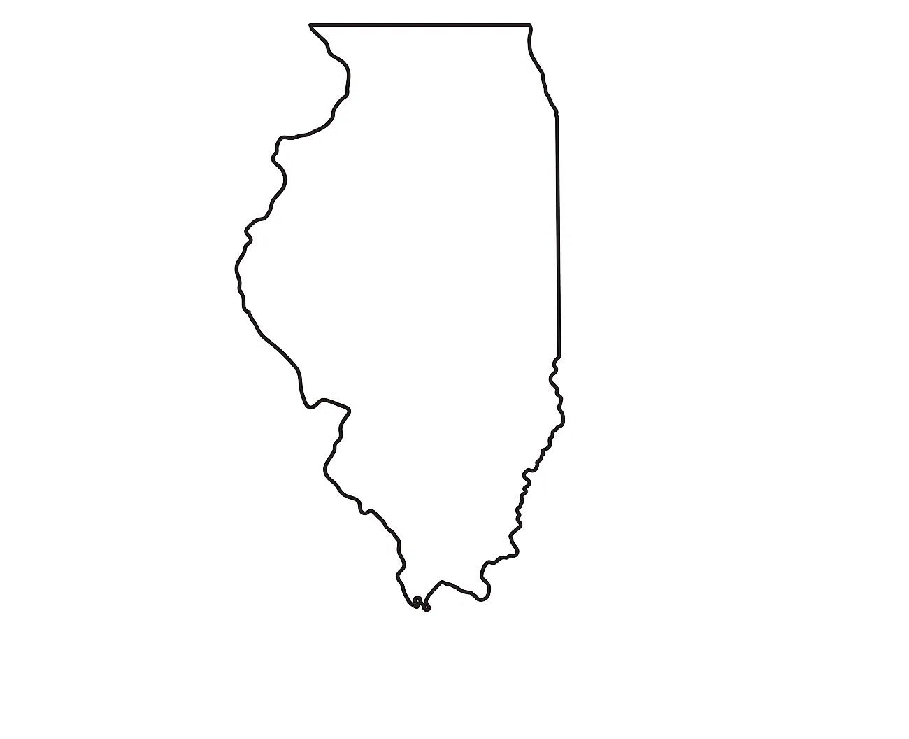
5. Outline Map of Illinois:
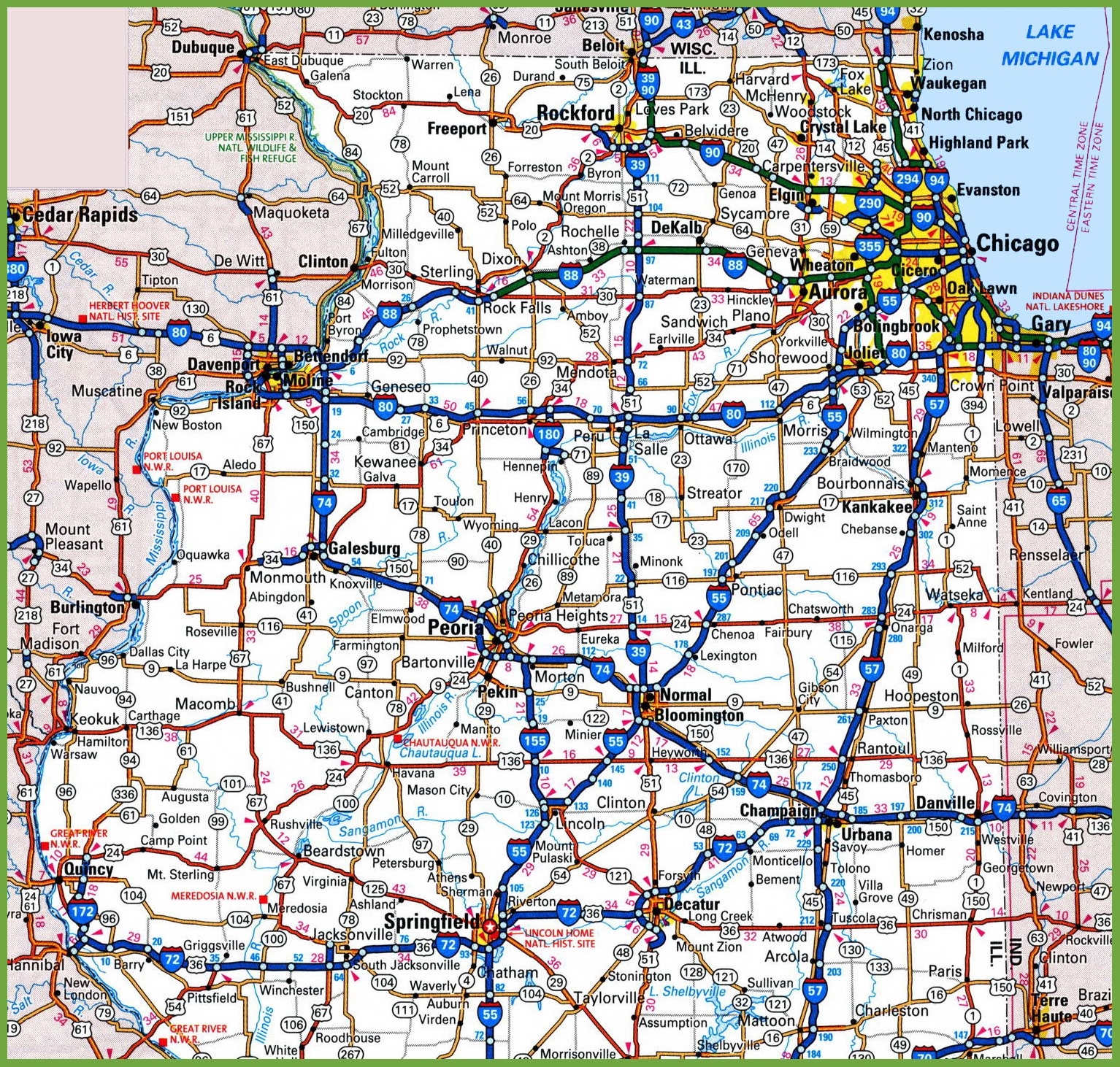
6. Physical Map of Illinois:

7. Map of Illinois with Counties:

8. Map of Illinois Cities and Towns :

9. Map of Northern Illinois:
10. Map of Southern Illinois:
Here, we have added different types of IL map. Each map contains some useful information. For you, we are adding some more useful information about each map here.
The first map is related to the detailed state map of Illinois, and this map shows some cities, counties, lakes, rivers, and mountains. You can easily locate major places with the help of this map. The second map shows the location of Illinois on the USA Map. As you can see in the map, the area filled with red colour indicates its location on the country map.
The third map is titled “Google Map of Illinois.” This map is a Google map version of this state which shows some cities, towns, and the capital city of Illinois. The fourth map is a Satellite image of this state. You will only see the outer boundary on this map. So, if you want a detailed map of this state, please check the first map. Now, the fifth map is a simple outline or blank map of Illinois, which shows the outer boundary.
The sixth map is related to the map of Illinois county. It is a full-detailed IL county map with cities. County seats are also shown on this map. The seventh map is a large and detailed map of Illinois with cities and towns. This map shows all cities, towns, roads, highways, railroads, airports, rivers, lakes, mountains, etc. The next two maps are the specific area maps of Illinois, USA. On the eighth map, you will see all cities, towns and roads of Northern Illinois, and on the last map, you will get to know all cities, towns and roads of Southern Illinois. Both maps are the regional maps of Illinois state.
So, these were some best and most useful Illinois maps that we have added above. All the maps are available in PDF format and JPG format. You can easily download any map by clicking on the buttons under the preview image. All these maps are free to download.