Oklahoma is located in the South-Central region of the United States. This is the 20th-largest state in the United States, Oklahoma covers an area of 181,040 km2, with 177,660 km2 of land and 3,380 km2 of water. You can learn more about this state through a map of Oklahoma. And, for this, you have to scroll down the page and check our collection of City maps of Oklahoma. These printable maps are in high resolution, so you can use these maps anywhere. You may also check our other collection of Roads and Highways Maps of Oklahoma (OK) state. These maps are very helpful during travel or journey. So, let’s start with the map of Oklahoma cities.
Maps Collection of Oklahoma (OK) Cities and Towns:
1. Oklahoma Map with Cities:
2. Oklahoma Map with Towns:
3. Oklahoma State Map with Cities:
4. Oklahoma Map with Cities and Towns:
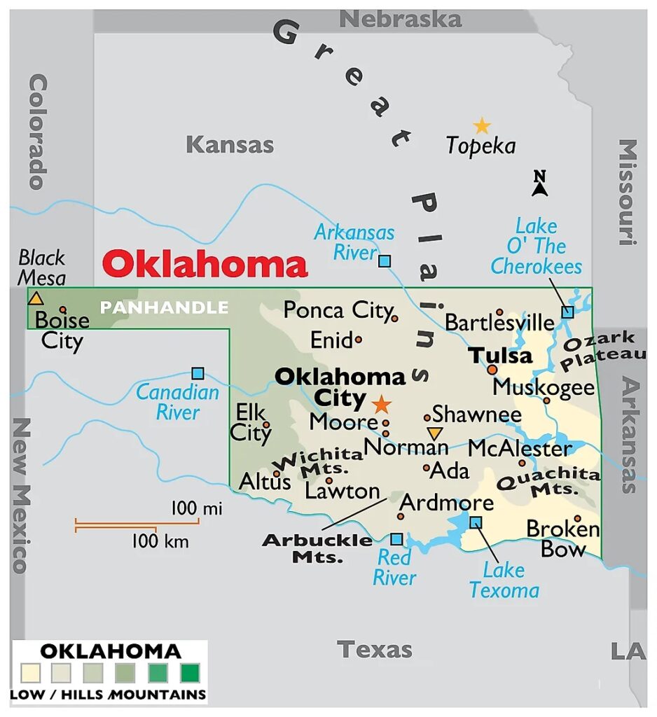
5. Map of Oklahoma:
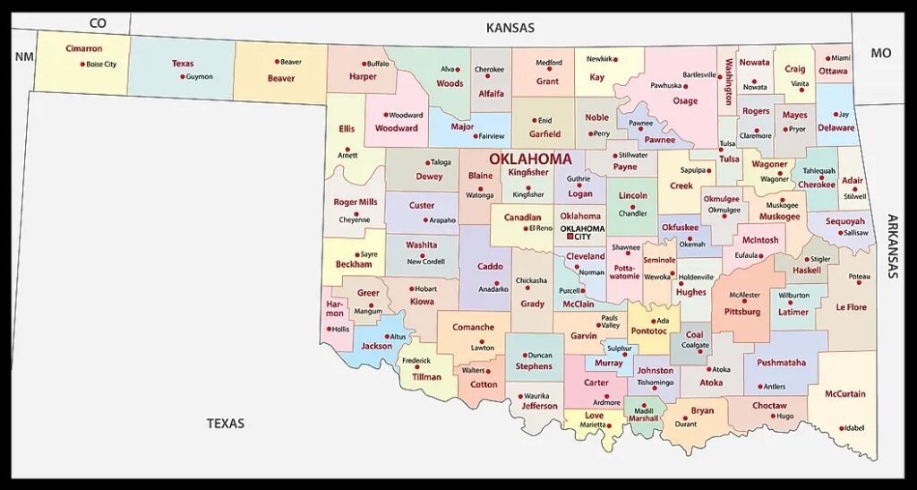
6. County Map of Oklahoma:
This is the collection of maps of Oklahoma Cities and Towns that we have added above. We have added six different maps that contain some helpful information. Below, we are also adding some brief information about each map. So, please read the full description before viewing or downloading any map from the above.
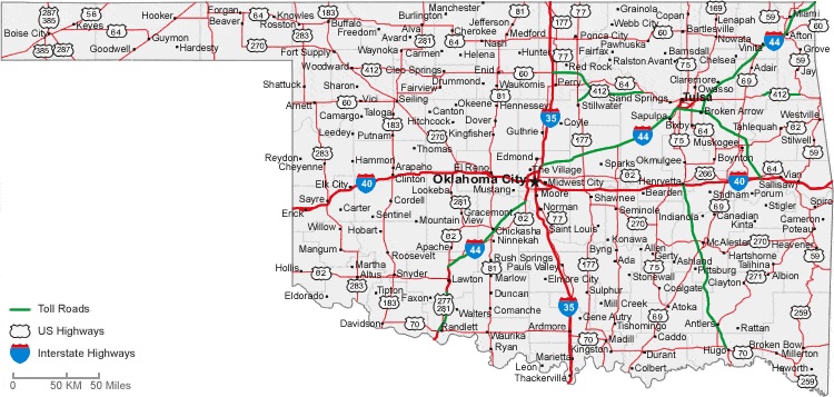
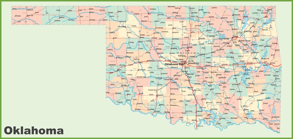
The first map is about the city map of Oklahoma state, and this map shows all cities of OK. You can locate any city on this map. This map also shows all counties. The second is related to the Town map of this state. As you can see on the map, all major towns are visible, along with some interstate highways. A thick red line indicates all interstate highways of this state. The third map is a combined map of the towns and cities of Oklahoma, and this map also shows all counties of Oklahoma. You may also check the county map of Oklahoma for more detailed information. For the county map, please click this link.
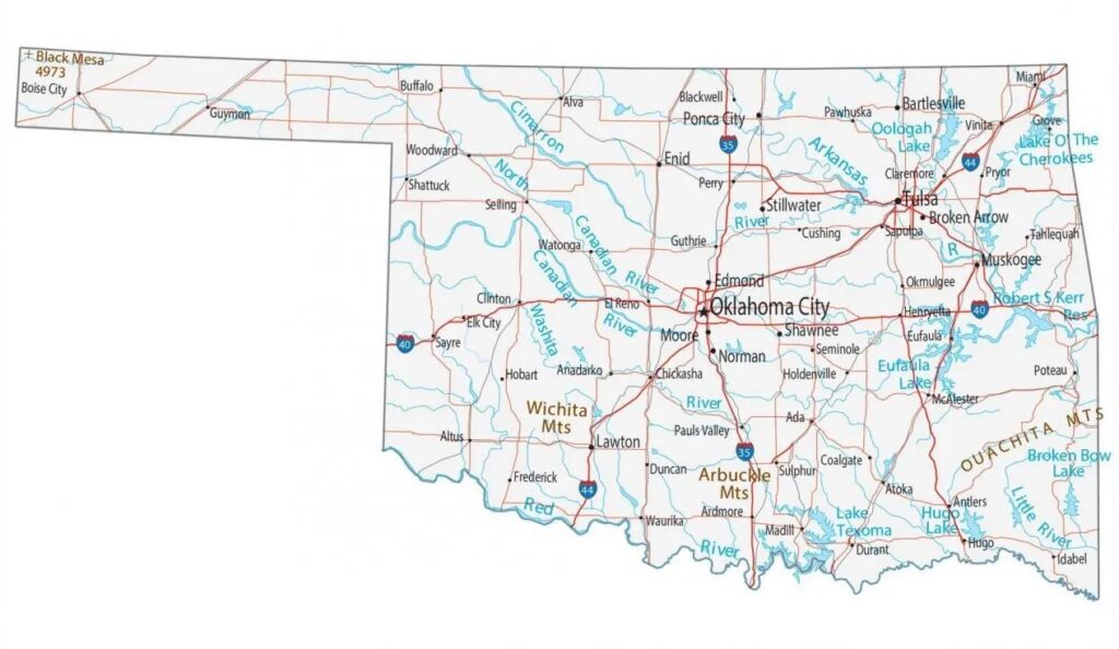
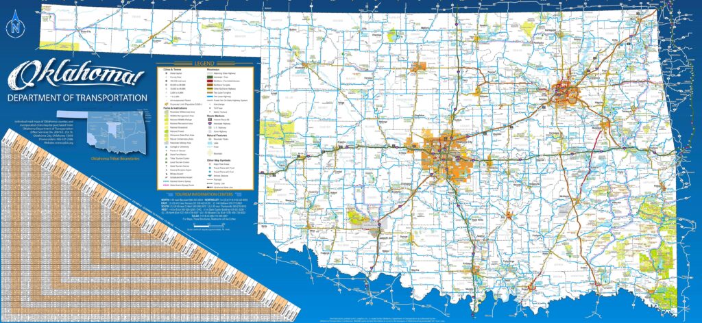
The fourth map is a large and detailed Map of Oklahoma Cities and Towns, showing all the cities, towns, counties, other significant places, and tourist places. And on this map, you can also know about all parks, malls, beaches, airports, railroads, street roads, city roads, interstate highways, and other states’ highways. The fifth map is related to the main state map of this state, which shows all counties and major cities on the map. This map also shows national highways, major roads, railway lines, the state capital, and major towns.
The last map is related to the Oklahoma County map. You can easily identify any county with the help of this map. So, these were some large and printable Oklahoma City maps that we have added above. These high-quality maps are available in PDF format and JPG (Image) format. You can easily download any map by clicking on the buttons under the preview image. All these high-quality maps are free to download.