Iowa (IA) is Located in the Midwestern region of the United States of America. This is the 26th most broad in total area and the 31st most populous in the whole county, with a population of 3,190,369. If you want to know more about this state then you should stay on this page and have a look at the amazing collection of maps of Iowa cities and towns. So, let’s start with the map of Iowa cities. You may also check some other maps related to Roads and Highways map of Iowa (IA).
Maps of Iowa (IA) with Cities and Towns:
1. Iowa Map with Cities:

2. Iowa Map with Towns:

3. Map of Iowa with Cities:

4. Iowa Map with Cities and Towns:

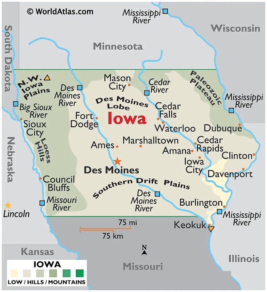
5. Iowa USA Map:
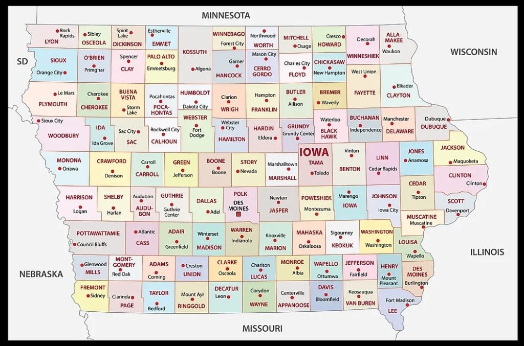
6. Map of Iowa County:
Above, we have added six types of different maps related to the cities and towns of Iowa state. Here, we are also giving some information about each map, so read the information and get any map on your device for free.
The first map is related to the Cities of Iowa. So, you can easily locate any city of this state with the help of this map. Now, on the second map, you will get to know about the towns and the roads and highways of these towns. So, the second map is a detailed map of IA towns that will also help you in travel. The third map is about the complete map of the Iowa towns and cities with roads and highways. With the help of this map, you can easily navigate from one city to another city in this state.
The fourth map is also a map of Iowa towns and cities, although it’s a detailed HD map of Iowa with all cities and towns. This map will help you a lot while travelling or exploring this state. Because all cities, towns, roads, street roads, highways, rivers, lakes, railroads, stations, beaches, parks, national museums, hotels, malls, fuel stations, airports and etc are mentioned on this map.
The fifth map is related to the main state map of Iowa. This map shows all counties, major cities, towns, and some water bodies also. So, get this map for free if you need a complete state map. The sixth map is related to the main County map of Iowa. In this map, you can easily locate any county. The county seat is also mentioned in this map and the state boundary. So, these were some best printable maps of Iowa with Towns. You can easily print any map because all maps are of HD quality and available in both PDF and JPG format. And you can download any map for free by clicking on the buttons under the preview image.