Missouri is a state in the United States of America that is situated in the Midwestern region of the country. This state is bordered by eight other states in the USA The name of this state is derived from the Missouri River. Missouri has three nicknames which are “Show Me State”, “Cave State” and “Mother of West”. There are lots of beautiful places that you can explore with the help of a Missouri Map. Because maps are very helpful and important during journey, study or project. And, if you are a traveler or student then you must check our collection of maps. Please scroll down the page and have a look at the collections of maps.
Missouri (MO) State Maps Collection:
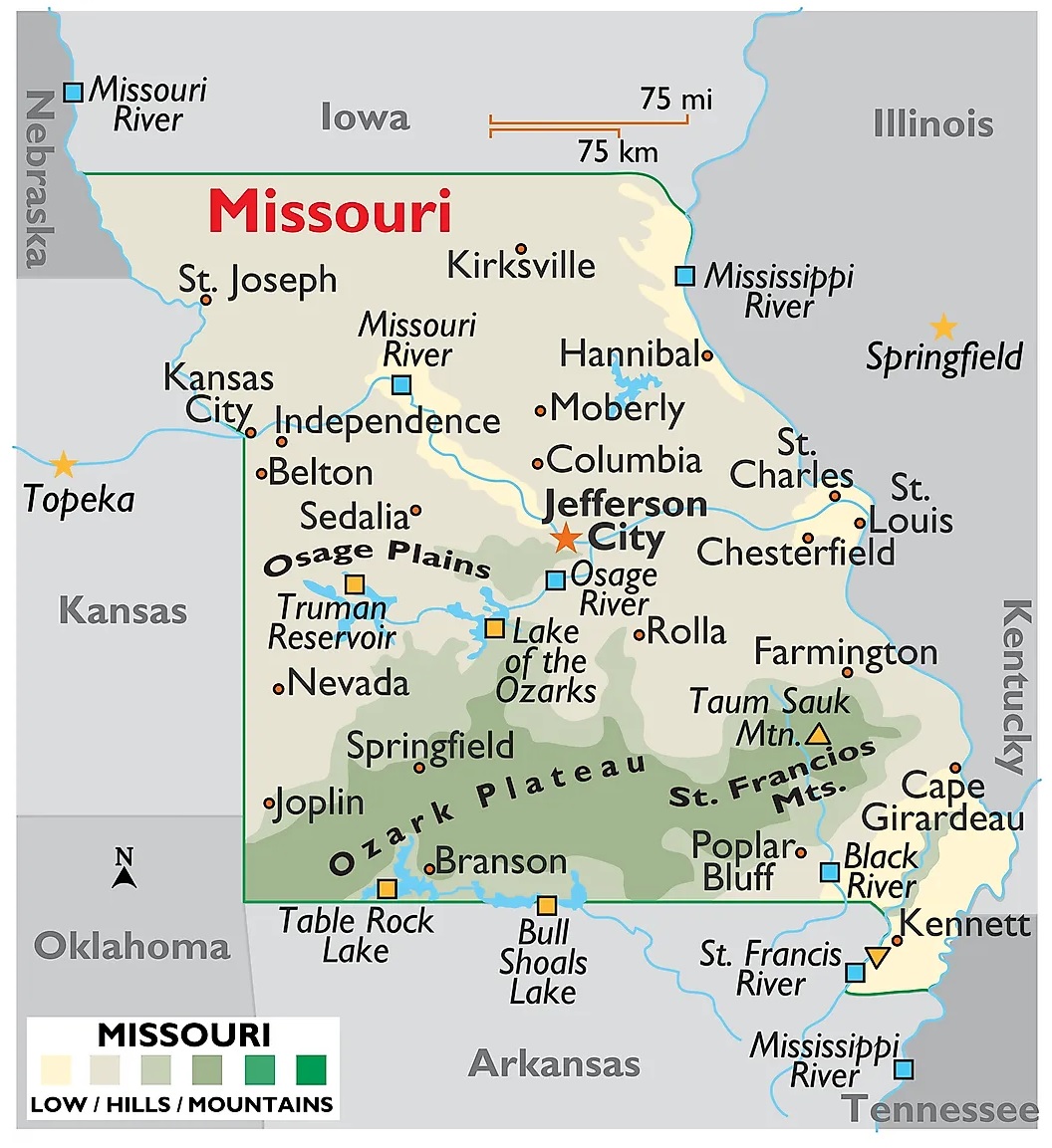
1. Map of Missouri:
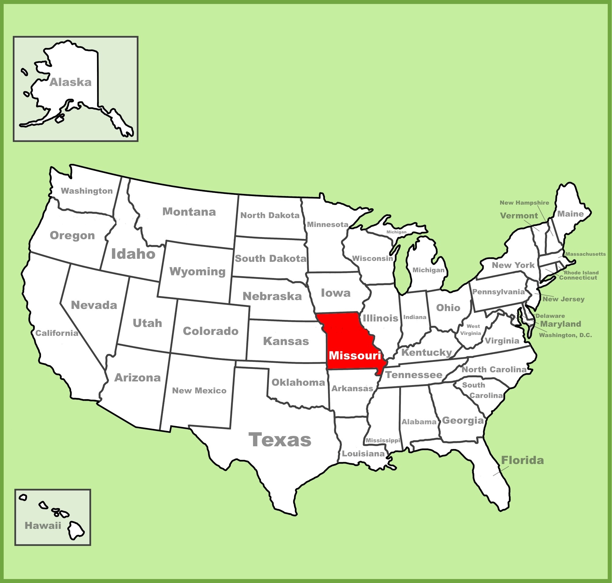
2. Missouri on US Map:
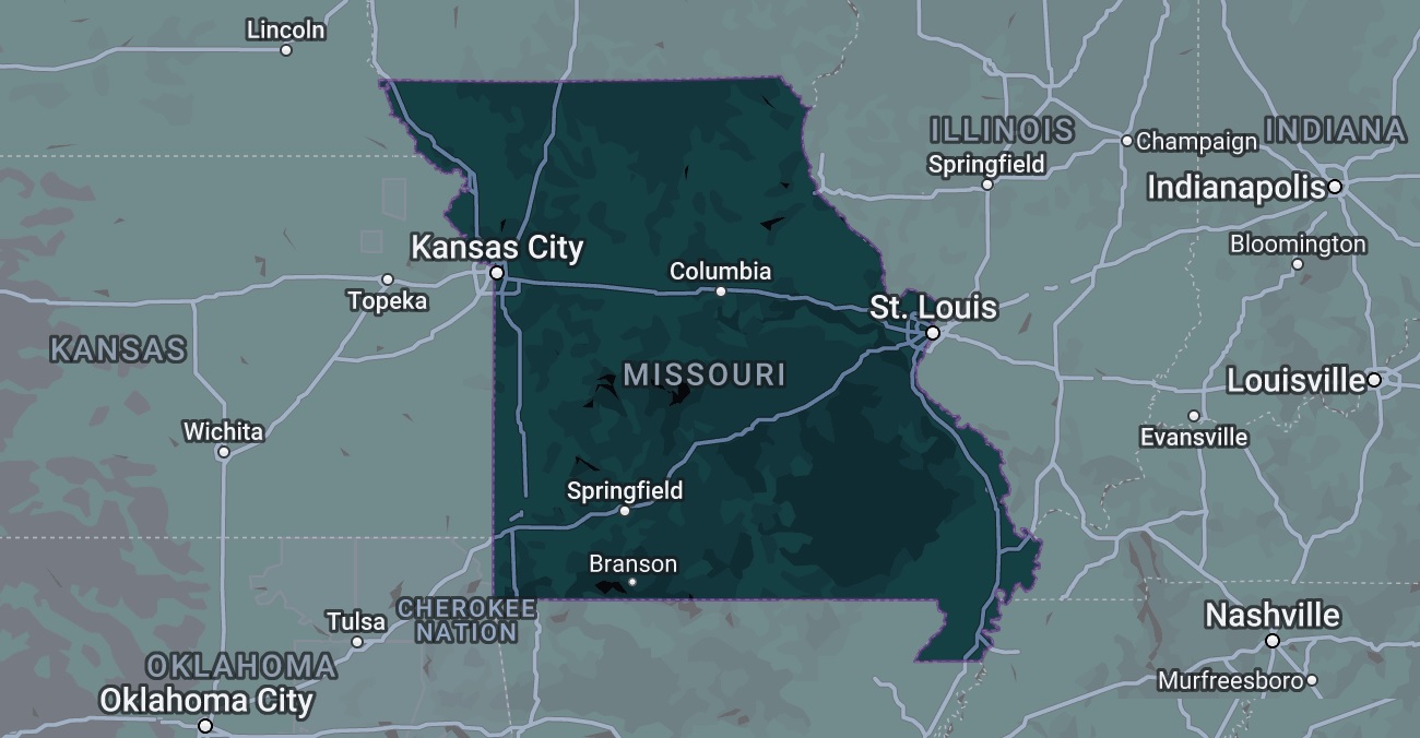
3. Google Map of Missouri:
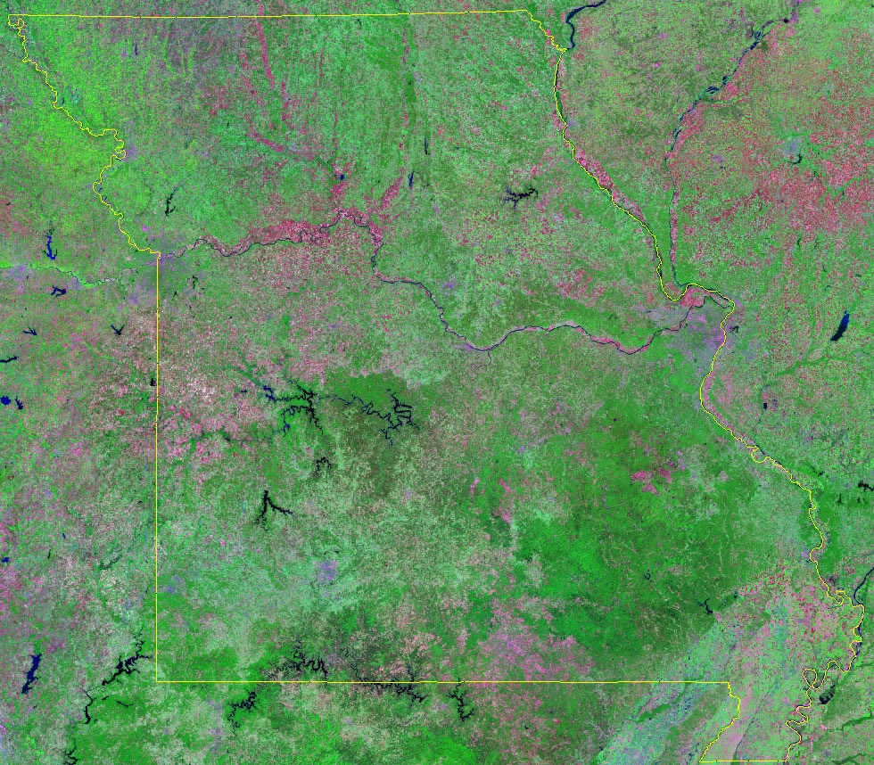
4. Satellite Image of Missouri:
5. Blank Map of Missouri:
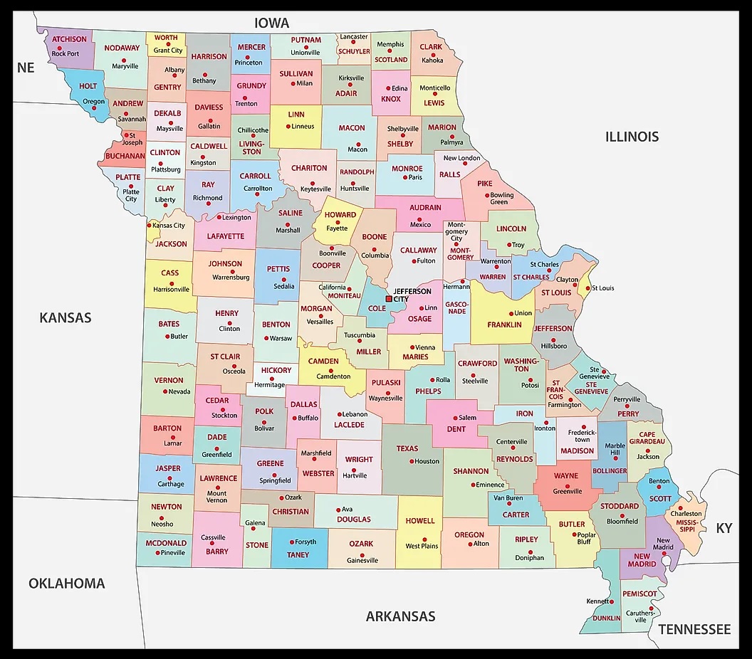
6. County Map of Missouri:
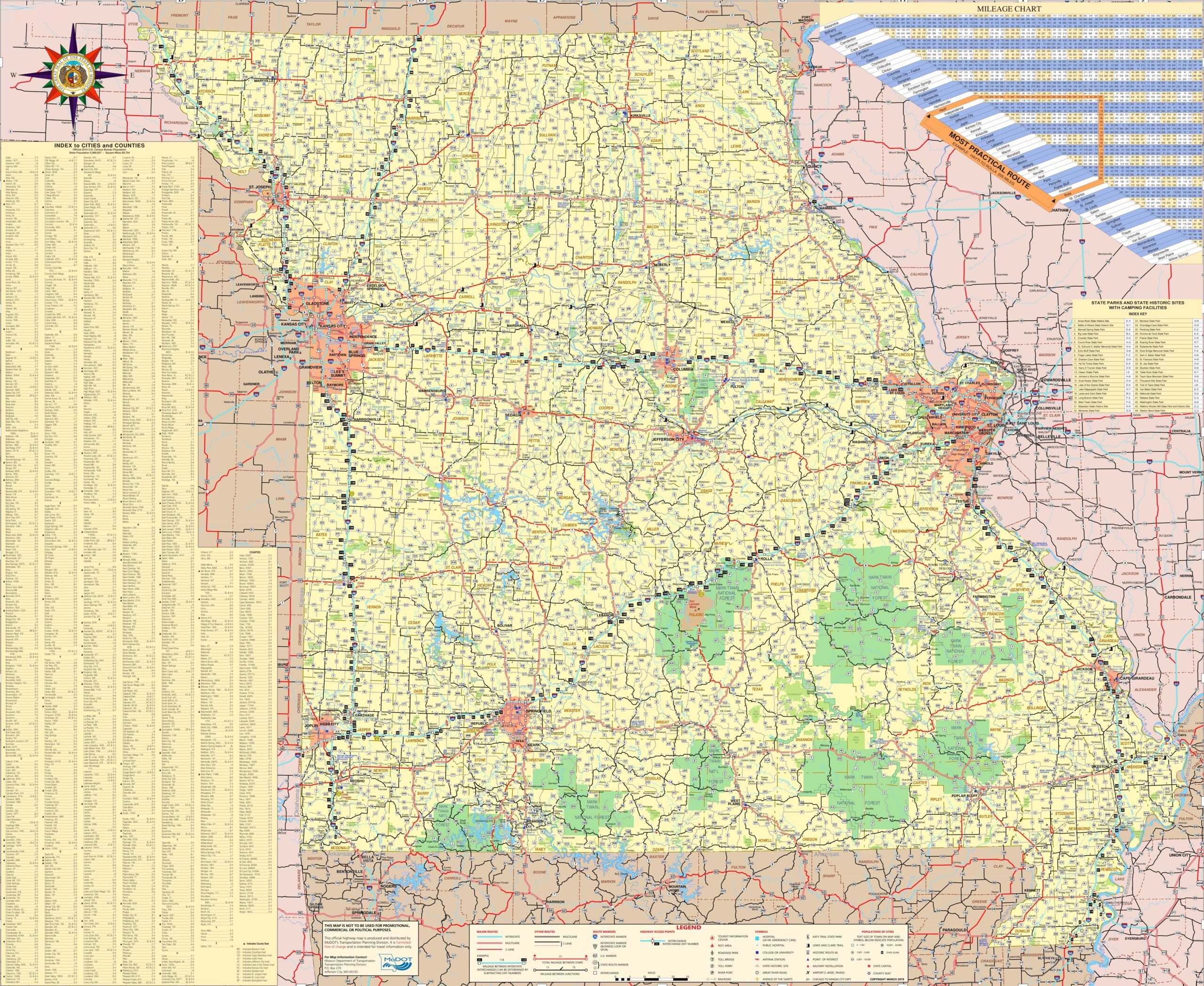
7. Missouri Map with Cities and Towns:
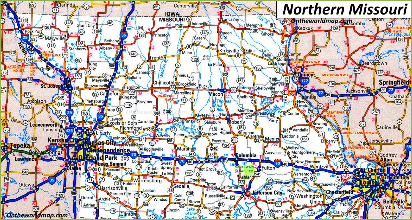
8. Northern Missouri Map
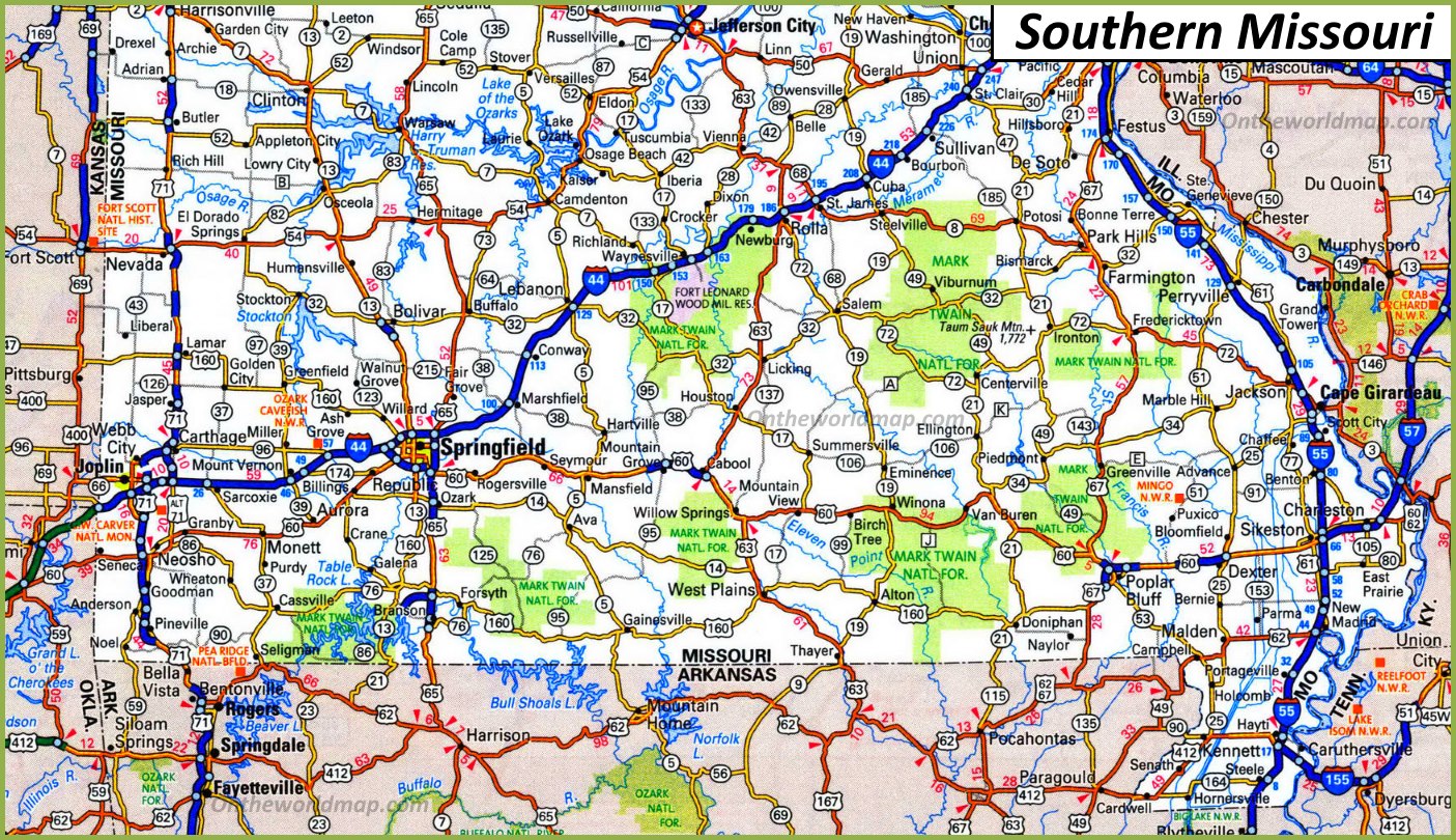
9. Southern Missouri Map
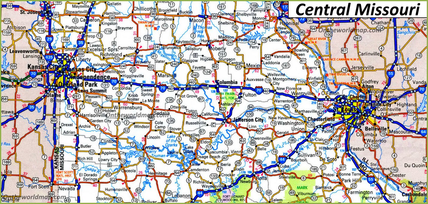
10. Central Missouri Map
Here, we have added nine different types of MO map. Each map contains some useful information. For you, we are adding some more useful information about each map here.
The first map is related to the detailed state map of Missouri, and this map shows some cities, counties, lakes, rivers, hills, and mountains. You can easily identify any major location with the help of this map. The second map shows the location of Missouri on the USA Map. As you can see on the map, the area filled with red color indicates its location on the country map.
The third map is titled “Google Map of Missouri.” This map is a Google map version of this state which shows some cities, towns, and the capital city. The fourth map is a Satellite image of Missouri which shows the structure. You will only see the outer boundary on this map. So, if you want a detailed map of this state, please check the first map. Now, the fifth map is a simple outline or blank map of Missouri, which shows the outer boundary.
The sixth map is related to the map of Missouri county. It is a full-detailed MO county map with cities. County seats are also shown on this map. The seventh map is a large and detailed map of Missouri with cities and towns. This map shows all cities, towns, roads, highways, railroads, airports, beaches, rivers, lakes, mountains, etc. The next three maps are the specific area maps of Missouri, USA. On the eighth map, you will see all cities, towns, and roads of Northern Missouri, and on the last map, you will get to know all cities and towns of Southern Missouri. The last map is related to the Central part of the country. All three maps are the regional maps of Missouri state.
So, these were some best and most useful Missouri maps that we have added above. All the maps are available in PDF format and JPG format. You can easily download any map by clicking on the buttons under the preview image. All these maps are free to download.