State Roads in Indiana are numbered logically. The U.S Highways in Indiana are maintained and owned by the Indiana Department of Transportation. Generally, Indiana routes are state-maintained. These are the facts or information one should know about. The Indiana Department of Transportation or INDOT has released an Indiana Roadway map. This Indiana Road Map is added below along with other Highway Maps, Interstate Highway Maps, County Maps, City Maps, etc. So, let’s have a look at the different Road and Highway Maps of Indiana.
Collection of Indiana Road & Highway Maps:
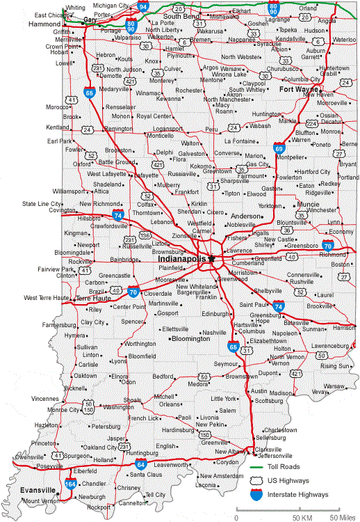
1. Indiana Roadway Map:

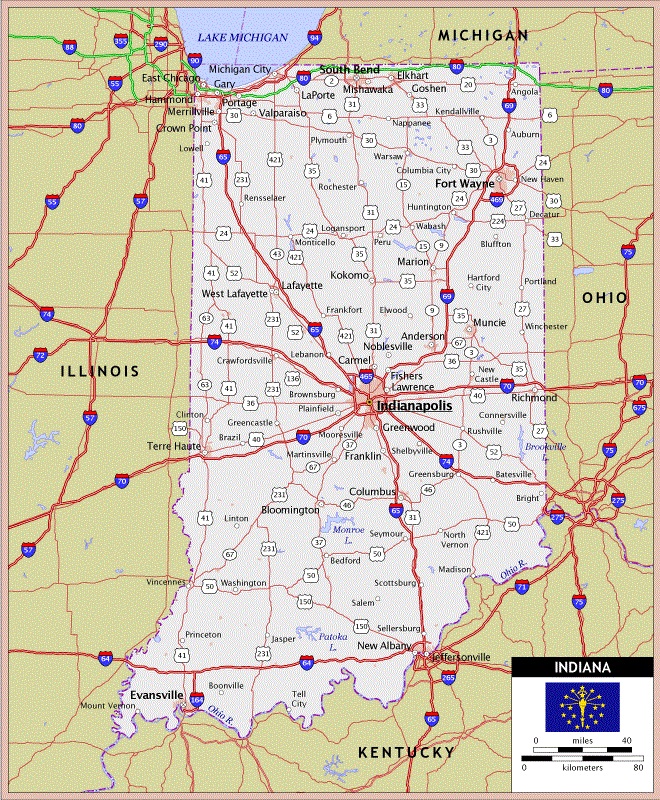
2. Indiana Road Map:
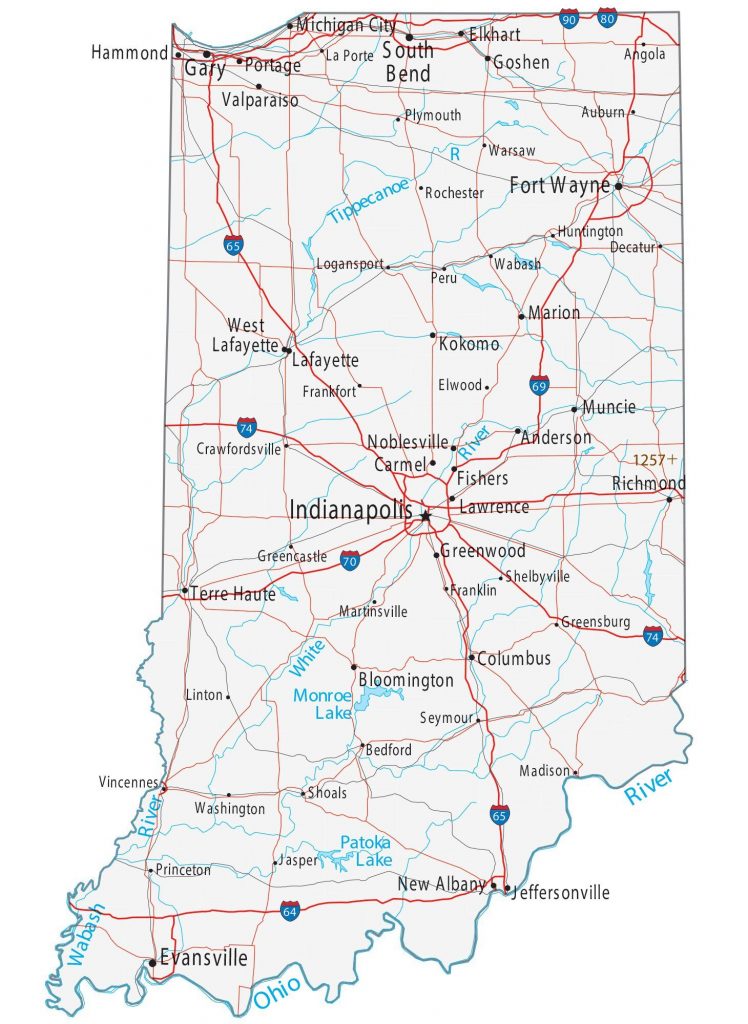
3. Indiana Highway Map:

4. Indiana Highway Map (Highlighted)
5. Indiana Highway Map with Roads, Cities, Rivers, Lakes:
6. Indiana Interstate Map:

7. Indiana County Map with Roads, Highways, Cities:

8. Indiana Extra Heavy Duty Route Map:

As you can see, here, we have eight different types of maps. Every single map contains useful information.
The first map, titled “Indiana Roadway Map,” was released by the Indiana Department of Transportation (INDOT). It is the most detailed map of Indiana. Every city, lake, river, highway, road, and other important location are visible here.
The second map, titled “Indian Road Map,” was composed by Brad Cole of Geology.com. Cities, U.S. Highways, Toll Roads, and Interstate highways are visible on this map.
The third map, titled “Indiana Highway Map,” was created by the U.S. Department of Transportation. On this map, all U.S. highways in Indiana are visible. Water bodies, Airports, Truck/Pipeline Terminal, Port Terminal, Truck/Rail Facility, etc., are also shown on this map.
The fourth map shows you the highways from Indiana to other states.
The fifth map contains information about lakes, rivers, and also the highways in Indiana. The next map is titled “Indiana Interstate Map,” which shows you the route to travel to other states. All types of roads and highways are there on this map.
The seventh map is a kind of Indiana county map with roads, highways, cities, etc. You can also see the name of the cities on this map.
The last or the eighth map is the Indiana Extra Heavy Duty Route Map that contains the Extra Heavy Duty Highway Information (North West and North East).
You can download any of these maps using the PDF and JPG buttons under all the images.