Chicago is the most populated city in Illinois, the U.S that is located on the shores of freshwater Lake Michigan. Chicago covers 606.1 km², including water bodies. Here, we are talking about the river of Chicago. If you want to explore more about the river and lakes of Chicago, then you must stay on this page. Because here, we are adding Chicago river maps and some brief information about the major rivers of Chicago. Please, scroll down the page and have a look at these maps.
Chicago River Maps Collection:
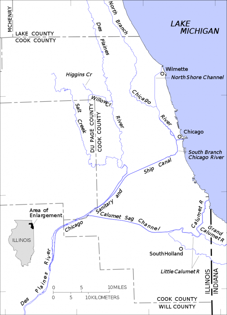
1. Chicago River Map:
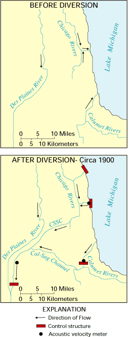
2. Diversion Map of Chicago River:
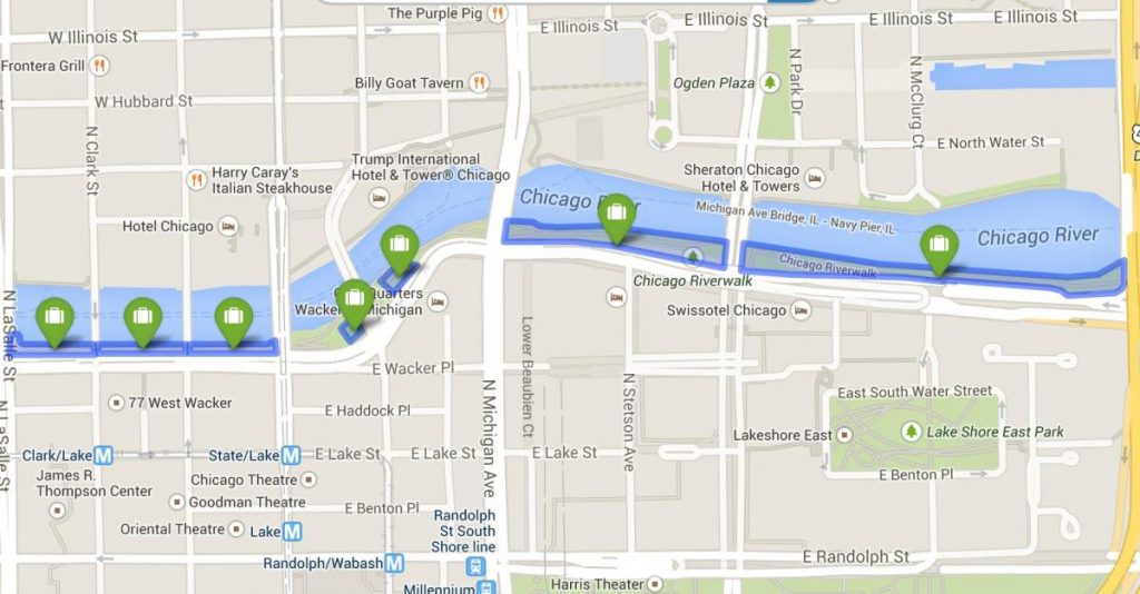
3. Chicago Riverwalk Map:
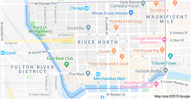
3. River North Chicago Map:
4. Chicago Waterways Map:
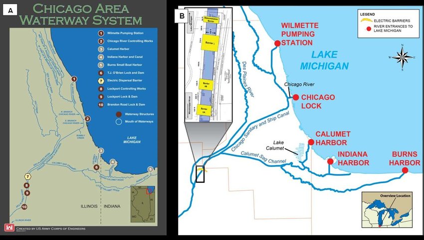
Above we have added four types of river maps and waterways map of Chicago. All these maps are very useful and show the information that will help you in your study, project, or other work. We are also describing each map, so read the description of each map before viewing or downloading any map. Please scroll down the page and have a look at the information.
The first map is the Chicago River Map, a detailed river map that shows all major rivers flowing through this city. The Chicago River is 156 miles long (251 km) and flows through Chicago (Illinois), USA. The river is not so long. The river is the only river in the world that flows in a reverse direction (with the help of Civil Engineering, the natural flow direction of this river changed backward).
The second map is related to the Diversion map of the Chicago River. In this map, you will get to know about the flow direction, information about the mouth of this river, its tributary rivers, and its drainage information, as you can see in the map, how the water flow is diverted into its reverse direction. The main reason behind this diversion is the – pollution in this river and Michigan Lake. Later in 1886, researchers at the University of Illinois, with the help of civil engineering, a campaign is run to clean the river to control the disease and pollution. After a long, the plan to reverse the direction of the Chicago River was completed in 1900.
The third map is titled “Chicago Riverwalk Map.” In this map, you will learn about the Riverwalk area beside the Chicago River. The Chicago Riverwalk is located on the south bank of the Chicago River. This riverwalk is stretched from Lake Shore Drive and Lake Michigan to Lake Street. This area is for public fun, which has Bars, cafes, restaurants, parks, boats on rental, a Vietnam War memorial and other amenities. You can enjoy your weekend or holiday at this riverwalk. For more information, you can check the map.
Above were some river maps and waterways maps of Chicago(Illinois). These maps are available in both PDF and JPG format. Save or Download any map by clicking on the buttons that are under the preview image of each map. You can get all these maps on your device without paying.