Wyoming is a beautiful state that is located in the Mountain West subregion of the Western U.S.A. It is also the 10th largest state by area in the United States of America. If you want to explore the beautiful places or plan to spend your holidays in this state, then you should have a Wyoming road map. Here in this article, we have added some helpful WYO road and highway maps. Please scroll down the page and have a look at these maps.
Wyoming Road and Highway Map Collection:
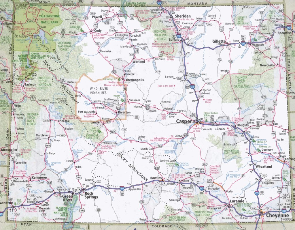
1. Wyoming Road Map:
2. Wyoming Highway Map:
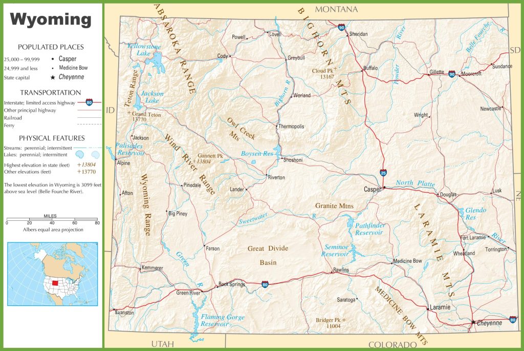
This was the collection of Wyoming Road and Highways maps. These maps are very useful and contain every single piece of information that you will need while roaming or travelling in this state or any city of Wyoming.
List of Main Interstate Highways in Wyoming
| Number | Length (mi) | Length (km) | Notes |
| I-80 | 402.78 | 648.21 | Longest interstate in Wyoming; also known as the Lincoln Highway |
| I-25 | 300.53 | 483.66 | Runs concurrently with US 87 almost entirely in the state |
| I-90 | 208.8 | 336.03 | Only Interstate that does not serve Cheyenne |
| I-180 | 1.09 | 1.75 | Highway not up to Interstate Highway standards; runs concurrently with I-25 Business, US 85, and US 87 Business in its entire length; also the only auxiliary route in Wyoming |
In this table, you can see a list of main Interstate highways that are passing through the Wyoming. Interstate-80 is the longest state highway, as mentioned in this table. If you want to see the map of all the interstate highways, then you should check the second map in the map section above.
List of Main U.S Routes / Highways in Wyoming
| Number | Length (mi) | Length (km) |
| US 14 | 449.21 | 722.93 |
| US 14A | 103 | 166 |
| US 18 | 100 | 160 |
| US 20 | 433 | 697 |
| US 26 | 454 | 731 |
| US 16 | 544.04 | 875.55 |
As you can see that, all major U.S routes are shown in this table, along with some information. You can read the entire table for more details. And for detailed information, you can also check the maps that show these U.S routes. And below, we are describing each map, so read the description before downloading or saving any map.
List of State Highways in Wyoming that are currently in Operation
| Number | Length (mi) | Length (km) | Notes |
| WYO 59 | 171.97 | 276.76 | |
| WYO 89 | 55.84 | 89.87 | Route only covered northern portion 1926-, decommissioned (became WYO 91) 1936, recommissioned over WYO 65 and WYO 91 1938 |
| WYO 34 | 52.38 | 84.3 | Laramie–Wheatland Road |
| WYO 24 | 46.72 | 75.19 | Bear Lodge Highway |
| WYO 77 | 22.18 | 35.7 | Old Shirley Basin Road |
| WYO 22 | 17.53 | 28.21 | Teton Pass Highway |
Although, there are approx more than 200 State highways in Wyoming. But this table is shows the State Highways that are currently in use. So, check the table for more information.
The first map contains the details of roads and their routes that connect all places and other cities within the Wyoming State. You can easily identify any direction and navigate anywhere inside any city. The last map is related to Wyoming Highway Map contains all the information about interstate highways, state routes, and US routes that are stretched inside the Wyoming State.
So, these were some best road and highways maps of Wyoming State that we have added above. All maps are available in PDF format as well as in JPG (Image) format. You can easily download any map by clicking on the buttons. And, these maps are available free for you.