Washington, also known as the State of Washington, is located in the Pacific Northwest region of the Western United States. Washington is the 18th-largest state and is spread across 71,362 square miles (184,830 km2). It is also the 13th-most populous state of the United States. There is also a big road network spread in this state. So, if you are thinking of travelling in this state or working on some road projects, you must look at all these Highway Maps and Road Maps. Please scroll down the page, and let’s start with the Washington road map.
Road and Highway Maps of Washington State:
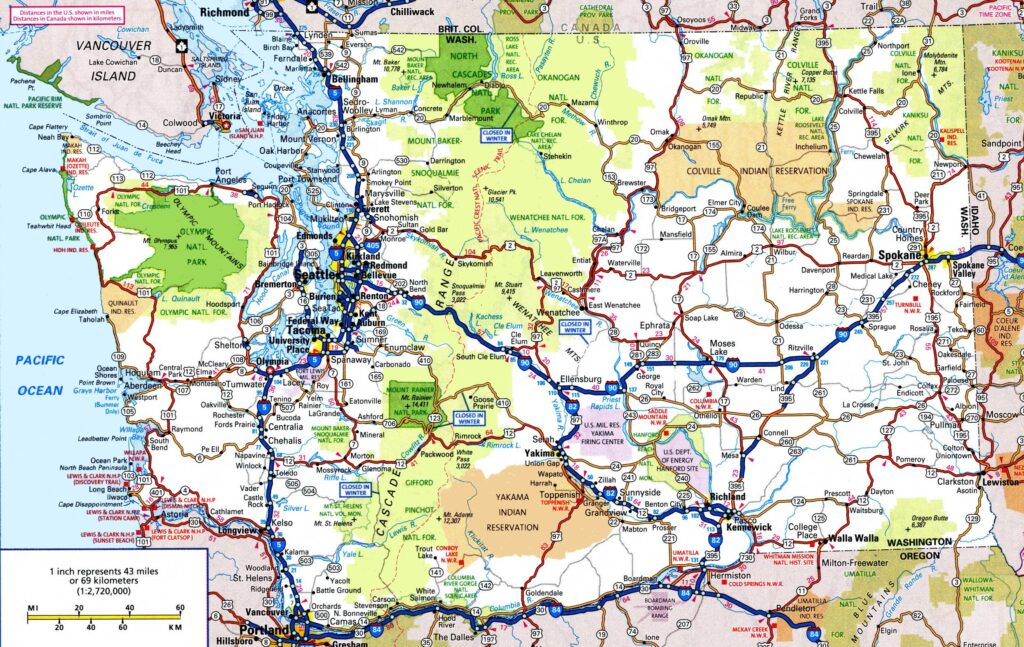
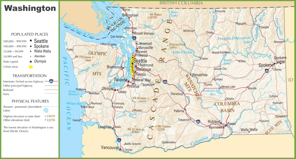
1. Washington State Road Map:
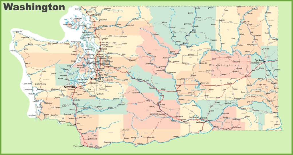
2. Road Map of Washington with Cities:
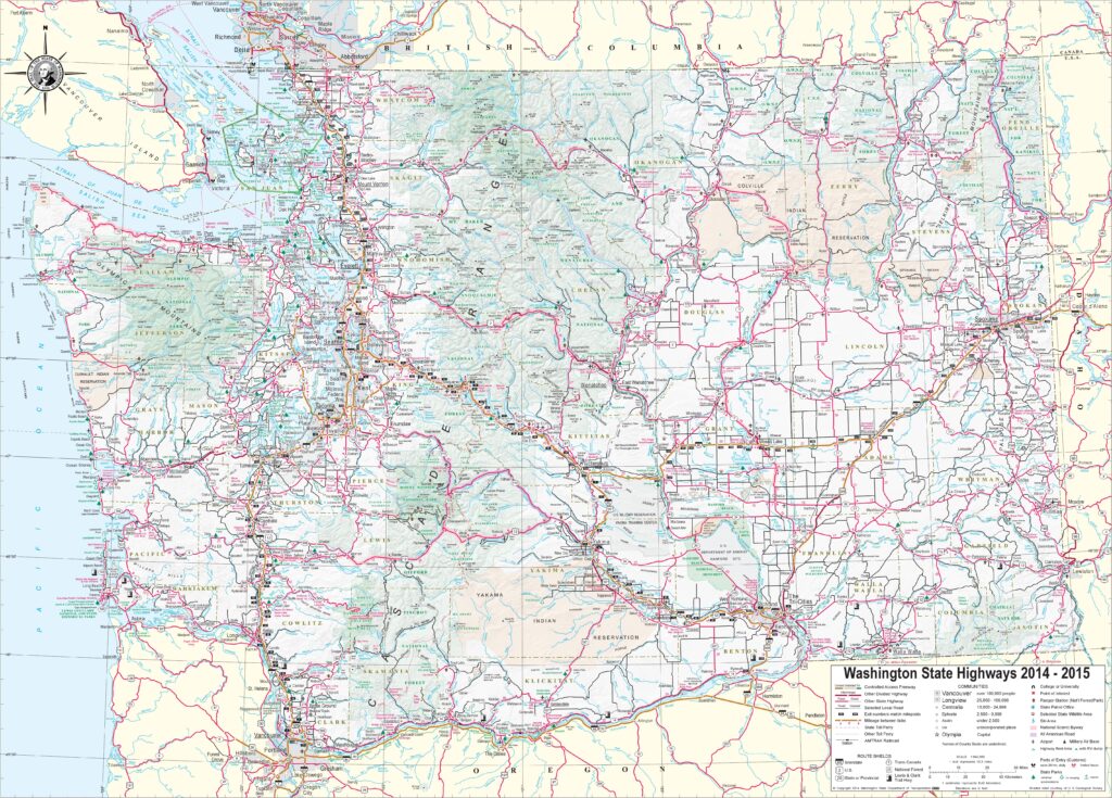
3. Large Detailed Tourist Road Map of Washington with Cities:
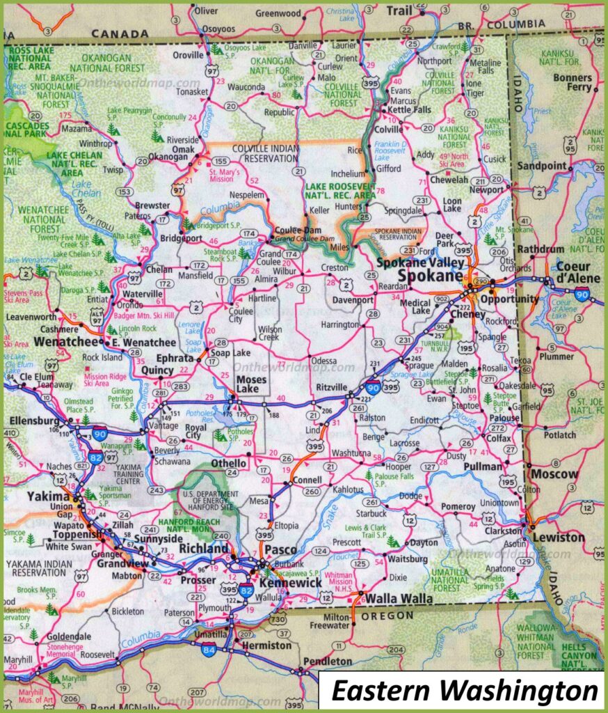
4. Road Map of Eastern Washington:
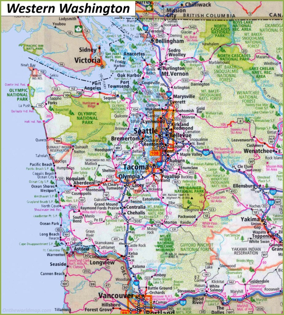
5. Road Map of Western Washington:
6. Washington State Highway Map:
As you saw, this was the collection of all Washington’s road and highway maps. There are six types of different maps that we have added above. Below we are describing each map. Please read each map’s description before downloading or viewing any map.
In the first section of “Road Maps”, there are a total of five maps, and all maps belong to roads of all cities of this state. In addition, we have also added some specific region maps. So, you can easily navigate in all directions of this state.When you look at the first map, which is the “Washington Road Map “, you will see all the roads and their routes. Therefore, you can easily navigate from one city to another city in this state. The next map is related to the detailed map of roads and the city names.
Now, the third map is the “Road Map of Eastern Washington”. Here, you will get to know all the information about roads and their routes that connect all the cities in the East region of Washington state. The next map is also a specific region map: the “Road Map of Western Washington”. This map shows all the information about the city’s roads and their incoming and outgoing routes of the western area of Washington state.
In the second or last section, there is a map which is the” Washington Highway Map”. In this map, you will get to know all highways, interstate highways, and U.S. highways of this state. You can identify an Interstate Highway indicated by a thick red line. A unique number also indicates all interstate highways, so you can easily identify them and navigate anywhere through any route.
These were some road and highways maps that we have provided above. All the maps are available in PDF format and JPG format. You can easily download any map by clicking on the buttons that are under the preview image of a particular map.