North Carolina is a US state located in the Southeastern region of the United States. It is the 28th largest and 9th-most populous of the 50 United States. If you want to explore more about this city or also planning to travel in this state, you must have a North Carolina road map and Highway Maps. Here we have useful maps of this state. Scroll down the page and have a look at these maps.
North Carolina Road and Highway Map Collection:
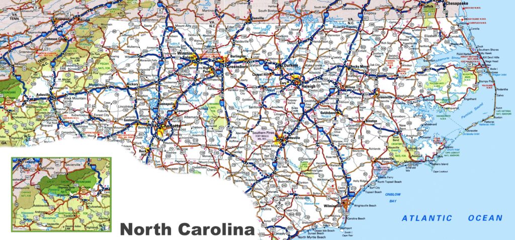
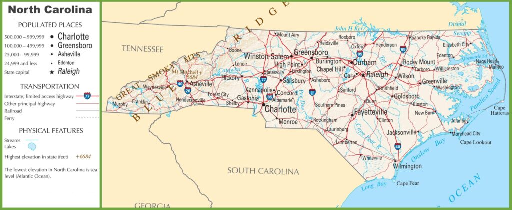
1. North Carolina Road Map:
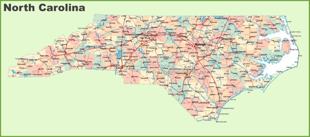
2. Road Map of North Carolina with Cities:
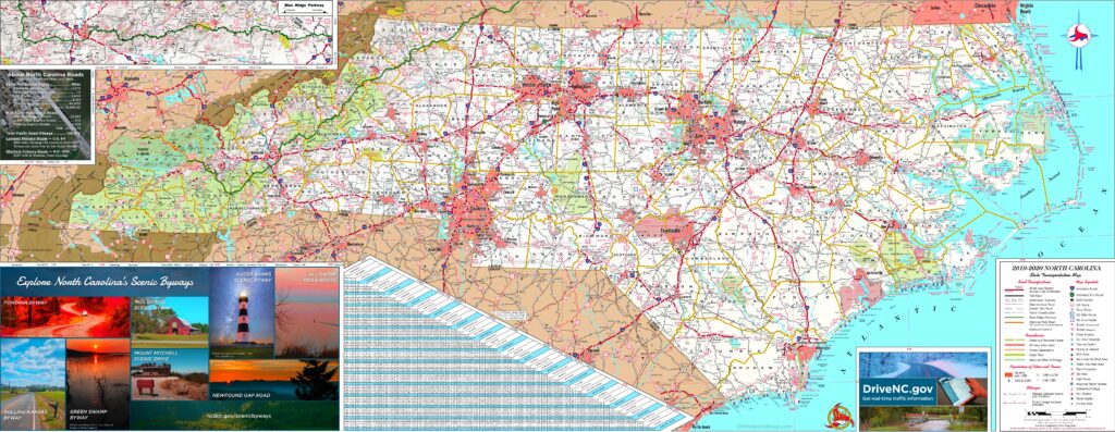
3. Large detailed Tourist Road Map of North Carolina with Cities:
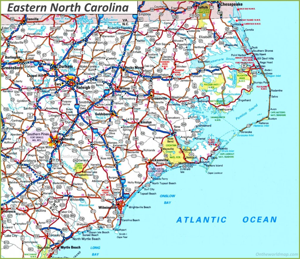
4. Road Map of Eastern North Carolina:
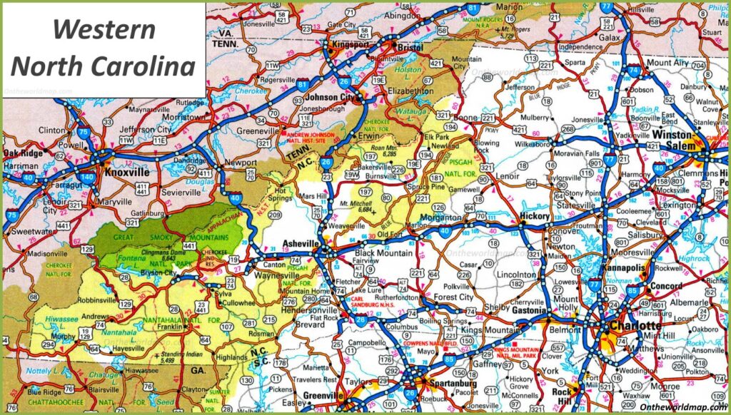
5. Road Map of Western North Carolina:
6. North Carolina Highway Map:
Above were some useful and interactive North Carolina (N.C.) road maps and highway maps in high quality that we have added above. Below, we describe some brief descriptions of each map shown above.
The first map, “North Carolina Road Map,” contains details of roads and their routes that connect all other cities of North Carolina State. So, you can easily identify any direction and navigate anywhere inside any city. The next nap is a detailed road map that shows all city’s roads, streets, roads and other roads with all cities of North Carolina. We have also added some specific region/area road and highway maps. So, you can check those maps.
The third map titled “Large detailed Tourist Map with cities” will provide you with information about tourist places and their location as well as their routes. You can easily navigate to anywhere in the city with the help of this map. All famous places such as Malls, zoos, restaurants, beaches, Bars, Mountains, Adventure Spot and other major tourist attractions points are visible on this map. The fourth and fifth maps are related to specific area or region maps: Eastern and Western North Carolina Road and Highway maps. These maps show all city’s roads, highways and street roads of these areas. These maps will help you a lot in your travel.
The last map is related to North Carolina Highways Map. This map shows all the major state highways, interstate highways, and U.S. highways. The thick red line shows the all interstate highways of this State. You can easily find the best route to any city with the help of this map.
Below, we are adding two tables showing a list of all Interstate and U.S. highways of North Carolina state. So, check the list to get more information.
List of all Interstate Highways in North Carolina:
| Number | Length (mi) | Length (km) |
| I-26 | 53.67 | 86.37 |
| I-40 | 419.4 | 674.96 |
| I-73 | 76.52 | 123.15 |
| I-74 | 69.61 | 112.03 |
| I-77 | 102.31 | 164.65 |
| I-85 | 231.23 | 372.13 |
| I-87 | 12.6 | 20.3 |
| I-95 | 181.71 | 292.43 |
List of all US Highways in North Carolina:
| Number | Length (mi) | Length (km) |
| US 1 | 174.1 | 280.2 |
| US 13 | 189.1 | 304.3 |
| US 15 | 158.5 | 255.1 |
| US 17 | 284 | 457.1 |
| US 19 | 145 | 233.4 |
| US 19E | 44.9 | 72.3 |
| US 19W | 21.9 | 35.2 |
| US 21 | 124.3 | 200 |
| US 23 | 106 | 170.6 |
| US 25 | 75.4 | 121.3 |
| US 29 | 168 | 270.4 |
| US 52 | 150 | 241.4 |
| US 64 | 608.4 | 979.1 |
| US 70 | 488 | 785.4 |
| US 74 | 451.8 | 727.1 |
| US 76 | 80.4 | 129.4 |
| US 117 | 114 | 183.5 |
| US 129 | 63.6 | 102.4 |
| US 158 | 350.2 | 563.6 |
| US 176 | 19.3 | 31.1 |
| US 178 | 6.4 | 10.3 |
| US 220 | 123.4 | 198.6 |
| US 221 | 153 | 246.2 |
| US 258 | 152 | 244.6 |
| US 264 | 215.7 | 347.1 |
| US 276 | 62.9 | 101.2 |
| US 301 | 193.7 | 311.7 |
| US 311 | 62 | 99.8 |
| US 321 | 217.2 | 349.5 |
| US 401 | 173.8 | 279.7 |
| US 421 | 328 | 527.9 |
| US 441 | 64.5 | 103.8 |
| US 501 | 170 | 273.6 |
| US 521 | 3.8 | 6.1 |
| US 601 | 133.6 | 215 |
| US 701 | 109.9 | 176.9 |
So, these were some important and useful road and highways maps of North Carolina that we have added above. All the maps are available in PDF format and JPG format. In addition, you can easily download any map by clicking on the buttons under the preview image of a particular map.