Rhode Island is the seventh least populous state of the USA, which is located in the New England region of the Northeastern United States. If you want to know more about Rhode Island’s Cities and Towns through maps, then you should stay on this page. Because here we are adding the best map of RI towns and cities. So, please scroll down the page and have a look at these amazing maps of Rhode Island towns and cities. And, if you are also planning to travel, then you should also check some other Road and Highway Maps of Rhode Island and State Map of Rhode Island for more detailed information
Maps of Rhode Island Towns and Cities:
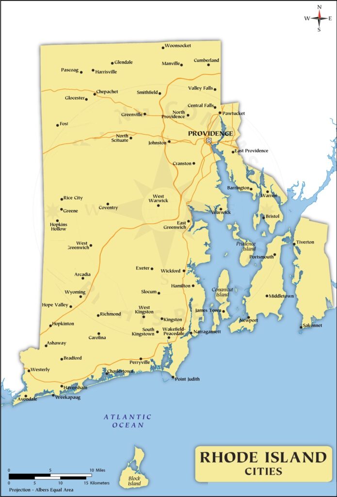
1. Rhode Island Map with Cities:
2. Rhode Island Map with Towns:
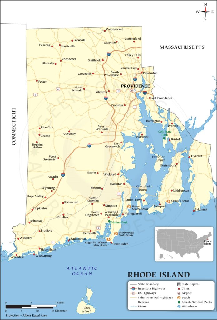
3. Map of Rhode Island Towns and Cities:
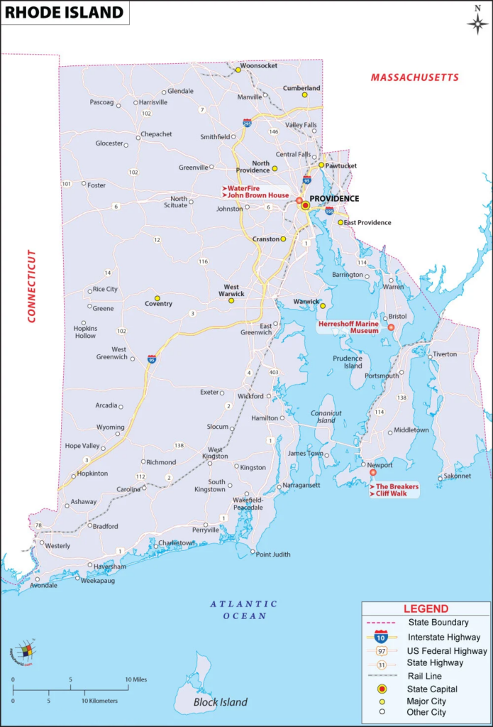
4. Rhode Island State Map:

5. County Map of Rhode Island:

6. Rhode Island County Map with Cities :

Above, we have added six types of different maps related to the cities and towns of Rhode Island. Below, we’re also giving some information about each map, so read the information and get any map on your device for free.
The first map is related to the Cities of Rhode Island. So, you can easily locate any city of this state with the help of this map. Now, on the next map, you will get to know about the towns and the roads and highways of these towns. So, the second map is a detailed map of RI towns that will also help you in navigate.
The third map is about the complete map of the Rhode Island towns and cities with roads and highways. With the help of this map, you can easily navigate from one city to another city in this state. And, for more information, we are also giving a list of Town and City of RI, USA. Check the table to know more about Rhode Island. The fourth map is related to the main state map of Rhode Island. This map shows all counties, major cities, towns, and some water bodies also. So, get this map for free if you need a complete state map.
The fifth map is related to the main County map of Rhode Island. In this map, you can easily locate any county of RI. The county seat is also mentioned in this map and the state boundary. Now, the last map is also a county map with cities. As its name specified, this map shows all counties with major cities. So, this map will be very helpful if you’re looking for such a county’s map.
So, these were some best printable Town maps of Rhode Island. You can easily print any map because all maps are of HD quality and available in both PDF and JPG format. And you can download any map for free by clicking on the buttons under the preview image.